Category:Chequamegon-Nicolet National Forest
Zur Navigation springen
Zur Suche springen
national forest in Wisconsin, United States  | |||||
| Medium hochladen | |||||
| Ist ein(e) | |||||
|---|---|---|---|---|---|
| Ort | Wisconsin | ||||
| Hauptverwaltung | |||||
| Fläche |
| ||||
| offizielle Website | |||||
 | |||||
Unterkategorien
Es werden 19 von insgesamt 19 Unterkategorien in dieser Kategorie angezeigt:
In Klammern die Anzahl der enthaltenen Kategorien (K), Seiten (S), Dateien (D)
1
- 1979 Capitol Christmas Tree (2 D)
A
- Anvil Lake Trail State Natural Area (118 D)
B
- Birch Grove Campground (2 D)
- Brule Lookout (1 D)
F
- Fifield Fire Lookout Tower (1 D)
L
- Lauterman Creek (7 D)
M
- Mondeaux Dam Lodge (3 D)
- Mountain Fire Lookout Tower (4 D)
N
V
- Valhalla Recreation Area (3 D)
W
Medien in der Kategorie „Chequamegon-Nicolet National Forest“
Folgende 96 Dateien sind in dieser Kategorie, von 96 insgesamt.
-
 A turtle nesting platform on the Chequamegon-Nicolet National Forest (44095505061).jpg 5.312 × 2.988; 4,83 MB
-
 Bathroom - Chequamegon-Nicolet NF - Dec 2017.jpg 1.200 × 900; 199 KB
-
 Bayfield co HW 63 southwards Chequamegon Natl Forest IMG 1637.JPG 3.767 × 2.461; 1,98 MB
-
 Bayfield co HW 63 southwards Chequamegon Natl Forest IMG 1638.JPG 3.228 × 2.332; 1,89 MB
-
 Beaver Creek.jpg 3.264 × 4.928; 20,28 MB
-
 Black and white water scene.JPG 2.136 × 2.848; 1,5 MB
-
 Black Creek Bog.jpg 4.928 × 3.264; 18,14 MB
-
 The Nicolet national forest, northeastern Wisconsin (IA CAT10680144).pdf 1.741 × 1.235, 4 Seiten; 552 KB
-
 National forests vacations, Nicolet National Forest, Wisconsin - a radio talk (IA CAT31364543).pdf 1.018 × 1.281, 4 Seiten; 183 KB
-
 Chequamegon-Nicolet National Forest - Sept 2017.jpg 900 × 1.200; 397 KB
-
 Chequamegon.jpg 1.856 × 1.256; 1,19 MB
-
 D7K 8009.jpg - Flickr - wackybadger.jpg 3.545 × 3.043; 4,66 MB
-
 Forest - Flickr - wackybadger (33).jpg 2.592 × 3.872; 12,19 MB
-
 The forest resources of the Chequamegon-Nicolet national forest (microform) (IA forestresourceso194haug).pdf 1.122 × 1.525, 62 Seiten; 3,21 MB
-
 Headwaters Wilderness.jpg 2.400 × 1.600; 673 KB
-
 Ice Age Trail bog Taylor County WI.JPG 3.648 × 2.736; 5,08 MB
-
 Lake Scenes - Wisconsin - DPLA - c573536563fac0e72c42e0c4defa0d76.jpg 4.776 × 3.882; 2,53 MB
-
 Lake Scenes - Wisconsin - DPLA - d48d0332739e69e26de02ea535360184.jpg 4.794 × 3.803; 2,53 MB
-
 Miltary vets - Chequamegon-Nicolet National Forest.jpg 900 × 1.200; 325 KB
-
 Moose Lake viewed from behind Campsite 2.jpg 800 × 600; 113 KB
-
Morgan Falls in the Chequamegon National Forest near Mellen, WI and Copper Falls State park.ogv 2 min 15 s, 640 × 480; 73,7 MB
-
 Path - Chequamegon-Nicolet National Forest - Oct 2017.jpg 1.200 × 900; 399 KB
-
 Photograph of a Farm on Submarginal Land - NARA - 2127647.jpg 1.056 × 639; 429 KB
-
-
 Photograph of a Good Type of Summer Home - NARA - 2127515.jpg 1.578 × 920; 944 KB
-
 Photograph of a Government Truck - NARA - 2127419.jpg 1.584 × 940; 1.021 KB
-
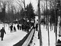
 Photograph of a Group of Skiers - NARA - 2128566.jpg 933 × 1.287; 833 KB
-

-
 Photograph of a Group of Transplant Beds of White Spruce - NARA - 2128941.jpg 1.164 × 876; 748 KB
-
 Photograph of a Hardwood and Hemlock Virgin Stand - NARA - 2127520.jpg 1.606 × 968; 1,15 MB
-
-
 Photograph of a Settler on Submarginal Land - NARA - 2127644.jpg 1.076 × 624; 444 KB
-
 Photograph of Bag of White-Tailed Bucks - NARA - 2129292.jpg 1.377 × 1.089; 1,08 MB
-
 Photograph of Burned Over Jack Pine Stand - NARA - 2127848.jpg 860 × 619; 481 KB
-
 Photograph of Canoes Negotiating White Water on a Fishing Trip - NARA - 2129317.jpg 1.374 × 1.074; 1,09 MB
-
 Photograph of Clam Lake Guard Station - NARA - 2128420.jpg 927 × 648; 391 KB
-
 Photograph of Clam Lake Guard Station - NARA - 2128636.jpg 918 × 663; 403 KB
-
 Photograph of Clam Lake Guard Station - NARA - 2128637.jpg 906 × 672; 403 KB
-
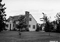
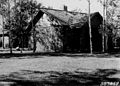 Photograph of Custodian's Dwelling - NARA - 2128470.jpg 900 × 642; 448 KB
-

-
 Photograph of Deer Pen - NARA - 2127955.jpg 596 × 799; 426 KB
-

-
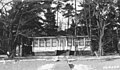
 Photograph of Drummond Ranger's Dwelling - NARA - 2128521.jpg 904 × 656; 408 KB
-
 Photograph of Drummond Ranger's Garage - NARA - 2128523.jpg 940 × 636; 430 KB
-
 Photograph of Drummond Ranger's Office - NARA - 2128522.jpg 924 × 660; 463 KB
-
 Photograph of Drummond Warehouse Number One - NARA - 2128525.jpg 932 × 656; 427 KB
-
 Photograph of Drummond Warehouse Number Two - NARA - 2128526.jpg 932 × 644; 439 KB
-
 Photograph of Edward J. Hines Sawmill and Finishing Mill - NARA - 2128650.jpg 1.412 × 1.038; 879 KB
-
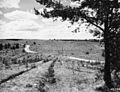
 Photograph of Entering Chequamegon National Forest - NARA - 2128640.jpg 909 × 669; 442 KB
-
 Photograph of Extensive Jack Pine Plantations - NARA - 2129297.jpg 1.413 × 1.068; 1,16 MB
-
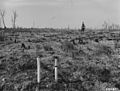
 Photograph of Extreme Browse Line - NARA - 2128196.jpg 1.292 × 936; 957 KB
-
 Photograph of Fire Camp - NARA - 2128657.jpg 912 × 660; 450 KB
-
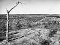
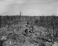
 Photograph of Fire Damage - NARA - 2127537.jpg 1.337 × 905; 909 KB
-

-

-

-
 Photograph of Fire-Line Guide Showing the Way for a Fire Plow - NARA - 2129404.jpg 1.047 × 1.398; 1,16 MB
-

-
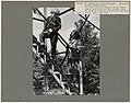
 Photograph of Forest Ranger H. O. Nixon Scaling a Log - NARA - 2129534.jpg 1.668 × 943; 1,04 MB
-
 Photograph of Hard Maple Stand Tapped for Maple Sap - NARA - 2128648.jpg 1.643 × 1.182; 1,36 MB
-
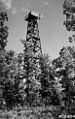
 Photograph of Hiles Lookout Tower and Improvements - NARA - 2127698.jpg 1.079 × 634; 572 KB
-
 Photograph of Jump River Tower, Cabin and Garage - NARA - 2128469.jpg 900 × 645; 471 KB
-
 Photograph of Macedonia Tower - NARA - 2129059.jpg 615 × 978; 490 KB
-

-

-
 Photograph of Plantation Number 17 in Glidden Ranger District - NARA - 2129285.jpg 1.425 × 1.083; 1,13 MB
-

-

-
 Photograph of Plantation Number 45B in Washburn Ranger District - NARA - 2129287.jpg 1.428 × 1.092; 1,18 MB
-
 Photograph of Plantation Number 46B in the Washburn Ranger District - NARA - 2129290.jpg 1.413 × 1.062; 1,29 MB
-
 Photograph of Plantation Number 9 in Medford Ranger District - NARA - 2129282.jpg 1.398 × 1.104; 1,05 MB
-
 Photograph of Ranger Office at Hugo Sauer Nursery - NARA - 2128505.jpg 1.224 × 704; 470 KB
-
 Photograph of Ranger W. G. Wilson - NARA - 2128475.jpg 906 × 666; 539 KB
-
 Photograph of Ranger W. G. Wilson - NARA - 2128476.jpg 1.269 × 880; 726 KB
-
 Photograph of Ranger's Dwelling - NARA - 2128709.jpg 903 × 639; 364 KB
-
 Photograph of Ranger's Dwelling at Eagle River - NARA - 2128414.jpg 1.242 × 717; 622 KB
-
 Photograph of Ranger's Office - NARA - 2128710.jpg 888 × 654; 416 KB
-
 Photograph of Ranger's Warehouse - NARA - 2128711.jpg 906 × 666; 399 KB
-
 Photograph of Six Sharptail Grouse - NARA - 2128448.jpg 705 × 615; 281 KB
-
 Photograph of Six Sharptail Grouse - NARA - 2128449.jpg 744 × 606; 279 KB
-
 Photograph of Two Locomotives - NARA - 2127616.jpg 1.085 × 617; 453 KB
-
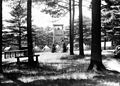 Photograph of View of the Tower Exhibit - NARA - 2127760.jpg 843 × 602; 426 KB
-
 Photograph of Virgin Lake - NARA - 2128163.jpg 1.371 × 931; 617 KB
-

-
 Photograph of Washburn Ranger's Dwelling and Garage - NARA - 2128517.jpg 904 × 672; 451 KB
-
 Public Relations - Wisconsin - DPLA - ed2e4148e1786eeaa954d5c9ddcde1ed.jpg 4.822 × 3.779; 1,86 MB
-
 Pulp and Paper Woods - Wisconsin - DPLA - f465b23da15131b411288a9cce1de811.jpg 5.133 × 3.863; 2,27 MB
-
 Reforestation- Plantations - Wisconsin - DPLA - 7be4c0b6ba8514ce6a6d800391f3d2f6.jpg 4.764 × 3.876; 2,7 MB
-
 Reforestation- Plantations - Wisconsin - DPLA - c37ec302041a647dc79def4347212580.jpg 4.788 × 3.852; 2,59 MB
-
 Reforestation- Planting - Wisconsin - DPLA - 6d74e718573bcb44adcb0dcec9d96b22.jpg 4.812 × 3.894; 2,35 MB
-
 Signs - Wisconsin - DPLA - 3a1714e8660dace68e08f566337c3a1a.jpg 4.895 × 3.867; 2,82 MB
-
 Snow - Chequamegon-Nicolet National Forest - Dec 2017.jpg 900 × 1.200; 206 KB
-
 Swamp - Flickr - wackybadger.jpg 3.264 × 4.928; 18,08 MB
-
 Tree Identification - Larch - DPLA - 20d5ce039aad65134ec8f7d287bb35fe.jpg 3.816 × 4.749; 1,62 MB
-
 Washburn Wisconsin Ranger Station Chequamegon Nicolet National Forest.jpg 1.878 × 1.238; 1,07 MB
-
 Water Sports - Wisconsin - DPLA - 9324ac6174d4d68e8cda0aae98ec59d6.jpg 4.733 × 3.780; 1,89 MB
.jpg)


.jpg)


Kategorien:
- National Forests of Wisconsin
- National Forests of the United States by name
- Protected areas of Ashland County, Wisconsin
- Protected areas of Bayfield County, Wisconsin
- Protected areas of Price County, Wisconsin
- Protected areas of Sawyer County, Wisconsin
- Protected areas of Taylor County, Wisconsin
- Protected areas of Vilas County, Wisconsin
- Protected areas of Florence County, Wisconsin
- Protected areas of Forest County, Wisconsin
- Protected areas of Oconto County, Wisconsin
- Protected areas of Langlade County, Wisconsin
- Protected areas of Oneida County, Wisconsin
- Western Great Lakes Forests Ecoregion (One Earth)