Category:Cherrapunji
Vai alla navigazione
Vai alla ricerca
town of Meghalaya, India  Cartell que presenta Cherrapunji com l'indret més humit de la terra | |||||
| Carica un file multimediale | |||||
| Audio | |||||
|---|---|---|---|---|---|
| Istanza di | |||||
| Luogo | distretto dei Monti Khasi Orientali, Meghalaya, India | ||||
| Popolazione |
| ||||
| Altezza sul mare |
| ||||
| sito web ufficiale | |||||
 | |||||
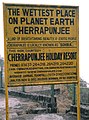
Cherrapunji (also spelled as Cherrapunjee), is a town in East Khasi Hills district in the Indian state of Meghalaya. It is credited as being the wettest place on Earth. However, nearby Mawsynram has more rainfall nowadays. It is the traditional capital of a hima (Khasi tribal chieftainship constituting a petty state) known as Sohra or Churra. 25°18′0″N 91°42′0″E / 25.3°N 91.7°E
Sottocategorie
Questa categoria contiene le 5 sottocategorie indicate di seguito, su un totale di 5.
File nella categoria "Cherrapunji"
Questa categoria contiene 8 file, indicati di seguito, su un totale di 8.
-
 A NEW HORIZON.jpg 3 648 × 2 736; 4,33 MB
-
 Cherrapunji.jpg 695 × 934; 380 KB
-
Cherrapunji.ogg 1,1 s; 13 KB
-
 Duwan Sing Syiem View Point Dympep Cherrapunjee 1046.JPG 3 648 × 2 736; 3,59 MB
-
 Megaliths cherra.JPG 3 008 × 2 008; 1 MB
-
 Nokhali Falls, Cherrapunji.jpg 4 048 × 3 036; 3,11 MB
-
 State Highway 5 Cherapunjee Meghalaya India.jpg 2 448 × 3 264; 4,15 MB
-
 The Lone House.jpg 3 163 × 2 101; 2,37 MB


