Category:Cheswardine
Aller à la navigation
Aller à la recherche
English: Cheswardine is a rural village and civil parish in north east Shropshire, England. The village lies close to the border with Staffordshire and is about 8 miles north of Newport and 5 miles south east of Market Drayton. At the 2001 Census, Cheswardine had a population of 991 people.
village britannique  Stryd Fawr, Cheswardine | |||||
| Téléverser des médias | |||||
| Nature de l’élément | |||||
|---|---|---|---|---|---|
| Lieu | Shropshire, Midlands de l'Ouest, Angleterre | ||||
| Population |
| ||||
 | |||||
Sous-catégories
Cette catégorie comprend 4 sous-catégories, dont les 4 ci-dessous.
C
- Cheswardine Hall (4 F)
S
- St Swithun, Cheswardine (11 F)
Média dans la catégorie « Cheswardine »
Cette catégorie comprend 302 fichiers, dont les 200 ci-dessous.
(page précédente) (page suivante)-
 "Caution our dogs bite" - geograph.org.uk - 1925783.jpg 640 × 480 ; 121 kio
-
 'Missus Mouse' at Goldstone Wharf - geograph.org.uk - 5672486.jpg 1 280 × 851 ; 494 kio
-
 A straight track at Thorneypits - geograph.org.uk - 391731.jpg 453 × 640 ; 103 kio
-

-
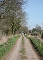
 Approaching Cheswardine on Haywood Lane - geograph.org.uk - 5456858.jpg 640 × 480 ; 63 kio
-
 Barn conversion, Goldstone - geograph.org.uk - 6470812.jpg 4 849 × 3 298 ; 3,8 Mio
-
 Bench Mark 357.1 Bridge 56, Shropshire Union Canal - geograph.org.uk - 6381065.jpg 1 333 × 2 000 ; 1,72 Mio
-
 Benchmark 348.6 Bridge 53, Shropshire Union Canal - geograph.org.uk - 6381226.jpg 2 000 × 1 333 ; 2,65 Mio
-
 Black barn and a mound of silage - geograph.org.uk - 5456962.jpg 640 × 480 ; 74 kio
-
 Bridge 54, Shropshire Union Canal - geograph.org.uk - 6381084.jpg 2 000 × 1 333 ; 3,56 Mio
-
 Bridge No. 49, Shropshire Union Canal.jpg 1 280 × 960 ; 1,01 Mio
-
 Canal approaching Little Soudley in Shropshire - geograph.org.uk - 6533919.jpg 1 280 × 1 280 ; 2,05 Mio
-
 Canal approaching Little Soudley in Shropshire - geograph.org.uk - 6533921.jpg 1 600 × 900 ; 1,68 Mio
-
 Canal approaching Woodseaves Cutting, , Shropshire - geograph.org.uk - 6537526.jpg 960 × 1 280 ; 1,63 Mio
-
 Canal at Cheswardine Bridge near Woodseaves, Shropshire - geograph.org.uk - 6537759.jpg 960 × 1 280 ; 1,82 Mio
-
 Canal at Soudley Bridge in Shropshire - geograph.org.uk - 6532608.jpg 1 280 × 960 ; 1,46 Mio
-
 Canal by Goldstone Wharf in Shropshire - geograph.org.uk - 6536240.jpg 1 600 × 900 ; 1,4 Mio
-
 Canal by Goldstone Wharf in Shropshire - geograph.org.uk - 6536257.jpg 1 280 × 960 ; 1,43 Mio
-
 Canal milepost near Park Heath.jpg 734 × 979 ; 506 kio
-
 Canal moorings near Cheswardine in Shropshire - geograph.org.uk - 6534460.jpg 1 440 × 960 ; 1,43 Mio
-
 Canal moorings near Cheswardine in Shropshire - geograph.org.uk - 6535331.jpg 1 440 × 960 ; 1,85 Mio
-
 Canal near Cheswardine in Shropshire - geograph.org.uk - 6534431.jpg 1 440 × 960 ; 2,06 Mio
-
 Canal near Little Soudley in Shropshire - geograph.org.uk - 6532649.jpg 1 600 × 900 ; 1,88 Mio
-
 Canal near Little Soudley in Shropshire - geograph.org.uk - 6533915.jpg 1 440 × 960 ; 1,62 Mio
-
 Canal near Little Soudley in Shropshire - geograph.org.uk - 6533993.jpg 1 323 × 960 ; 1,43 Mio
-
 Canal near Little Soudley in Shropshire - geograph.org.uk - 6533999.jpg 1 440 × 960 ; 1,49 Mio
-
 Canal south of Soudley in Shropshire - geograph.org.uk - 6531968.jpg 1 440 × 960 ; 1,26 Mio
-
 Canal south of Soudley in Shropshire - geograph.org.uk - 6531990.jpg 1 440 × 960 ; 1,36 Mio
-
 Canal south of Soudley in Shropshire - geograph.org.uk - 6532053.jpg 1 440 × 960 ; 1,74 Mio
-
 Canal south of Soudley in Shropshire - geograph.org.uk - 6532055.jpg 1 440 × 960 ; 1,63 Mio
-
 Canal west of Cheswardine in Shropshire - geograph.org.uk - 6537435.jpg 1 280 × 960 ; 1,61 Mio
-
 Canal west of Cheswardine in Shropshire - geograph.org.uk - 6537458.jpg 1 280 × 1 280 ; 2,19 Mio
-
 Cemetery, Cheswardine - geograph.org.uk - 6263058.jpg 800 × 600 ; 127 kio
-
 Cheswardine - Fox ^ Hounds PH ^ St Swithun's Church - geograph.org.uk - 5608329.jpg 5 184 × 2 920 ; 6,04 Mio
-
 Cheswardine - Symons Way, miniature stone circle - geograph.org.uk - 5608330.jpg 5 184 × 2 920 ; 6,11 Mio
-
 Cheswardine Bridge near Woodseaves in Shropshire - geograph.org.uk - 6537540.jpg 960 × 1 280 ; 1,64 Mio
-
 Cheswardine Bridge near Woodseaves in Shropshire - geograph.org.uk - 6537778.jpg 960 × 1 280 ; 1,79 Mio
-
 Cheswardine High Street - geograph.org.uk - 1925725.jpg 640 × 480 ; 76 kio
-
 Cheswardine Village Sign - geograph.org.uk - 5456887.jpg 640 × 480 ; 100 kio
-
 Church Lane, Cheswardine - geograph.org.uk - 6262319.jpg 800 × 600 ; 166 kio
-
 Coal Brook - geograph.org.uk - 574664.jpg 640 × 480 ; 111 kio
-
 Comprehensive milestone at Cheswardine - geograph.org.uk - 1925793.jpg 480 × 640 ; 107 kio
-
 Cottage, Park Heath - geograph.org.uk - 6462511.jpg 800 × 600 ; 115 kio
-
 Country Lane by Bishops Wood - geograph.org.uk - 430569.jpg 640 × 429 ; 67 kio
-
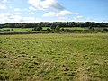
 Crop field near Ellerton - geograph.org.uk - 6463634.jpg 800 × 600 ; 136 kio
-
 Crop field near Soudley Park - geograph.org.uk - 6463293.jpg 800 × 600 ; 121 kio
-
 Direction Sign - Signpost in Cheswardine - geograph.org.uk - 6102059.jpg 262 × 581 ; 98 kio
-
 Dwelling at Thorneypits - geograph.org.uk - 391730.jpg 640 × 427 ; 80 kio
-
 Easy does it^ - geograph.org.uk - 5456848.jpg 640 × 480 ; 54 kio
-
 Edward VII postbox, Goldstone - geograph.org.uk - 6470810.jpg 512 × 800 ; 114 kio
-
 Elizabeth II postbox, Doley - geograph.org.uk - 6263121.jpg 2 676 × 4 397 ; 3,36 Mio
-
 Elizabeth II postbox, Ellerton - geograph.org.uk - 6470886.jpg 526 × 800 ; 153 kio
-
 Elizabeth II postbox, Soudley - geograph.org.uk - 6470900.jpg 640 × 502 ; 156 kio
-
 Ellerton Pool Cottage - geograph.org.uk - 751545.jpg 640 × 480 ; 123 kio
-
 Ellerton Wood Farm - geograph.org.uk - 3825164.jpg 1 142 × 857 ; 453 kio
-
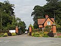 Entrance to Cheswardine Hall - geograph.org.uk - 2030309.jpg 640 × 480 ; 216 kio
-
 Entrance to Ellerton Woodww - geograph.org.uk - 391711.jpg 427 × 640 ; 130 kio
-
 Entrance to Lipley Farm - geograph.org.uk - 2302038.jpg 640 × 480 ; 156 kio
-
 Entrance to Soudley Park Farm - geograph.org.uk - 5456953.jpg 640 × 480 ; 106 kio
-
 Family of swans along the Shropshire Union Canal - geograph.org.uk - 6449859.jpg 800 × 565 ; 182 kio
-
 Farm and pasture at Little Soudley in Shropshire - geograph.org.uk - 6534007.jpg 1 600 × 900 ; 1,53 Mio
-
 Farm building at Park Heath - geograph.org.uk - 391745.jpg 534 × 640 ; 104 kio
-
 Farm buildings neat Cheswardine Park Farm - geograph.org.uk - 2030253.jpg 640 × 480 ; 197 kio
-
 Farm land near Little Soudley in Shropshire - geograph.org.uk - 6533964.jpg 1 440 × 960 ; 1,81 Mio
-
 Farm track (footpath) near Soudley Park Farm - geograph.org.uk - 6463298.jpg 800 × 600 ; 112 kio
-
 Farm track off Haywood Lane - geograph.org.uk - 6262292.jpg 800 × 600 ; 175 kio
-
 Farm Tracks - geograph.org.uk - 391690.jpg 640 × 415 ; 76 kio
-
 Farmland and the Shropshire Union Canal - geograph.org.uk - 6447665.jpg 800 × 601 ; 133 kio
-
 Farmland at Ellerton Wood - geograph.org.uk - 6447268.jpg 800 × 547 ; 121 kio
-
 Farmland beside the Shropshire Union Canal - geograph.org.uk - 6463524.jpg 800 × 517 ; 76 kio
-
 Farmland from path leading to Thorneypits - geograph.org.uk - 391724.jpg 640 × 427 ; 45 kio
-
 Farmland near Little Soudley in Shropshire - geograph.org.uk - 6534381.jpg 1 440 × 960 ; 2,04 Mio
-
 Farmland near Little Soudley in Shropshire - geograph.org.uk - 6534384.jpg 1 280 × 960 ; 1,8 Mio
-
 Farmland near to Hopshort - geograph.org.uk - 391761.jpg 640 × 322 ; 32 kio
-
 Farmland next to the Shropshire Union Canal - geograph.org.uk - 6447322.jpg 650 × 800 ; 221 kio
-
 Farmland next to the Shropshire Union Canal - geograph.org.uk - 6447662.jpg 800 × 493 ; 112 kio
-
 Farmland south of Soudley in Shropshire - geograph.org.uk - 6532056.jpg 1 440 × 1 080 ; 1,81 Mio
-
 Field and woodland near Ellerton - geograph.org.uk - 6463626.jpg 800 × 600 ; 146 kio
-
 Field beside Shropshire Union Canal - geograph.org.uk - 4599891.jpg 640 × 427 ; 78 kio
-
 Field Demarcation - geograph.org.uk - 391695.jpg 640 × 444 ; 66 kio
-
 Field entrance, Ellerton - geograph.org.uk - 6463686.jpg 800 × 600 ; 137 kio
-
 Field path near Lawn Drumble , NW of Cheswardine - geograph.org.uk - 5608325.jpg 5 184 × 2 920 ; 6,11 Mio
-
 Fields and crops near Hopshot - geograph.org.uk - 2706086.jpg 640 × 480 ; 97 kio
-
 Footpath near Soudley - geograph.org.uk - 5456908.jpg 640 × 480 ; 81 kio
-
 Footpath through the spuds - geograph.org.uk - 5456899.jpg 640 × 480 ; 98 kio
-
 Footpath to Chipnall Lees - geograph.org.uk - 2302040.jpg 640 × 480 ; 110 kio
-
 Fox Bridge at Little Soudley in Shropshire - geograph.org.uk - 6533984.jpg 1 280 × 960 ; 1,3 Mio
-
 Fox Bridge at Little Soudley in Shropshire - geograph.org.uk - 6533988.jpg 1 280 × 960 ; 1,47 Mio
-
 Fox Bridge Farm at Little Soudley in Shropshire - geograph.org.uk - 6534010.jpg 1 280 × 960 ; 1,45 Mio
-
 Gateway into Castle Wood - geograph.org.uk - 5456868.jpg 640 × 480 ; 113 kio
-
 Goldstone Bridge near Cheswardine in Shropshire - geograph.org.uk - 6535400.jpg 960 × 1 280 ; 1,52 Mio
-
 Goldstone Bridge west of Cheswardine in Shropshire - geograph.org.uk - 6536174.jpg 960 × 1 280 ; 1,59 Mio
-
 Goldstone Bridge west of Cheswardine in Shropshire - geograph.org.uk - 6536202.jpg 1 280 × 960 ; 1,73 Mio
-
 Goldstone Hall Country House Hotel - geograph.org.uk - 6463532.jpg 800 × 537 ; 154 kio
-
 Goldstone Road - geograph.org.uk - 6463619.jpg 800 × 600 ; 148 kio
-
 Goldstone Wharf west of Cheswardine, Shropshire - geograph.org.uk - 6536227.jpg 1 280 × 960 ; 1,49 Mio
-
 Goldstone Wharf, Market Drayton - geograph.org.uk - 280073.jpg 640 × 424 ; 85 kio
-
 Goldstone Wharf, Shropshire Union Canal - geograph.org.uk - 187430.jpg 640 × 427 ; 90 kio
-
 Grassland near Lipley Heath Farm - geograph.org.uk - 6262386.jpg 800 × 600 ; 87 kio
-
 Grassland near Park Heath - geograph.org.uk - 6462504.jpg 800 × 600 ; 87 kio
-
 Grazing near Chipnallmill Farm - geograph.org.uk - 6262333.jpg 800 × 600 ; 112 kio
-
 Grazing near Ellerton - geograph.org.uk - 6463622.jpg 800 × 600 ; 104 kio
-
 Grazing near Heatherdale Farm - geograph.org.uk - 6262338.jpg 800 × 600 ; 97 kio
-
 Grazing near Hopshort - geograph.org.uk - 6463300.jpg 800 × 600 ; 111 kio
-
 Grazing off Haywood Lane - geograph.org.uk - 6262289.jpg 800 × 600 ; 149 kio
-
 Grazing towards Bishop's Wood - geograph.org.uk - 6262389.jpg 800 × 600 ; 90 kio
-
 Grazing, Chipnall - geograph.org.uk - 6262325.jpg 800 × 600 ; 169 kio
-
 Halleman's Bridge near Cheswardine in Shropshire - geograph.org.uk - 6534435.jpg 1 280 × 960 ; 1,69 Mio
-
 Hanwood Farm, Soudley - geograph.org.uk - 6463305.jpg 800 × 600 ; 92 kio
-
 Hay bales and pasture near Soudley in Shropshire - geograph.org.uk - 6532044.jpg 1 440 × 960 ; 1,47 Mio
-
 Hay bales south of Soudley in Shropshire - geograph.org.uk - 6532051.jpg 960 × 1 280 ; 1,21 Mio
-
 Haywood Lane - geograph.org.uk - 6262294.jpg 800 × 600 ; 160 kio
-
 Haywood Lane towards Cheswardine - geograph.org.uk - 6262290.jpg 800 × 600 ; 134 kio
-
 Haywood Lane, Bridge Farm - geograph.org.uk - 6262288.jpg 800 × 600 ; 133 kio
-
 Hazeldines Bridge near Soudley in Shropshire - geograph.org.uk - 6532035.jpg 1 280 × 1 280 ; 1,67 Mio
-

-
 Horses in paddock at Soudley - geograph.org.uk - 1925803.jpg 640 × 480 ; 102 kio
-
 House in Hopshort - geograph.org.uk - 6463304.jpg 800 × 593 ; 82 kio
-
 House on junction, Ellerton - geograph.org.uk - 6470888.jpg 5 159 × 3 465 ; 5,03 Mio
-
 House on the junction, Ellerton - geograph.org.uk - 6463637.jpg 800 × 516 ; 82 kio
-
 House on the junction, Soudley - geograph.org.uk - 6463522.jpg 800 × 528 ; 92 kio
-
 Houses on Haywood Lane - geograph.org.uk - 6262296.jpg 800 × 600 ; 98 kio
-
 Inside the horse gin - geograph.org.uk - 728849.jpg 640 × 480 ; 70 kio
-
 Junction near Goldstone Wharf - geograph.org.uk - 5457765.jpg 640 × 480 ; 98 kio
-
 Lane from Ellerton towards Sambrook - geograph.org.uk - 6463689.jpg 800 × 600 ; 101 kio
-
 Lane junction that could be almost anywhere - geograph.org.uk - 2030367.jpg 640 × 480 ; 131 kio
-
 Lane towards Chipnall Lees - geograph.org.uk - 6262331.jpg 800 × 600 ; 142 kio
-
 Lane towards Chipnallmill Farm - geograph.org.uk - 6262335.jpg 800 × 600 ; 154 kio
-
 Lane towards Shawbroom Farm - geograph.org.uk - 6463301.jpg 800 × 600 ; 127 kio
-
 Lodge to Cheswardine Hall - geograph.org.uk - 6262321.jpg 800 × 531 ; 105 kio
-
 Maize crop towards Rushymoss Wood - geograph.org.uk - 6262328.jpg 800 × 600 ; 114 kio
-
 Make way for Electricity - geograph.org.uk - 391742.jpg 640 × 448 ; 97 kio
-
 Manor Cottage, Doley - geograph.org.uk - 6263122.jpg 5 184 × 3 888 ; 4,21 Mio
-
 Manure mountain at Ellerton - geograph.org.uk - 1925699.jpg 640 × 480 ; 125 kio
-
 Milepost near Fox Bridge.jpg 979 × 734 ; 510 kio
-
 Milepost SU-22-17, Shropshire Union Canal - geograph.org.uk - 6381183.jpg 2 000 × 1 333 ; 3,63 Mio
-
 Mind your head^ - geograph.org.uk - 5456845.jpg 640 × 480 ; 69 kio
-
 Minor road from Doley towards Cheswardine - geograph.org.uk - 6262393.jpg 800 × 600 ; 103 kio
-
 Minor road near Hanwood Farm - geograph.org.uk - 6463520.jpg 800 × 600 ; 103 kio
-
 Minor road towards Chipnall - geograph.org.uk - 6262322.jpg 800 × 600 ; 148 kio
-
 Minor road towards Doley - geograph.org.uk - 6262387.jpg 800 × 600 ; 185 kio
-
 Minor road towards Doley - geograph.org.uk - 6262391.jpg 800 × 600 ; 164 kio
-
 Minor road towards Ellerton - geograph.org.uk - 6463625.jpg 800 × 600 ; 162 kio
-
 Minor road towards Ellerton - geograph.org.uk - 6463631.jpg 800 × 600 ; 110 kio
-
 Minor road towards Glass Houses - geograph.org.uk - 6262339.jpg 800 × 600 ; 122 kio
-
 Minor road towards Soudley - geograph.org.uk - 6462508.jpg 800 × 600 ; 73 kio
-
 Minor road towards Soudley - geograph.org.uk - 6462516.jpg 800 × 600 ; 91 kio
-
 Minor road towards Soudley - geograph.org.uk - 6463295.jpg 640 × 480 ; 68 kio
-
 Minor road, Chipnall - geograph.org.uk - 6262327.jpg 800 × 600 ; 170 kio
-
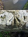
 Moat Remains, Cheswardine - geograph.org.uk - 6381152.jpg 2 000 × 1 333 ; 2,28 Mio
-

-

-
 Moorings south-west of Cheswardine in Shropshire - geograph.org.uk - 6034343.jpg 1 280 × 960 ; 1,6 Mio
-
 Mother duck and offspring - geograph.org.uk - 5457560.jpg 640 × 480 ; 81 kio
-
 Muddy field entrance, Park Heath - geograph.org.uk - 6462515.jpg 800 × 600 ; 87 kio
-
 Muddy road towards Thorneypits - geograph.org.uk - 6463636.jpg 800 × 600 ; 135 kio
-
 Narrow boat on narrow canal - geograph.org.uk - 2030206.jpg 640 × 480 ; 447 kio
-
 Narrow boat with a garden - geograph.org.uk - 5456974.jpg 640 × 480 ; 69 kio
-
 Narrowboat at Park Heath Bridge No 48 - geograph.org.uk - 6447209.jpg 800 × 537 ; 149 kio
-
 Narrowboat on the Shropshire Union Canal - geograph.org.uk - 6447040.jpg 800 × 576 ; 157 kio
-
 Narrowboat with pub^ Goldstone Wharf, Shropshire - geograph.org.uk - 5287029.jpg 1 280 × 960 ; 1,11 Mio
-
 Narrowboats at Fox Bridge No 52 - geograph.org.uk - 6447317.jpg 800 × 527 ; 145 kio
-

-

-

-

-

-
 New Brighton Bridge near Little Soudley, Shropshire - geograph.org.uk - 6532658.jpg 1 280 × 960 ; 1,69 Mio
-
 New Brighton Bridge No 51 - geograph.org.uk - 6447295.jpg 800 × 511 ; 117 kio
-

-

-

-
 On guard at Cheswardine - geograph.org.uk - 2030299.jpg 640 × 480 ; 274 kio
-
 Ordnance Survey Cut Mark - geograph.org.uk - 5230102.jpg 3 855 × 2 891 ; 1,62 Mio
-
 OS benchmark - New Brighton Bridge - geograph.org.uk - 3822003.jpg 734 × 979 ; 444 kio
-
 OS rivet and benchmark on Goldstone Bridge - geograph.org.uk - 3825152.jpg 857 × 1 142 ; 460 kio
-
 Overflow along the Shropshire Union Canal - geograph.org.uk - 6448736.jpg 800 × 554 ; 164 kio
-
 Paddock and house at Soudley - geograph.org.uk - 1925801.jpg 640 × 480 ; 99 kio
-
 Park Heath Bridge No 48 - geograph.org.uk - 6447052.jpg 800 × 577 ; 147 kio
-
 Park Heath Bridge No 48 - geograph.org.uk - 6447203.jpg 800 × 596 ; 183 kio
-
 Park Heath Bridge south of Soudley in Shropshire - geograph.org.uk - 6532004.jpg 1 440 × 960 ; 1,57 Mio
-
 Park Heath Bridge south of Soudley in Shropshire - geograph.org.uk - 6532008.jpg 1 280 × 960 ; 1,31 Mio
-
 Playing field, Cheswardine - geograph.org.uk - 1925791.jpg 640 × 480 ; 71 kio
-
 Pollarded willows at Sambrook - geograph.org.uk - 1925675.jpg 640 × 480 ; 126 kio
-
 Postbox at Doley crossroads - geograph.org.uk - 2706397.jpg 640 × 480 ; 104 kio
-
 Postbox at Ellerton - geograph.org.uk - 2706062.jpg 640 × 480 ; 88 kio
-
 Private driveway - geograph.org.uk - 3179707.jpg 640 × 480 ; 143 kio
-
 Public footpath south east of Cheswardine - geograph.org.uk - 5456897.jpg 640 × 480 ; 69 kio
-
 Ready for sowing - geograph.org.uk - 2706074.jpg 640 × 480 ; 131 kio
-
 Road junction at Ellerton - geograph.org.uk - 1925695.jpg 640 × 480 ; 63 kio
-
 Rope wear on Hazeldines Bridge No 49 - geograph.org.uk - 6447252.jpg 680 × 800 ; 145 kio
-
 Rope wear on Soudley Bridge - geograph.org.uk - 3819024.jpg 857 × 1 142 ; 383 kio
-
 Shropshire cropfields towards Ellerton - geograph.org.uk - 1460916.jpg 640 × 470 ; 134 kio
-
 Shropshire farmland near Little Soudley - geograph.org.uk - 6533925.jpg 1 440 × 960 ; 1,8 Mio
-
 Shropshire farmland near Little Soudley - geograph.org.uk - 6533927.jpg 1 280 × 960 ; 1,61 Mio
-
 Shropshire farmland near Little Soudley - geograph.org.uk - 6533959.jpg 1 280 × 960 ; 1,63 Mio
-
 Shropshire farmland near Little Soudley - geograph.org.uk - 6534386.jpg 960 × 1 280 ; 1,63 Mio
-
 Shropshire farmland near Soudley - geograph.org.uk - 6531994.jpg 1 440 × 960 ; 1,38 Mio
-
 Shropshire farmland near Soudley - geograph.org.uk - 6531999.jpg 1 440 × 960 ; 1,48 Mio
-
 Shropshire farmland south of Little Soudley - geograph.org.uk - 6034293.jpg 1 600 × 900 ; 1,59 Mio


_near_Soudley_Park_Farm_-_geograph.org.uk_-_6463298.jpg)


