Category:Chilcompton
Aller à la navigation
Aller à la recherche
English: Chilcompton is a village in Somerset, England, situated in the Mendip Hills two miles south of Midsomer Norton.
localité britannique du comté anglais de Somerset  | |||||
| Téléverser des médias | |||||
| Nature de l’élément | |||||
|---|---|---|---|---|---|
| Lieu | Mendip, Somerset, Angleterre du Sud-Ouest, Angleterre | ||||
| Réputé identique à | Chilcompton (page en doublon, paroisse civile) | ||||
 | |||||
Sous-catégories
Cette catégorie comprend 5 sous-catégories, dont les 5 ci-dessous.
C
- Chilcompton railway station (2 F)
- Chilcompton Tunnel (1 F)
- Chilcompton War Memorial (3 F)
S
- Stock Hill, Gurney Slade (5 F)
Média dans la catégorie « Chilcompton »
Cette catégorie comprend 116 fichiers, dont les 116 ci-dessous.
-
 2010 , A bit further, just a little bit further - geograph.org.uk - 1947533.jpg 800 × 566 ; 168 kio
-
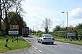 2010 , B3139 Wells Road entering Chilcompton - geograph.org.uk - 1947450.jpg 800 × 532 ; 133 kio
-
 2010 , B3139 Wells Road heading east - geograph.org.uk - 1851874.jpg 800 × 548 ; 183 kio
-
 2010 , B3139 Wells Road, Chilcompton - geograph.org.uk - 1947477.jpg 800 × 639 ; 176 kio
-
 2010 , B3139 Wells Road, Chilcompton - geograph.org.uk - 1947517.jpg 800 × 573 ; 154 kio
-

-
 2010 , Baker's Lane, Chilcompton - geograph.org.uk - 1851878.jpg 800 × 774 ; 181 kio
-

-
 2010 , Road repairs on "The Street" Chilcompton - geograph.org.uk - 1851885.jpg 800 × 558 ; 135 kio
-
 2010 , Roadworks on "The Street" Chilcompton -2 - geograph.org.uk - 1947570.jpg 800 × 671 ; 229 kio
-
 2010 , The roadworks are a coming - geograph.org.uk - 1947566.jpg 800 × 673 ; 159 kio
-
 2010 , Tyning House from the B3139 - geograph.org.uk - 1947470.jpg 800 × 525 ; 126 kio
-
 2010 , West from B3356 - geograph.org.uk - 1870932.jpg 1 024 × 419 ; 142 kio
-
 2010 , West of north from the B3139 - geograph.org.uk - 1947462.jpg 800 × 325 ; 57 kio
-
 A bench on Bowden Hill - geograph.org.uk - 6062036.jpg 3 296 × 2 472 ; 3,24 Mio
-
 A business opportunity following on from the railways - geograph.org.uk - 6064452.jpg 3 296 × 2 472 ; 3,28 Mio
-
 A hidden prospect - geograph.org.uk - 6059118.jpg 3 296 × 2 472 ; 3,57 Mio
-
 A pair of semis on Chilcompton Road - geograph.org.uk - 5754218.jpg 1 024 × 615 ; 159 kio
-
 A pillbox in quiet Chilcompton - geograph.org.uk - 6063890.jpg 3 296 × 2 472 ; 4,48 Mio
-
 A school day out - geograph.org.uk - 6059125.jpg 3 296 × 2 472 ; 3,34 Mio
-
 A stop temporarily stopped - geograph.org.uk - 6060534.jpg 3 296 × 2 472 ; 3,29 Mio
-
 A strange feature on Bowden Hill - geograph.org.uk - 6062040.jpg 3 296 × 2 472 ; 3,3 Mio
-
 Along The Pitching - geograph.org.uk - 6060515.jpg 2 472 × 3 296 ; 3,29 Mio
-
 An issue on the old railway track - geograph.org.uk - 6064434.jpg 3 296 × 2 472 ; 3,3 Mio
-
 An old part of Manor Farm - geograph.org.uk - 6060502.jpg 2 472 × 3 296 ; 3,5 Mio
-
 At the end of Coalpit Lane - geograph.org.uk - 1547593.jpg 640 × 462 ; 165 kio
-
 At the junction of The Street and Parsonage Lane - geograph.org.uk - 6062878.jpg 3 296 × 2 472 ; 3,41 Mio
-
 Barn on Bowden Hill - geograph.org.uk - 6062027.jpg 3 296 × 2 472 ; 3,57 Mio
-
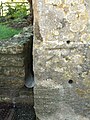 Benchmark on Hollwey Cottages - geograph.org.uk - 6062882.jpg 2 472 × 3 296 ; 3,31 Mio
-
 Brook beside The Street, Chilcompton - geograph.org.uk - 1209615.jpg 480 × 640 ; 113 kio
-
 Brook House, Chilcompton.jpg 1 800 × 1 350 ; 414 kio
-
 Bunker above tunnel - panoramio.jpg 4 288 × 2 848 ; 5,54 Mio
-
 Captain Streeten's gift to Chilcompton - geograph.org.uk - 6062019.jpg 2 472 × 3 296 ; 3,27 Mio
-
 Chilcompton - panoramio.jpg 4 288 × 2 848 ; 5,08 Mio
-
 Chilcompton road - panoramio.jpg 4 288 × 2 848 ; 5,43 Mio
-
 Chilcompton Village Hall - geograph.org.uk - 2276355.jpg 1 600 × 1 200 ; 437 kio
-
 Chilcompton village hall - geograph.org.uk - 6063877.jpg 3 296 × 2 472 ; 3,17 Mio
-
 Chilcompton, fingerpost 2 - geograph.org.uk - 1249404.jpg 480 × 640 ; 74 kio
-
 Chilcompton, Radstock BA3, UK - panoramio.jpg 4 288 × 2 848 ; 5,69 Mio
-
 Church House - geograph.org.uk - 6062893.jpg 3 296 × 2 472 ; 3,55 Mio
-
 Coronation Terrace - geograph.org.uk - 6064462.jpg 3 296 × 2 472 ; 3,55 Mio
-
 Croft House and the B3356 - geograph.org.uk - 3511819.jpg 3 264 × 2 448 ; 1,71 Mio
-

-
 Downside - The old church - geograph.org.uk - 137573.jpg 480 × 640 ; 106 kio
-
 Early colour by the Somer - geograph.org.uk - 6062009.jpg 2 472 × 3 296 ; 3,2 Mio
-
 East of south at the end of Coalpit Lane - geograph.org.uk - 1547716.jpg 640 × 490 ; 230 kio
-
 East on Sweet Leaze Lane - geograph.org.uk - 1250957.jpg 640 × 459 ; 222 kio
-
 Entrance and farm buildings, Three Tuns Farm - geograph.org.uk - 1547564.jpg 640 × 469 ; 210 kio
-
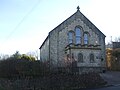 Epworth House - geograph.org.uk - 6063757.jpg 3 296 × 2 472 ; 3,46 Mio
-
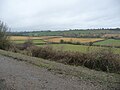
 Farmland in Chilcompton - geograph.org.uk - 6064429.jpg 3 296 × 2 472 ; 3,57 Mio
-
 Farmland in the valley of the River Somer - geograph.org.uk - 5754212.jpg 1 024 × 768 ; 188 kio
-
 Filling in the steamy past - geograph.org.uk - 6062045.jpg 2 472 × 3 296 ; 3,27 Mio
-
 Five-barred gate, Chilcompton - geograph.org.uk - 3000571.jpg 2 172 × 1 908 ; 1,55 Mio
-
 Footpath - panoramio (5).jpg 4 288 × 2 848 ; 5,38 Mio
-
 For family fun - geograph.org.uk - 6062023.jpg 3 296 × 2 472 ; 3,34 Mio
-
 Fry's Well - geograph.org.uk - 6063818.jpg 3 296 × 2 472 ; 3,53 Mio
-
 Fry's Well and the silent railway bridge - geograph.org.uk - 6063811.jpg 3 296 × 2 472 ; 3,55 Mio
-
 Heading south on Thickthorn Lane - geograph.org.uk - 1545161.jpg 640 × 511 ; 291 kio
-
 Heart Restarter - geograph.org.uk - 6060519.jpg 3 296 × 2 472 ; 3,27 Mio
-
 Herd seen from Coalpit Lane - geograph.org.uk - 1531300.jpg 640 × 489 ; 109 kio
-
 Jubilee gate - geograph.org.uk - 2998214.jpg 2 560 × 1 920 ; 1,83 Mio
-
 Junction of Coalpit Lane - geograph.org.uk - 1217323.jpg 640 × 457 ; 198 kio
-
 Just the thing on Church Lane - geograph.org.uk - 6060510.jpg 2 472 × 3 296 ; 3,42 Mio
-
 Keeping pupils and the public apart - geograph.org.uk - 3513651.jpg 3 264 × 2 448 ; 1,68 Mio
-
 Lane junction on Blacker's Hill - geograph.org.uk - 4966413.jpg 640 × 479 ; 175 kio
-
 Looking toward Chilcompton from Thickthorn Lane - geograph.org.uk - 1531292.jpg 640 × 462 ; 115 kio
-
 Milk from a Simple Cow - geograph.org.uk - 6063885.jpg 3 296 × 2 472 ; 3,31 Mio
-
 No cycling along The Pitching - geograph.org.uk - 6060492.jpg 3 296 × 2 472 ; 3,69 Mio
-
 North from Stock Hill - geograph.org.uk - 1251047.jpg 640 × 493 ; 196 kio
-
 Norton Green farm - geograph.org.uk - 2998219.jpg 2 560 × 1 920 ; 1,56 Mio
-
 Not the preferred route - geograph.org.uk - 6064449.jpg 3 296 × 2 472 ; 3,16 Mio
-

-
-

-

-
 Old Direction Sign - Signpost Stock Hill, Chilcompton parish - geograph.org.uk - 6097767.jpg 1 762 × 1 194 ; 520 kio
-
 Old route Somerset & Dorset railway - panoramio.jpg 4 288 × 2 848 ; 5,3 Mio
-
 Old Toll House, Old Down - geograph.org.uk - 6115165.jpg 800 × 585 ; 220 kio
-
 Over the wall at the end of Coalpit Lane - geograph.org.uk - 1547680.jpg 640 × 469 ; 221 kio
-
 Panorama of Midsomer Norton and surrounding fields - panoramio.jpg 6 735 × 1 843 ; 3,18 Mio
-
 Parsonage Lane, Chilcompton - geograph.org.uk - 3511831.jpg 3 264 × 2 448 ; 1,69 Mio
-
 Pasture near Three Tuns Farm - geograph.org.uk - 1547582.jpg 640 × 470 ; 257 kio
-
 Pasture south west of Coalpit Lane - geograph.org.uk - 1547573.jpg 640 × 517 ; 211 kio
-
 Pillbox interior - geograph.org.uk - 6063894.jpg 3 296 × 2 472 ; 3,36 Mio
-
 Returning into view - geograph.org.uk - 6060526.jpg 3 296 × 2 472 ; 3,89 Mio
-
 Shell House, Chilcompton.jpg 1 800 × 1 350 ; 198 kio
-
 Signpost to Chilcompton - geograph.org.uk - 4966416.jpg 640 × 479 ; 125 kio
-
 St Aldhelm's church in Chilcompton - geograph.org.uk - 6063729.jpg 3 296 × 2 472 ; 2,49 Mio
-
 Stock Hill, leaving Gurney Slade - geograph.org.uk - 1217347.jpg 640 × 517 ; 231 kio
-
 Swerving around the water - geograph.org.uk - 6064439.jpg 3 296 × 2 472 ; 3,42 Mio
-
 The Brook beside the Old Schoolhouse Church Lane - geograph.org.uk - 1209584.jpg 480 × 640 ; 157 kio
-
 The Court, Chilcompton - geograph.org.uk - 1545217.jpg 640 × 465 ; 188 kio
-
 The former railway line from Radstock to Shepton Mallet - geograph.org.uk - 2276389.jpg 2 048 × 1 536 ; 1,53 Mio
-
 The Hollies, Chilcompton.jpg 1 800 × 1 350 ; 309 kio
-
 The old S&D - geograph.org.uk - 6064420.jpg 3 296 × 2 472 ; 3,46 Mio
-
 The Old School - geograph.org.uk - 6060498.jpg 3 296 × 2 472 ; 3,52 Mio
-

-
 The Old Shop on Bowden Hill - geograph.org.uk - 6062037.jpg 3 296 × 2 472 ; 3,54 Mio
-
 The Pitching Chilcompton - geograph.org.uk - 1209596.jpg 480 × 640 ; 121 kio
-
 The Redan Inn - geograph.org.uk - 6063847.jpg 3 296 × 2 472 ; 2,78 Mio
-
 The River Somer in Chilcompton Church Lane - geograph.org.uk - 1209571.jpg 480 × 640 ; 125 kio
-
 The Somer and The Street - geograph.org.uk - 6062005.jpg 2 472 × 3 296 ; 3,17 Mio
-
 The Street, Chilcompton - geograph.org.uk - 2998198.jpg 2 560 × 1 920 ; 2,06 Mio
-
 The view from Bakers Lane - geograph.org.uk - 6062046.jpg 3 296 × 2 472 ; 3,45 Mio
-
 The western end of Sweet Leaze Lane - geograph.org.uk - 1250984.jpg 640 × 534 ; 191 kio
-
 Tree - panoramio (33).jpg 4 288 × 2 848 ; 5,19 Mio
-
 Waterfall and bus shelter, Chilcompton - geograph.org.uk - 2998204.jpg 2 560 × 1 920 ; 2,08 Mio
-
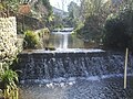
 Waterfall in The Street Chilcompton - geograph.org.uk - 1209606.jpg 640 × 480 ; 122 kio
-
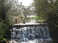
 Waterfall in The Street Chilcompton - geograph.org.uk - 1209627.jpg 480 × 640 ; 106 kio
-
 West on Sweet Leaze Lane - geograph.org.uk - 1250973.jpg 640 × 470 ; 175 kio
-
 What else would you expect to find on Bakers Lane? - geograph.org.uk - 6062048.jpg 3 296 × 2 472 ; 3,52 Mio
-
 Where hill and lane go their separate ways - geograph.org.uk - 6063777.jpg 3 296 × 2 472 ; 3,39 Mio
-
 B3139 through Chilcompton - geograph.org.uk - 137568.jpg 640 × 480 ; 68 kio
-
 New Whitchurch Farm - geograph.org.uk - 137549.jpg 640 × 480 ; 82 kio
-
 The Rookery, Chilcompton - geograph.org.uk - 137555.jpg 640 × 480 ; 103 kio
-
 Tumulus and Three Tuns Farm - geograph.org.uk - 137552.jpg 640 × 480 ; 108 kio


.jpg)


.jpg)


