Category:Chillesford
Aller à la navigation
Aller à la recherche
.
localité britannique du comté anglais de Suffolk | |||||
| Téléverser des médias | |||||
| Nature de l’élément | |||||
|---|---|---|---|---|---|
| Lieu |
| ||||
 | |||||
Sous-catégories
Cette catégorie comprend 3 sous-catégories, dont les 3 ci-dessous.
Média dans la catégorie « Chillesford »
Cette catégorie comprend 101 fichiers, dont les 101 ci-dessous.
-
 25 Long Row, Chillesford Postbox - geograph.org.uk - 2609302.jpg 2 304 × 3 072 ; 1,55 Mio
-
 A plethora of signage in Tunstall Forest - geograph.org.uk - 4361696.jpg 1 024 × 768 ; 559 kio
-
 A small part of the mill pond - geograph.org.uk - 4440365.jpg 1 024 × 768 ; 700 kio
-
 A wander through Chillesford forest - geograph.org.uk - 4440298.jpg 1 024 × 768 ; 674 kio
-
 A wander through Chillesford forest - geograph.org.uk - 4440305.jpg 1 024 × 768 ; 630 kio
-
 B1078 and FRP 22 near Chillesford - geograph.org.uk - 4361729.jpg 1 024 × 768 ; 637 kio
-
 B1078, Orford Road - geograph.org.uk - 4361689.jpg 1 024 × 768 ; 557 kio
-
 B1084 Hertfords Place looking towards Butley - geograph.org.uk - 2609337.jpg 3 072 × 2 304 ; 1,32 Mio
-
 B1084 Hertfords Place looking towards Five Ways Crossroads - geograph.org.uk - 2609334.jpg 3 072 × 2 304 ; 1,31 Mio
-
 B1084 northeast of Neutral Farm - geograph.org.uk - 3550411.jpg 3 400 × 2 620 ; 1,34 Mio
-
 Boyton Marshes - geograph.org.uk - 4387124.jpg 1 024 × 768 ; 160 kio
-
 Buildings south of Butley Mill - geograph.org.uk - 4021624.jpg 640 × 427 ; 138 kio
-
 Butley Mill - geograph.org.uk - 4021612.jpg 640 × 457 ; 161 kio
-
 Butley Mill - geograph.org.uk - 4021618.jpg 640 × 427 ; 156 kio
-
 Butley Mill - geograph.org.uk - 4062343.jpg 1 024 × 768 ; 283 kio
-
 Butley Mill Sluice No. 1 - geograph.org.uk - 4022101.jpg 640 × 427 ; 236 kio
-
 Butley Mills - geograph.org.uk - 3568466.jpg 1 064 × 1 600 ; 488 kio
-
 Cattle - geograph.org.uk - 4387133.jpg 1 024 × 768 ; 201 kio
-
 Chillesford - B1084 Main Road through Village - geograph.org.uk - 5233605.jpg 4 608 × 3 456 ; 6,54 Mio
-
 Chillesford - geograph.org.uk - 4165465.jpg 640 × 427 ; 74 kio
-
 Chillesford Lodge - geograph.org.uk - 427023.jpg 640 × 429 ; 93 kio
-
 Chillesford Village Notice Board - geograph.org.uk - 2609311.jpg 2 304 × 3 072 ; 1,34 Mio
-
 Chillesford Village Sign.webp 1 500 × 1 500 ; 726 kio
-
 Converted watermill at Butley - geograph.org.uk - 6180763.jpg 2 287 × 1 524 ; 941 kio
-
 Cook's Barn - geograph.org.uk - 4022096.jpg 640 × 427 ; 134 kio
-

-
 Crag Pit west of Chillesford Lodge - geograph.org.uk - 4022088.jpg 640 × 427 ; 139 kio
-
 Disused Pit on Chillesford Estate - geograph.org.uk - 4022097.jpg 640 × 427 ; 107 kio
-
 Farm track near Broom Covert - geograph.org.uk - 4440387.jpg 1 024 × 768 ; 326 kio
-
 Field off the Sandlings Walk north of Chillesford - geograph.org.uk - 5914503.jpg 1 600 × 1 064 ; 373 kio
-
 Field on Low Farm - geograph.org.uk - 4021623.jpg 640 × 427 ; 119 kio
-
 Fields and woodland, Chillesford - geograph.org.uk - 2575468.jpg 3 648 × 2 048 ; 1,49 Mio
-
 Footpath - geograph.org.uk - 4387141.jpg 1 024 × 768 ; 217 kio
-
 Footpath - geograph.org.uk - 4387146.jpg 1 024 × 768 ; 344 kio
-
 Footpath along Butley River - geograph.org.uk - 4022083.jpg 640 × 427 ; 142 kio
-
 Footpath along Butley River - geograph.org.uk - 4022091.jpg 640 × 427 ; 120 kio
-
 Footpath along southern edge of Decoy Wood - geograph.org.uk - 4021595.jpg 640 × 427 ; 204 kio
-

-
 Footpath south of Decoy Wood - geograph.org.uk - 4021605.jpg 427 × 640 ; 162 kio
-
 Footpath Track And Field Boundary - geograph.org.uk - 4387139.jpg 1 024 × 768 ; 212 kio
-
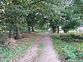 Forest track - geograph.org.uk - 1016327.jpg 640 × 480 ; 151 kio
-
 Former school, now housing, Chillesford - geograph.org.uk - 5915509.jpg 1 600 × 1 064 ; 404 kio
-
 FRPs 24 and 25 in Tunstall Forest on Orford Road - geograph.org.uk - 4361691.jpg 1 024 × 768 ; 443 kio
-
 Gate at eastern edge of RSPB Reserve - geograph.org.uk - 4022093.jpg 640 × 427 ; 160 kio
-
 Gate into RSPB reserve - geograph.org.uk - 4021631.jpg 640 × 427 ; 147 kio
-
 Gateway into RSPB reserve - geograph.org.uk - 4022099.jpg 640 × 427 ; 200 kio
-
 Grove House and Brick Kiln, Chillesford - geograph.org.uk - 4021564.jpg 640 × 427 ; 149 kio
-
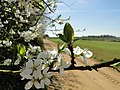 Hedgerow flowers - geograph.org.uk - 4440390.jpg 1 024 × 768 ; 271 kio
-
 Hill Covert and Marshland, Butley River - geograph.org.uk - 4022106.jpg 640 × 427 ; 150 kio
-
 Hill Covert seen from footpath beside Decoy Wood - geograph.org.uk - 4021591.jpg 640 × 427 ; 119 kio
-
 Holly tree beside the B1078 and FRP 22 near Chillesford - geograph.org.uk - 4361735.jpg 768 × 1 024 ; 624 kio
-
 House at entrance to Chillesford Lodge - geograph.org.uk - 4144589.jpg 4 320 × 3 240 ; 4,63 Mio
-
 House named The Glebe, Chillesford - geograph.org.uk - 4021368.jpg 640 × 427 ; 142 kio
-
 Hut on Butley River - geograph.org.uk - 4022086.jpg 640 × 427 ; 110 kio
-
 Long Row Telephone Box - geograph.org.uk - 2609297.jpg 2 304 × 3 072 ; 1,49 Mio
-
 Long Row, Chillesford - geograph.org.uk - 4021349.jpg 640 × 427 ; 162 kio
-
 Marshes beside Butley River - geograph.org.uk - 4022095.jpg 640 × 427 ; 126 kio
-
 Meadow View, Chillesford - geograph.org.uk - 4021482.jpg 640 × 427 ; 131 kio
-
 Meadow, Chillesford - geograph.org.uk - 4021492.jpg 640 × 427 ; 166 kio
-
 Mill Lane passes Butley Mill - geograph.org.uk - 3551718.jpg 3 648 × 2 736 ; 2 Mio
-
 Mill Lane ^ Butley Mills - geograph.org.uk - 2618852.jpg 3 072 × 2 304 ; 1,15 Mio
-
 Mill Lane, Chillesford - geograph.org.uk - 2618848.jpg 3 072 × 2 304 ; 1,35 Mio
-
 Old farm machinery near Chillesford Church - geograph.org.uk - 2575454.jpg 3 648 × 2 736 ; 2,26 Mio
-
 Old Stable north of Church Farm, Chillesford - geograph.org.uk - 4021459.jpg 640 × 427 ; 199 kio
-
 On the Suffolk Coast Path - track through Tunstall Forest - geograph.org.uk - 5240518.jpg 5 184 × 2 920 ; 5,02 Mio
-
 Path Through The Wood - geograph.org.uk - 4062402.jpg 768 × 1 024 ; 418 kio
-
 Path through Tunstall Forest - geograph.org.uk - 5880671.jpg 1 600 × 1 064 ; 447 kio
-
 Pedlar's Lane, Chillesford - geograph.org.uk - 4021466.jpg 640 × 427 ; 146 kio
-
 Pedlars Lane Bridleway - geograph.org.uk - 2609328.jpg 3 072 × 2 304 ; 1,36 Mio
-
 Pedlars Lane sign - geograph.org.uk - 2609319.jpg 3 072 × 2 304 ; 1,67 Mio
-
 Pedlars Lane, Chillesford - geograph.org.uk - 2949186.jpg 1 024 × 803 ; 169 kio
-
 Pond north of Church Farm, Chillesford - geograph.org.uk - 4021389.jpg 640 × 427 ; 186 kio
-
 Power lines in Tunstall Forest - geograph.org.uk - 3125470.jpg 1 064 × 1 600 ; 454 kio
-
 Reedbeds in the Butley River estuary - geograph.org.uk - 5879170.jpg 1 600 × 1 064 ; 505 kio
-
 Sandlings Walk north of Chillesford - geograph.org.uk - 5877256.jpg 1 600 × 1 064 ; 624 kio
-
 Sandy soil on track and field - geograph.org.uk - 4440394.jpg 1 024 × 768 ; 412 kio
-
 Sheds in Decoy Wood - geograph.org.uk - 4021601.jpg 640 × 427 ; 205 kio
-
 Slurry Spreading - geograph.org.uk - 4062417.jpg 1 024 × 768 ; 214 kio
-
 St Peter's church, Chillesford - geograph.org.uk - 5877260.jpg 1 600 × 1 064 ; 330 kio
-
 Suffolk Coast Path in Tunstall Forest - geograph.org.uk - 5915534.jpg 1 600 × 1 064 ; 522 kio
-
 Suffolk Coast Path in Tunstall Forest - geograph.org.uk - 5916193.jpg 1 064 × 1 600 ; 443 kio
-

-
 Suffolk Coast Path north of Decoy Wood - geograph.org.uk - 4021580.jpg 640 × 427 ; 184 kio
-
 Telephone Box Notice Board ^ 25 Long Row, Chillesford Postbox - geograph.org.uk - 2609307.jpg 3 072 × 2 304 ; 1,65 Mio
-
 Telephone Box Notice Board ^ 25 Long Row,Chillesford Postbox - geograph.org.uk - 2609290.jpg 3 072 × 2 304 ; 1,52 Mio
-
 Telephone Box Notice Board ^ 25 Long Row,Chillesford Postbox - geograph.org.uk - 2609291.jpg 3 072 × 2 304 ; 1,65 Mio
-
 Telephone Box Notice Board ^ 25 Long Row,Chillesford Postbox - geograph.org.uk - 2609331.jpg 3 072 × 2 304 ; 1,48 Mio
-
 The Glebe Land, Chillesford - geograph.org.uk - 4021337.jpg 640 × 427 ; 167 kio
-
 The School House, Chillesford - geograph.org.uk - 4021364.jpg 640 × 427 ; 184 kio
-
 The Suffolk Coast Path near Chillesford - geograph.org.uk - 3125465.jpg 1 600 × 1 064 ; 506 kio
-
 Towards Hill Farm - geograph.org.uk - 1016269.jpg 640 × 480 ; 81 kio
-
 Track into Tunstall Forest with warning signs - geograph.org.uk - 4361694.jpg 1 024 × 768 ; 536 kio
-
 Track to St. Peter's Church, Chillesford - geograph.org.uk - 4021379.jpg 640 × 427 ; 163 kio
-
 Tunstall Forest where the Suffolk Coast Path crosses the B1078 - geograph.org.uk - 5879183.jpg 1 600 × 1 064 ; 661 kio
-
 Tunstall Forest, off the Suffolk Coast Path - geograph.org.uk - 5915552.jpg 1 600 × 1 064 ; 507 kio
-
 View downhill off the Sandlings Walk, west of Chillesford - geograph.org.uk - 5914565.jpg 1 600 × 1 064 ; 380 kio
-
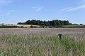
 Wheat field south of Tunstall Forest - geograph.org.uk - 5879177.jpg 1 600 × 1 064 ; 389 kio
-
 Wheat field south of Tunstall Forest - geograph.org.uk - 5916216.jpg 1 600 × 1 064 ; 530 kio
-
 Wheel track in the mud - geograph.org.uk - 4361731.jpg 1 024 × 768 ; 608 kio
-
 Woodland off the Sandlings Walk, west of Chillesford - geograph.org.uk - 5914564.jpg 1 600 × 1 064 ; 421 kio
-
 Woodland track - geograph.org.uk - 1016334.jpg 640 × 480 ; 110 kio


