Category:Chillington, Somerset
Aller à la navigation
Aller à la recherche
English: Chillington is a village and parish in Somerset, England, situated east of Chard in the South Somerset district. The village has a population of 98. The parish includes the hamlet of Coombe.
localité britannique du comté anglais de Somerset  | |||||
| Téléverser des médias | |||||
| Nature de l’élément | |||||
|---|---|---|---|---|---|
| Lieu | South Somerset, Somerset, Angleterre du Sud-Ouest, Angleterre | ||||
 | |||||
Média dans la catégorie « Chillington, Somerset »
Cette catégorie comprend 34 fichiers, dont les 34 ci-dessous.
-
 Benchmark on Sheep House Farm, Chillington - geograph.org.uk - 5342833.jpg 640 × 427 ; 125 kio
-
 Coley Lane - geograph.org.uk - 5214043.jpg 640 × 427 ; 88 kio
-
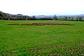
 Countryside near Chillington - geograph.org.uk - 5223085.jpg 640 × 427 ; 95 kio
-
 Countryside near Warren Hill - geograph.org.uk - 1222703.jpg 640 × 428 ; 75 kio
-
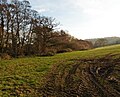
 Farm track, east of Heber's Lane - geograph.org.uk - 5219673.jpg 1 024 × 801 ; 206 kio
-
 Farmland near Higher Chillington - geograph.org.uk - 5219685.jpg 1 024 × 809 ; 182 kio
-
 Field of Swede - geograph.org.uk - 5223092.jpg 640 × 427 ; 89 kio
-
 Fields near Hill Farm - geograph.org.uk - 5219653.jpg 1 024 × 824 ; 256 kio
-
 Fisherway Lane - geograph.org.uk - 5219660.jpg 1 024 × 852 ; 304 kio
-
 Holcombe Copse - geograph.org.uk - 5659491.jpg 1 024 × 683 ; 574 kio
-
 Manor Farm, Chillington - geograph.org.uk - 5169484.jpg 1 024 × 767 ; 185 kio
-
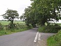
 Minor road on Warren Hill - geograph.org.uk - 4438937.jpg 1 024 × 768 ; 328 kio
-
 Minor road to Kingstone - geograph.org.uk - 5169524.jpg 1 024 × 835 ; 347 kio
-
 Nash Lane - geograph.org.uk - 5219638.jpg 1 024 × 808 ; 328 kio
-
 Road junction - geograph.org.uk - 3115591.jpg 640 × 480 ; 116 kio
-
 Road junction, St Rayn Hill - geograph.org.uk - 5659492.jpg 1 024 × 683 ; 506 kio
-
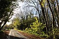 Road Through the Woods - geograph.org.uk - 5214012.jpg 640 × 427 ; 156 kio
-
 Road to Chibley Farm - geograph.org.uk - 5219572.jpg 1 024 × 820 ; 228 kio
-
 Sheep House Farm, Chillington - geograph.org.uk - 5342837.jpg 640 × 427 ; 63 kio
-
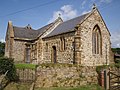
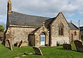 St James Church, Chillington - geograph.org.uk - 5169497.jpg 1 024 × 713 ; 190 kio
-
 St. James Church, Chillington - geograph.org.uk - 508076.jpg 640 × 480 ; 129 kio
-
 St.James church, Chillington - geograph.org.uk - 2577158.jpg 1 094 × 821 ; 294 kio
-
 Turning for Chibley Farm - geograph.org.uk - 5219565.jpg 1 024 × 768 ; 218 kio
-
 Turning for Winsham - geograph.org.uk - 5219696.jpg 1 024 × 869 ; 238 kio
-
 Turnip tops near Chibley Farm - geograph.org.uk - 5169466.jpg 1 024 × 797 ; 238 kio
-
 Village centre, Chillington - geograph.org.uk - 5321323.jpg 3 456 × 2 304 ; 5,09 Mio
-
 Across Stretford Water - geograph.org.uk - 508131.jpg 640 × 480 ; 123 kio
-
 After the harvest - geograph.org.uk - 1156536.jpg 640 × 480 ; 95 kio
-
 Eighteen Acre Plantation - geograph.org.uk - 508451.jpg 640 × 480 ; 110 kio
-
 Footpath near Chillington - geograph.org.uk - 508104.jpg 480 × 640 ; 127 kio
-
 Footpath near Hill Farm - geograph.org.uk - 546266.jpg 640 × 480 ; 140 kio
-
 Holcombe Copse - geograph.org.uk - 546235.jpg 640 × 480 ; 126 kio
-
 Junction at Chillington - geograph.org.uk - 511737.jpg 640 × 480 ; 139 kio
-
 Lane junction above Purtington - geograph.org.uk - 508582.jpg 640 × 480 ; 115 kio


