Category:Chirnside (civil parish)
Vai alla navigazione
Vai alla ricerca
Scottish parish in Scottish Borders, Scotland, UK | |||||
| Carica un file multimediale | |||||
| Istanza di | |||||
|---|---|---|---|---|---|
| Parte di |
| ||||
| Prende il nome da | |||||
| Luogo |
| ||||
| Capitale | |||||
| Popolazione |
| ||||
| Superficie |
| ||||
 | |||||
Sottocategorie
Questa categoria contiene le 2 sottocategorie indicate di seguito, su un totale di 2.
C
File nella categoria "Chirnside (civil parish)"
Questa categoria contiene 200 file, indicati di seguito, su un totale di 312.
(pagina precedente) (pagina successiva)-
 A barley field near Chirnside - geograph.org.uk - 5010921.jpg 1 024 × 678; 223 KB
-
 A cleared strip wood - geograph.org.uk - 2326481.jpg 640 × 480; 305 KB
-
 A Matter Of Urgency - geograph.org.uk - 2597993.jpg 1 600 × 1 200; 505 KB
-

-
 A swan patrols its domain - geograph.org.uk - 1985393.jpg 640 × 480; 142 KB
-
 A6105 approaching Chirnside - geograph.org.uk - 5481384.jpg 640 × 480; 52 KB
-
 A6105 towards Foulden - geograph.org.uk - 5481434.jpg 640 × 480; 63 KB
-
 A6105 towards Foulden - geograph.org.uk - 5481443.jpg 640 × 480; 42 KB
-
 A6105, Chirnside - geograph.org.uk - 4470087.jpg 640 × 480; 74 KB
-
 Allanton Bridge - geograph.org.uk - 1985375.jpg 640 × 480; 108 KB
-
 Allanton Bridge - geograph.org.uk - 5359252.jpg 640 × 480; 108 KB
-
 An undulating field, Edington - geograph.org.uk - 1927780.jpg 640 × 480; 105 KB
-
 Another Tight Squeeze - geograph.org.uk - 2597876.jpg 640 × 480; 83 KB
-

-
 Arable field north of Chirnside - geograph.org.uk - 5011021.jpg 1 024 × 678; 228 KB
-
 Arable land to the west of West Foulden - geograph.org.uk - 3455608.jpg 3 264 × 2 448; 3,76 MB
-
 Arable land, Causewaybank - geograph.org.uk - 4226328.jpg 800 × 450; 336 KB
-
 Arable land, West Foulden - geograph.org.uk - 2326488.jpg 640 × 480; 229 KB
-
 Awaiting The Next Load... - geograph.org.uk - 2597979.jpg 1 600 × 1 200; 407 KB
-
 B6355 near North Lodge - geograph.org.uk - 4482081.jpg 640 × 480; 84 KB
-
 B6355 towards Ayton - geograph.org.uk - 5481413.jpg 640 × 480; 55 KB
-
 B6355, Easter Crowbutt - geograph.org.uk - 4482068.jpg 640 × 480; 84 KB
-
 B6355, Edington Hill - geograph.org.uk - 5481416.jpg 640 × 480; 72 KB
-
 B6437 - geograph.org.uk - 4226338.jpg 800 × 450; 285 KB
-
 B6437 heading south east - geograph.org.uk - 4482057.jpg 640 × 480; 83 KB
-
 B6437 leaving Chirnside - geograph.org.uk - 4482099.jpg 640 × 480; 57 KB
-
 B6437 near Causewaybank - geograph.org.uk - 4482055.jpg 640 × 480; 53 KB
-
 B6437 towards Chirnside - geograph.org.uk - 4482053.jpg 640 × 480; 67 KB
-
 B6437, Chirnside - geograph.org.uk - 1829208.jpg 640 × 480; 107 KB
-
 B6437, Harelaw - geograph.org.uk - 4482062.jpg 640 × 480; 73 KB
-
 Barley, Chirnside - geograph.org.uk - 1927744.jpg 640 × 359; 85 KB
-
 Barley, Chirnside - geograph.org.uk - 1927746.jpg 640 × 359; 80 KB
-
 Barn and bales, Blackburn Farm - geograph.org.uk - 4704580.jpg 640 × 480; 459 KB
-
 Bench Mark at Chirnside Parish Church - geograph.org.uk - 943809.jpg 427 × 640; 152 KB
-
 Berwickshire landscape - geograph.org.uk - 4704166.jpg 640 × 480; 466 KB
-
 Berwickshire landscape - geograph.org.uk - 4705195.jpg 640 × 480; 502 KB
-
 Billie Burn - geograph.org.uk - 1829199.jpg 640 × 480; 141 KB
-
 Billie Burn at the Whiteadder - geograph.org.uk - 1985382.jpg 640 × 480; 123 KB
-
 Billiemire Burn near Auchencrow in the Scottish Borders - geograph.org.uk - 6315095.jpg 3 128 × 2 346; 2,87 MB
-
 Blackburn Cottage - geograph.org.uk - 4704175.jpg 640 × 480; 618 KB
-
 Blue Braes - geograph.org.uk - 1918771.jpg 640 × 480; 157 KB
-
 Bluestone Ford - geograph.org.uk - 1940614.jpg 640 × 480; 126 KB
-
 Bluestone Ford - geograph.org.uk - 4703809.jpg 480 × 640; 541 KB
-
 Bluestone Ford - geograph.org.uk - 5827955.jpg 2 001 × 1 125; 381 KB
-
 Car park and picnic tables at Chirnside - geograph.org.uk - 4703817.jpg 640 × 480; 474 KB
-
 Cereal crop off the A6105 - geograph.org.uk - 5481437.jpg 640 × 480; 63 KB
-
 Cereal crop, Edington - geograph.org.uk - 5481410.jpg 640 × 480; 71 KB
-
 Cereal crop, Edingtonhill - geograph.org.uk - 5481422.jpg 640 × 480; 90 KB
-
 Chirnside - geograph.org.uk - 1831575.jpg 640 × 361; 172 KB
-
 Chirnside Bowling Club - geograph.org.uk - 4641486.jpg 640 × 468; 54 KB
-
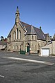 Chirnside Community Centre - geograph.org.uk - 1821097.jpg 427 × 640; 130 KB
-
 Chirnside Community Centre - geograph.org.uk - 3535005.jpg 3 240 × 4 320; 2,92 MB
-
 Chirnside Community Centre - geograph.org.uk - 5481403.jpg 480 × 640; 56 KB
-
 Chirnside Football Club ground - geograph.org.uk - 1822612.jpg 638 × 401; 135 KB
-
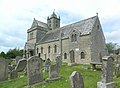
 Chirnside Parish Church - geograph.org.uk - 2127521.jpg 640 × 481; 59 KB
-
 Chirnside parish church - geograph.org.uk - 3535007.jpg 4 320 × 3 240; 3,04 MB
-
 Chirnside parish church - geograph.org.uk - 3535008.jpg 4 320 × 3 240; 2,99 MB
-
 Chirnside parish church - geograph.org.uk - 3535009.jpg 4 194 × 3 078; 3,12 MB
-
 Chirnside parish church - geograph.org.uk - 3535010.jpg 4 320 × 3 240; 2,8 MB
-
 Chirnside Parish Church - geograph.org.uk - 4482095.jpg 640 × 480; 62 KB
-
 Chirnside Parish Church - geograph.org.uk - 5359228.jpg 640 × 480; 74 KB
-
 Chirnside Parish Church - geograph.org.uk - 5359235.jpg 640 × 480; 64 KB
-
 Chirnside Parish Church - geograph.org.uk - 5576171.jpg 2 048 × 1 536; 929 KB
-
 Chirnside Parish Church - geograph.org.uk - 5576218.jpg 2 048 × 1 536; 1,1 MB
-
 Chirnside Parish Church - geograph.org.uk - 6214789.jpg 1 600 × 935; 200 KB
-
 Chirnside parish church and its gateway - geograph.org.uk - 3535006.jpg 4 050 × 2 976; 2,67 MB
-
 Chirnside Parish Church graveyard - geograph.org.uk - 943783.jpg 640 × 427; 133 KB
-
 Chirnside Primary School - geograph.org.uk - 3902662.jpg 640 × 480; 75 KB
-
 Chirnside Primary School - geograph.org.uk - 4482082.jpg 640 × 480; 62 KB
-
 Chirnside Saw Mill - geograph.org.uk - 4482100.jpg 640 × 480; 53 KB
-
 Chirnside War Memorial - geograph.org.uk - 948902.jpg 408 × 640; 121 KB
-
 Church and War Memorial, Chirnside - geograph.org.uk - 3348243.jpg 3 264 × 2 448; 3,47 MB
-
 Claas Lexion 580- Combine Harvester Discharging Wheat - geograph.org.uk - 2597985.jpg 1 600 × 1 200; 389 KB
-
 Claas Lexion 580- Terra Trac Combine Harvester - geograph.org.uk - 2597924.jpg 1 600 × 1 200; 470 KB
-
 Claas Lexion 600 Combine Harvester - geograph.org.uk - 2597950.jpg 1 600 × 1 200; 550 KB
-
 Claas Lexion 600 Combine Harvester - Job Complete - geograph.org.uk - 2597960.jpg 1 600 × 1 200; 483 KB
-
 Comrade's Park - geograph.org.uk - 1918842.jpg 640 × 480; 82 KB
-
 Comrades Park - geograph.org.uk - 3902665.jpg 640 × 480; 60 KB
-
 Crag, Hutton - geograph.org.uk - 1927763.jpg 640 × 345; 106 KB
-

-
 Crop field near Chirnside - geograph.org.uk - 4470078.jpg 640 × 480; 56 KB
-
 Crop field off the B6355 - geograph.org.uk - 4482078.jpg 640 × 480; 75 KB
-
 Crop field, Causewaybank - geograph.org.uk - 4470075.jpg 640 × 480; 64 KB
-
 Crop field, Chirnside - geograph.org.uk - 4482098.jpg 640 × 480; 71 KB
-
 Crop field, Easter Crowbutt - geograph.org.uk - 4482073.jpg 640 × 480; 58 KB
-
 Crop field, West Foulden - geograph.org.uk - 5481439.jpg 640 × 480; 58 KB
-

-
 Development sign, Edington Mill - geograph.org.uk - 1927755.jpg 640 × 359; 83 KB
-
-
 Down the hill to Mains - geograph.org.uk - 3455575.jpg 3 264 × 2 448; 3,47 MB
-
 Drill Hall in Chirnside, Scottish Borders - geograph.org.uk - 4234687.jpg 4 608 × 3 456; 6,66 MB
-
 Easter Crowbutt - geograph.org.uk - 4470081.jpg 640 × 480; 82 KB
-
 Eddington Hill Plantation - geograph.org.uk - 6286770.jpg 1 024 × 683; 467 KB
-
 Edingtonhill - geograph.org.uk - 3455546.jpg 3 020 × 2 150; 2,48 MB
-
 Edingtonhill Farm - geograph.org.uk - 1165530.jpg 640 × 480; 65 KB
-
 Edingtonhill from the B6355 - geograph.org.uk - 3455477.jpg 2 954 × 2 063; 2,42 MB
-

-
 Elizabethan postbox on Main Street West End, Chirnside - geograph.org.uk - 5481887.jpg 1 434 × 2 039; 642 KB
-
 Entering Chirnside - geograph.org.uk - 4482066.jpg 640 × 480; 67 KB
-

-

-
 Farm road, Edingtonhill - geograph.org.uk - 5481424.jpg 640 × 480; 71 KB
-
 Farm track at Oldcastles near Chirnside - geograph.org.uk - 6245925.jpg 3 128 × 2 346; 2,72 MB
-
 Farm track north of Chirnside - geograph.org.uk - 5011011.jpg 1 024 × 678; 251 KB
-
 Farmhouse, Ninewells Mains - geograph.org.uk - 5481378.jpg 640 × 480; 49 KB
-
 Farmland at Chirnside - geograph.org.uk - 4778182.jpg 640 × 421; 163 KB
-
 Farmland near Blue Braes - geograph.org.uk - 4710390.jpg 3 648 × 2 736; 4,2 MB
-
 Farmland near Edingtonhill - geograph.org.uk - 3455488.jpg 3 264 × 2 448; 3,32 MB
-
 Farmland, Causewaybank - geograph.org.uk - 4470074.jpg 640 × 480; 79 KB
-

-

-
 Field Boundary - Chirnside - geograph.org.uk - 4055027.jpg 1 600 × 1 200; 585 KB
-
 Field edge view from Harelaw Reservoir Triangulation Pillar - geograph.org.uk - 5190460.jpg 4 000 × 3 000; 3,31 MB
-
 Field entrance, Edington - geograph.org.uk - 5481426.jpg 640 × 480; 86 KB
-

-
 Field not in cultivation - geograph.org.uk - 1829212.jpg 640 × 480; 88 KB
-

-
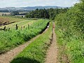
 Field path near Chirnside - geograph.org.uk - 5010898.jpg 1 024 × 678; 228 KB
-
 Field path north of Chirnside - geograph.org.uk - 5010915.jpg 1 024 × 678; 177 KB
-
 Field Track - Between Blackburn and Edington Hill - geograph.org.uk - 3525715.jpg 3 648 × 2 736; 2,63 MB
-
 Field track near Chirnside - geograph.org.uk - 5011038.jpg 1 024 × 678; 282 KB
-
 Field under wheat crop near Oldcastles Farm, Chirnside - geograph.org.uk - 6245199.jpg 5 184 × 3 888; 7,71 MB
-
 Field with bales at Blackburn Farm - geograph.org.uk - 4704183.jpg 640 × 480; 526 KB
-
 Fields and woods near Blackburn Farm - geograph.org.uk - 4704582.jpg 640 × 480; 469 KB
-
 Finishing The Field - geograph.org.uk - 2598000.jpg 1 600 × 1 200; 422 KB
-
 Footpath in Chirnside - geograph.org.uk - 5011678.jpg 1 024 × 678; 177 KB
-
 Footpath sign, Chirnside - geograph.org.uk - 1918862.jpg 640 × 359; 66 KB
-
 Footpath sign, North Lodge Chirnside - geograph.org.uk - 5011836.jpg 1 024 × 678; 175 KB
-
 Footpath signpost north of Chirnside - geograph.org.uk - 5010928.jpg 1 024 × 678; 240 KB
-
 Footpaths near Chirnside Parish Church - geograph.org.uk - 5011821.jpg 1 024 × 684; 210 KB
-
 Ford near Whitehall - geograph.org.uk - 1852615.jpg 640 × 480; 94 KB
-
 Former Post Office, Chirnside - geograph.org.uk - 5481871.jpg 640 × 480; 72 KB
-
 Fox Covert near Blackburn - geograph.org.uk - 3525734.jpg 3 648 × 2 736; 1,85 MB
-
 Gated farm track off the B6355 - geograph.org.uk - 4470082.jpg 640 × 480; 81 KB
-
 Gateway, Chirnside Parish Church - geograph.org.uk - 4482092.jpg 640 × 480; 68 KB
-
 George VI postbox - geograph.org.uk - 943812.jpg 427 × 640; 122 KB
-
 Green Lane - geograph.org.uk - 4705171.jpg 640 × 480; 617 KB
-
 Green lane from Blackburn to Harelaw - geograph.org.uk - 4704174.jpg 640 × 480; 554 KB
-
 Harelaw Farm - geograph.org.uk - 4703820.jpg 640 × 480; 387 KB
-
 Harelaw Farm Cottages - geograph.org.uk - 4470076.jpg 640 × 480; 60 KB
-
 Harvest in progress, Edington Hill - geograph.org.uk - 5481414.jpg 640 × 480; 62 KB
-
 Harvest in progress, Edingtonhill - geograph.org.uk - 5481419.jpg 640 × 480; 75 KB
-
 Harvesting Wheat Near North Lodge, Chirnside - geograph.org.uk - 2597941.jpg 1 600 × 1 200; 579 KB
-

-
 Houses on Kirkgate - geograph.org.uk - 4482087.jpg 640 × 480; 62 KB
-
 Houses undergoing renovation - geograph.org.uk - 1954810.jpg 1 024 × 768; 177 KB
-
 Housing at Edingtonhill - geograph.org.uk - 3455527.jpg 3 264 × 2 448; 3,54 MB
-
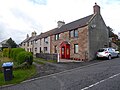 Image Row, Chirnside - geograph.org.uk - 4703800.jpg 640 × 480; 376 KB
-
 Improved cottages at Oldcastles near Chirnside - geograph.org.uk - 6245931.jpg 5 184 × 3 888; 6,63 MB
-
 In The Crop - geograph.org.uk - 2597929.jpg 1 600 × 1 200; 555 KB
-
 Jack by the hedge - geograph.org.uk - 3455330.jpg 4 608 × 3 456; 5,64 MB
-
 Jim Clark Memorial Clock, Chirnside - geograph.org.uk - 4703799.jpg 480 × 640; 429 KB
-
 Jim Clark Memorial Clock, Chirnside - geograph.org.uk - 5359215.jpg 640 × 480; 62 KB
-
 Junction for Edington - geograph.org.uk - 3455572.jpg 2 176 × 1 632; 1,19 MB
-
 Junction of minor road and the B6437 - geograph.org.uk - 3455382.jpg 3 158 × 2 300; 2,4 MB
-
 Junction with Oldcastles road and B6437 - geograph.org.uk - 4055061.jpg 1 600 × 1 200; 288 KB
-
 Kirkgate, Chirnside - geograph.org.uk - 4482089.jpg 640 × 480; 59 KB
-
 Kirkyard gateway, Chirnside - geograph.org.uk - 3535011.jpg 4 320 × 3 240; 2,93 MB
-
 Lane across Westmains Moor - geograph.org.uk - 6286766.jpg 1 024 × 683; 387 KB
-
 Lane to the west of Oldcastles near Chirnside - geograph.org.uk - 6245930.jpg 3 128 × 2 346; 2,67 MB
-
 Looking back in Chirnside - geograph.org.uk - 1165500.jpg 640 × 593; 75 KB
-
 Looking west in Chirnside Church - geograph.org.uk - 2375482.jpg 640 × 480; 73 KB
-
 Main Street East End, Chirnside (2) - geograph.org.uk - 5010887.jpg 1 024 × 678; 157 KB
-
 Main Street East End, Chirnside - geograph.org.uk - 5010884.jpg 1 024 × 678; 192 KB
-
 Main Street West End (B6335) in Chirnside - geograph.org.uk - 5190432.jpg 4 000 × 3 000; 2,72 MB
-
 Main Street West End - geograph.org.uk - 4510584.jpg 2 048 × 1 536; 1,55 MB
-
 Main Street West End, Chirnside - geograph.org.uk - 5011676.jpg 1 024 × 678; 228 KB
-
 Main Street West End, Chirnside - geograph.org.uk - 5481889.jpg 2 848 × 2 136; 1,14 MB
-
 Market Road Footpath - Chirnside - geograph.org.uk - 4055014.jpg 1 200 × 1 600; 587 KB
-
 Market Road path, Chirnside - geograph.org.uk - 5011436.jpg 1 024 × 678; 300 KB
-
 McBain’s Path at Chirnside - geograph.org.uk - 3516747.jpg 480 × 640; 199 KB
-
 Meeting of the Waters - geograph.org.uk - 3346796.jpg 3 232 × 2 404; 3,55 MB
-
 Memorial gates at Chirnside Church - geograph.org.uk - 2127556.jpg 640 × 480; 61 KB
-
 Mill building, Edington - geograph.org.uk - 3346639.jpg 3 264 × 2 448; 3,34 MB
-
 Minor road near Chirnside - geograph.org.uk - 1887708.jpg 800 × 531; 230 KB
-
 Minor road near Chirnside - geograph.org.uk - 1887713.jpg 800 × 531; 206 KB
-
 Minor road near Fox Covert - geograph.org.uk - 5191151.jpg 4 000 × 3 000; 2,92 MB
-
 Minor road near Tom Long Strip - geograph.org.uk - 5191147.jpg 4 000 × 3 000; 2,98 MB
-
 Minor road to Edingtonhill - geograph.org.uk - 3455500.jpg 3 264 × 2 448; 3,53 MB
-
 Minor road to Maines Farm - geograph.org.uk - 3455374.jpg 2 943 × 2 240; 2,69 MB
-
 Minor road to the west of Chirnside Hall - geograph.org.uk - 3455363.jpg 3 264 × 2 448; 3,08 MB
-
 Minor road towards Edington - geograph.org.uk - 5481425.jpg 640 × 480; 65 KB
-
 Minor road towards Edington Mill - geograph.org.uk - 5481432.jpg 640 × 480; 79 KB
-
 Minor road, Edingtonhill - geograph.org.uk - 5481420.jpg 640 × 480; 85 KB
-
 Muddy gateway and field near Harelaw - geograph.org.uk - 4703829.jpg 640 × 480; 504 KB
-
 Nearly at Chirnside - geograph.org.uk - 1165481.jpg 640 × 480; 49 KB
-
 New house alongside the B6355 - geograph.org.uk - 3455466.jpg 1 817 × 1 291; 1 000 KB
-
 New housing at Edington Mill - geograph.org.uk - 3346687.jpg 4 608 × 3 456; 6,32 MB
-
 New shed, old shed on Oldcastles Farm, Chirnside - geograph.org.uk - 6245947.jpg 5 184 × 3 888; 5,83 MB
-
 Ninewells Mains - geograph.org.uk - 5481377.jpg 640 × 480; 49 KB
-
 North Lodge - geograph.org.uk - 4703804.jpg 640 × 480; 403 KB
-
 North Maines Lodge on the B6355 - geograph.org.uk - 3455462.jpg 3 264 × 2 448; 3,8 MB
-
 Oilseed rape field near Chirnside - geograph.org.uk - 1829214.jpg 640 × 480; 100 KB
-
 Oilseed rape in flower at Chirnside - geograph.org.uk - 3455347.jpg 3 232 × 2 404; 3,37 MB
-
 Oilseed rape, Edington - geograph.org.uk - 1927773.jpg 640 × 480; 116 KB
-

-

-

-
 Old Toll plantation - geograph.org.uk - 1829221.jpg 640 × 480; 130 KB
-


_-_geograph.org.uk_-_5010887.jpg)

_in_Chirnside_-_geograph.org.uk_-_5190432.jpg)


&uselang=it&filefrom=On+The+Road+Again+-+geograph.org.uk+-+2597975.jpg#mw-category-media)