Category:Chorlton-cum-Hardy
Zur Navigation springen
Zur Suche springen
English: Chorlton-cum-Hardy is a suburban area of the city of Manchester, England. It is known locally as Chorlton. It is situated about 4 miles southwest of Manchester city centre.
Stadtteil von Manchester  | |||||
| Medium hochladen | |||||
| Ist ein(e) | |||||
|---|---|---|---|---|---|
| Ort | Manchester, Greater Manchester, North West England, England | ||||
 | |||||
Unterkategorien
Es werden 10 von insgesamt 10 Unterkategorien in dieser Kategorie angezeigt:
In Klammern die Anzahl der enthaltenen Kategorien (K), Seiten (S), Dateien (D)
B
C
- Chorlton Brook (22 D)
- Chorlton War Memorial (1 D)
J
S
- Streets in Chorlton-cum-Hardy (58 D)
T
U
- Unicorn Grocery (3 D)
W
- Chorlton Water Park (16 D)
Medien in der Kategorie „Chorlton-cum-Hardy“
Folgende 84 Dateien sind in dieser Kategorie, von 84 insgesamt.
-
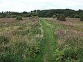
 A path in Chorlton Ees and Ivy Green Nature Reserve - geograph.org.uk - 4444361.jpg 3.056 × 4.094; 6,71 MB
-
 A rash of signs at Hardy Farm, Chorlton - geograph.org.uk - 2861296.jpg 800 × 600; 149 KB
-
 Alexandra Park Aerodrome Chart 1917-1924.jpg 1.600 × 1.056; 177 KB
-
 Allotments at Hough End - geograph.org.uk - 798187.jpg 640 × 480; 223 KB
-
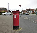 Anonymous postbox (M21 653) - geograph.org.uk - 5388556.jpg 1.024 × 908; 524 KB
-
 Badge, Chorlton pub walk.jpg 3.492 × 2.484; 4,19 MB
-
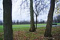
 Beech Road Park - geograph.org.uk - 1565247.jpg 640 × 479; 151 KB
-
 Bird hide, Chorlton Park - geograph.org.uk - 447725.jpg 640 × 426; 109 KB
-
 Brantingham Road, Manchester, January 2014.jpg 3.252 × 1.567; 4,56 MB
-
 Brantingham Road.jpg 599 × 356; 30 KB
-
 Brookburn Road.jpg 2.048 × 1.536; 873 KB
-
 Chorlton Brook - geograph.org.uk - 1228955.jpg 480 × 640; 94 KB
-
 Chorlton Ees and Ivy Green Nature Reserve - geograph.org.uk - 3779628.jpg 3.569 × 2.379; 3,88 MB
-
 Chorlton Ees from the Mersey bund - geograph.org.uk - 3121386.jpg 640 × 480; 120 KB
-

-
 Chorlton Park - geograph.org.uk - 3779716.jpg 3.683 × 2.455; 4,57 MB
-
 Chorlton Park - geograph.org.uk - 3779739.jpg 3.547 × 2.365; 2,9 MB
-
 Chorlton Park Primary School - geograph.org.uk - 4554532.jpg 1.000 × 750; 796 KB
-
 Chorlton Park, football pitch - geograph.org.uk - 4293141.jpg 1.024 × 768; 297 KB
-
 Chorlton Park, owl - geograph.org.uk - 4293135.jpg 1.024 × 768; 287 KB
-
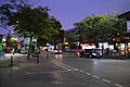 Chorlton-Cum-Hardy after dark - geograph.org.uk - 6277047.jpg 6.240 × 4.160; 4,76 MB
-
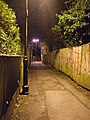 Chorltonville-ginnel.jpg 2.472 × 3.296; 1,56 MB
-
 Coloured doors - geograph.org.uk - 6269246.jpg 3.999 × 6.196; 7,52 MB
-
 Community use - geograph.org.uk - 6269219.jpg 4.160 × 6.240; 6,13 MB
-
 Datestone - geograph.org.uk - 6269233.jpg 4.251 × 4.106; 4,27 MB
-
 Datestone - geograph.org.uk - 6270944.jpg 4.160 × 6.240; 5,83 MB
-
 Disabled parking bays on Wilbraham Road, Chorlton - geograph.org.uk - 6351393.jpg 3.648 × 2.736; 3,93 MB
-

-
 Fancy Dress Dustbins.jpg 2.592 × 3.872; 2,35 MB
-
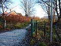
 Footbridge over Chorlton Brook - geograph.org.uk - 3779620.jpg 3.872 × 2.592; 4,9 MB
-

-
 Footpath off Edge Lane, Chorlton - geograph.org.uk - 3775317.jpg 3.872 × 2.592; 6,08 MB
-
 Footpath off Nell Lane - geograph.org.uk - 2734606.jpg 800 × 600; 208 KB
-

-
 Hough End Clough - geograph.org.uk - 2757181.jpg 640 × 480; 553 KB
-
 Hough End Clough - geograph.org.uk - 2757210.jpg 480 × 640; 565 KB
-
 Hough End Clough - geograph.org.uk - 2757214.jpg 640 × 640; 829 KB
-
 Hough End Clough, Red Lion Brook - geograph.org.uk - 2757225.jpg 640 × 480; 621 KB
-
 Hough End Fields - geograph.org.uk - 2757236.jpg 640 × 480; 404 KB
-
 Hough End Fields - geograph.org.uk - 2757240.jpg 640 × 480; 350 KB
-
 Hough End Fields - geograph.org.uk - 2757243.jpg 640 × 480; 405 KB
-
 Hough End Fields - geograph.org.uk - 3048387.jpg 640 × 475; 132 KB
-
 Hough End Fields - geograph.org.uk - 4095239.jpg 3.888 × 2.592; 1,8 MB
-
 Housing at Weller Avenue, Chorlton - geograph.org.uk - 2848768.jpg 800 × 600; 183 KB
-
 Into the woods - geograph.org.uk - 6432370.jpg 6.240 × 4.160; 6,78 MB
-
 January Storm 2006 - geograph.org.uk - 598170.jpg 640 × 480; 151 KB
-

-

-

-
 Low-lying grassland by the Mersey - geograph.org.uk - 3779665.jpg 3.626 × 2.417; 3,41 MB
-
-
 Manchester South banner Chorlton cum Hardy.jpg 3.399 × 486; 533 KB
-

-
 Merseybank snow.jpg 600 × 800; 114 KB
-
 MerseybankBoardings.jpg 1.585 × 1.047; 469 KB
-
 Murals to combat graffiti on the sluice gate building - geograph.org.uk - 4454000.jpg 3.879 × 2.609; 7,82 MB
-
 New bridge over the Mersey - geograph.org.uk - 3779686.jpg 3.639 × 2.426; 3,04 MB
-

-
 Outflow into the Mersey - geograph.org.uk - 3779660.jpg 3.705 × 2.470; 3,99 MB
-
 Path by Chorlton Brook - geograph.org.uk - 3779611.jpg 3.872 × 2.592; 5,71 MB
-
 Path Through Hough End Clough - geograph.org.uk - 2757197.jpg 640 × 480; 547 KB
-
 Pond by Hawthorn Road - geograph.org.uk - 5848884.jpg 4.968 × 3.269; 4,34 MB
-
 Quirks Badge.jpg 1.940 × 1.880; 742 KB
-
 River Mersey - geograph.org.uk - 634604.jpg 640 × 480; 76 KB
-
 River Mersey - geograph.org.uk - 634607.jpg 640 × 480; 71 KB
-

-
 Shop in the dark - geograph.org.uk - 6280228.jpg 6.240 × 4.160; 6,09 MB
-
 Signpost at Jackson's Bridge - geograph.org.uk - 3779681.jpg 3.634 × 2.423; 3,03 MB
-
-

-
 Solar powered lighting, Chorlton Park - geograph.org.uk - 447479.jpg 426 × 640; 82 KB
-
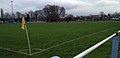
 South West Manchester Cricket Club - Ground - geograph.org.uk - 3386925.jpg 1.600 × 1.200; 406 KB
-

-
 Sunset with illuminated clock - geograph.org.uk - 6280225.jpg 6.240 × 4.160; 6,94 MB
-
 The 'seasonal pond', Chorlton Park - geograph.org.uk - 447733.jpg 640 × 426; 171 KB
-
 The River Mersey near Chorlton - geograph.org.uk - 3779642.jpg 3.586 × 2.391; 2,51 MB
-

-
 The Transpennine Trail - geograph.org.uk - 4444641.jpg 4.592 × 3.056; 6,6 MB
-
 Trans Pennine Trail - geograph.org.uk - 1383511.jpg 640 × 480; 133 KB
-
 Trans-Pennine Trail beside River Mersey - geograph.org.uk - 447703.jpg 640 × 426; 120 KB
-

-
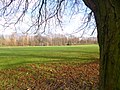
 Village green, Chorlton - geograph.org.uk - 3779595.jpg 3.679 × 2.453; 3,93 MB
-
 Chorlton Green - geograph.org.uk - 266976.jpg 2.048 × 1.536; 1,12 MB
-
 Church yard and lych gate, Chorlton Green - geograph.org.uk - 266969.jpg 1.536 × 2.048; 1,43 MB


_-_geograph.org.uk_-_5388556.jpg)


