Category:City Circle Line
Zur Navigation springen
Zur Suche springen


Kopenhagener Metronetz .jpg)  | |||||
| Medium hochladen | |||||
| Ist ein(e) |
| ||||
|---|---|---|---|---|---|
| Ort | |||||
| Transportnetz | |||||
| Eröffnungsdatum |
| ||||
| Schlüsselereignis |
| ||||
| Länge |
| ||||
| Endpunkt (Objekt) | |||||
| Kosten |
| ||||
| offizielle Website | |||||
 | |||||
Unterkategorien
Es werden 26 von insgesamt 26 Unterkategorien in dieser Kategorie angezeigt:
In Klammern die Anzahl der enthaltenen Kategorien (K), Seiten (S), Dateien (D)
#
A
- Aerial views of City Circle Line (38 D)
- Aksel Møllers Have Station (3 D)
C
E
- Enghave Plads Station (18 D)
F
- Frederiksberg Allé Station (23 D)
G
- Gammel Strand Station (19 D)
K
- Kongens Nytorv Station (45 D)
M
- Marmorkirken Station (8 D)
N
- Nuuks Plads Station (18 D)
- Nørrebro Station (Cityringen) (14 D)
- Nørrebros Runddel Station (19 D)
P
R
- Rådhuspladsen Station (25 D)
S
- Skjolds Plads Station (13 D)
T
- Trianglen Station (25 D)
V
- Vibenshus Runddel Station (29 D)
Ø
- Østerport Station (Cityringen) (17 D)
Medien in der Kategorie „City Circle Line“
Folgende 5 Dateien sind in dieser Kategorie, von 5 insgesamt.
-
 Indfletning på Cityringen før København H 01.jpg 2.592 × 1.944; 1,65 MB
-
 Indfletning på Cityringen før København H 02.jpg 2.592 × 1.944; 1,9 MB
-
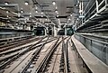
 Junction metro M3 and M4.jpg 5.472 × 3.648; 7,24 MB
-
 Splitsing metro M3 en M4.jpg 3.648 × 2.736; 2,98 MB
-
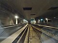
 Tunnel interchange for the Copenhagen Metro (51305934414).jpg 3.809 × 2.571; 6,8 MB


.jpg)