Category:Clare Island
Salti al navigilo
Salti al serĉilo
island in County Mayo, Ireland  .jpg) | |||||
| Alŝuti plurmedion | |||||
| Estas | |||||
|---|---|---|---|---|---|
| Parto de | |||||
| Loko | Graflando Mayo, Connacht, Irlando | ||||
| Ĉe akvokorpo | |||||
| Larĝeco |
| ||||
| Longo |
| ||||
| Plej alta punkto |
| ||||
| Loĝantaro |
| ||||
| Areo |
| ||||
 | |||||
Subkategorioj
Ĉi tiu kategorio havas la 5 jenajn subkategoriojn, el 5 entute.
A
C
- Clare Island Abbey (9 D)
- Clare Island Lighthouse (11 D)
- Clare Island cliffs (6 D)
G
- Granuaile's castle (7 D)
Dosieroj en kategorio “Clare Island”
La jenaj 104 dosieroj estas en ĉi tiu kategorio, el 104 entute.
-
 'Wade' on the lane to Kinnacorra - geograph.org.uk - 1035057.jpg 640 × 513; 64 KB
-
 Achill 2010 050-1.JPG 3 888 × 2 592; 4,13 MB
-
 Admiralty Chart No 2667 Achill Head to Roonagh Head, Published 1859.jpg 16 414 × 11 266; 19,07 MB
-
 An Muillean - geograph.org.uk - 1394347.jpg 640 × 480; 88 KB
-
 Approaching Clare Island - geograph.org.uk - 965091.jpg 640 × 427; 202 KB
-
 Ballytoughy Loom Workshop - geograph.org.uk - 1394326.jpg 640 × 480; 80 KB
-
 Bayview Hotel and Bar - geograph.org.uk - 1394361.jpg 640 × 480; 72 KB
-
 Beach at Clare Island Harbour - geograph.org.uk - 1394391.jpg 640 × 480; 80 KB
-
 Cashleen View of Clare Island 2018 09 04.jpg 3 469 × 2 313; 5,52 MB
-
 Clare Island (3585761830).jpg 3 465 × 2 167; 518 KB
-
 Clare Island (NASA Geocover 2000).jpg 1 024 × 768; 468 KB
-
 Clare Island - geograph.org.uk - 195532.jpg 640 × 480; 105 KB
-

-
 Clare Island - Waiting to board the ferry - geograph.org.uk - 5221208.jpg 5 184 × 2 920; 4,61 MB
-
 Clare Island from Roonah Quay - geograph.org.uk - 65982.jpg 640 × 430; 74 KB
-
 Clare Island harbour - geograph.org.uk - 965196.jpg 640 × 427; 181 KB
-

-
 Clare Island views, Co Mayo 01.jpg 1 672 × 1 176; 257 KB
-
 Clare Island views, Co Mayo 02.jpg 1 676 × 1 176; 192 KB
-
 Clare Island views, Co Mayo 03.jpg 1 676 × 1 176; 268 KB
-
 Clare Island views, Co Mayo 04.jpg 1 656 × 1 176; 317 KB
-
 Clare Island views, Co Mayo 05.jpg 1 676 × 1 176; 262 KB
-
 Clare Island views, Co Mayo 06.jpg 1 676 × 1 176; 322 KB
-
 Clare Island views, Co Mayo 07.jpg 1 676 × 1 176; 250 KB
-
 Clare Island views, Co Mayo 08.jpg 1 676 × 1 176; 265 KB
-
 Clare Island vistas, Co Mayo, Ireland 01.jpg 1 452 × 1 028; 1,17 MB
-
 Clare Island vistas, Co Mayo, Ireland 02.jpg 1 468 × 1 028; 1,06 MB
-
 Clare Island vistas, Co Mayo, Ireland 03.jpg 1 464 × 1 028; 789 KB
-
 Clare Island vistas, Co Mayo, Ireland 04.jpg 1 464 × 1 024; 1,06 MB
-
 Clare Island vistas, Co Mayo, Ireland 05.jpg 1 460 × 1 024; 858 KB
-
 Clare Island, County Mayo, Ireland in summer 1994 01.jpg 1 740 × 1 176; 495 KB
-
 Clare Island, County Mayo, Ireland in summer 1994 02.jpg 1 176 × 1 740; 388 KB
-
 Clare Island, County Mayo, Ireland in summer 1994 03.jpg 1 740 × 1 176; 359 KB
-
 Clare Island, County Mayo, Ireland in summer 1994 04.jpg 1 744 × 1 176; 418 KB
-
 Clare Island, County Mayo, Ireland in summer 1994 05.jpg 1 744 × 1 176; 491 KB
-
 Clare Island, County Mayo, Ireland in summer 1994 06.jpg 1 744 × 1 176; 369 KB
-

-
 Clare Island, the Cistercian Abbey - geograph.org.uk - 1843271.jpg 800 × 600; 79 KB
-
 Clare Island. - geograph.org.uk - 2806296.jpg 2 560 × 1 920; 1,06 MB
-
 Clare Island.jpg 2 272 × 1 704; 464 KB
-
 Clareisland1.jpg 4 928 × 3 264; 6,99 MB
-
 Clareisland2.jpg 4 928 × 3 264; 7,81 MB
-
 Clarre Island Harbour - geograph.org.uk - 1394359.jpg 640 × 480; 94 KB
-
 Clew Bay from The Reek - panoramio.jpg 1 024 × 768; 88 KB
-
 Clew Bay with Clare Island.JPG 2 272 × 1 704; 1,13 MB
-
 Cliff top at Lecknacurra - geograph.org.uk - 1394338.jpg 640 × 480; 69 KB
-
 Cliffs at north end of Clare Island - geograph.org.uk - 4492619.jpg 1 600 × 1 067; 436 KB
-
 Cottages below Knockmore - geograph.org.uk - 1033940.jpg 640 × 467; 118 KB
-
 Cove on Clare Island - geograph.org.uk - 1394353.jpg 640 × 480; 111 KB
-
 Cyclist and walker on Clare Island - geograph.org.uk - 1394330.jpg 640 × 480; 72 KB
-
 Cyclists on Clare Island - geograph.org.uk - 1394331.jpg 640 × 480; 69 KB
-
 Descent from Knocknaveen - geograph.org.uk - 965179.jpg 640 × 427; 175 KB
-
 Dorree River - geograph.org.uk - 1394325.jpg 640 × 480; 104 KB
-
 Eastern Clare Island - geograph.org.uk - 965115.jpg 640 × 427; 183 KB
-
 Fawnglass Quay - geograph.org.uk - 965105.jpg 640 × 427; 168 KB
-
 Fawnglass Quay - geograph.org.uk - 965233.jpg 427 × 640; 172 KB
-
 Fish Curing on Clare Island (7108837815).jpg 2 000 × 1 515; 1,39 MB
-
 Gate on Clare Island - geograph.org.uk - 1394381.jpg 640 × 480; 95 KB
-

-

-
 Gráinne Mhaol Castle (17087792645).jpg 1 477 × 2 000; 1,72 MB
-
 Harbour on Clare Island, Co. Mayo (7689894462).jpg 2 000 × 1 527; 1,41 MB
-
 In the pink - geograph.org.uk - 1394386.jpg 640 × 480; 102 KB
-
 Inishturk clare island.jpg 5 184 × 3 456; 6,43 MB
-
 IRL Jan99 23 (9280732634).jpg 3 026 × 2 352; 1,32 MB
-
 IRL Jan99 26 (9277948677).jpg 2 846 × 2 145; 1,02 MB
-
 Kill pier, Clare Island, Co Mayo 01.jpg 1 456 × 1 028; 914 KB
-
 Kill pier, Clare Island, Co Mayo 02.jpg 1 464 × 1 028; 1,17 MB
-
 Kill pier, Clare Island, Co Mayo 04.jpg 1 472 × 1 028; 944 KB
-
 Kill pier, Clare Island, Co Mayo 05.jpg 1 464 × 1 028; 1,05 MB
-
 Knockmore, Clare Island, Co Mayo 03.jpg 1 464 × 1 028; 1,02 MB
-
 Lecanvey-pier.jpg 800 × 600; 137 KB
-
 Levelling the island - geograph.org.uk - 965144.jpg 640 × 427; 214 KB
-
 Clare Island - County Mayo.svg 615 × 731; 796 KB
-

-
 Moorland view - geograph.org.uk - 965170.jpg 640 × 427; 176 KB
-
 North of Clare Island - geograph.org.uk - 965156.jpg 640 × 427; 167 KB
-
 North of Kinnacorra - geograph.org.uk - 965228.jpg 640 × 427; 201 KB
-
 North of Knocknaveen - geograph.org.uk - 965166.jpg 640 × 427; 173 KB
-
 North of Knocknaveen - geograph.org.uk - 965172.jpg 640 × 427; 170 KB
-
 North of Knocknaveen - geograph.org.uk - 965185.jpg 640 × 427; 199 KB
-
 Old wood on Clare Island - geograph.org.uk - 1394341.jpg 640 × 480; 95 KB
-
 Ordnance Survey Half-Inch Sheet 10 Clifden, Published 1968.jpg 8 231 × 11 330; 9,75 MB
-
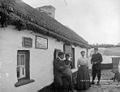 Post Office, Clare Island c1900.jpg 591 × 453; 161 KB
-
 Raindrops - geograph.org.uk - 1035042.jpg 640 × 431; 85 KB
-
 Rock outcrop - geograph.org.uk - 965163.jpg 640 × 427; 172 KB
-
 Rocky hillside on Clare Island - geograph.org.uk - 1394394.jpg 640 × 480; 100 KB
-
 Rough grazing on Clare Island - geograph.org.uk - 1394323.jpg 640 × 480; 100 KB
-
 Sea cliffs at Lecknacurra - geograph.org.uk - 1394335.jpg 640 × 480; 83 KB
-
 Sea stack at Lecknacurra - geograph.org.uk - 1394336.jpg 640 × 480; 113 KB
-
 Shop at Kill - geograph.org.uk - 965126.jpg 640 × 427; 194 KB
-
 Storm Clouds towards Clare island - geograph.org.uk - 1032378.jpg 640 × 426; 45 KB
-
 Stream at An Muillean - geograph.org.uk - 1394344.jpg 640 × 480; 123 KB
-
 Sunset over Clare Island - geograph.org.uk - 1403601.jpg 640 × 480; 42 KB
-
 Sunset over Mwellaun - geograph.org.uk - 1397615.jpg 640 × 480; 40 KB
-

-
 The Pier and Beach - geograph.org.uk - 1033945.jpg 640 × 457; 39 KB
-
 The road from the lighthouse - geograph.org.uk - 1394328.jpg 640 × 480; 92 KB
-
 The road to the lighthouse - geograph.org.uk - 1394327.jpg 640 × 480; 79 KB
-
 Towards Knockmore - geograph.org.uk - 965140.jpg 640 × 427; 181 KB
-
 Towards Knockmore - geograph.org.uk - 965146.jpg 640 × 427; 164 KB
-
 Towards the quay - geograph.org.uk - 965192.jpg 427 × 640; 186 KB
-
 Wild flowers at Capnagower - geograph.org.uk - 965204.jpg 427 × 640; 201 KB
-
 Clare Island. - geograph.org.uk - 296318.jpg 640 × 480; 111 KB


.jpg)


.jpg)


.jpg)
.jpg)


.jpg)
.jpg)


