Category:Cleland, North Lanarkshire
Zur Navigation springen
Zur Suche springen
village in North Lanarkshire, Scotland, UK  | |||||
| Medium hochladen | |||||
| Ist ein(e) | |||||
|---|---|---|---|---|---|
| Ort |
| ||||
| Einwohnerzahl |
| ||||
 | |||||
English: Cleland is a small village near Motherwell, North Lanarkshire, Scotland and Wishaw. The village has a strong mining heritage and is a typical example of a working class village in North Lanarkshire and the Glasgow Area.
Norsk bokmål: Cleland er en landsby ( village) i regionen North Lanarkshire i Skottland. Den ligger like nord for byen Motherwell.
Unterkategorien
Es werden 4 von insgesamt 4 Unterkategorien in dieser Kategorie angezeigt:
In Klammern die Anzahl der enthaltenen Kategorien (K), Seiten (S), Dateien (D)
Medien in der Kategorie „Cleland, North Lanarkshire“
Folgende 32 Dateien sind in dieser Kategorie, von 32 insgesamt.
-
 A73 heading north - geograph.org.uk - 1250636.jpg 640 × 480; 49 KB
-
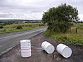 Abandoned Oil Drums - geograph.org.uk - 232335.jpg 640 × 473; 88 KB
-
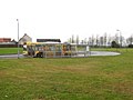
 Beth Shean - geograph.org.uk - 699778.jpg 640 × 427; 66 KB
-
 Blaeu - Atlas of Scotland 1654 - GLOTTIANA PRÆFECTVRA INFERIOR - Cleland.png 2.064 × 952; 3,66 MB
-
 Bus stop, Parkside - geograph.org.uk - 2267177.jpg 640 × 480; 180 KB
-
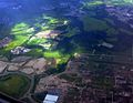
 Cleland and Parkside from the air - geograph.org.uk - 5625984.jpg 640 × 480; 188 KB
-
 Cleland from the air - geograph.org.uk - 5681379.jpg 640 × 480; 140 KB
-
 Cleland Parish Church - geograph.org.uk - 699782.jpg 640 × 427; 69 KB
-
 Demolition at Cleland Hospital - geograph.org.uk - 699780.jpg 640 × 427; 81 KB
-
 Former church, Cleland (geograph 6974412).jpg 800 × 583; 94 KB
-
 Former landfill - geograph.org.uk - 1250782.jpg 640 × 480; 84 KB
-
 Fruit Corner, Cleland - geograph.org.uk - 232367.jpg 640 × 457; 67 KB
-
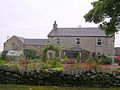 Hill of Murdostoun Farm - geograph.org.uk - 232282.jpg 640 × 480; 87 KB
-
 Houses on Captain's Walk (geograph 6974426).jpg 800 × 498; 67 KB
-
 Houses on Main Street, Cleland (geograph 6974413).jpg 1.024 × 604; 150 KB
-
 Low bridge - geograph.org.uk - 1250778.jpg 640 × 480; 60 KB
-
 Main Street, Cleland (geograph 6974414).jpg 640 × 480; 92 KB
-
 Omoa Road, Cleland - geograph.org.uk - 2665804.jpg 640 × 480; 261 KB
-
 Railway Bridge near Shawstonfoot - geograph.org.uk - 232277.jpg 640 × 480; 132 KB
-
 Ravenscraig from the air.jpg 640 × 498; 107 KB
-
 Road to Collyshot Cottage - geograph.org.uk - 232375.jpg 640 × 478; 108 KB
-

-
 Screening - geograph.org.uk - 1250673.jpg 640 × 480; 59 KB
-
 Site of Whitecraighead, Cleland (geograph 7672763).jpg 1.024 × 576; 160 KB
-
 St. Mary's Church, Cleland - geograph.org.uk - 1253716.jpg 640 × 480; 128 KB
-
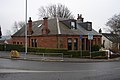
 Station Bar, Cleland - geograph.org.uk - 945849.jpg 640 × 480; 71 KB
-
 Station Road, Cleland - geograph.org.uk - 6178196.jpg 1.600 × 1.200; 484 KB
-
 Tandoori Takeaway, Cleland - geograph.org.uk - 232372.jpg 640 × 467; 84 KB
-
 Tunnel vision - geograph.org.uk - 1654366.jpg 640 × 480; 52 KB
-
 View from Wishaw Low Road Cleland - geograph.org.uk - 1253704.jpg 640 × 480; 60 KB
-
 Waste disposal and recycling centre - geograph.org.uk - 1250649.jpg 640 × 480; 72 KB
-
 Wishaw Low Road - geograph.org.uk - 699775.jpg 640 × 427; 73 KB


.jpg)


.jpg)
.jpg)

.jpg)


.jpg)


