Category:Cliburn
Vai alla navigazione
Vai alla ricerca
village and civil parish in Cumbria, UK  | |||||
| Carica un file multimediale | |||||
| Istanza di | |||||
|---|---|---|---|---|---|
| Luogo | Eden, Cumbria, Nord Ovest dell'Inghilterra, Inghilterra | ||||
| Distinto da | |||||
 | |||||
Sottocategorie
Questa categoria contiene le 6 sottocategorie indicate di seguito, su un totale di 6.
C
- Cliburn Mill Bridge (2 F)
- Cliburn Moss (1 F)
- Cliburn railway station (3 F)
- Commonholme Bridge (2 F)
G
- Golden Pheasant, Cliburn (3 F)
File nella categoria "Cliburn"
Questa categoria contiene 58 file, indicati di seguito, su un totale di 58.
-
 A happy horse - geograph.org.uk - 4391934.jpg 640 × 480; 307 KB
-
 Barley, Cliburn - geograph.org.uk - 900640.jpg 640 × 480; 121 KB
-
 Briggle Sike - geograph.org.uk - 113581.jpg 427 × 640; 153 KB
-
 Cattle by the River Leith - geograph.org.uk - 4494541.jpg 640 × 480; 103 KB
-
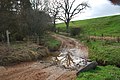 Cliburn Ford - geograph.org.uk - 3894336.jpg 3 872 × 2 592; 4,86 MB
-
 Cliburn geograph-3475733-by-Ben-Brooksbank.jpg 2 396 × 1 589; 3,88 MB
-
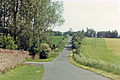
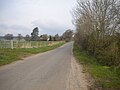
 Cliburn to Eamont Bridge road - geograph.org.uk - 4194728.jpg 4 320 × 3 240; 4,6 MB
-
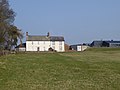
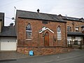 Converted chapel, Cliburn - geograph.org.uk - 4961658.jpg 1 024 × 768; 162 KB
-
 Crossroads, Cliburn - geograph.org.uk - 4961668.jpg 1 024 × 768; 123 KB
-
-
 Driveway to Chatburn - geograph.org.uk - 4391866.jpg 480 × 640; 343 KB
-
 Driveway to farm at Town Head, Cliburn - geograph.org.uk - 4391939.jpg 640 × 480; 250 KB
-
 Fallowfields, Cliburn - geograph.org.uk - 4335700.jpg 640 × 480; 132 KB
-
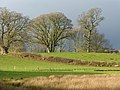
 Farmland, Cliburn - geograph.org.uk - 4335690.jpg 640 × 480; 200 KB
-
 Farmland, Cliburn - geograph.org.uk - 4336640.jpg 640 × 480; 211 KB
-
 Field by Ling Farm near Cliburn - geograph.org.uk - 4494557.jpg 640 × 480; 98 KB
-
 Footbridge over Briggle Sike - geograph.org.uk - 4194724.jpg 4 320 × 3 240; 4,74 MB
-
 Footpath by the River Leith - geograph.org.uk - 4494552.jpg 640 × 480; 122 KB
-
 Forest road in Ling Plantation - geograph.org.uk - 4391877.jpg 480 × 640; 348 KB
-
-
 Former school house, Cliburn - geograph.org.uk - 4498427.jpg 640 × 480; 111 KB
-
-
 Howgate House Farm, Cliburn - geograph.org.uk - 4393157.jpg 640 × 480; 234 KB
-
 Lang Plantations - geograph.org.uk - 5864157.jpg 1 024 × 768; 358 KB
-
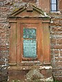 Monument, St Cuthbert's Church, Cliburn - geograph.org.uk - 4499454.jpg 480 × 640; 151 KB
-
 Northerly view... - geograph.org.uk - 4194734.jpg 4 320 × 3 240; 4,86 MB
-
-
 Pasture near Cliburn - geograph.org.uk - 6110483.jpg 1 024 × 683; 256 KB
-
 Pasture near Cliburn - geograph.org.uk - 6110484.jpg 1 024 × 683; 260 KB
-
 Pasture, Cliburn - geograph.org.uk - 4346002.jpg 640 × 480; 182 KB
-
 Pasture, Cliburn - geograph.org.uk - 4427855.jpg 640 × 480; 172 KB
-

-
-
 River Leith - geograph.org.uk - 113432.jpg 640 × 480; 122 KB
-
 River Leith - geograph.org.uk - 1427982.jpg 640 × 480; 124 KB
-
 River Leith south of Cliburn - geograph.org.uk - 4961677.jpg 1 024 × 768; 186 KB
-
 River Leith, Cliburn Bridge - geograph.org.uk - 5499472.jpg 640 × 480; 92 KB
-
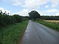
 Road north of Cliburn village - geograph.org.uk - 4961625.jpg 1 024 × 768; 172 KB
-
 Road north of Commonholme Bridge - geograph.org.uk - 5499485.jpg 640 × 480; 51 KB
-
 Sandy Ford - geograph.org.uk - 113423.jpg 640 × 480; 104 KB
-
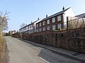 Terraced housing at Cliburn - geograph.org.uk - 4391926.jpg 640 × 480; 237 KB
-
 The Coach House and Dove Cottage - geograph.org.uk - 4391944.jpg 640 × 480; 254 KB
-
 The magazine of American history with notes and queries (1877) (14591701139).jpg 3 072 × 1 862; 1,21 MB
-
 The Old Rectory Cliburn - geograph.org.uk - 113439.jpg 640 × 480; 100 KB
-
 The River Leith above Cliburn - geograph.org.uk - 4498399.jpg 640 × 480; 97 KB
-
 Townhead Lane, Cliburn - geograph.org.uk - 4961613.jpg 1 024 × 768; 227 KB
-
 Track at Town Head near Cliburn - geograph.org.uk - 4494562.jpg 640 × 480; 141 KB
-
 Track north of Cliburn - geograph.org.uk - 4961640.jpg 1 024 × 768; 241 KB
-
 Trough Gill, Cliburn - geograph.org.uk - 5859657.jpg 1 024 × 683; 396 KB
-
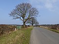
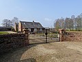
 Farm gate on the Morland road - geograph.org.uk - 1427976.jpg 640 × 480; 101 KB
-
 Farmland after heymaking - geograph.org.uk - 566471.jpg 640 × 480; 80 KB
-
 Lakeside Inn, Whinfell Forest - geograph.org.uk - 739987.jpg 640 × 480; 61 KB
-
 Lonely gate post - geograph.org.uk - 696510.jpg 450 × 600; 90 KB
-
 Public footpath up Leacet Hill - geograph.org.uk - 566783.jpg 640 × 480; 153 KB
-
 River Leith near Cliburn - geograph.org.uk - 696499.jpg 600 × 450; 90 KB
-
 Whinfell Forest - geograph.org.uk - 347542.jpg 640 × 480; 137 KB
-
 Whinfell Forest clearing - geograph.org.uk - 347555.jpg 640 × 480; 143 KB
-
 Whinfell Forest Leisure Village - geograph.org.uk - 278452.jpg 640 × 410; 67 KB


_(14591701139).jpg)


