Category:Coaley
Aller à la navigation
Aller à la recherche
localité britannique du comté anglais de Gloucestershire .jpg) | |||||
| Téléverser des médias | |||||
| Nature de l’élément | |||||
|---|---|---|---|---|---|
| Lieu | Stroud, Gloucestershire, Angleterre du Sud-Ouest, Angleterre | ||||
| site officiel | |||||
 | |||||
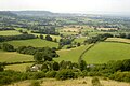
English: Coaley is a village in the English county of Gloucestershire roughly 4 miles from the town of Dursley, and 5 miles from the town of Stroud. The village drops from the edge of the Cotswold Hills, overlooked by Frocester Hill and Coaley Peak picnic site, towards the River Cam at Cam and Cambridge and the Severn Estuary beyond. It has a population of around 1,080.
Sous-catégories
Cette catégorie comprend 2 sous-catégories, dont les 2 ci-dessous.
C
S
Média dans la catégorie « Coaley »
Cette catégorie comprend 145 fichiers, dont les 145 ci-dessous.
-
-
 A slightly weedy crop of maize - geograph.org.uk - 6215179.jpg 1 600 × 900 ; 498 kio
-
 A wonky obelisk. - geograph.org.uk - 339186.jpg 640 × 480 ; 130 kio
-
 AA Toposcope, Coaley Peak - geograph.org.uk - 3743732.jpg 1 024 × 680 ; 214 kio
-
 Arable field in Coaley - geograph.org.uk - 2672578.jpg 1 024 × 680 ; 246 kio
-

-
 Beechmeadow Farm - geograph.org.uk - 6214611.jpg 1 600 × 900 ; 481 kio
-

-
 Bristol Road (A38) near Cambridge - geograph.org.uk - 6287997.jpg 800 × 600 ; 702 kio
-
 Bristol Road, Cambridge - geograph.org.uk - 5861202.jpg 2 048 × 1 536 ; 1,66 Mio
-
 Brooklands - geograph.org.uk - 4388960.jpg 640 × 443 ; 75 kio
-
 Cam ^ Dursley - geograph.org.uk - 2991425.jpg 1 024 × 692 ; 909 kio
-
 Coaley , Grassy Field - geograph.org.uk - 6283888.jpg 6 000 × 4 000 ; 4,68 Mio
-
 Coaley , Grassy Field - geograph.org.uk - 6283889.jpg 6 000 × 4 000 ; 4,53 Mio
-
 Coaley Mill - geograph.org.uk - 196203.jpg 600 × 450 ; 102 kio
-
 Coaley Mill - geograph.org.uk - 4926583.jpg 5 184 × 3 456 ; 5,83 Mio
-
 Coaley Peak Gradiant.jpg 4 896 × 2 752 ; 8,75 Mio
-
 Coaley village infrastructure - geograph.org.uk - 6221226.jpg 1 600 × 900 ; 446 kio
-
 Coaley West End - geograph.org.uk - 6215200.jpg 1 600 × 900 ; 448 kio
-
 Coaley, postbox and honesty table - geograph.org.uk - 6215192.jpg 1 600 × 900 ; 488 kio
-
 Copse by the Cam - geograph.org.uk - 6215184.jpg 1 600 × 900 ; 463 kio
-
 Cotswold Way on Coaley Peak - geograph.org.uk - 3743693.jpg 1 024 × 680 ; 239 kio
-
 Cotswold Way on Frocester Hill - geograph.org.uk - 5718712.jpg 2 048 × 1 536 ; 1,75 Mio
-
 Cotswold Way traversing steep slope - geograph.org.uk - 5718720.jpg 1 536 × 2 048 ; 1,9 Mio
-
-

-
 Cotswold Way, Uley Bury, Uley, Gloucestershire 2014 - geograph.org.uk - 5823838.jpg 3 760 × 2 449 ; 2,98 Mio
-
 Descending Frocester Hill - geograph.org.uk - 1734790.jpg 640 × 462 ; 62 kio
-
 Disused quarry, Coaley Wood - geograph.org.uk - 5489932.jpg 3 776 × 2 520 ; 3,49 Mio
-
 Diverging paths in Coaley Wood - geograph.org.uk - 5061908.jpg 6 000 × 4 000 ; 4,64 Mio
-
 Diverted stream at Coaley Mill - geograph.org.uk - 4926601.jpg 3 456 × 5 184 ; 7,5 Mio
-
 Elm Farm - geograph.org.uk - 6214601.jpg 1 600 × 900 ; 487 kio
-
 Elmcote Farm - geograph.org.uk - 6214763.jpg 1 600 × 901 ; 445 kio
-
 Elmcote Lane - geograph.org.uk - 6288001.jpg 800 × 600 ; 762 kio
-
 Evening over the eight day trail on Uleybury - Uley, Gloucestershire - geograph.org.uk - 3980152.jpg 3 072 × 2 304 ; 2,61 Mio
-
 Exposed rockface in Coaley Wood - geograph.org.uk - 5061931.jpg 6 000 × 4 000 ; 5,33 Mio
-
 Fallen tree across the Cotswold Way - geograph.org.uk - 5061896.jpg 6 000 × 4 000 ; 5,63 Mio
-
 Fallen tree in Coaley Wood - geograph.org.uk - 5061904.jpg 6 000 × 4 000 ; 5,14 Mio
-
 Farmland on Lever's Hill - geograph.org.uk - 1040096.jpg 640 × 426 ; 79 kio
-
 Farmland, Cambridge - geograph.org.uk - 3403730.jpg 640 × 480 ; 72 kio
-
 Field and Coaley Wood south of Hetty Pegler's Tump - geograph.org.uk - 5856975.jpg 1 600 × 1 200 ; 787 kio
-
 Field and footpath - geograph.org.uk - 6215182.jpg 1 600 × 900 ; 530 kio
-
 Field on a Cotswold hillside - geograph.org.uk - 5864005.jpg 1 024 × 768 ; 314 kio
-
 Fields near Cam and Dursley Station - geograph.org.uk - 4699156.jpg 1 495 × 805 ; 191 kio
-
 Footpath towards the River Cam, Cambridge - geograph.org.uk - 3403733.jpg 640 × 480 ; 81 kio
-
 Former route of A38 at Hillhouse Farm - geograph.org.uk - 5877104.jpg 1 600 × 1 200 ; 742 kio
-
 Frocester Hill Nature Reserve (National Trust) - geograph.org.uk - 5489968.jpg 3 776 × 2 520 ; 3,17 Mio
-
 Grazing near Westfield Farm - geograph.org.uk - 4387854.jpg 640 × 410 ; 84 kio
-
 Lever's Hill - geograph.org.uk - 2672535.jpg 1 024 × 680 ; 236 kio
-
 Looking towards Dursley Road, Cambridge - geograph.org.uk - 5858674.jpg 2 048 × 1 536 ; 1,61 Mio
-
 Lower slope of Coaley Peak - geograph.org.uk - 6221245.jpg 1 600 × 900 ; 523 kio
-
 M5 approaching bridge near Elmcote Farms - geograph.org.uk - 4117999.jpg 1 600 × 1 043 ; 281 kio
-
 M5 approaching Elmcote Farms bridge - geograph.org.uk - 4032315.jpg 640 × 469 ; 48 kio
-
 M5 at marker A107.0 - geograph.org.uk - 4118004.jpg 1 600 × 1 061 ; 301 kio
-

-
 M5 Motorway near Elmcote Farms - geograph.org.uk - 2045828.jpg 640 × 480 ; 51 kio
-
 M5 Motorway north of Elmcote Farms - geograph.org.uk - 2045832.jpg 640 × 480 ; 53 kio
-
 M5 northbound towards junction 13 - geograph.org.uk - 4324115.jpg 1 600 × 1 200 ; 1,14 Mio
-
 M5 northbound towards junction 13 - geograph.org.uk - 4324118.jpg 1 600 × 1 200 ; 1 009 kio
-
 Many centuries ago on Uleybury - Uley, Gloucestershire - geograph.org.uk - 3980135.jpg 3 072 × 2 304 ; 2 Mio
-
 Mill race near Halmore Mill - geograph.org.uk - 4926625.jpg 3 456 × 5 184 ; 7,06 Mio
-
 Minor road crossing M5 to Elmcote Farms - geograph.org.uk - 3185817.jpg 1 024 × 768 ; 513 kio
-
 Minor Road off the A38 near Cambridge - geograph.org.uk - 6287994.jpg 800 × 533 ; 533 kio
-
 National Trust - Coaley Peak - geograph.org.uk - 1994903.jpg 2 304 × 1 704 ; 790 kio
-
 Next stop Cheltenham - geograph.org.uk - 4171999.jpg 1 600 × 1 065 ; 394 kio
-
 On Frocester Hill - geograph.org.uk - 1956331.jpg 1 024 × 768 ; 244 kio
-
 Overbridge near Elmcote Farms - geograph.org.uk - 4740498.jpg 640 × 384 ; 89 kio
-
 Overgrown footpath - geograph.org.uk - 4172011.jpg 1 600 × 1 063 ; 741 kio
-
 Panorama - Coaley Peak - 2 - geograph.org.uk - 2128176.jpg 3 648 × 2 048 ; 2,33 Mio
-
 Pastoral view from Lever's Hill - geograph.org.uk - 6193890.jpg 1 600 × 900 ; 625 kio
-
 Pinnells End Lane - geograph.org.uk - 6215208.jpg 1 600 × 900 ; 409 kio
-
 Railway Bridge on the Bristol to Birmingham line - geograph.org.uk - 2562437.jpg 640 × 427 ; 133 kio
-
 Ridge and furrow near Cambridge - geograph.org.uk - 2741688.jpg 640 × 287 ; 27 kio
-
 Ripening crop - geograph.org.uk - 6214762.jpg 1 600 × 900 ; 425 kio
-
 River Cam - geograph.org.uk - 196211.jpg 450 × 600 ; 105 kio
-
 Road up Lever's Hill - geograph.org.uk - 2672541.jpg 680 × 1 024 ; 301 kio
-
 Roman Road, Cambridge - geograph.org.uk - 5870611.jpg 2 048 × 1 536 ; 1,56 Mio
-
 Sharp bend in the road from Cam to Coaley - geograph.org.uk - 3171078.jpg 640 × 508 ; 133 kio
-
 South Gloucestershire , M5 Motorway Roadworks - geograph.org.uk - 2793957.jpg 4 288 × 2 848 ; 5,06 Mio
-
 Steps leading to Frocester Hill Road - geograph.org.uk - 3446210.jpg 800 × 600 ; 194 kio
-
 Stroud , The M5 Motorway - geograph.org.uk - 2795437.jpg 4 240 × 2 776 ; 3,8 Mio
-
 Stroud , The M5 Motorway Roadworks - geograph.org.uk - 2795434.jpg 4 288 × 2 848 ; 4,76 Mio
-
 Stroud , The M5 Motorway Roadworks - geograph.org.uk - 2795436.jpg 4 266 × 2 816 ; 3,95 Mio
-
 Stroud , The M5 Motorway Roadworks - geograph.org.uk - 2795438.jpg 4 188 × 2 688 ; 3,57 Mio
-
 Stroud , The M5 Motorway Roadworks - geograph.org.uk - 2795439.jpg 4 288 × 2 848 ; 4,7 Mio
-
 Stroud , The M5 Motorway Southbound - geograph.org.uk - 2795435.jpg 4 288 × 2 848 ; 4,95 Mio
-
 Stroud District , Countryside Scenery - geograph.org.uk - 3723709.jpg 4 288 × 2 848 ; 5,83 Mio
-
 Stroud District , Grassy Field - geograph.org.uk - 5951345.jpg 6 000 × 4 000 ; 6,62 Mio
-
 Stroud District , Grassy Field - geograph.org.uk - 6107212.jpg 6 000 × 4 000 ; 6,69 Mio
-
 Stroud District , M5 Motorway - geograph.org.uk - 5951342.jpg 6 000 × 4 000 ; 6,95 Mio
-
 The B4066 - geograph.org.uk - 5489941.jpg 3 776 × 2 520 ; 4,2 Mio
-
 The Cotswold Way at Coaley Wood - geograph.org.uk - 3446239.jpg 800 × 600 ; 192 kio
-
 The Cotswold Way at Coaley Wood - geograph.org.uk - 3446255.jpg 800 × 600 ; 131 kio
-
 The Cotswold Way at Coaley Wood - geograph.org.uk - 3446257.jpg 800 × 600 ; 180 kio
-
 The Cotswold Way at Coaley Wood - geograph.org.uk - 3446269.jpg 800 × 600 ; 180 kio
-
 The Cotswold Way at Coaley Wood - geograph.org.uk - 3446276.jpg 800 × 600 ; 179 kio
-
 The Cotswold Way at Coaley Wood - geograph.org.uk - 3446279.jpg 800 × 600 ; 184 kio
-
 The Cotswold Way at Coaley Wood - geograph.org.uk - 3446285.jpg 800 × 600 ; 193 kio
-
 The Cotswold Way at Coaley Wood - geograph.org.uk - 3446385.jpg 800 × 600 ; 157 kio
-
 The Cotswold Way at Coaley Wood - geograph.org.uk - 3446395.jpg 800 × 600 ; 137 kio
-
 The Cotswold Way at Frocester Hill - geograph.org.uk - 3445997.jpg 800 × 600 ; 187 kio
-
 The Cotswold Way at Frocester Hill - geograph.org.uk - 3446004.jpg 800 × 600 ; 162 kio
-
 The Cotswold Way at Frocester Hill - geograph.org.uk - 3446209.jpg 800 × 600 ; 160 kio
-
 The Cotswold Way at Frocester Hill Road - geograph.org.uk - 3446219.jpg 800 × 600 ; 174 kio
-
 The Cotswold Way at Hodgecombe Farm - geograph.org.uk - 3446408.jpg 800 × 600 ; 159 kio
-
 The Cotswold Way at Hodgecombe Farm - geograph.org.uk - 3446411.jpg 800 × 600 ; 154 kio
-
 The Cotswold Way at the B4066 - geograph.org.uk - 3446227.jpg 800 × 600 ; 160 kio
-
 The Cotswold Way in Coaley Wood - geograph.org.uk - 3446237.jpg 800 × 600 ; 186 kio
-
 The Cotswold Way in Coaley Wood - geograph.org.uk - 5061891.jpg 5 542 × 3 695 ; 3,89 Mio
-
 The Cotswold Way in Coaley Wood - geograph.org.uk - 5061913.jpg 6 000 × 4 000 ; 4,63 Mio
-
 The Cotswold Way in Coaley Wood - geograph.org.uk - 5061924.jpg 6 000 × 4 000 ; 4,67 Mio
-
 The Cotswold Way on Frocester Hill - geograph.org.uk - 3445960.jpg 800 × 600 ; 155 kio
-
 The Cotswold Way on Frocester Hill - geograph.org.uk - 3743704.jpg 1 024 × 680 ; 279 kio
-
 The Cotswold Way on Frocester Hill - geograph.org.uk - 5061885.jpg 6 000 × 4 000 ; 6,54 Mio
-
 The Cotswold Way through Coaley Wood - geograph.org.uk - 5489936.jpg 3 776 × 2 520 ; 4,12 Mio
-
 The Cotswold Way towards Hodgecombe Farm - geograph.org.uk - 3446400.jpg 800 × 600 ; 155 kio
-
 The Vale of Beakeley viewed from Coaley Peak - geograph.org.uk - 3743768.jpg 1 024 × 680 ; 226 kio
-
 The view point at Coaley Peak - geograph.org.uk - 3445957.jpg 800 × 600 ; 143 kio
-
 To the foot crossing - geograph.org.uk - 4172004.jpg 1 600 × 1 063 ; 392 kio
-
 Toposcope on Coaley Peak - geograph.org.uk - 3743685.jpg 1 024 × 680 ; 238 kio
-
 Track in Coaley Wood - geograph.org.uk - 5061939.jpg 6 000 × 4 000 ; 5,14 Mio
-
 Uley Bury view over the Severn Vale, Uley, Gloucestershire 2014 - geograph.org.uk - 5823840.jpg 3 724 × 2 388 ; 2,43 Mio
-
 Uley Bury view over the Severn Vale, Uley, Gloucestershire 2014 - geograph.org.uk - 5823843.jpg 3 872 × 1 426 ; 1,52 Mio
-
 Un-named Minor Road near Cambridge House Farm - geograph.org.uk - 6287991.jpg 800 × 600 ; 646 kio
-
 Vapour trail above Coaley Hill - geograph.org.uk - 3743707.jpg 680 × 1 024 ; 225 kio
-
 View of the Severn Estuary from the Coaley Peak.jpg 4 896 × 2 752 ; 8,32 Mio
-
 View over Coaley and the Vale of Berkeley - geograph.org.uk - 5179384.jpg 1 024 × 768 ; 189 kio
-
 View over Coaley to the Severn estuary - geograph.org.uk - 5995984.jpg 1 024 × 576 ; 142 kio
-
 View to Cam Long Down - geograph.org.uk - 2672585.jpg 1 024 × 680 ; 245 kio
-
 Walkers in Coaley Wood - geograph.org.uk - 3446282.jpg 800 × 600 ; 165 kio
-
 War Memorial, Coaley - geograph.org.uk - 2672570.jpg 680 × 1 024 ; 132 kio
-
 Wind power - geograph.org.uk - 196212.jpg 600 × 450 ; 112 kio
-
 Woodlands by Roman Road, Cambridge - geograph.org.uk - 5870610.jpg 2 048 × 1 536 ; 2,03 Mio
-
 Barn - geograph.org.uk - 196223.jpg 600 × 450 ; 60 kio
-
 Elmcote Farms - geograph.org.uk - 299520.jpg 640 × 480 ; 99 kio
-
 English Oak at Cam Green - geograph.org.uk - 376872.jpg 640 × 374 ; 56 kio
-
 Entrance to Keepers Cottage - geograph.org.uk - 376903.jpg 640 × 480 ; 135 kio
-
 Farmland west of Frocester - geograph.org.uk - 316758.jpg 640 × 480 ; 98 kio
-
 Fox and Hounds public house - geograph.org.uk - 196216.jpg 600 × 450 ; 49 kio
-
 Lever's hill - geograph.org.uk - 196227.jpg 600 × 450 ; 101 kio
-
 Lever's hill - geograph.org.uk - 196230.jpg 600 × 450 ; 69 kio
-
 Pinnell's End farm - geograph.org.uk - 196221.jpg 600 × 450 ; 78 kio
-
 Railway bridge - geograph.org.uk - 196199.jpg 600 × 450 ; 91 kio
-
 The Street, Coaley - geograph.org.uk - 103520.jpg 1 024 × 768 ; 448 kio
-
 Waterend Farm, near Draycott - geograph.org.uk - 303639.jpg 640 × 480 ; 117 kio


_-_geograph.org.uk_-_6113893.jpg)
_near_Cambridge_-_geograph.org.uk_-_6287997.jpg)


_-_geograph.org.uk_-_5489968.jpg)


