Category:Codolet
Jump to navigation
Jump to search
commune in Gard, France  .svg)  | |||||
| Upload media | |||||
| Instance of | |||||
|---|---|---|---|---|---|
| Location |
| ||||
| Located in or next to body of water | |||||
| Population |
| ||||
| Area |
| ||||
| Elevation above sea level |
| ||||
| official website | |||||
 | |||||
Mga ubos-nga-kaarangay
Ini nga kaarangay mayda han mga nasunod nga 2 nga mga ubos-nga-kaarangay, tikang hin 2 nga kabug-osan.
E
M
- Maps of Codolet (7 F)
Media ha kaarangay nga "Codolet"
An mga nasunod nga 15 ka mga fayl aada han hini nga kaarangay, tikang hin 15 nga kabug-osan.
-
 CEA Marcoule Site.jpg 1,244 × 605; 185 nga KB
-
 Blason de la ville de Codolet (30).svg 600 × 660; 16 nga KB
-
 Codolet (Gard, Fr) La Tave.JPG 4,000 × 3,000; 3.92 nga MB
-
 Codolet 2.JPG 3,216 × 2,144; 3.22 nga MB
-
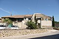
 Codolet 3.JPG 3,216 × 2,144; 3.29 nga MB
-
 Codolet 4.JPG 3,216 × 2,144; 3.21 nga MB
-
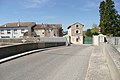
 Codolet.JPG 3,216 × 2,144; 3.15 nga MB
-
 Cèze (rivière) près de Codolet.JPG 3,216 × 2,144; 3.27 nga MB
-
 Digue protégeant du Rhône à Codolet.JPG 3,216 × 2,144; 3.2 nga MB
-
 Le Rhône à Codolet.JPG 3,216 × 2,144; 3.27 nga MB
-
 Population - Municipality code 30084.svg 475 × 355; 13 nga KB
-
 Système de pompage à Codolet.JPG 3,216 × 2,144; 3.18 nga MB
-
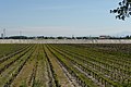
 Vignerons à Codolet.JPG 3,216 × 2,144; 3.2 nga MB
-
 Vue près de Codolet.JPG 3,216 × 2,144; 3.32 nga MB
-
 Vue sur Codolet, à droite le Mont-Ventoux.JPG 3,216 × 2,144; 3.37 nga MB

_La_Tave.JPG)


_pr%C3%A8s_de_Codolet.JPG)


