Category:Cogenhoe
Aller à la navigation
Aller à la recherche
English: Cogenhoe is a village in the civil parish of Cogenhoe and Whiston, in the South Northamptonshire district, in the county of Northamptonshire, England.
village britannique  | |||||
| Téléverser des médias | |||||
| Nature de l’élément | |||||
|---|---|---|---|---|---|
| Lieu | Cogenhoe and Whiston, West Northamptonshire, Northamptonshire, Midlands de l'Est, Angleterre | ||||
| site officiel | |||||
 | |||||
Sous-catégories
Cette catégorie comprend seulement la sous-catégorie ci-dessous.
P
- St Peter's Church, Cogenhoe (1 F)
Média dans la catégorie « Cogenhoe »
Cette catégorie comprend 17 fichiers, dont les 17 ci-dessous.
-
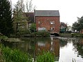 Cogenhoe Mill - geograph.org.uk - 162050.jpg 640 × 480 ; 89 kio
-
 Cogenhoe Pocket Park - geograph.org.uk - 3549308.jpg 478 × 640 ; 123 kio
-
 Cogenhoe War Memorial - geograph.org.uk - 1371923.jpg 640 × 503 ; 507 kio
-
 Entering Cogenhoe along the Nene Way - geograph.org.uk - 171401.jpg 640 × 480 ; 100 kio
-
 Footpath to Cogenhoe - geograph.org.uk - 3549321.jpg 640 × 478 ; 104 kio
-
 Footpath to Denton - geograph.org.uk - 3549275.jpg 478 × 640 ; 104 kio
-
 Poignant Grave Stone - geograph.org.uk - 1371927.jpg 640 × 480 ; 375 kio
-
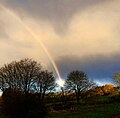 RainbowG.jpg 1 200 × 1 177 ; 222 kio
-
 Station Road, Cogenhoe - geograph.org.uk - 171412.jpg 640 × 480 ; 78 kio
-
 The Royal Oak Public House, Cogenhoe - geograph.org.uk - 117896.jpg 640 × 478 ; 109 kio
-
 Village Sign Cogenhoe - geograph.org.uk - 1053747.jpg 428 × 640 ; 257 kio
-
 Junction of Station Road and Billing Road - geograph.org.uk - 171694.jpg 640 × 480 ; 89 kio
-
 Northern Entrance to Brafield on the Green - geograph.org.uk - 248877.jpg 640 × 440 ; 112 kio
-
 Station Road - geograph.org.uk - 171416.jpg 640 × 480 ; 89 kio
-
 Towards the Nene - geograph.org.uk - 161939.jpg 640 × 480 ; 113 kio
-

-
 View towards the Nene Valley - geograph.org.uk - 171695.jpg 640 × 480 ; 93 kio


