Category:Coggeshall
Vai alla navigazione
Vai alla ricerca

town in Essex, England, UK  Panneau à l'entrée de Coggeshall. | |||||
| Carica un file multimediale | |||||
| Istanza di | |||||
|---|---|---|---|---|---|
| Luogo | Braintree, Essex, Est dell'Inghilterra, Inghilterra | ||||
| Considerato essere uguale a | Coggeshall (pagina Wikimedia duplicata, parrocchia civile dell'Inghilterra) | ||||
| sito web ufficiale | |||||
 | |||||
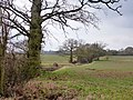
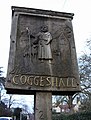
Pictures to do with the historic English town of w:Coggeshall, Essex.
Sottocategorie
Questa categoria contiene le 16 sottocategorie indicate di seguito, su un totale di 16.
A
- Abbey Mill, Coggeshall (5 F)
B
- River Blackwater in Coggeshall (17 F)
C
- Christ Church, Coggeshall (3 F)
- Coggeshall Clock Tower (9 F)
- Coggeshall Grange Barn (24 F)
- Coggeshall Hamlet (3 F)
- Coggeshall War Memorial (1 F)
L
- Long Bridge, Coggeshall (5 F)
M
P
- Paycocke's (78 F)
R
- Roads in Coggeshall (142 F)
S
- Streets in Coggeshall (50 F)
File nella categoria "Coggeshall"
Questa categoria contiene 108 file, indicati di seguito, su un totale di 108.
-
 Rood House Goggeshall Essex England darker.jpg 5 772 × 3 850; 20,5 MB
-
 Rood House Goggeshall Essex England lighter.jpg 5 772 × 3 850; 20,51 MB
-
 Rood House plague Goggeshall Essex England.jpg 4 076 × 4 076; 14,73 MB
-
 Wicker Heart Wreath, Coggeshall, Essex England darker.jpg 4 005 × 5 189; 17,3 MB
-
 Wicker Heart Wreath, Coggeshall, Essex England lighter.jpg 4 005 × 5 189; 20,5 MB
-
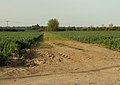
 Arable field boundary near Purley Farm, Coggeshall - geograph.org.uk - 4480655.jpg 3 648 × 2 736; 3,88 MB
-
 Barn in the fields - geograph.org.uk - 4350200.jpg 640 × 480; 93 KB
-
 Big Joslins - geograph.org.uk - 3429791.jpg 3 648 × 2 736; 5,31 MB
-
 Bouchiers Barn Visitor Centre - geograph.org.uk - 3627260.jpg 640 × 424; 100 KB
-
 Bullocks Cross farmhouse - geograph.org.uk - 4722759.jpg 640 × 480; 120 KB
-
 Coggeshal SPO.jpg 1 536 × 2 048; 398 KB
-
 Coggeshall fire station - geograph.org.uk - 1910256.jpg 640 × 427; 284 KB
-
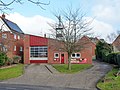 Coggeshall Fire Station - geograph.org.uk - 4350307.jpg 640 × 480; 109 KB
-
 Coggeshall Hamlet Village Name sign - geograph.org.uk - 6302912.jpg 4 608 × 3 456; 3,88 MB
-
 Coggeshall Recreation Ground - geograph.org.uk - 6303218.jpg 4 608 × 3 456; 4,13 MB
-
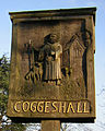 Coggeshall Sign.jpg 636 × 796; 401 KB
-
 Coggeshall Village Name sign - geograph.org.uk - 6302972.jpg 3 697 × 2 773; 4,37 MB
-
 Coggeshall-St Nicholas' Chapel (view from St Stephens Bridge).JPG 2 288 × 1 712; 802 KB
-
 Coggleshall from the air (geograph 2413170).jpg 640 × 480; 162 KB
-
 Coggleshall from the air - geograph.org.uk - 2413135.jpg 640 × 480; 159 KB
-
 Collapsing Barn, Great Nunty's Farm - geograph.org.uk - 3429829.jpg 2 964 × 2 223; 2,43 MB
-
 Cradle House - geograph.org.uk - 4818700.jpg 640 × 428; 120 KB
-
 Curd Hall Farm (geograph 6649033).jpg 3 776 × 2 520; 3,11 MB
-
 Curd Hall Farm near Coggeshall - geograph.org.uk - 4648491.jpg 1 024 × 768; 189 KB
-
 Essex Way Milestone - geograph.org.uk - 1051574.jpg 480 × 640; 65 KB
-
 Footbridge over Robin's Brook - geograph.org.uk - 4818707.jpg 640 × 480; 200 KB
-
 Footpath to Earls Colne Airfield - geograph.org.uk - 5857206.jpg 4 608 × 3 456; 3,91 MB
-
 Footpath to Earls Colne Business Park - geograph.org.uk - 5928027.jpg 4 608 × 3 456; 4,02 MB
-
 Footpath to the A120 Coggeshall Road - geograph.org.uk - 5866211.jpg 4 608 × 3 456; 4,08 MB
-
 Former Hitcham School, Coggeshall - geograph.org.uk - 4049841.jpg 1 152 × 1 536; 1,19 MB
-

-
 Foundry House, Bridge Street, Coggeshall - geograph.org.uk - 5620776.jpg 1 600 × 1 067; 351 KB
-
 Georgian house, Coggeshall, Essex - geograph.org.uk - 2494449.jpg 1 600 × 1 015; 339 KB
-
 Great Monks Wood, Pattiswick - geograph.org.uk - 3430647.jpg 3 648 × 2 736; 4,85 MB
-
 Hardware store in Coggeshall - geograph.org.uk - 4418433.jpg 3 888 × 5 184; 6,16 MB
-
 Haywards Farm - geograph.org.uk - 4904904.jpg 1 142 × 857; 495 KB
-
 Hedgerow west of Tey Road - geograph.org.uk - 4722731.jpg 640 × 480; 80 KB
-
 Herons Farm sign - geograph.org.uk - 5867174.jpg 4 608 × 3 456; 3,72 MB
-
 Holfield Grange - geograph.org.uk - 2232261.jpg 1 600 × 1 063; 384 KB
-
 Hop Green Farm sign - geograph.org.uk - 5857192.jpg 4 608 × 3 456; 4,01 MB
-
 Hop Green Farm, Earls Colne - geograph.org.uk - 5857180.jpg 2 958 × 2 632; 3,92 MB
-
 House with date 1560, Coggeshall - geograph.org.uk - 4209464.jpg 3 991 × 2 622; 3,57 MB
-
 Houses in West Street, Coggeshall - geograph.org.uk - 5620773.jpg 1 600 × 1 067; 308 KB
-
 Library, Coggeshall - geograph.org.uk - 4358923.jpg 640 × 480; 123 KB
-
 Little Nunty's Farm - geograph.org.uk - 2484985.jpg 640 × 480; 75 KB
-
 Little Nunty's Farmhouse - geograph.org.uk - 3429411.jpg 3 648 × 2 736; 3,11 MB
-

-
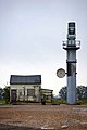
 Marconi Tower at former Rivenhall Aerodrome - geograph.org.uk - 4208982.jpg 4 172 × 3 032; 4,27 MB
-
 Marshy Pond - geograph.org.uk - 5079616.jpg 2 212 × 3 318; 2,2 MB
-
 Martyrdom of Thomas Haukes.png 505 × 786; 393 KB
-
 Monkwood House and pump - geograph.org.uk - 4819464.jpg 640 × 480; 160 KB
-
 National Grid power line 4YLA - geograph.org.uk - 4818908.jpg 480 × 640; 95 KB
-
 Old Cedar - geograph.org.uk - 3952416.jpg 2 588 × 1 764; 1,66 MB
-
 Old Road sign - geograph.org.uk - 5930715.jpg 4 608 × 3 456; 4,03 MB
-
 OS benchmark - Coggeshall, 2 Bridge Street - geograph.org.uk - 4908096.jpg 857 × 1 142; 285 KB
-
 OS benchmark - Coggeshall, 46 East Street - geograph.org.uk - 4908087.jpg 798 × 1 066; 238 KB
-

-

-
 OS Flush Bracket - Coggeshall - geograph.org.uk - 4908051.jpg 857 × 1 142; 523 KB
-
 Path to Pointwell Mill - geograph.org.uk - 2884953.jpg 1 067 × 1 600; 620 KB
-
 Path to the war memorial - geograph.org.uk - 3366074.jpg 640 × 480; 94 KB
-
 Peter Watts Wines sign - geograph.org.uk - 5929830.jpg 4 608 × 3 456; 3,86 MB
-
 Pink House, near Coggeshall - geograph.org.uk - 1003483.jpg 640 × 425; 86 KB
-
 Pointwell Mill - geograph.org.uk - 2884947.jpg 1 600 × 1 067; 424 KB
-
 Pointwell Mill - geograph.org.uk - 6116234.jpg 2 560 × 1 920; 1,66 MB
-
 Pointwell Spill Weir - geograph.org.uk - 6116232.jpg 2 560 × 1 920; 1,98 MB
-
 Public byway to Brooks Farm - geograph.org.uk - 4350362.jpg 640 × 480; 140 KB
-
 Public footpath to Coggeshall Hamlet - geograph.org.uk - 4350250.jpg 640 × 480; 90 KB
-
 Pylon and Giant Sequoia - geograph.org.uk - 3366127.jpg 480 × 640; 79 KB
-
 Pylon and Robins Brook - geograph.org.uk - 3362697.jpg 480 × 640; 67 KB
-
 Pylons - Brooms farm - geograph.org.uk - 271826.jpg 501 × 640; 42 KB
-
 Quite a large hole in the ground - geograph.org.uk - 4904919.jpg 1 142 × 857; 416 KB
-
 Radar tower and hut at the end of the runway - geograph.org.uk - 4904928.jpg 1 142 × 857; 376 KB
-
 Radar tower at former RAF Rivenhall - geograph.org.uk - 4350243.jpg 640 × 480; 77 KB
-
 Re-created benchmark - Coggeshall, Long Bridge - geograph.org.uk - 4904876.jpg 857 × 1 142; 466 KB
-
 Robins Brook - geograph.org.uk - 3362707.jpg 640 × 480; 126 KB
-

-
 Short Bridge, Coggeshall - geograph.org.uk - 4048904.jpg 1 536 × 1 152; 1,05 MB
-
 Signpost on Kilns Hill - geograph.org.uk - 5929675.jpg 2 806 × 3 741; 3,37 MB
-
 Signpost on Kings Hill - geograph.org.uk - 5865509.jpg 4 000 × 3 000; 6,29 MB
-

-

-
 The Essex Way 93 - geograph.org.uk - 2166441.jpg 640 × 426; 54 KB
-
 The Essex Way 94 - geograph.org.uk - 2166447.jpg 640 × 426; 60 KB
-
 The Essex Way 95 - geograph.org.uk - 2166533.jpg 640 × 426; 36 KB
-
 The Essex Way 96 - geograph.org.uk - 2166536.jpg 640 × 426; 69 KB
-
 The Essex Way 97 - geograph.org.uk - 2166562.jpg 640 × 426; 111 KB
-
 The Essex Way 98 - geograph.org.uk - 2166568.jpg 640 × 426; 60 KB
-
 The Essex Way 99 - geograph.org.uk - 2166573.jpg 640 × 426; 103 KB
-
 The Grange, Coggeshall - geograph.org.uk - 4209052.jpg 4 196 × 3 068; 4,25 MB
-
 'The Normans', Sweet shop, Coggeshall - geograph.org.uk - 2492858.jpg 1 200 × 1 600; 465 KB
-

-
 Trees along Robin's Brook - geograph.org.uk - 4818713.jpg 640 × 480; 141 KB
-
 Trees near Coggeshall.JPG 2 000 × 3 008; 2,74 MB
-
 Village Sign Coggeshall Essex - geograph.org.uk - 2180620.jpg 485 × 640; 102 KB
-
 Water pump near Monk Wood Cottage, Nunty's Lane - geograph.org.uk - 3429394.jpg 2 315 × 3 087; 3,3 MB
-
 Waterfall on Robins Brook - geograph.org.uk - 3362714.jpg 640 × 480; 97 KB
-
 Wayne petrol pump in Essex.jpg 2 616 × 3 488; 4,13 MB
-
 Yard at Scrip's Farm - geograph.org.uk - 4960472.jpg 640 × 480; 119 KB
-
 Bucklers Farm - geograph.org.uk - 300147.jpg 640 × 458; 103 KB
-
 Coggeshall Town and Youth FC - geograph.org.uk - 122475.jpg 640 × 480; 63 KB
-
 Footpath to Coggeshall Hamlet - geograph.org.uk - 414173.jpg 640 × 454; 66 KB
-
 Holfield Grange - geograph.org.uk - 271318.jpg 640 × 480; 143 KB
-
 Last Rites for Rivenhall - geograph.org.uk - 229342.jpg 640 × 426; 102 KB
-

-
 Plantation of Willows - geograph.org.uk - 122463.jpg 480 × 640; 136 KB
-
 Rivenhall Radar - geograph.org.uk - 229388.jpg 426 × 640; 79 KB
-
 Ruined mill - geograph.org.uk - 152657.jpg 640 × 480; 134 KB


.JPG)
.jpg)


.jpg)


