Category:Coleshill, Oxfordshire
Aller à la navigation
Aller à la recherche
localité britannique du comté anglais d'Oxfordshire  | |||||
| Téléverser des médias | |||||
| Nature de l’élément | |||||
|---|---|---|---|---|---|
| Lieu | Vale of White Horse, Oxfordshire, Angleterre du Sud-Est, Angleterre | ||||
 | |||||
Sous-catégories
Cette catégorie comprend 8 sous-catégories, dont les 8 ci-dessous.
C
- Coleshill Bridge (3 F)
- Coleshill House (22 F)
- Coleshill Mill (7 F)
F
R
- Radnor Arms, Coleshill (4 F)
Média dans la catégorie « Coleshill, Oxfordshire »
Cette catégorie comprend 141 fichiers, dont les 141 ci-dessous.
-
 1 and 2 semi-detached cottages in Coleshill (geograph 7449673).jpg 4 080 × 3 060 ; 4,97 Mio
-
 16 and 17, Church Lane, Coleshill.jpg 4 000 × 3 000 ; 4,94 Mio
-
 52-53 The Old Carpenters Yard (geograph 7449666).jpg 4 080 × 3 060 ; 4,41 Mio
-
-
 Across the field - geograph.org.uk - 4236103.jpg 640 × 480 ; 159 kio
-
 Arable field near Coleshill - geograph.org.uk - 3886363.jpg 1 500 × 999 ; 192 kio
-
 Around the field edge - geograph.org.uk - 4236065.jpg 640 × 480 ; 176 kio
-
 Ashen Copse Farm (1) - geograph.org.uk - 4236075.jpg 640 × 480 ; 96 kio
-
 Ashen Copse Farm (2) - geograph.org.uk - 4236091.jpg 640 × 480 ; 162 kio
-
 Ashencopse Cottage, near Coleshill - geograph.org.uk - 3060893.jpg 4 000 × 3 000 ; 2,84 Mio
-
 Ashencopse Farm, near Coleshill - geograph.org.uk - 3060900.jpg 4 000 × 3 000 ; 2,92 Mio
-
 B4019 in Coleshill (geograph 7449677).jpg 4 080 × 3 060 ; 4,65 Mio
-
 Badbury Hill - geograph.org.uk - 6246539.jpg 4 000 × 3 000 ; 4,72 Mio
-
 Barns and view - geograph.org.uk - 4236105.jpg 640 × 480 ; 174 kio
-
 Beware, very soft ground - geograph.org.uk - 4236081.jpg 640 × 480 ; 151 kio
-
 Brimstone Farm (1) - geograph.org.uk - 4233717.jpg 640 × 480 ; 159 kio
-
 Brimstone Farm (2) - geograph.org.uk - 4233732.jpg 640 × 480 ; 171 kio
-
 Brimstone Farm (3) - geograph.org.uk - 4233747.jpg 640 × 480 ; 175 kio
-
 Bushells, Coleshill.jpg 4 000 × 3 000 ; 1,68 Mio
-
 Cemetery, Coleshill - geograph.org.uk - 3060924.jpg 4 000 × 3 000 ; 2,94 Mio
-
 Coccinella septempunctata, Coleshill, Oxfordshire - geograph.org.uk - 393915.jpg 480 × 640 ; 146 kio
-
 Old Milestone by the B4019 in Coleshill (geograph 5622335).jpg 1 061 × 1 693 ; 279 kio
-
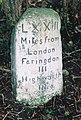 Old Milestone by the B4019, east of Coleshill (geograph 5622334).jpg 1 104 × 1 640 ; 239 kio
-
 Statue, Coleshill Estate, Oxfordshire - geograph.org.uk - 829640.jpg 480 × 640 ; 192 kio
-
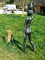 Statue, Coleshill Estate, Oxfordshire - geograph.org.uk - 829641.jpg 480 × 640 ; 189 kio
-
 The village phone box, Coleshill, Oxfordshire - geograph.org.uk - 393873.jpg 640 × 480 ; 157 kio
-
 Coleshill church and model village - geograph.org.uk - 2214211.jpg 1 920 × 2 560 ; 3,75 Mio
-
 Coleshill in Oxfordshire - geograph.org.uk - 470460.jpg 640 × 480 ; 50 kio
-
 Coleshill Park - geograph.org.uk - 1210108.jpg 640 × 428 ; 115 kio
-
 Coleshill Park lower lodge (geograph 7449668).jpg 4 080 × 3 060 ; 6,29 Mio
-
 Coleshill playing field - geograph.org.uk - 1561348.jpg 640 × 427 ; 94 kio
-

-
 Coleshill village - geograph.org.uk - 1560188.jpg 640 × 427 ; 81 kio
-
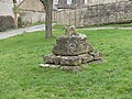 Coleshill Village Cross.jpg 4 000 × 3 000 ; 4,9 Mio
-
 Coleshill Village School - geograph.org.uk - 307420.jpg 640 × 480 ; 112 kio
-

-
 Colleymore Farm near Coleshill - geograph.org.uk - 6237317.jpg 1 850 × 1 170 ; 942 kio
-
 Colleymore Farm near Coleshill - geograph.org.uk - 6237318.jpg 1 916 × 1 276 ; 1,02 Mio
-
 Collymore Farm, Coleshill.jpg 4 000 × 3 000 ; 1,56 Mio
-
 Cottage in Coleshill - geograph.org.uk - 274321.jpg 480 × 640 ; 135 kio
-
 Cottage, Coleshill Estate - geograph.org.uk - 3060933.jpg 4 000 × 3 000 ; 2,81 Mio
-
 Country lane outside Coleshill - geograph.org.uk - 3060928.jpg 4 000 × 3 000 ; 2,82 Mio
-
 Courtleaze Farmhouse, Coleshill.jpg 4 000 × 3 000 ; 1,13 Mio
-
 Cuckoo Pen Plantation signs - geograph.org.uk - 3886357.jpg 999 × 1 500 ; 184 kio
-
 D'Arcy Dalton Way - geograph.org.uk - 4757326.jpg 640 × 480 ; 68 kio
-
 D'Arcy Dalton Way - geograph.org.uk - 4757330.jpg 640 × 480 ; 77 kio
-
 D'Arcy Dalton Way - geograph.org.uk - 4757334.jpg 640 × 480 ; 75 kio
-
 D'Arcy Dalton Way - geograph.org.uk - 4757336.jpg 640 × 480 ; 53 kio
-
 D'Arcy Dalton Way - geograph.org.uk - 4757338.jpg 640 × 480 ; 75 kio
-
 D'Arcy Dalton Way - geograph.org.uk - 4757340.jpg 640 × 480 ; 81 kio
-
 David Brown tractor, Coleshill - geograph.org.uk - 542004.jpg 480 × 640 ; 329 kio
-
 Double stile - geograph.org.uk - 4236109.jpg 640 × 480 ; 165 kio
-
 Enclosed path - geograph.org.uk - 4233179.jpg 640 × 480 ; 167 kio
-
 Entrance to Colehill Park - geograph.org.uk - 4236111.jpg 640 × 480 ; 169 kio
-
 Entrance to Cuckoo Pen Plantation - geograph.org.uk - 2380332.jpg 427 × 640 ; 185 kio
-
 Entrance to woods, Coleshill Estate - geograph.org.uk - 3060911.jpg 4 000 × 3 000 ; 2,84 Mio
-
 Farm Cottages - geograph.org.uk - 307418.jpg 640 × 480 ; 64 kio
-
 Farm track - geograph.org.uk - 4192314.jpg 640 × 480 ; 121 kio
-
 Farmland composition - geograph.org.uk - 4233173.jpg 640 × 480 ; 160 kio
-
 Farmland near Brimstone Farm - geograph.org.uk - 6246538.jpg 4 000 × 3 000 ; 4,77 Mio
-
 Farmland opposite Worsall Farm - geograph.org.uk - 5118308.jpg 800 × 600 ; 112 kio
-
 Farmland, Coleshill - geograph.org.uk - 443898.jpg 640 × 480 ; 153 kio
-
 Farmland, Coleshill - geograph.org.uk - 443902.jpg 640 × 480 ; 153 kio
-
 Fern Copse - geograph.org.uk - 4233164.jpg 640 × 480 ; 170 kio
-
 Field at Coleshill - geograph.org.uk - 5118314.jpg 800 × 600 ; 123 kio
-
 Field entrance near Worsall Farm - geograph.org.uk - 5118312.jpg 800 × 600 ; 119 kio
-
 Flamborough Wood - geograph.org.uk - 4236094.jpg 640 × 480 ; 172 kio
-
 Footpath in Cuckoo Pen Plantation - geograph.org.uk - 3886359.jpg 999 × 1 500 ; 215 kio
-
 Footpath in Cuckoo Pen Plantation - geograph.org.uk - 3886361.jpg 1 500 × 999 ; 373 kio
-
 Footpath nearing Coleshill - geograph.org.uk - 2221163.jpg 640 × 480 ; 64 kio
-
 Footpath to Coleshill (3) - geograph.org.uk - 4236062.jpg 640 × 480 ; 175 kio
-
 Footpath to Worsall Farm - geograph.org.uk - 2221179.jpg 640 × 480 ; 83 kio
-
 Footpath, Coleshill - geograph.org.uk - 222638.jpg 640 × 480 ; 282 kio
-
 Fork in the road in Coleshill - geograph.org.uk - 1561362.jpg 640 × 427 ; 108 kio
-
 Garden of 26 Coleshill (geograph 7449740).jpg 4 080 × 3 060 ; 6,89 Mio
-
 Hay barns at Colleymore Farm - geograph.org.uk - 6237314.jpg 1 870 × 1 202 ; 1,11 Mio
-
 Heifers, Coleshill Estate, Oxfordshire - geograph.org.uk - 536256.jpg 640 × 480 ; 363 kio
-
 In Coleshill Park - geograph.org.uk - 4236110.jpg 640 × 480 ; 161 kio
-
 Into the copse - geograph.org.uk - 4233165.jpg 640 × 480 ; 164 kio
-
 Into the open - geograph.org.uk - 4233695.jpg 640 × 480 ; 160 kio
-
 Into the park - geograph.org.uk - 4236106.jpg 640 × 480 ; 162 kio
-
 Mill leat, Coleshill Estate - geograph.org.uk - 2381944.jpg 640 × 427 ; 179 kio
-
 Minor road in Coleshill - geograph.org.uk - 1560260.jpg 640 × 427 ; 98 kio
-
 New gates - geograph.org.uk - 4236099.jpg 640 × 480 ; 169 kio
-
 Over the bridge - geograph.org.uk - 4236063.jpg 640 × 480 ; 162 kio
-
 Over the ditch - geograph.org.uk - 4233167.jpg 640 × 480 ; 160 kio
-
 Over the stream - geograph.org.uk - 4233768.jpg 640 × 480 ; 167 kio
-
 Oxfordshire farmland - geograph.org.uk - 4233161.jpg 640 × 480 ; 170 kio
-
 Oxfordshire Wiltshire county boundary - geograph.org.uk - 1560107.jpg 640 × 427 ; 62 kio
-
-
 Path in Cuckoopen Plantation - geograph.org.uk - 4192283.jpg 640 × 480 ; 182 kio
-
 Path leaves road - geograph.org.uk - 4233146.jpg 640 × 480 ; 171 kio
-
 Path to Brimstone (1) - geograph.org.uk - 4233151.jpg 640 × 480 ; 167 kio
-
 Path to Brimstone (2) - geograph.org.uk - 4233158.jpg 640 × 480 ; 171 kio
-
 Path to Brimstone (3) - geograph.org.uk - 4233704.jpg 640 × 480 ; 171 kio
-
 Path to Brimstone Farm - geograph.org.uk - 4233148.jpg 640 × 480 ; 162 kio
-
 Pennyswick Farm - geograph.org.uk - 1561384.jpg 640 × 427 ; 52 kio
-
 Pollarded willows by the River Cole - geograph.org.uk - 1210042.jpg 640 × 428 ; 83 kio
-
 Pond by the path - geograph.org.uk - 4233153.jpg 640 × 480 ; 165 kio
-
 Pyracantha Berries - geograph.org.uk - 307422.jpg 640 × 480 ; 162 kio
-
 River Cole, Coleshill, Oxfordshire - geograph.org.uk - 393529.jpg 480 × 640 ; 150 kio
-

-
 Road from Coleshill to Lechlade - geograph.org.uk - 1561365.jpg 640 × 427 ; 94 kio
-
 Road to Lechlade - geograph.org.uk - 4233145.jpg 640 × 480 ; 158 kio
-
 School Lane, Coleshill, Oxfordshire - geograph.org.uk - 3244093.jpg 1 600 × 1 267 ; 514 kio
-
 Snowswick Lane - geograph.org.uk - 2221182.jpg 640 × 480 ; 58 kio
-
 Snowswick Lane - geograph.org.uk - 2221191.jpg 640 × 480 ; 37 kio
-
 Snowswick Lane - geograph.org.uk - 4192319.jpg 640 × 480 ; 87 kio
-
 Snowswick Lane, towards Coleshill - geograph.org.uk - 5754548.jpg 640 × 427 ; 97 kio
-
 Stone cottage next to Fresden Farm - geograph.org.uk - 305861.jpg 640 × 480 ; 121 kio
-
-
 Straw stack - geograph.org.uk - 4233777.jpg 640 × 480 ; 164 kio
-
 Test plots - geograph.org.uk - 4233176.jpg 640 × 480 ; 168 kio
-
 The B4019 by Colleymore Farm - geograph.org.uk - 2568115.jpg 1 500 × 1 000 ; 235 kio
-
 The B4019 to Highworth - geograph.org.uk - 2568116.jpg 1 500 × 1 000 ; 324 kio
-
 The B4019, Coleshill - geograph.org.uk - 6237307.jpg 1 884 × 1 226 ; 1,24 Mio
-
 The D'Arcy Dalton Way heading for Coleshill - geograph.org.uk - 6246540.jpg 4 000 × 3 000 ; 4,92 Mio
-
 The mill stream at Coleshill Park - geograph.org.uk - 1210105.jpg 640 × 428 ; 71 kio
-
 The path has been ploughed - geograph.org.uk - 4236064.jpg 640 × 480 ; 169 kio
-
 The road to Ashen Copse Farm - geograph.org.uk - 2568117.jpg 1 500 × 1 000 ; 222 kio
-
 The way to the park - geograph.org.uk - 4236112.jpg 640 × 480 ; 160 kio
-
 There's a lot of it about - geograph.org.uk - 4236095.jpg 640 × 480 ; 173 kio
-
 Three ways to go (1) - geograph.org.uk - 4236084.jpg 640 × 480 ; 156 kio
-
 Three ways to go (2) - geograph.org.uk - 4236086.jpg 640 × 480 ; 154 kio
-
 Three ways to go (3) - geograph.org.uk - 4236087.jpg 640 × 480 ; 147 kio
-
 Towards Ashen Copse Farm - geograph.org.uk - 4236066.jpg 640 × 480 ; 172 kio
-
 Trees by the path - geograph.org.uk - 4233154.jpg 640 × 480 ; 178 kio
-
 Two ways to go (1) - geograph.org.uk - 4236077.jpg 640 × 480 ; 170 kio
-
 Two ways to go (2) - geograph.org.uk - 4236079.jpg 640 × 480 ; 162 kio
-
 Un-named copse - geograph.org.uk - 4233162.jpg 640 × 480 ; 167 kio
-
 Unusual crop - geograph.org.uk - 4233169.jpg 640 × 480 ; 175 kio
-
 View north from Cuckoopen Plantation - geograph.org.uk - 4192293.jpg 640 × 480 ; 105 kio
-
 Village green and cross - geograph.org.uk - 1904898.jpg 3 264 × 2 448 ; 3,12 Mio
-
 Village green, Coleshill - geograph.org.uk - 1560209.jpg 640 × 427 ; 91 kio
-
 Wall by the B4019, Coleshill - geograph.org.uk - 6237311.jpg 1 849 × 1 232 ; 1,11 Mio
-
 Waterloo Lodge, Coleshill Estate - geograph.org.uk - 3060944.jpg 4 000 × 3 000 ; 2,82 Mio
-
 Wheat field near Coleshill - geograph.org.uk - 2568118.jpg 1 500 × 1 000 ; 211 kio
-
 Wheat field near Coleshill - geograph.org.uk - 2568119.jpg 1 500 × 1 000 ; 186 kio
-
 Wild Garlic, Cuckoo Pen Plantation - geograph.org.uk - 2380354.jpg 640 × 427 ; 242 kio
-
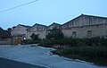
 Worsall Farm - geograph.org.uk - 6228802.jpg 4 000 × 3 000 ; 4,75 Mio
-
 Worsall Farm, Coleshill - geograph.org.uk - 307416.jpg 640 × 480 ; 89 kio
.jpg)

.jpg)


_-_geograph.org.uk_-_4236075.jpg)
_-_geograph.org.uk_-_4236091.jpg)


.jpg)


_-_geograph.org.uk_-_4233717.jpg)
_-_geograph.org.uk_-_4233732.jpg)
_-_geograph.org.uk_-_4233747.jpg)


.jpg)
.jpg)


.jpg)


_-_geograph.org.uk_-_4236062.jpg)


.jpg)


_-_geograph.org.uk_-_4233151.jpg)
_-_geograph.org.uk_-_4233158.jpg)
_-_geograph.org.uk_-_4233704.jpg)


_-_geograph.org.uk_-_4236084.jpg)
_-_geograph.org.uk_-_4236086.jpg)
_-_geograph.org.uk_-_4236087.jpg)


_-_geograph.org.uk_-_4236077.jpg)
_-_geograph.org.uk_-_4236079.jpg)


