Category:Colnbrook with Poyle
Zur Navigation springen
Zur Suche springen
English: Colnbrook with Poyle is a civil parish in the unitary authority of Slough in Berkshire, consisting of Colnbrook with Poyle. It is at the eastern end of the borough, and is just to the west of the M25 motorway, which separates the parish from Heathrow Airport in the London Borough of Hillingdon in Greater London. The parish had a population of 5,426 in 2001.
civil parish in Berkshire, England | |||||
| Medium hochladen | |||||
| Ist ein(e) | |||||
|---|---|---|---|---|---|
| Benannt nach | |||||
| Ort | Slough, Berkshire, Südostengland, England | ||||
| Fläche |
| ||||
 | |||||
Unterkategorien
Es werden 5 von insgesamt 5 Unterkategorien in dieser Kategorie angezeigt:
In Klammern die Anzahl der enthaltenen Kategorien (K), Seiten (S), Dateien (D)
Medien in der Kategorie „Colnbrook with Poyle“
Folgende 171 Dateien sind in dieser Kategorie, von 171 insgesamt.
-
 A failed development - geograph.org.uk - 4498794.jpg 1.600 × 991; 256 KB
-
 A4 bridge over Colne Brook - geograph.org.uk - 2620586.jpg 3.487 × 2.212; 1,15 MB
-
 A4 bridge over Colne Brook - geograph.org.uk - 5423274.jpg 640 × 480; 148 KB
-
 A4 Colnbrook By-Pass - geograph.org.uk - 2619677.jpg 3.201 × 2.324; 991 KB
-
 Access for Wraysbury Reservoir - geograph.org.uk - 4498772.jpg 1.600 × 1.011; 354 KB
-
 Approaching junction 4B (M4) - geograph.org.uk - 2182869.jpg 640 × 424; 53 KB
-
 Arriving on time^ - geograph.org.uk - 2800424.jpg 640 × 468; 30 KB
-
 Aviation fuel tank wagons on Colnbrook Branch - geograph.org.uk - 2786754.jpg 683 × 1.024; 189 KB
-
 BancTec Ltd - Jarman House - geograph.org.uk - 4498780.jpg 1.600 × 1.015; 380 KB
-
 Borough of Slough , The M25 Motorway - geograph.org.uk - 5733223.jpg 6.000 × 4.000; 5,96 MB
-
 Bridge on mill stream for Colnbrook Mill - geograph.org.uk - 5427038.jpg 640 × 480; 168 KB
-
 Britannia Trading Estate from the air - geograph.org.uk - 4652891.jpg 640 × 480; 139 KB
-
 Car Park and Warehouse, Axis Park - geograph.org.uk - 5596243.jpg 3.888 × 2.592; 3,02 MB
-
 Colindale Road - geograph.org.uk - 4498773.jpg 1.600 × 1.022; 308 KB
-
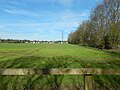
 Colnbrook - Crown Meadow - geograph.org.uk - 5323876.jpg 4.608 × 3.456; 6,48 MB
-
 Colnbrook - Crown Meadow - geograph.org.uk - 5323879.jpg 4.608 × 3.456; 6,35 MB
-
 Colnbrook and Poyle United Church - geograph.org.uk - 4008563.jpg 3.072 × 2.304; 1,78 MB
-
 Colnbrook Bridge - geograph.org.uk - 5425191.jpg 640 × 480; 172 KB
-
 Colnbrook Bridge and The Smithy - geograph.org.uk - 5425182.jpg 640 × 480; 112 KB
-
 Colnbrook High Street - geograph.org.uk - 4231076.jpg 2.560 × 1.920; 1,98 MB
-
 Colnbrook High Street at the junction of Crown Meadow - geograph.org.uk - 4230335.jpg 2.560 × 1.920; 2,3 MB
-
 Colnbrook Logistics Centre - geograph.org.uk - 6213801.jpg 2.216 × 854; 261 KB
-
 Colnbrook Telephone Exchange - geograph.org.uk - 4008553.jpg 3.072 × 2.304; 1,79 MB
-
 Colne Valley Way near Colnbrook - geograph.org.uk - 5594317.jpg 3.888 × 2.592; 2,3 MB
-
 Cottesbrooke Close from the air - geograph.org.uk - 3989578.jpg 640 × 481; 208 KB
-
 Cottesbrooke Close from the air - geograph.org.uk - 3989580.jpg 640 × 480; 189 KB
-
 Crawling along under M4 - geograph.org.uk - 1983185.jpg 640 × 480; 58 KB
-
 Crown Meadow, Colnbrook - geograph.org.uk - 4229728.jpg 2.560 × 1.920; 1,97 MB
-
 Crown Meadow, Colnbrook - geograph.org.uk - 4230336.jpg 2.560 × 1.920; 2,01 MB
-
 Cycle Docking Station, Sutton Lane - geograph.org.uk - 5592404.jpg 3.486 × 2.445; 2,55 MB
-
 Disused golf driving range, Poyle - geograph.org.uk - 5425299.jpg 640 × 420; 91 KB
-

-

-
 Embankment, Wraysbury Reservoir - geograph.org.uk - 4734266.jpg 640 × 426; 63 KB
-
 Factory Building next to the A4 - geograph.org.uk - 4968567.jpg 3.264 × 1.840; 2,37 MB
-
 Farm access bridge, M4 - geograph.org.uk - 3529629.jpg 640 × 395; 44 KB
-
 Fawsley Close - geograph.org.uk - 5815112.jpg 4.000 × 3.000; 4,66 MB
-

-
 Fields North of the M4 - geograph.org.uk - 5324849.jpg 4.608 × 3.456; 6,37 MB
-
 Footbridge Across Langley Roundabout - geograph.org.uk - 4463009.jpg 640 × 481; 300 KB
-
 Footbridge over the Langley roundabout - geograph.org.uk - 2811545.jpg 1.600 × 1.200; 667 KB
-
 Footbridge over the Langley roundabout - geograph.org.uk - 2811550.jpg 1.600 × 1.200; 675 KB
-
 Footpath to the south of the M4 - geograph.org.uk - 5910106.jpg 1.024 × 768; 398 KB
-
 Former Honda Offices, Langley - geograph.org.uk - 4463014.jpg 640 × 481; 289 KB
-
 Formerly the Golden Cross - geograph.org.uk - 5462393.jpg 640 × 428; 121 KB
-
 Grazing Horses - geograph.org.uk - 5594308.jpg 3.410 × 1.958; 991 KB
-
 Heathrow Spur Bridge Over M25 - geograph.org.uk - 5247661.jpg 1.433 × 853; 87 KB
-
 Hillingdon , M4 Motorway - geograph.org.uk - 6268123.jpg 4.608 × 3.456; 4,73 MB
-
 Horses on the Colne Valley Way - geograph.org.uk - 5594314.jpg 3.888 × 2.592; 2,53 MB
-
 Horton Rd - geograph.org.uk - 4734270.jpg 640 × 426; 68 KB
-
 Ibis Hotel - Horton Road (geograph 7372679).jpg 4.032 × 3.024; 3,8 MB
-
 In Cox's Orchard, Colnbrook - geograph.org.uk - 5815137.jpg 4.000 × 3.000; 4,77 MB
-
 Joining M4 from M25 - geograph.org.uk - 1983176.jpg 640 × 480; 28 KB
-
 Joining the M4 - geograph.org.uk - 4673986.jpg 640 × 426; 53 KB
-

-
 Lake near Colnbrook - geograph.org.uk - 5594323.jpg 3.888 × 2.592; 2,12 MB
-
 Langley Roundabout, M4 Junction 5 - geograph.org.uk - 4463022.jpg 640 × 480; 251 KB
-
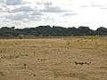
 Large open space northeast of Colnbrook (2) - geograph.org.uk - 5908687.jpg 1.024 × 768; 235 KB
-
 Large open space northeast of Colnbrook (3) - geograph.org.uk - 5908689.jpg 1.024 × 768; 226 KB
-
 Large open space northeast of Colnbrook (4) - geograph.org.uk - 5908690.jpg 1.024 × 768; 296 KB
-
 Large open space northeast of Colnbrook - geograph.org.uk - 5908674.jpg 1.024 × 768; 226 KB
-
 Locomotive waits in Colnbrook Branch sidings - geograph.org.uk - 2786742.jpg 1.024 × 683; 133 KB
-

-
 London Road joins Colnbrook By-Pass - geograph.org.uk - 4498795.jpg 1.600 × 1.116; 336 KB
-
 London Road, Brands Hill - geograph.org.uk - 3241111.jpg 1.024 × 768; 147 KB
-
 Longwood Park Flats - geograph.org.uk - 3401233.jpg 640 × 425; 50 KB
-
 M25 - junction 14 - geograph.org.uk - 3401231.jpg 640 × 425; 52 KB
-
 M25 embankment at junction 14 - geograph.org.uk - 6213756.jpg 3.235 × 1.641; 784 KB
-
 M25 from Bath Road bridge - geograph.org.uk - 5166774.jpg 4.608 × 3.456; 3,54 MB
-
 M25 Junction 14 from the air - geograph.org.uk - 4217173.jpg 640 × 396; 122 KB
-
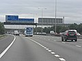
 M4 - junction 5 (eastbound) - geograph.org.uk - 2466984.jpg 640 × 432; 35 KB
-
 M4 approaching J5 - geograph.org.uk - 3529635.jpg 640 × 379; 41 KB
-
 M4 bridge carries Sutton Lane - geograph.org.uk - 2572855.jpg 3.648 × 2.736; 1,5 MB
-
 M4 Exit Sliproad at Junction 5 (Langley) - geograph.org.uk - 4463104.jpg 640 × 427; 226 KB
-
 M4 from Sutton Lane - geograph.org.uk - 3184644.jpg 640 × 480; 119 KB
-
 M4 gantry and footbridge - geograph.org.uk - 2572878.jpg 3.648 × 2.736; 1,15 MB
-
 M4 looking west - geograph.org.uk - 5423243.jpg 640 × 480; 104 KB
-
 M4 Motorway Eastbound - geograph.org.uk - 4565888.jpg 1.845 × 1.863; 807 KB
-
 M4 near Langley (1) - geograph.org.uk - 1994972.jpg 1.024 × 635; 200 KB
-
 M4 near Langley (2) - geograph.org.uk - 1997195.jpg 1.024 × 678; 221 KB
-
 M4 near Richings Park - geograph.org.uk - 1995002.jpg 1.024 × 602; 180 KB
-
 M4 slip road at Junction 5 - geograph.org.uk - 2619520.jpg 3.263 × 2.545; 1,4 MB
-
 M4 westbound - 1mile to junction 5 - geograph.org.uk - 2446557.jpg 640 × 479; 41 KB
-
 M4 westbound - geograph.org.uk - 5645974.jpg 640 × 428; 76 KB
-
 M4 westbound - geograph.org.uk - 5645980.jpg 640 × 428; 92 KB
-
 M4 westbound - geograph.org.uk - 5645983.jpg 640 × 428; 74 KB
-
 M4 westbound at Junction 5 - geograph.org.uk - 3609584.jpg 2.427 × 1.518; 1,79 MB
-
 M4 westbound, 1 mile to Junction 5 - geograph.org.uk - 3607096.jpg 2.409 × 1.483; 1,7 MB
-
 M4 westbound, Junction 5 half a mile - geograph.org.uk - 3609553.jpg 2.367 × 1.521; 1,82 MB
-
 M4, J5 - geograph.org.uk - 3529636.jpg 640 × 409; 37 KB
-
 M4, Junction 5 slip road - geograph.org.uk - 3358339.jpg 640 × 398; 40 KB
-
 M4, Junction 5 slip road - geograph.org.uk - 3358349.jpg 640 × 350; 48 KB
-
 M4, Queen Mother Reservoir, Langley from the air - geograph.org.uk - 5646675.jpg 3.237 × 1.437; 1,04 MB
-
 M4, westbound - geograph.org.uk - 3529634.jpg 640 × 430; 52 KB
-
 M4, westbound - geograph.org.uk - 4673994.jpg 640 × 426; 47 KB
-
 M4, westbound - geograph.org.uk - 4674011.jpg 640 × 426; 56 KB
-
 M4, westbound - geograph.org.uk - 4674022.jpg 640 × 426; 45 KB
-
 Major's Farm Road - geograph.org.uk - 4498797.jpg 1.600 × 1.028; 447 KB
-
 Manor Farm from the air - geograph.org.uk - 4217175.jpg 640 × 480; 157 KB
-
 Mill stream and bridge, Colnbrook Mill - geograph.org.uk - 5424248.jpg 640 × 480; 164 KB
-
 Notice at Albany Park - geograph.org.uk - 5815134.jpg 4.000 × 3.000; 4,64 MB
-
 Oak Plantation - geograph.org.uk - 6073874.jpg 4.264 × 2.688; 2,59 MB
-

-
 Old Slade Bridge western view of M4 - geograph.org.uk - 5324817.jpg 4.608 × 3.456; 6,63 MB
-
 Old Slade Lake - geograph.org.uk - 5910115.jpg 1.024 × 768; 295 KB
-
 Old Slade Lane bridge over M4 - geograph.org.uk - 4084308.jpg 1.600 × 1.196; 975 KB
-
 Over the A4, Under the M4 - geograph.org.uk - 4463020.jpg 640 × 481; 270 KB
-
 Passing White Hart House - geograph.org.uk - 4498789.jpg 1.600 × 1.124; 425 KB
-
 Pie and Chips ^ Car Wash - geograph.org.uk - 5594011.jpg 3.888 × 2.592; 1,46 MB
-
 Poyle Channel, east of Poyle Road - geograph.org.uk - 5906823.jpg 768 × 1.024; 375 KB
-
 Poyle Road - Bath Road - geograph.org.uk - 2799716.jpg 640 × 469; 58 KB
-
 Poyle Road - geograph.org.uk - 4229776.jpg 2.560 × 1.920; 1,97 MB
-
 Poyle Road - geograph.org.uk - 4498778.jpg 1.600 × 1.028; 454 KB
-
 Poyle Road passing Poyle Farm - geograph.org.uk - 4498776.jpg 1.600 × 1.068; 335 KB
-
 Poyle, Beau Nash's Water Pump - geograph.org.uk - 3796769.jpg 640 × 480; 68 KB
-

-
 Pylons at Colnbrook - panoramio.jpg 3.648 × 2.736; 1,63 MB
-
 Riverside Cafe, Colnbrook Bypass - geograph.org.uk - 5427026.jpg 640 × 428; 95 KB
-
 Roundabout at the end of Colnbrook Bypass - geograph.org.uk - 2811544.jpg 1.600 × 1.200; 673 KB
-
 Roundabout on Colnbrook Bypass and London Road - geograph.org.uk - 2811537.jpg 1.600 × 1.200; 549 KB
-
 Roundabout on Poyle Road at the junction of Blackthorne Road - geograph.org.uk - 4231081.jpg 2.560 × 1.920; 1,96 MB
-
 Roundabout on Poyle Road at the junction of Blackthorne Road - geograph.org.uk - 4231084.jpg 2.560 × 1.920; 1,96 MB
-
 Row of four - geograph.org.uk - 4498782.jpg 1.600 × 828; 375 KB
-
 Semis in Tall Trees - geograph.org.uk - 4498785.jpg 1.600 × 1.032; 467 KB
-

-
 Side of Queen Mother Reservoir - geograph.org.uk - 4498800.jpg 1.600 × 1.043; 500 KB
-
 Slip road to the M4 - geograph.org.uk - 4673971.jpg 640 × 426; 60 KB
-
 Slip roads, M4-M25 interchange - geograph.org.uk - 6209486.jpg 1.706 × 747; 198 KB
-
 Slough , Aerial Scenery - geograph.org.uk - 5086716.jpg 5.477 × 3.651; 7,86 MB
-
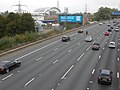
 Slough , M4 Motorway - geograph.org.uk - 5726460.jpg 5.621 × 3.748; 5,88 MB
-
 Slough , M4 Motorway - geograph.org.uk - 5726462.jpg 6.000 × 4.000; 6,38 MB
-
 Slough , M4 Motorway - geograph.org.uk - 5726463.jpg 6.000 × 4.000; 6,5 MB
-
 Slough , M4 Motorway - geograph.org.uk - 5726464.jpg 6.000 × 4.000; 6,75 MB
-
 Slough District , M4 Motorway - geograph.org.uk - 4227701.jpg 4.248 × 2.821; 5,87 MB
-
 Slough District , M4 Motorway - geograph.org.uk - 4227706.jpg 4.201 × 1.988; 4,66 MB
-
 Slough District , M4 Motorway - geograph.org.uk - 5898873.jpg 6.000 × 4.000; 6,68 MB
-
 Stanwell Rd - geograph.org.uk - 4734267.jpg 640 × 426; 73 KB
-

-
 Stanwell Road roundabout - geograph.org.uk - 3977548.jpg 2.048 × 1.536; 1,11 MB
-
 Sutton Lane Bridge, M4 - geograph.org.uk - 4674014.jpg 640 × 401; 49 KB
-
 Terrace on Colnbrook High Street - geograph.org.uk - 4229723.jpg 2.560 × 1.920; 1,97 MB
-
 The A4 at Langley Roundabout - geograph.org.uk - 4463027.jpg 640 × 481; 248 KB
-
 The A4 Colnbrook Bypass - geograph.org.uk - 2811527.jpg 1.600 × 1.200; 676 KB
-
 The Blacksmiths Shop - geograph.org.uk - 3358355.jpg 640 × 430; 28 KB
-
 The Colnbrook Bypass by the Grundon waste incinerator - geograph.org.uk - 2812030.jpg 1.600 × 1.200; 527 KB
-

-
 The Holiday Inn Express on London Road, Slough - geograph.org.uk - 6295804.jpg 1.884 × 1.224; 1,17 MB
-
 The Holiday Inn Express on London Road, Slough - geograph.org.uk - 6300991.jpg 1.892 × 1.236; 1,32 MB
-
 The M25 just west of Heathrow - geograph.org.uk - 3010305.jpg 3.264 × 2.448; 3,51 MB
-
 The M25 motorway from the air - geograph.org.uk - 4652866.jpg 640 × 480; 103 KB
-
 The M4 flyover on Langley roundabout - geograph.org.uk - 2811547.jpg 1.600 × 1.200; 644 KB
-
 The Mill House and mill stream, Mill Street (2) - geograph.org.uk - 5908662.jpg 1.024 × 768; 214 KB
-
 The Mill House and mill stream, Mill Street - geograph.org.uk - 5908660.jpg 1.024 × 768; 293 KB
-
 The Poyle Travelodge - geograph.org.uk - 4008363.jpg 2.031 × 1.523; 372 KB
-
 The Wraysbury reservoir - geograph.org.uk - 3977452.jpg 2.048 × 1.536; 1,19 MB
-
 Tower block beside M4 at junction 5 - geograph.org.uk - 5431444.jpg 1.600 × 1.200; 738 KB
-
 Track south of Bath Road - geograph.org.uk - 5906979.jpg 1.024 × 768; 351 KB
-
 Track-bed, old Staines West branch - geograph.org.uk - 5424177.jpg 640 × 480; 165 KB
-

-
 Travelodge, Horton Rd - geograph.org.uk - 4734272.jpg 640 × 426; 49 KB
-
 Turning for Britannia Industrial Estate - geograph.org.uk - 4498805.jpg 1.600 × 1.042; 297 KB
-
 Upside down Union Flag ^36 - geograph.org.uk - 2981429.jpg 800 × 600; 143 KB
-
 Victorian Detached House on the Poyle Road - geograph.org.uk - 5297791.jpg 4.608 × 3.456; 5,95 MB
-
 View along Park Street (Bath Road) - geograph.org.uk - 4498793.jpg 1.600 × 1.131; 386 KB
-

-
 View over M4 and Colne Brook valley from the air - geograph.org.uk - 5646620.jpg 3.264 × 1.601; 792 KB
-
 Wild flowers at Albany Park - geograph.org.uk - 5815120.jpg 4.000 × 3.000; 4,69 MB
-
 Wild flowers at Albany Park - geograph.org.uk - 5815145.jpg 4.000 × 3.000; 4,68 MB
-
 Woodland by the M4 - geograph.org.uk - 3358363.jpg 640 × 430; 78 KB
-
 Woodland by the M4 - geograph.org.uk - 6073862.jpg 4.185 × 2.675; 2,2 MB
-
 Wraysbury House - Poyle Road - geograph.org.uk - 4498774.jpg 1.600 × 958; 284 KB


_-_geograph.org.uk_-_2182869.jpg)


_-_geograph.org.uk_-_4482226.jpg)


.jpg)


_-_geograph.org.uk_-_5908687.jpg)
_-_geograph.org.uk_-_5908689.jpg)
_-_geograph.org.uk_-_5908690.jpg)


_-_geograph.org.uk_-_2466984.jpg)


_-_geograph.org.uk_-_4463104.jpg)


_-_geograph.org.uk_-_1994972.jpg)
_-_geograph.org.uk_-_1997195.jpg)


_-_geograph.org.uk_-_5908662.jpg)


_-_geograph.org.uk_-_4498793.jpg)


