Category:Colsterworth
Aller à la navigation
Aller à la recherche
localité britannique du comté anglais de Lincolnshire  | |||||
| Téléverser des médias | |||||
| Nature de l’élément | |||||
|---|---|---|---|---|---|
| Lieu | South Kesteven, Lincolnshire, Midlands de l'Est, Angleterre | ||||
 | |||||
English: Colsterworth is a village in the English county of Lincolnshire. Colsterworth, together with the hamlet of Woolsthorpe-by-Colsterworth, had a population of 1,508 according to the 2001 census, and lies half a mile to the west of the A1 road, seven miles south of Grantham and 13 miles north of Stamford. The name Colsterworth is from the Old English colestre + worth for "enclosure of the charcoal burners"; the name appeared as Colsteuorde in the 1086 Domesday Book.
Italiano: Colsterworth è un paese di 1.508 abitanti della contea del Lincolnshire, in Inghilterra. Nel territorio della sua parrocchia civile si trova il villaggio di Woolsthorpe-by-Colsterworth, luogo di nascita di Sir Isaac Newton.
Sous-catégories
Cette catégorie comprend 6 sous-catégories, dont les 6 ci-dessous.
F
- Fields in Colsterworth (4 F)
J
T
- The White Lion, Colsterworth (3 F)
- Twyford Wood, Colsterworth (21 F)
W
Média dans la catégorie « Colsterworth »
Cette catégorie comprend 317 fichiers, dont les 200 ci-dessous.
(page précédente) (page suivante)-
 13th century doorway - geograph.org.uk - 6247975.jpg 603 × 800 ; 152 kio
-
 A break in the clouds - geograph.org.uk - 3781908.jpg 4 896 × 3 264 ; 6,62 Mio
-
 A human sundial at Woolsthorpe Manor - geograph.org.uk - 3591025.jpg 1 024 × 768 ; 257 kio
-
 A rare bend in Woolsthorpe Road - geograph.org.uk - 3514244.jpg 1 024 × 768 ; 135 kio
-
 A Shady Corner - geograph.org.uk - 5946678.jpg 6 032 × 4 014 ; 4,01 Mio
-
 A1 - B6403 turning - geograph.org.uk - 2644061.jpg 640 × 428 ; 87 kio
-

-
 A1 - turning for B676 and A151 - geograph.org.uk - 2644023.jpg 640 × 428 ; 85 kio
-
 A1 junction - geograph.org.uk - 5405845.jpg 4 896 × 3 672 ; 6,78 Mio
-
 A1 junction of A151 at Colsterworth - geograph.org.uk - 3456439.jpg 1 490 × 880 ; 746 kio
-
 A1 layby - geograph.org.uk - 2643989.jpg 640 × 428 ; 70 kio
-
 A1 near Woolsthorpe-by-Colsterworth - geograph.org.uk - 4219382.jpg 640 × 480 ; 256 kio
-
 A1 northbound - geograph.org.uk - 2644078.jpg 640 × 428 ; 88 kio
-
 A1 northbound - geograph.org.uk - 5501187.jpg 640 × 428 ; 91 kio
-
 A1 northbound - geograph.org.uk - 5501196.jpg 640 × 428 ; 97 kio
-
 A1 northbound near Colsterworth - geograph.org.uk - 5132714.jpg 640 × 480 ; 45 kio
-
 A1 northbound near Lodge Farm - geograph.org.uk - 5132736.jpg 640 × 479 ; 46 kio
-
 A1 Southbound - geograph.org.uk - 4216935.jpg 640 × 480 ; 299 kio
-
 A1 southbound approaching B6403 - geograph.org.uk - 3456406.jpg 1 548 × 997 ; 986 kio
-
 A1 southbound seen from A151 overbridge - geograph.org.uk - 3606444.jpg 640 × 481 ; 48 kio
-
 A1 southbound towards Colsterworth - geograph.org.uk - 3502013.jpg 2 103 × 1 467 ; 1,1 Mio
-
 A1 southbound, Colsterworth - geograph.org.uk - 3076897.jpg 640 × 443 ; 79 kio
-
 A1 truckstop - geograph.org.uk - 4826289.jpg 6 480 × 4 320 ; 7,78 Mio
-
 A1, A151 overbridge - geograph.org.uk - 3187243.jpg 640 × 430 ; 40 kio
-
 A1, northbound - geograph.org.uk - 3187236.jpg 640 × 430 ; 38 kio
-
 A1, northbound - geograph.org.uk - 3187258.jpg 640 × 430 ; 38 kio
-
 A1, Woolsthorpe turning - geograph.org.uk - 3187260.jpg 640 × 430 ; 45 kio
-
 A151 eastbound near Pasture Lodge - geograph.org.uk - 3608128.jpg 640 × 481 ; 56 kio
-
 A151 overbridge, A1 - geograph.org.uk - 2511230.jpg 640 × 364 ; 35 kio
-
 A151 towards Bourne - geograph.org.uk - 3077431.jpg 640 × 419 ; 30 kio
-
 Aerodrome Farm - geograph.org.uk - 3514453.jpg 1 024 × 768 ; 124 kio
-
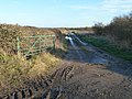
 Airfield track - geograph.org.uk - 3781905.jpg 4 896 × 3 264 ; 6,52 Mio
-
 An unnamed lane joining Crabtree Road - geograph.org.uk - 4321885.jpg 3 088 × 2 056 ; 2,89 Mio
-
 B6403 entering Colsterworth - geograph.org.uk - 6208736.jpg 1 024 × 655 ; 190 kio
-
 B6403 High Dike - geograph.org.uk - 3568703.jpg 2 256 × 1 504 ; 1,82 Mio
-
 B6403 overbridge, A1 - geograph.org.uk - 2511236.jpg 640 × 295 ; 35 kio
-
 B6403 Stamford Road - geograph.org.uk - 6208730.jpg 1 024 × 683 ; 184 kio
-
 B6403 towards Colsterworth - geograph.org.uk - 3076878.jpg 640 × 480 ; 54 kio
-
 B6403 turn off, A1 - geograph.org.uk - 2621952.jpg 640 × 606 ; 63 kio
-
 B6403, High Dike near Colsterworth - geograph.org.uk - 4214267.jpg 640 × 480 ; 264 kio
-
 B676 Crossing the A1 at Colsterworth - geograph.org.uk - 4222409.jpg 640 × 480 ; 295 kio
-
 B676 eastbound - geograph.org.uk - 3652109.jpg 640 × 480 ; 48 kio
-
 B676 towards the A1 - geograph.org.uk - 3076894.jpg 640 × 480 ; 51 kio
-
 Back Lane, Colsterworth - geograph.org.uk - 6260608.jpg 4 000 × 3 000 ; 4,72 Mio
-
 Back Lane, Colsterworth - geograph.org.uk - 6260613.jpg 4 000 × 3 000 ; 4,52 Mio
-
 Back Lane, Colsterworth - geograph.org.uk - 6260636.jpg 4 000 × 3 000 ; 4,51 Mio
-
 Back Lane, Colsterworth - geograph.org.uk - 6260646.jpg 4 000 × 3 000 ; 4,73 Mio
-
 Barn near Colsterworth limestone quarry - geograph.org.uk - 3591035.jpg 1 024 × 735 ; 71 kio
-
 Barn, Aerodrome Farm - geograph.org.uk - 3077455.jpg 640 × 480 ; 88 kio
-
 Bed and Breakfast - geograph.org.uk - 5946482.jpg 6 032 × 4 014 ; 3,88 Mio
-
 Bourne Road, Colsterworth - geograph.org.uk - 5445157.jpg 3 776 × 2 520 ; 3,73 Mio
-

-
 Bridge along Woolsthorpe Road - geograph.org.uk - 6299688.jpg 800 × 508 ; 126 kio
-
 Building at Aerodrome Farm - geograph.org.uk - 6248058.jpg 800 × 527 ; 136 kio
-
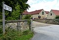
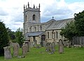 Church of St John the Baptist in Colsterworth - geograph.org.uk - 6247937.jpg 800 × 589 ; 113 kio
-
 Church of St John the Baptist in Colsterworth - geograph.org.uk - 6247972.jpg 800 × 573 ; 137 kio
-
 Church of St John the Baptist in Colsterworth - geograph.org.uk - 6299807.jpg 615 × 800 ; 153 kio
-
 Church of St John the Baptist in Colsterworth - geograph.org.uk - 6299816.jpg 800 × 681 ; 126 kio
-

-
 Churchyard path - geograph.org.uk - 5945991.jpg 4 014 × 6 032 ; 5,81 Mio
-
 Churchyard tree - geograph.org.uk - 5945692.jpg 7 113 × 6 301 ; 7,93 Mio
-
 Churchyard tree - geograph.org.uk - 5945718.jpg 5 927 × 6 615 ; 7,64 Mio
-
 Co-op store at Bridge End, Colsterworth - geograph.org.uk - 6246369.jpg 800 × 474 ; 97 kio
-
 Colsterworth filling station - geograph.org.uk - 3187250.jpg 640 × 430 ; 39 kio
-
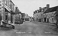
 Colsterworth High Street - geograph.org.uk - 1470102.jpg 640 × 480 ; 84 kio
-
 Colsterworth High Street - geograph.org.uk - 6299812.jpg 800 × 420 ; 99 kio
-
 Colsterworth Landfill Site - geograph.org.uk - 5834469.jpg 9 261 × 3 092 ; 7,84 Mio
-
 Colsterworth Methodist Church - geograph.org.uk - 6260621.jpg 4 000 × 3 000 ; 4,74 Mio
-
 Colsterworth North Quarry, the lorry road - geograph.org.uk - 1468923.jpg 640 × 480 ; 105 kio
-
 Colsterworth Post Office - geograph.org.uk - 3076893.jpg 800 × 528 ; 63 kio
-
 Colsterworth Road - Crabtree Road junction - geograph.org.uk - 5264948.jpg 1 024 × 683 ; 173 kio
-
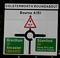 Colsterworth Roundabout sign - geograph.org.uk - 2913670.jpg 640 × 617 ; 73 kio
-
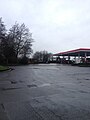
 Colsterworth services - geograph.org.uk - 5185416.jpg 1 024 × 648 ; 144 kio
-
 Colsterworth turn from A1 - geograph.org.uk - 14358.jpg 600 × 278 ; 18 kio
-
 Colsterworth War Memorial - geograph.org.uk - 3608008.jpg 4 000 × 3 000 ; 4,13 Mio
-
 Colsterworth war memorial along the High Street - geograph.org.uk - 6247923.jpg 800 × 588 ; 107 kio
-
 Colsterworth war memorial along the High Street - geograph.org.uk - 6299820.jpg 610 × 800 ; 125 kio
-
 Colsterworth welcomes careful drivers - geograph.org.uk - 2318508.jpg 1 024 × 768 ; 106 kio
-
 Colsterworth welcomes careful drivers - geograph.org.uk - 2318532.jpg 1 024 × 768 ; 124 kio
-
 Colsterworth, Back Lane - geograph.org.uk - 1461677.jpg 640 × 480 ; 67 kio
-
 Colsterworth, football field - geograph.org.uk - 1468980.jpg 640 × 480 ; 57 kio
-
 Colsterworth, former ironstone quarry - geograph.org.uk - 1468964.jpg 640 × 480 ; 89 kio
-
-
 Colsterworth, new housing development - geograph.org.uk - 1468976.jpg 640 × 480 ; 147 kio
-
 Colsterworth, Sir Isaac Newton Memorial Hall - geograph.org.uk - 1468970.jpg 640 × 480 ; 69 kio
-
 Colsterworth, view across the Witham - geograph.org.uk - 1468229.jpg 640 × 480 ; 77 kio
-
 Combed field east of Colsterworth - geograph.org.uk - 2318517.jpg 1 024 × 768 ; 199 kio
-
 Cottage by the churchyard, Colsterworth (geograph 6527004).jpg 1 024 × 768 ; 189 kio
-
 Cottages in Colsterworth - geograph.org.uk - 5644064.jpg 640 × 480 ; 80 kio
-
 Course of former mineral railway - geograph.org.uk - 6303336.jpg 1 024 × 768 ; 305 kio
-
 Crabtree Road - geograph.org.uk - 3514433.jpg 1 024 × 768 ; 127 kio
-
 Crabtree Road near Aerodrome Farm - geograph.org.uk - 4321874.jpg 3 088 × 2 056 ; 3,45 Mio
-
 Crabtree Road towards Buckminster - geograph.org.uk - 3077454.jpg 640 × 480 ; 45 kio
-
 Crabtree Road towards Buckminster - geograph.org.uk - 3077457.jpg 640 × 480 ; 66 kio
-
 Crabtree Road towards Buckminster - geograph.org.uk - 6248055.jpg 800 × 511 ; 113 kio
-
 Crop field, Glebe Farm - geograph.org.uk - 3077444.jpg 640 × 480 ; 90 kio
-
 Crossroads near Colsterworth Quarry - geograph.org.uk - 4322360.jpg 3 088 × 2 056 ; 2,71 Mio
-
 Dead tree - geograph.org.uk - 4292355.jpg 4 896 × 3 672 ; 6,62 Mio
-
 Distant church - geograph.org.uk - 6339617.jpg 5 551 × 3 701 ; 7,69 Mio
-
 Disused and blocked entrance to former quarry - geograph.org.uk - 3794578.jpg 1 024 × 768 ; 163 kio
-
 Disused field gates, west of Aerodrome Farm - geograph.org.uk - 3514455.jpg 1 024 × 615 ; 107 kio
-
 Double gated double field entry - geograph.org.uk - 3514432.jpg 1 024 × 768 ; 114 kio
-
 Entrance to Colsterworth landfill site - geograph.org.uk - 3794563.jpg 1 024 × 768 ; 124 kio
-
 Entrance to Ridd's Farm from the B6403 - geograph.org.uk - 5589198.jpg 3 776 × 2 520 ; 3,02 Mio
-
 Entrance to the Old Post Lane Cemetery - geograph.org.uk - 6244834.jpg 800 × 536 ; 184 kio
-
 Entrance to Woolsthorpe Manor - geograph.org.uk - 6244828.jpg 800 × 541 ; 136 kio
-
 Ermine Street (B6403) towards Colsterworth - geograph.org.uk - 3076843.jpg 640 × 480 ; 64 kio
-
 Ewes and lambs off Crabtree Road - geograph.org.uk - 5264965.jpg 1 024 × 683 ; 303 kio
-
 Exit for Woolsthorpe Manor - geograph.org.uk - 4219393.jpg 640 × 480 ; 284 kio
-
 Farm building off Skillington Road - geograph.org.uk - 3077442.jpg 640 × 480 ; 79 kio
-
 Farm track near Woolsthorpe - geograph.org.uk - 6302938.jpg 1 024 × 768 ; 180 kio
-
 Farm track running east from Skillington Road - geograph.org.uk - 3794569.jpg 1 024 × 768 ; 169 kio
-
 Farm track south of Aerodrome Farm - geograph.org.uk - 3514442.jpg 1 024 × 768 ; 132 kio
-
 Farmland along Crabtree Road - geograph.org.uk - 6248054.jpg 800 × 586 ; 158 kio
-
 Farmland and shelterbelt, south of Aerodrome Farm - geograph.org.uk - 3514438.jpg 1 024 × 768 ; 173 kio
-
 Farmland near Woolsthorpe by Colsterworth - geograph.org.uk - 3077447.jpg 640 × 480 ; 80 kio
-
 Farmland off Ermine Street - geograph.org.uk - 3076841.jpg 640 × 480 ; 59 kio
-
 Farmland south of Aerodrome Farm - geograph.org.uk - 3514444.jpg 1 024 × 768 ; 128 kio
-
 Farmland west of Woolsthorpe - geograph.org.uk - 3514393.jpg 1 024 × 768 ; 128 kio
-
 Farmland, Aerodrome Farm - geograph.org.uk - 3077456.jpg 640 × 480 ; 97 kio
-
 Field gate, south side of Woolsthorpe Road - geograph.org.uk - 3514386.jpg 1 024 × 768 ; 143 kio
-
 Field next to Colsterworth and the River Witham - geograph.org.uk - 6298274.jpg 800 × 589 ; 103 kio
-
 Field of barley near Lodge Farm, Colsterworth - geograph.org.uk - 4566422.jpg 4 320 × 3 240 ; 6,08 Mio
-
 Fields south of Colsterworth - geograph.org.uk - 5405846.jpg 4 896 × 3 672 ; 6,42 Mio
-
 Fields to the west of High Dyke - geograph.org.uk - 2631230.jpg 640 × 475 ; 86 kio
-
 Filling station, A1, Colsterworth - geograph.org.uk - 2621950.jpg 640 × 430 ; 43 kio
-
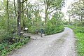
 Footbridge towards the road - geograph.org.uk - 934969.jpg 640 × 480 ; 173 kio
-
 Footbridges - geograph.org.uk - 934968.jpg 480 × 640 ; 152 kio
-
 Footpath at Colsterworth - geograph.org.uk - 6260630.jpg 4 000 × 3 000 ; 4,9 Mio
-
 Footpath off A151, near Firs Farm - geograph.org.uk - 3179910.jpg 3 088 × 2 056 ; 2,23 Mio
-
 Footpath Security - geograph.org.uk - 934966.jpg 640 × 480 ; 101 kio
-
 Footpath straight ahead^ - geograph.org.uk - 935207.jpg 640 × 480 ; 100 kio
-
 Footpath to Burton-le-Coggles - geograph.org.uk - 5444167.jpg 3 776 × 2 520 ; 3,83 Mio
-
 Footpath to Colsterworth - geograph.org.uk - 4629804.jpg 4 000 × 3 000 ; 4,13 Mio
-
 Footpath to the church of St John the Baptist - geograph.org.uk - 5189220.jpg 1 024 × 768 ; 193 kio
-
 Garage at Colsterworth Services - geograph.org.uk - 5644063.jpg 480 × 640 ; 52 kio
-
 Gates at entrance to Pasture Lodge - geograph.org.uk - 3503915.jpg 2 181 × 1 398 ; 1,84 Mio
-
 Grantham Colsterworth Travelodge - geograph.org.uk - 3076901.jpg 640 × 451 ; 70 kio
-
 Gravestones at St John the Baptist church - geograph.org.uk - 6299805.jpg 800 × 476 ; 103 kio
-
 Grazing, Ashleigh, near Colsterworth - geograph.org.uk - 3077429.jpg 640 × 480 ; 95 kio
-
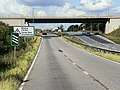
 Great North Road (A1), Junction with B6403 - geograph.org.uk - 4219363.jpg 640 × 480 ; 237 kio
-
 Green fields near Stainby - geograph.org.uk - 2793836.jpg 640 × 480 ; 64 kio
-
 Green lane near Skillington - geograph.org.uk - 5264964.jpg 1 024 × 683 ; 344 kio
-
 Green wheat and Easton Wood - geograph.org.uk - 5444171.jpg 3 776 × 2 520 ; 4,23 Mio
-
 High Dike - geograph.org.uk - 4216939.jpg 640 × 480 ; 287 kio
-
 High Dike, B6403 - geograph.org.uk - 4214264.jpg 640 × 427 ; 306 kio
-
 High Dyke southwards - geograph.org.uk - 2631232.jpg 640 × 433 ; 75 kio
-
 High Street in Colsterworth - geograph.org.uk - 6247900.jpg 800 × 547 ; 110 kio
-
 High Street in Colsterworth - geograph.org.uk - 6247905.jpg 800 × 489 ; 92 kio
-
 High Street, Colsterworth (B6403) - geograph.org.uk - 3076885.jpg 640 × 480 ; 72 kio
-
 High Street, Colsterworth - geograph.org.uk - 3608023.jpg 4 000 × 3 000 ; 4,45 Mio
-
 Holly berries - geograph.org.uk - 5945988.jpg 6 032 × 4 014 ; 2,34 Mio
-
 Honey Pot Lane - geograph.org.uk - 3503730.jpg 2 256 × 1 504 ; 2,23 Mio
-
 Honey Pot Lane eastwards - geograph.org.uk - 934971.jpg 640 × 484 ; 129 kio
-
 Honey Pot Lane westwards - geograph.org.uk - 934972.jpg 640 × 552 ; 151 kio
-
 House End - geograph.org.uk - 5970639.jpg 6 032 × 4 014 ; 3,23 Mio
-
 House in School Lane - geograph.org.uk - 5945714.jpg 13 000 × 4 395 ; 7,9 Mio
-
 Houses along Woolsthorpe Road - geograph.org.uk - 6299685.jpg 800 × 532 ; 115 kio
-
 Houses and Gardens seen from the churchyard - geograph.org.uk - 5945986.jpg 5 958 × 5 302 ; 7,04 Mio
-
 Houses near the church - geograph.org.uk - 5946367.jpg 6 032 × 4 014 ; 3,78 Mio
-
 Houses on the Bourne Road Estate - geograph.org.uk - 2318510.jpg 1 024 × 768 ; 193 kio
-
 Information board about North Witham airfield - geograph.org.uk - 6260614.jpg 4 608 × 3 072 ; 5,35 Mio
-
 Information board about RAF North Witham in Twyford Wood - geograph.org.uk - 6260606.jpg 4 608 × 3 072 ; 5,76 Mio
-
 Information board about RAF North Witham in Twyford Wood - geograph.org.uk - 6260611.jpg 4 608 × 3 072 ; 5,75 Mio
-
 Inside the Quarry - geograph.org.uk - 5836993.jpg 15 000 × 4 898 ; 7,83 Mio
-
 Landfill site in quarry near Buckminster - geograph.org.uk - 39044.jpg 640 × 480 ; 95 kio
-
 Landfill site sign - geograph.org.uk - 5837171.jpg 1 730 × 1 815 ; 658 kio
-
 Lane bypassing Colsterworth village - geograph.org.uk - 4434353.jpg 1 024 × 724 ; 198 kio
-

-
 Lane to Woolsthorpe-by-Colsterworth - geograph.org.uk - 6242562.jpg 767 × 800 ; 163 kio
-
 Layby on A1 South of Colsterworth - geograph.org.uk - 4219364.jpg 640 × 480 ; 232 kio
-
 Layby, A1 - geograph.org.uk - 3187233.jpg 640 × 430 ; 37 kio
-
 Lincolnshire woodland - geograph.org.uk - 3514480.jpg 1 024 × 768 ; 231 kio
-
 Little Chef, A1 Colsterworth Services - geograph.org.uk - 3076903.jpg 640 × 402 ; 53 kio
-
 Looking across an old industrial landscape - geograph.org.uk - 4629004.jpg 4 000 × 3 000 ; 3,86 Mio
-
 Looking across an old mineral railway track - geograph.org.uk - 4629013.jpg 4 000 × 3 000 ; 4,2 Mio
-
 Looking onto Newton Way - geograph.org.uk - 5324509.jpg 640 × 480 ; 95 kio
-
 Looking toward Colsterworth - geograph.org.uk - 6339634.jpg 6 240 × 4 160 ; 6,21 Mio
-
 Looking towards Colsterworth - geograph.org.uk - 4629798.jpg 4 000 × 3 000 ; 4,22 Mio
-
 Looking towards Easton Wood - geograph.org.uk - 5444159.jpg 3 776 × 2 520 ; 3,97 Mio
-
 Lorries on the A1 - geograph.org.uk - 5405849.jpg 4 896 × 3 672 ; 6,46 Mio
-
 Meanders on the Witham - geograph.org.uk - 6339632.jpg 14 999 × 3 000 ; 7,52 Mio
-
 Millstone House - geograph.org.uk - 5946361.jpg 6 032 × 4 014 ; 4,52 Mio
-
 Minor road (Crabtree Road) to Buckminster - geograph.org.uk - 3591041.jpg 1 024 × 677 ; 82 kio
-
 Molehills in the Witham valley - geograph.org.uk - 2318535.jpg 1 024 × 768 ; 134 kio
-
 Muddy Field near Firs Farm - geograph.org.uk - 3179726.jpg 3 088 × 2 056 ; 1,88 Mio
-

-
 New Flyover Bridge, A1 Colsterworth - geograph.org.uk - 1469539.jpg 640 × 480 ; 69 kio
-
 New junction layout at the A1 - geograph.org.uk - 5445166.jpg 3 776 × 2 520 ; 3,57 Mio
-
 New road from the A1 - geograph.org.uk - 2318504.jpg 1 024 × 768 ; 114 kio
-
 North Road - geograph.org.uk - 5946470.jpg 6 032 × 4 014 ; 4,38 Mio
-
 Northbound A1 - geograph.org.uk - 4219370.jpg 640 × 480 ; 276 kio
-
 Northbound A1 - geograph.org.uk - 4219378.jpg 640 × 480 ; 250 kio
-
 Northbound A1 from the B6403 flyover - geograph.org.uk - 3769474.jpg 2 516 × 1 681 ; 760 kio
-
 Northbound A1 near Colsterworth - geograph.org.uk - 4219374.jpg 640 × 480 ; 294 kio
-
 Northbound A1, Colsterworth - geograph.org.uk - 4219376.jpg 640 × 480 ; 260 kio
-
 Obelisk grave marker - geograph.org.uk - 5945980.jpg 4 014 × 6 032 ; 5,49 Mio
-
 Occupation Bridge on the High Dyke Branch - geograph.org.uk - 1539160.jpg 480 × 640 ; 177 kio
-
 Old house in Back Lane, Colsterworth - geograph.org.uk - 6260642.jpg 4 000 × 3 000 ; 4,75 Mio
-
 Old Post Lane - geograph.org.uk - 4150858.jpg 4 000 × 3 000 ; 4,31 Mio


_Over_the_A1_at_Woolsthorpe-by-Colsterworth_-_geograph.org.uk_-_4219386.jpg)


.jpg)


_towards_Colsterworth_-_geograph.org.uk_-_3076843.jpg)


,_Junction_with_B6403_-_geograph.org.uk_-_4219363.jpg)


_-_geograph.org.uk_-_3076885.jpg)


_to_Buckminster_-_geograph.org.uk_-_3591041.jpg)


