Category:Colyford
Aller à la navigation
Aller à la recherche
English: Colyford is a village in East Devon, England. It is adjacent to the town of Colyton to the north and lies within its civil parish boundaries.
village britannique  | |||||
| Téléverser des médias | |||||
| Nature de l’élément |
| ||||
|---|---|---|---|---|---|
| Lieu |
| ||||
 | |||||
Sous-catégories
Cette catégorie comprend 2 sous-catégories, dont les 2 ci-dessous.
C
- Colyford railway station (10 F)
M
Média dans la catégorie « Colyford »
Cette catégorie comprend 63 fichiers, dont les 63 ci-dessous.
-
 A woodland bridge - geograph.org.uk - 5260492.jpg 1 024 × 768 ; 308 kio
-
 A3052 - geograph.org.uk - 5249917.jpg 640 × 426 ; 87 kio
-
 A3052 Swan Hill Road, Colyford - geograph.org.uk - 6219626.jpg 1 024 × 684 ; 300 kio
-
 A3052 Swan Hill Road, Colyford - geograph.org.uk - 6219631.jpg 1 024 × 684 ; 337 kio
-
 A3052, Colyford - geograph.org.uk - 5249900.jpg 640 × 426 ; 61 kio
-
 A3052, Stafford Cross - geograph.org.uk - 5249918.jpg 640 × 315 ; 64 kio
-
 Across the fields in winter - geograph.org.uk - 5261597.jpg 1 024 × 768 ; 202 kio
-
 All quiet on a winter's Sunday - geograph.org.uk - 5260398.jpg 1 024 × 768 ; 135 kio
-
 Approaching tram near Colyford - geograph.org.uk - 1285279.jpg 640 × 480 ; 110 kio
-
 Arriving at Colyford Station - geograph.org.uk - 2489046.jpg 1 600 × 1 200 ; 647 kio
-
 B3172 Seaton Down Hill - geograph.org.uk - 6219616.jpg 1 024 × 684 ; 261 kio
-
 Bolshayne Farm - geograph.org.uk - 5888623.jpg 1 024 × 768 ; 161 kio
-
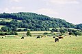
 Cattle by the River Coly, Colyford - geograph.org.uk - 5789081.jpg 1 024 × 770 ; 471 kio
-
 Cloyford - Houses on A3052 - geograph.org.uk - 4966035.jpg 4 608 × 3 456 ; 6,14 Mio
-
 Colyford , Colyford Tram Station - geograph.org.uk - 2807774.jpg 4 284 × 2 842 ; 6,13 Mio
-
 Colyford Cars - geograph.org.uk - 5741952.jpg 3 648 × 2 736 ; 2,03 Mio
-
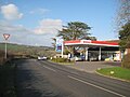
 Colyford filling station - geograph.org.uk - 5889405.jpg 1 024 × 768 ; 131 kio
-
 Colyford General Stores and Post Office - geograph.org.uk - 2758533.jpg 1 024 × 768 ; 160 kio
-
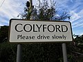 Colyford Welcome Sign.jpg 5 152 × 3 864 ; 3,8 Mio
-
 Colyford, road sign warning of cables - geograph.org.uk - 1477263.jpg 480 × 640 ; 60 kio
-
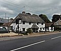
 Colyford, thatched cottages on the main road - geograph.org.uk - 1477266.jpg 640 × 480 ; 72 kio
-
 Colyton Fire Station - geograph.org.uk - 67979.jpg 640 × 422 ; 209 kio
-
-
 Colyton, on Colyton Hill - geograph.org.uk - 350695.jpg 640 × 427 ; 201 kio
-
 Driveway, Whitwell Farm - geograph.org.uk - 5888926.jpg 1 024 × 768 ; 278 kio
-
 Entering Colyford, A3052 - geograph.org.uk - 5249893.jpg 640 × 400 ; 60 kio
-
 Entrance, Colyton Grammar School - geograph.org.uk - 5888956.jpg 1 024 × 768 ; 269 kio
-
 Farm buildings on Whitwell Lane - geograph.org.uk - 5888944.jpg 1 024 × 768 ; 188 kio
-
 Fields at Colyford - geograph.org.uk - 1285535.jpg 640 × 480 ; 65 kio
-
 Footbridge over Holyford goyle - geograph.org.uk - 5260474.jpg 1 024 × 768 ; 315 kio
-
 Higher Bolshayne Barn - geograph.org.uk - 5888620.jpg 1 024 × 768 ; 249 kio
-
 Holyford Nature Reserve - geograph.org.uk - 5260438.jpg 640 × 480 ; 67 kio
-
 Holyford reservoir - geograph.org.uk - 5260461.jpg 1 024 × 768 ; 311 kio
-
 House on Swan Hill Road - geograph.org.uk - 5888966.jpg 1 024 × 822 ; 160 kio
-
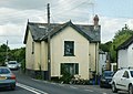 House, Colyford - geograph.org.uk - 1370494.jpg 640 × 455 ; 63 kio
-
 Kingsdon , Colyford Tram Station - geograph.org.uk - 2807813.jpg 4 246 × 2 784 ; 4,68 Mio
-
 Kingsdon , Colyford Tram Station - geograph.org.uk - 2807817.jpg 4 288 × 2 848 ; 6,31 Mio
-
 Looking Across Colyford Common Local Nature Reserve - geograph.org.uk - 6118560.jpg 5 343 × 3 005 ; 4,12 Mio
-
 Mobile homes park, at Colyford - geograph.org.uk - 1263236.jpg 640 × 480 ; 113 kio
-
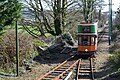 Northbound tram arriving at Colyford - geograph.org.uk - 5719379.jpg 640 × 427 ; 139 kio
-
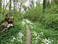 Path in Holyford Woods in May - geograph.org.uk - 6141487.jpg 1 024 × 768 ; 358 kio
-
 Rhode Cross - geograph.org.uk - 5888949.jpg 1 024 × 768 ; 202 kio
-
 River Axe at Colyford - geograph.org.uk - 1871090.jpg 640 × 480 ; 54 kio
-
 River Axe near Colyford - geograph.org.uk - 886342.jpg 640 × 426 ; 64 kio
-
 River Coly at Colyford - geograph.org.uk - 1285299.jpg 640 × 480 ; 116 kio
-
 River Coly at Colyford - geograph.org.uk - 1871094.jpg 640 × 480 ; 71 kio
-
 Seaton and District Tramway, south of Colyford - geograph.org.uk - 5719380.jpg 640 × 427 ; 128 kio
-
 Seaton Crossing, A3052 - geograph.org.uk - 5249895.jpg 640 × 426 ; 93 kio
-
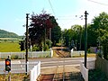
 Seaton Electric Tramway at Colyford Level Crossing - geograph.org.uk - 6007909.jpg 5 184 × 2 920 ; 4,83 Mio
-
 Seaton Tower petrol station - geograph.org.uk - 5260432.jpg 1 024 × 768 ; 149 kio
-
 Seaton Tramway just south of Colyton Station - geograph.org.uk - 5789045.jpg 1 024 × 770 ; 521 kio
-
 Seaton Tramway Swan Hill Road level crossing, Colyford - geograph.org.uk - 5788906.jpg 1 024 × 770 ; 317 kio
-
 Seaton Tramway,Colyford, Devon (geograph 4182318).jpg 1 289 × 967 ; 1,81 Mio
-
 Swan Hill Road, Colyford - geograph.org.uk - 5741963.jpg 3 648 × 2 736 ; 2,19 Mio
-
 The A3052 approaching Stafford Cross - geograph.org.uk - 6293916.jpg 1 067 × 1 600 ; 677 kio
-
 The Old Toilets at Colyford Station - geograph.org.uk - 2489054.jpg 1 600 × 1 200 ; 615 kio
-
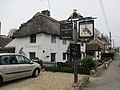
 The Wheelwright Inn, Colyford - geograph.org.uk - 5888971.jpg 1 024 × 854 ; 173 kio
-
 The Wheelwright, Colyford - geograph.org.uk - 5741956.jpg 3 648 × 2 736 ; 2,73 Mio
-
 The Wheelwright. Colyford - geograph.org.uk - 5741957.jpg 3 648 × 2 736 ; 2,34 Mio
-
 Tree house - geograph.org.uk - 5741967.jpg 3 648 × 2 736 ; 2,35 Mio
-
 View to Hawkesdown Hill from the Seaton Tramway - geograph.org.uk - 5789090.jpg 1 024 × 768 ; 246 kio
-
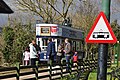
 Welcome to Seaton - geograph.org.uk - 5261547.jpg 1 024 × 768 ; 214 kio
-
 Wetlands on Colyford Common - geograph.org.uk - 5719377.jpg 640 × 427 ; 80 kio


.jpg)


