Category:Compton, Guildford
Aller à la navigation
Aller à la recherche
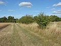
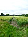
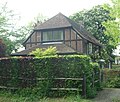
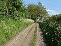
English: The village of Compton, Surrey, England, is situated between Godalming and Guildford, and close to an important trunk road linking London with Portsmouth (now the A3). The bridleway, the North Downs Way, cuts across the north of the village. The census area of Compton is within Shalford ward and contains 5,161 people.
localité britannique du comté anglais de Surrey  | |||||
| Téléverser des médias | |||||
| Nature de l’élément | |||||
|---|---|---|---|---|---|
| Lieu | Guildford, Surrey, Angleterre du Sud-Est, Angleterre | ||||
| Population |
| ||||
| Superficie |
| ||||
 | |||||
Sous-catégories
Cette catégorie comprend 11 sous-catégories, dont les 11 ci-dessous.
C
- Compton War Memorial, Guildford (12 F)
E
H
- The Harrow, Compton (8 F)
L
P
W
- White Hart Cottage, Compton (3 F)
- The Withies Inn (7 F)
Média dans la catégorie « Compton, Guildford »
Cette catégorie comprend 270 fichiers, dont les 200 ci-dessous.
(page précédente) (page suivante)-
 1 and 2 Church Cottages, The Street, Compton, near Guildford (May 2014).jpg 3 400 × 2 200 ; 1,29 Mio
-
 46 bus bound for Guildford - geograph.org.uk - 2687133.jpg 640 × 428 ; 105 kio
-
 A bad place for a walker to be - geograph.org.uk - 4049934.jpg 800 × 600 ; 118 kio
-

-
 A cross of bridleways - geograph.org.uk - 3052774.jpg 640 × 480 ; 187 kio
-
 A3 northbound - geograph.org.uk - 3104041.jpg 640 × 480 ; 48 kio
-
 A3 northbound - geograph.org.uk - 3104044.jpg 640 × 446 ; 61 kio
-
 A3, climbing up on to the Hogs Back - geograph.org.uk - 4261473.jpg 640 × 368 ; 35 kio
-
 A3, Compton - geograph.org.uk - 4261468.jpg 640 × 371 ; 34 kio
-
 A31 on the Hog's Back - geograph.org.uk - 2687109.jpg 640 × 428 ; 96 kio
-
 A31, the Hog's Back - geograph.org.uk - 3760599.jpg 1 958 × 1 469 ; 1,1 Mio
-
 A31, westbound - geograph.org.uk - 3538997.jpg 640 × 447 ; 68 kio
-
 Access road, Compton Common - geograph.org.uk - 4177249.jpg 1 997 × 1 497 ; 2,38 Mio
-
 Arrival at field between Hurtmore and Compton - geograph.org.uk - 1877886.jpg 800 × 600 ; 131 kio
-
 Autumn fire, North Downs Way - geograph.org.uk - 3751708.jpg 2 048 × 1 536 ; 1,98 Mio
-
 B3000, Compton Common - geograph.org.uk - 5913124.jpg 2 953 × 1 588 ; 1 018 kio
-
 Barn, Sandy farm - geograph.org.uk - 3751713.jpg 1 920 × 1 528 ; 799 kio
-
 Below the Hog's Back - geograph.org.uk - 3626714.jpg 2 048 × 1 536 ; 1,31 Mio
-
 Bend on Priorsfield Road by The Arbour - geograph.org.uk - 2307411.jpg 800 × 600 ; 154 kio
-
 Bend on road south of Down Place - geograph.org.uk - 4049857.jpg 800 × 600 ; 226 kio
-
 Bend on track east of Down Place - geograph.org.uk - 4049802.jpg 800 × 600 ; 173 kio
-
 Blackwell Farm - geograph.org.uk - 3004728.jpg 4 288 × 3 216 ; 3,68 Mio
-
 Blackwell Farm - geograph.org.uk - 3642692.jpg 2 048 × 1 536 ; 1,39 Mio
-
 Blackwell Farm - geograph.org.uk - 3642734.jpg 2 048 × 1 536 ; 1,37 Mio
-
 Bluebells, West Warren - geograph.org.uk - 3962196.jpg 2 048 × 1 536 ; 1,75 Mio
-
 Bridge with two crosses, Compton - geograph.org.uk - 1029855.jpg 640 × 480 ; 72 kio
-
 Bridleway by Chalkpit Wood - geograph.org.uk - 3004682.jpg 4 288 × 3 216 ; 3,6 Mio
-
 Bridleway off Priorsfield Road - geograph.org.uk - 2307402.jpg 800 × 600 ; 178 kio
-
 Brook House, Compton - geograph.org.uk - 4036908.jpg 4 320 × 3 240 ; 2,21 Mio
-
 Budburrow Hill - geograph.org.uk - 3752764.jpg 2 012 × 1 509 ; 920 kio
-

-
 Burnmoor Copse - geograph.org.uk - 3751931.jpg 1 884 × 1 413 ; 1,12 Mio
-
 By West Warren - geograph.org.uk - 856603.jpg 640 × 480 ; 125 kio
-
 Chalkpit Wood - geograph.org.uk - 3004708.jpg 4 288 × 3 216 ; 3,66 Mio
-
 Chicken and house - geograph.org.uk - 2282277.jpg 800 × 600 ; 197 kio
-
 Church path, Compton - geograph.org.uk - 4099877.jpg 2 048 × 1 536 ; 1,54 Mio
-
 Cloister, Watts memorial - geograph.org.uk - 3752795.jpg 2 048 × 1 536 ; 1,76 Mio
-
 Compton - The Withies Inn (geograph 7195745).jpg 1 333 × 1 000 ; 994 kio
-
 Compton cemetery - geograph.org.uk - 3752760.jpg 2 048 × 1 536 ; 1,89 Mio
-
 Compton Cemetery - geograph.org.uk - 3752769.jpg 2 048 × 1 536 ; 1,68 Mio
-
 Compton Cemetery - Gillett Tomb (geograph 7195687).jpg 1 321 × 1 000 ; 770 kio
-
 Compton Cemetery - Sturgis Tomb (geograph 7195676).jpg 1 333 × 1 000 ; 1,27 Mio
-
 Compton Cemetery - Well Head (geograph 7195697).jpg 1 000 × 1 588 ; 1,25 Mio
-
 Compton Common - geograph.org.uk - 4177245.jpg 2 048 × 1 536 ; 2,61 Mio
-
 Compton Gables - geograph.org.uk - 856484.jpg 640 × 480 ; 102 kio
-
 Compton Village - geograph.org.uk - 2905162.jpg 6 937 × 1 043 ; 2,5 Mio
-
 Compton Village Hall, The Street - geograph.org.uk - 1460621.jpg 640 × 444 ; 73 kio
-
 Compton, The Antique Centre - geograph.org.uk - 4548512.jpg 3 679 × 2 455 ; 4,98 Mio
-
 Compton, The old post office - geograph.org.uk - 4548357.jpg 3 678 × 2 456 ; 4,22 Mio
-

-
 Compton, The scene opposite the path to St. Nicholas Church - geograph.org.uk - 4548508.jpg 3 678 × 2 456 ; 5,54 Mio
-
 Coneycroft Farm - geograph.org.uk - 3752563.jpg 1 925 × 1 534 ; 905 kio
-
 Coneycroft Farm - geograph.org.uk - 3752588.jpg 2 048 × 1 536 ; 1,45 Mio
-
 Coneycroft Farm - geograph.org.uk - 856329.jpg 640 × 480 ; 132 kio
-
 Coneycroft Farm, Compton - geograph.org.uk - 858314.jpg 640 × 480 ; 131 kio
-
 Cottage in the woods - geograph.org.uk - 3642575.jpg 2 048 × 1 536 ; 1,41 Mio
-
 Cottongrass patch - geograph.org.uk - 4178904.jpg 2 048 × 1 536 ; 3 Mio
-
 Deer fencing - geograph.org.uk - 4101599.jpg 2 048 × 1 536 ; 1,71 Mio
-
 Door in the wall - geograph.org.uk - 4099896.jpg 1 512 × 2 007 ; 1,16 Mio
-
 Down Lane - geograph.org.uk - 3626750.jpg 2 048 × 1 536 ; 1,48 Mio
-
 Down Lane - geograph.org.uk - 3752572.jpg 1 958 × 1 468 ; 1,03 Mio
-
 Down Lane - geograph.org.uk - 6320015.jpg 3 260 × 1 833 ; 7,71 Mio
-
 Down Lane - geograph.org.uk - 6320050.jpg 3 260 × 1 833 ; 7,76 Mio
-
 Down Lane - geograph.org.uk - 6320054.jpg 3 260 × 1 833 ; 7,62 Mio
-
 Down Lane - geograph.org.uk - 6320059.jpg 3 339 × 1 878 ; 7,65 Mio
-
 Down Lane, Compton - geograph.org.uk - 2575862.jpg 1 600 × 1 200 ; 586 kio
-
 Downland by Misley Copse - geograph.org.uk - 3004647.jpg 4 288 × 3 216 ; 3,52 Mio
-
 Drinking Fountain - geograph.org.uk - 2905764.jpg 2 134 × 2 848 ; 1 Mio
-
 Eastbury Lane, Compton - geograph.org.uk - 4099887.jpg 2 012 × 1 510 ; 970 kio
-
 Eastbury Lane, Compton - geograph.org.uk - 4100185.jpg 2 048 × 1 536 ; 1,67 Mio
-
 Eastbury Manor - geograph.org.uk - 42637.jpg 640 × 465 ; 97 kio
-
 Eastbury Manor Garden - geograph.org.uk - 856540.jpg 640 × 480 ; 104 kio
-
 Eastbury Park - geograph.org.uk - 4101603.jpg 2 048 × 1 536 ; 1,26 Mio
-
 Eastbury Park - geograph.org.uk - 4133364.jpg 1 024 × 785 ; 123 kio
-
 Enclosed footpath by Coneycroft Stud Farm - geograph.org.uk - 2282255.jpg 800 × 600 ; 141 kio
-
 England 1938 Compton, St Nicholas 8-027 (10690437774).jpg 1 692 × 1 015 ; 1,04 Mio
-
 Entrance to Prior's Field School - geograph.org.uk - 2307408.jpg 800 × 600 ; 155 kio
-
 Entrance to Van Arnhem Nursery - geograph.org.uk - 3052828.jpg 640 × 428 ; 85 kio
-
 Exit from the Watts Gallery, Compton - geograph.org.uk - 2575858.jpg 1 600 × 1 200 ; 584 kio
-
 Field below West Warren - geograph.org.uk - 3962176.jpg 2 048 × 1 536 ; 1,5 Mio
-
 Field boundary - geograph.org.uk - 3642622.jpg 2 048 × 1 536 ; 1,35 Mio
-
 Field boundary by footpath - geograph.org.uk - 4049860.jpg 800 × 600 ; 207 kio
-
 Field edge by woodland - geograph.org.uk - 4049811.jpg 800 × 600 ; 176 kio
-
 Field Place Gatehouse - geograph.org.uk - 2905166.jpg 2 045 × 1 497 ; 376 kio
-
 Field viewed from corner - geograph.org.uk - 4049867.jpg 800 × 600 ; 134 kio
-
 Field, Compton - geograph.org.uk - 4099880.jpg 2 048 × 1 536 ; 1,38 Mio
-
 Fields in Compton - geograph.org.uk - 4100187.jpg 2 048 × 1 536 ; 1,42 Mio
-
 Fields near Compton - geograph.org.uk - 4177266.jpg 2 048 × 1 536 ; 2,82 Mio
-
 Footpath across the fields - geograph.org.uk - 3642614.jpg 2 048 × 1 536 ; 1,34 Mio
-
 Footpath by Coneycroft Farm - geograph.org.uk - 2905152.jpg 6 848 × 1 768 ; 2,55 Mio
-
 Footpath by Misley Copse - geograph.org.uk - 3004662.jpg 4 288 × 3 216 ; 3,86 Mio
-
 Footpath into wood - geograph.org.uk - 4049885.jpg 800 × 600 ; 219 kio
-
 Footpath near Binscombe - geograph.org.uk - 4177256.jpg 2 048 × 1 536 ; 2,84 Mio
-
 Footpath near Conduit Farm - geograph.org.uk - 3559046.jpg 2 048 × 1 536 ; 1,61 Mio
-
 Footpath near Eastbury Manor - geograph.org.uk - 4100189.jpg 2 031 × 1 522 ; 1,33 Mio
-
 Footpath near the Hog's Back - geograph.org.uk - 3642729.jpg 2 048 × 1 536 ; 1,5 Mio
-
 Footpath reaches Priorsfield Road - geograph.org.uk - 2307372.jpg 800 × 600 ; 178 kio
-
 Footpath through Loseley Park - geograph.org.uk - 2298885.jpg 800 × 600 ; 170 kio
-
 Footpath through wheat going north - geograph.org.uk - 4049876.jpg 600 × 800 ; 148 kio
-
 Footpath to Compton - geograph.org.uk - 4100408.jpg 2 048 × 1 536 ; 1,44 Mio
-
 Footpath to Compton Common - geograph.org.uk - 4178608.jpg 2 048 × 1 536 ; 3,24 Mio
-
 Footpath to the Hog's Back - geograph.org.uk - 3760576.jpg 2 048 × 1 536 ; 1,63 Mio
-
 Footpath up the Hog's Back - geograph.org.uk - 3626732.jpg 2 048 × 1 536 ; 1,52 Mio
-
 Footpath, Burnmoor Copse - geograph.org.uk - 3751925.jpg 2 048 × 1 536 ; 1,86 Mio
-
 Footpath, Field Place Farm - geograph.org.uk - 4100377.jpg 2 048 × 1 536 ; 1,52 Mio
-
 Former Congregational Chapel, Spiceall, Compton (May 2014) (1).JPG 2 600 × 2 200 ; 1,13 Mio
-
 Former Congregational Chapel, Spiceall, Compton (May 2014) (2).JPG 3 200 × 2 200 ; 1,45 Mio
-
 Freestanding gate - geograph.org.uk - 4178623.jpg 2 048 × 1 536 ; 3,03 Mio
-
 Gap in the hedge - geograph.org.uk - 3642695.jpg 2 048 × 1 536 ; 1,41 Mio
-
 Gateway at Broomfield Manor - geograph.org.uk - 1877871.jpg 800 × 600 ; 186 kio
-
 Gateway to Wellington House - geograph.org.uk - 4049856.jpg 800 × 600 ; 171 kio
-
 Hog's Back - geograph.org.uk - 3004651.jpg 4 288 × 3 216 ; 3,48 Mio
-
 Hog's Back - geograph.org.uk - 3004691.jpg 4 288 × 3 216 ; 3,83 Mio
-
 Hog's back ridge - geograph.org.uk - 3751716.jpg 2 048 × 1 536 ; 930 kio
-
 House and Garden - geograph.org.uk - 2905669.jpg 2 629 × 1 453 ; 498 kio
-

-
 House, Compton - geograph.org.uk - 2905709.jpg 2 493 × 1 925 ; 479 kio
-
 Houses, Compton - geograph.org.uk - 2687131.jpg 640 × 428 ; 86 kio
-
 Housing at Spiceall, Compton, near Guildford (May 2014) (1).jpg 3 600 × 2 400 ; 1,67 Mio
-
 Housing at Spiceall, Compton, near Guildford (May 2014) (2).jpg 3 600 × 2 200 ; 1,39 Mio
-
 Junction of roads south of Downs Place - geograph.org.uk - 4049854.jpg 800 × 600 ; 210 kio
-
 Junction of The Street and Eastbury Lane - geograph.org.uk - 2905717.jpg 6 944 × 1 696 ; 3,64 Mio
-
 Kiln Copse - geograph.org.uk - 4100395.jpg 2 048 × 1 536 ; 1,44 Mio
-
 Livestock at Coneycroft Stud Farm - geograph.org.uk - 2282269.jpg 800 × 600 ; 166 kio
-
 Lodge by footpath in Loseley Park - geograph.org.uk - 2298888.jpg 800 × 600 ; 217 kio
-
 Long straight road to Blackwell Farm - geograph.org.uk - 4049824.jpg 800 × 600 ; 145 kio
-
 Looking east from the Hog's Back - geograph.org.uk - 3813372.jpg 800 × 600 ; 122 kio
-
 Looking east on the top of the Hog's Back - geograph.org.uk - 3813328.jpg 800 × 502 ; 91 kio
-
 Looking north from the Hog's Back - geograph.org.uk - 3813365.jpg 800 × 600 ; 161 kio
-
 Looking north on the A3 from the B3000 bridge - geograph.org.uk - 2307363.jpg 800 × 600 ; 111 kio
-
 Looking south on Priorsfield Road - geograph.org.uk - 2307391.jpg 600 × 800 ; 218 kio
-
 Looking south on the A3 from the B3000 bridge - geograph.org.uk - 2307354.jpg 800 × 600 ; 101 kio
-
 Looking west on the top of the Hog's Back - geograph.org.uk - 3813341.jpg 800 × 600 ; 127 kio
-
 Loseley Park access road - geograph.org.uk - 3965515.jpg 2 048 × 1 536 ; 1,58 Mio
-
 Loseley Park estate - geograph.org.uk - 2203307.jpg 2 816 × 1 880 ; 3,94 Mio
-
 Lynams and Country Rustics, Compton - geograph.org.uk - 4012149.jpg 4 320 × 3 240 ; 2,63 Mio
-
 Maize crop near Binscombe - geograph.org.uk - 4177272.jpg 2 048 × 1 536 ; 2,9 Mio
-
 Meadow, Compton - geograph.org.uk - 858311.jpg 640 × 480 ; 119 kio
-
 Memorial to George Frederic Watts, Compton - geograph.org.uk - 4007065.jpg 640 × 480 ; 81 kio
-
 Moors Cottage Compton GU3.jpg 6 016 × 4 000 ; 6,09 Mio
-
 Moors Cottage, Compton - geograph.org.uk - 2905729.jpg 2 097 × 1 557 ; 404 kio
-
 Near Puttenham Heath - geograph.org.uk - 2208098.jpg 2 816 × 1 880 ; 4,49 Mio
-
 Niched wall at the Withies Inn - geograph.org.uk - 1877947.jpg 800 × 600 ; 111 kio
-
 No access to Loseley Estate sign, Compton, Guildford, Surrey.jpg 1 536 × 2 048 ; 1,06 Mio
-
 North Downs Way - geograph.org.uk - 3752569.jpg 2 048 × 1 536 ; 1,53 Mio
-
 North Downs Way - geograph.org.uk - 6320242.jpg 3 021 × 2 015 ; 7,5 Mio
-
 North Downs Way - geograph.org.uk - 6320246.jpg 3 021 × 2 015 ; 7,72 Mio
-
 North Downs Way - geograph.org.uk - 6320261.jpg 3 339 × 1 878 ; 7,54 Mio
-
 North Downs Way - geograph.org.uk - 6320330.jpg 3 657 × 2 057 ; 7,61 Mio
-
 North Downs Way by Watts Gallery, Compton - geograph.org.uk - 2575875.jpg 1 600 × 1 200 ; 578 kio
-
 North Downs Way, Compton - geograph.org.uk - 858285.jpg 640 × 480 ; 132 kio
-
 North Downs Way, crosses on A3 slip road.jpg 1 665 × 2 500 ; 1,02 Mio
-
 Oak trees - geograph.org.uk - 3642603.jpg 2 048 × 1 536 ; 1,33 Mio
-
 Old ice house, Eastbury Manor - geograph.org.uk - 4100388.jpg 2 048 × 1 536 ; 1,52 Mio
-
 Old outhouse, new extension - geograph.org.uk - 4100362.jpg 2 048 × 1 536 ; 1,91 Mio
-
 Old Post Office, Compton - geograph.org.uk - 2905721.jpg 2 609 × 1 445 ; 454 kio
-
 On the Hog's flank - geograph.org.uk - 2687103.jpg 640 × 428 ; 99 kio
-
 Overhanging bay window at Compton - geograph.org.uk - 1877960.jpg 600 × 800 ; 152 kio
-
 Paddocks, Compton - geograph.org.uk - 3752766.jpg 2 048 × 1 536 ; 1,47 Mio
-
 Paddocks, Compton - geograph.org.uk - 858307.jpg 640 × 480 ; 120 kio
-
 Pasture in Loseley Park - geograph.org.uk - 2298886.jpg 800 × 600 ; 88 kio
-
 Path emerges onto the A31 - geograph.org.uk - 4049917.jpg 800 × 600 ; 176 kio
-
 Path inside woodland edge - geograph.org.uk - 4049887.jpg 800 × 600 ; 191 kio
-
 Path through Watts Gallery complex - geograph.org.uk - 2575884.jpg 1 600 × 1 200 ; 564 kio
-
 Path Through Wheat Field - geograph.org.uk - 3004676.jpg 4 288 × 3 216 ; 3,69 Mio
-
 Path, Burnmoor Copse - geograph.org.uk - 3751731.jpg 2 048 × 1 536 ; 1,66 Mio
-
 Perton Hill - geograph.org.uk - 3751730.jpg 2 048 × 1 536 ; 1,38 Mio
-
 Pole in field west of Down Place - geograph.org.uk - 4049874.jpg 800 × 600 ; 108 kio
-
 Polstead Lane - geograph.org.uk - 3751936.jpg 1 993 × 1 494 ; 1,19 Mio
-
 Polstead Lane - geograph.org.uk - 3751941.jpg 2 048 × 1 536 ; 1,48 Mio
-
 Polsted Lane at Compton - geograph.org.uk - 1877937.jpg 800 × 600 ; 198 kio
-
 Polsted Manor - geograph.org.uk - 3962169.jpg 2 048 × 1 536 ; 1,62 Mio
-
 Polsted Manor - geograph.org.uk - 856592.jpg 640 × 480 ; 129 kio
-
 Post Box, Compton - geograph.org.uk - 2905726.jpg 2 134 × 2 848 ; 728 kio
-
 Postbox on Priorsfield Road - geograph.org.uk - 2307378.jpg 800 × 600 ; 118 kio
-
 Priors Close on Priorsfield Road - geograph.org.uk - 2307412.jpg 800 × 600 ; 183 kio
-
 Priorsfield Road - geograph.org.uk - 4101588.jpg 2 048 × 1 536 ; 1,62 Mio
-
 Pug Mill - geograph.org.uk - 2905758.jpg 5 225 × 1 920 ; 3,11 Mio
-
 Pug Mill - geograph.org.uk - 2905761.jpg 2 848 × 2 134 ; 1,06 Mio
-
 Road by wall at Down Place - geograph.org.uk - 4049849.jpg 800 × 600 ; 198 kio
-
 Road to Loseley Park - geograph.org.uk - 3962203.jpg 2 048 × 1 536 ; 1,64 Mio
-
 Roads and wall at Down Place - geograph.org.uk - 4049853.jpg 800 × 600 ; 174 kio
-
 Ross Cottage Compton GU3.jpg 6 016 × 4 000 ; 5,91 Mio
-
 Rural scene, Surrey - geograph.org.uk - 3642721.jpg 2 048 × 1 536 ; 1,37 Mio
-
 Sandy Farm - geograph.org.uk - 3626724.jpg 1 931 × 1 447 ; 908 kio
-
 Sandy Farm - geograph.org.uk - 3751726.jpg 2 048 × 1 536 ; 1,57 Mio
-
 Sandy Lane - geograph.org.uk - 3751722.jpg 2 048 × 1 536 ; 1,6 Mio
-
 Sandy Lane - geograph.org.uk - 3752578.jpg 1 858 × 1 393 ; 1 014 kio
-
 Seed Head - geograph.org.uk - 3004720.jpg 4 288 × 3 216 ; 2,68 Mio
-
 Signpost on Down Lane at Compton - geograph.org.uk - 2282283.jpg 600 × 800 ; 182 kio
-
 Slip Road to the A3 - geograph.org.uk - 6320064.jpg 3 657 × 2 057 ; 7,81 Mio
-
 Spring flowers on the playing field - geograph.org.uk - 2362540.jpg 2 048 × 1 536 ; 628 kio
-
 St. Nicholas, Compton, churchyard (6) - geograph.org.uk - 2908614.jpg 640 × 480 ; 76 kio
-
 St. Nicholas, Compton, path - geograph.org.uk - 2908598.jpg 640 × 480 ; 127 kio
-
 St. Nicholas, Compton, porch - geograph.org.uk - 2908612.jpg 640 × 480 ; 92 kio
-

-

-

-
 Summer Lane - geograph.org.uk - 3052896.jpg 640 × 480 ; 189 kio
-
 Sunken footpath - geograph.org.uk - 2094047.jpg 1 704 × 2 272 ; 2,9 Mio
.jpg)


.jpg)


.jpg)
.jpg)
.jpg)


.jpg)


_(1).JPG)
_(2).JPG)


_(1).jpg)
_(2).jpg)


_-_geograph.org.uk_-_2908614.jpg)


_-_geograph.org.uk_-_2908676.jpg)


