Category:Congresbury
Vai alla navigazione
Vai alla ricerca
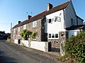
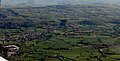
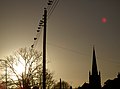
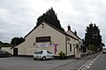
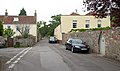
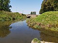
English: Congresbury (locally pronounced "Congsbry") is a village and civil parish in Somerset, England. It is situated in the Unitary authority of North Somerset, and in 2001 had a population of 3,400. It lies on the A370, roughly equidistant between Junction 21 of the M5 and Bristol International Airport, approximately north of Weston-super-Mare. The Congresbury Yeo river flows through the village.
village and civil parish in Somerset, UK  | |||||
| Carica un file multimediale | |||||
| Istanza di | |||||
|---|---|---|---|---|---|
| Luogo | North Somerset, Somerset, Sud Ovest dell'Inghilterra, Inghilterra | ||||
| Popolazione |
| ||||
 | |||||
Sottocategorie
Questa categoria contiene le 8 sottocategorie indicate di seguito, su un totale di 8.
A
B
- Bow Bridge over River Yeo (4 F)
C
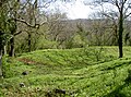
- Cadbury Hill (11 F)
- Congresbury Methodist Church (5 F)
- Congresbury railway station (5 F)
S
U
- Urchinwood Manor (2 F)
V
- The Vicarage, Congresbury (2 F)
File nella categoria "Congresbury"
Questa categoria contiene 200 file, indicati di seguito, su un totale di 274.
(pagina precedente) (pagina successiva)-
 A boundary stone among the utilities - geograph.org.uk - 6311273.jpg 3 296 × 2 472; 3,41 MB
-
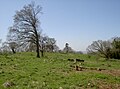
 A Congresbury field, trees and cows - geograph.org.uk - 2959146.jpg 640 × 480; 87 KB
-
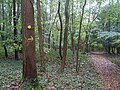
 A misty morning walk in King's Wood nature reserve - geograph.org.uk - 4117450.jpg 2 346 × 3 128; 2,59 MB
-
 A slice out of history - geograph.org.uk - 5744119.jpg 2 304 × 1 704; 1,71 MB
-
 A Spring setting on the fort - geograph.org.uk - 5745330.jpg 2 304 × 1 704; 1,66 MB
-
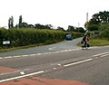
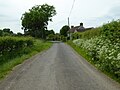
 A370 layby - geograph.org.uk - 2901846.jpg 2 048 × 1 536; 607 KB
-
 A370 past Oak Farm - geograph.org.uk - 5061670.jpg 2 533 × 1 670; 842 KB
-
 A370 Station Road, Congresbury - geograph.org.uk - 5813463.jpg 1 024 × 754; 136 KB
-
 A370 Weston Road - geograph.org.uk - 5813466.jpg 1 024 × 769; 112 KB
-
 Across the eastern enclosure - geograph.org.uk - 5745319.jpg 2 304 × 1 704; 1,66 MB
-
 Agency benchmark - geograph.org.uk - 3797304.jpg 1 704 × 2 304; 1,74 MB
-

-
 An appropriate implement - geograph.org.uk - 6312333.jpg 2 472 × 3 296; 3,21 MB
-
 Autumn colour on Brinsea Road - geograph.org.uk - 5939964.jpg 1 024 × 784; 199 KB
-
 B3133 Frost Hill, Yatton - geograph.org.uk - 5813459.jpg 1 024 × 769; 248 KB
-

-
 Belmont House, Congresbury - geograph.org.uk - 2959695.jpg 640 × 535; 76 KB
-
 Benchmark on boundary stone number 16 - geograph.org.uk - 6311252.jpg 2 472 × 3 296; 3,56 MB
-

-
-
 Boundary Stone number 16 - geograph.org.uk - 6311246.jpg 2 472 × 3 296; 3,42 MB
-
 Boundary Stone number 27 - geograph.org.uk - 6311277.jpg 2 472 × 3 296; 3,4 MB
-
 Boundary stone opposite Cleeve Hill Farm - geograph.org.uk - 6311233.jpg 2 472 × 3 296; 3,52 MB
-
 Bridge House, Congresbury - geograph.org.uk - 2960113.jpg 640 × 480; 74 KB
-
 Bridge over the Congresbury Yeo - geograph.org.uk - 98549.jpg 640 × 480; 132 KB
-
 Brighton House Garage, Congresbury - geograph.org.uk - 2960271.jpg 640 × 433; 65 KB
-
 Brinsea Batch - geograph.org.uk - 4984107.jpg 1 024 × 768; 139 KB
-
 Brinsea Batch Farm - geograph.org.uk - 5938992.jpg 1 024 × 838; 198 KB
-
 Brinsea Batch Road - geograph.org.uk - 4984080.jpg 1 024 × 768; 181 KB
-
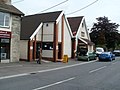
 Broad Street shops, Congresbury - geograph.org.uk - 2960156.jpg 640 × 559; 71 KB
-
 Bus stops on Weston Road - geograph.org.uk - 5940501.jpg 1 024 × 772; 200 KB
-

-
 Cadbury Hill - geograph.org.uk - 5745300.jpg 1 704 × 2 304; 2,21 MB
-
 Cadbury Hill trees - geograph.org.uk - 5745303.jpg 2 304 × 1 704; 1,68 MB
-
 Carditch Rhyne - geograph.org.uk - 5062071.jpg 1 846 × 1 028; 493 KB
-

-
 Chicken farm - geograph.org.uk - 99251.jpg 640 × 398; 48 KB
-
 Christmas light and street lamp - geograph.org.uk - 3797421.jpg 1 704 × 2 304; 1,35 MB
-
 Churchill Rhyne - geograph.org.uk - 5062078.jpg 2 617 × 1 726; 1,25 MB
-
 Clarence Court, Congresbury - geograph.org.uk - 2421946.jpg 640 × 480; 96 KB
-
 Cleeve Hill Road - geograph.org.uk - 2419737.jpg 640 × 480; 84 KB
-
 Congresbury , The River Yeo - geograph.org.uk - 2392341.jpg 3 264 × 2 448; 2,4 MB
-
 Congresbury aerial.jpg 4 000 × 3 000; 3,55 MB
-
 Congresbury Bridge - geograph.org.uk - 1392422.jpg 480 × 640; 78 KB
-
 Congresbury Bridge - geograph.org.uk - 3796700.jpg 2 304 × 1 704; 1,78 MB
-
 Congresbury bridge - geograph.org.uk - 98547.jpg 640 × 480; 149 KB
-
 Congresbury Bridge on the A370 - geograph.org.uk - 98544.jpg 640 × 480; 115 KB
-
 Congresbury church - geograph.org.uk - 4986312.jpg 600 × 800; 110 KB
-
 Congresbury Estate signpost - geograph.org.uk - 6312370.jpg 2 472 × 3 296; 3,15 MB
-
 Congresbury Library - geograph.org.uk - 2960306.jpg 640 × 431; 74 KB
-
 Congresbury Manor boundary stone number 26 - geograph.org.uk - 6312335.jpg 2 472 × 3 296; 3,29 MB
-
 Congresbury Methodist Hall - geograph.org.uk - 2959822.jpg 640 × 480; 86 KB
-
 Congresbury Moor - Information Board - geograph.org.uk - 95817.jpg 640 × 480; 153 KB
-
 Congresbury War Memorial Hall - geograph.org.uk - 3797296.jpg 2 304 × 1 704; 1,12 MB
-
 Congresbury War Memorial Hall - geograph.org.uk - 5939976.jpg 1 024 × 768; 135 KB
-
 Congresbury Yeo - geograph.org.uk - 2419447.jpg 640 × 420; 91 KB
-
 Congresbury Yeo - geograph.org.uk - 2419485.jpg 480 × 640; 125 KB
-
 Congresbury Yeo - geograph.org.uk - 2419518.jpg 640 × 480; 123 KB
-
 Congresbury Yeo - geograph.org.uk - 2959553.jpg 640 × 480; 103 KB
-
 Congresbury.jpg 640 × 480; 52 KB
-
 Congressbury Moor - geograph.org.uk - 5172350.jpg 1 600 × 1 067; 554 KB
-

-
 Cottages on Old Weston Road - geograph.org.uk - 5940489.jpg 1 024 × 768; 205 KB
-
 Country around Churchill from the air - geograph.org.uk - 5483536.jpg 1 630 × 833; 327 KB
-
 Crookwell Rhyne - geograph.org.uk - 4936552.jpg 1 920 × 1 309; 890 KB
-
 Crookwell Rhyne - geograph.org.uk - 5061952.jpg 2 549 × 1 344; 699 KB
-
 Death of a garden centre - geograph.org.uk - 4213243.jpg 800 × 451; 158 KB
-
 Decorated bus shelter near Congresbury Bridge - geograph.org.uk - 5071783.jpg 1 600 × 1 067; 701 KB
-

-

-

-
 Does the 54 stop here^ - geograph.org.uk - 3797222.jpg 1 704 × 2 304; 1,76 MB
-
 Dolemoor Lane - geograph.org.uk - 4939095.jpg 1 920 × 1 145; 887 KB
-
 Down in Ball Wood - geograph.org.uk - 6312360.jpg 2 472 × 3 296; 3,47 MB
-
 Drainage channel, Congresbury - geograph.org.uk - 2959160.jpg 640 × 480; 143 KB
-
 Eastern end of the ramparts - geograph.org.uk - 5745326.jpg 2 304 × 1 704; 1,77 MB
-
 Electricity pylons ranging across Puxton Moor - geograph.org.uk - 5007583.jpg 3 648 × 2 048; 1,78 MB
-
 Elliott Modular, Congresbury - geograph.org.uk - 2959727.jpg 640 × 418; 58 KB
-
 Entering Congresbury - geograph.org.uk - 4422091.jpg 1 744 × 1 211; 839 KB
-

-

-

-

-
 Entrance, Cadbury Garden Centre - geograph.org.uk - 4633514.jpg 1 024 × 784; 148 KB
-
 Esso filling station, Weston Road, Congresbury - geograph.org.uk - 5071790.jpg 1 600 × 1 597; 709 KB
-
 Evening song - geograph.org.uk - 3796764.jpg 2 304 × 1 704; 1,35 MB
-

-
 Field edge boundary on Puxton Moor - geograph.org.uk - 5007506.jpg 3 648 × 2 048; 1,85 MB
-

-
 Footpath, Congresbury - geograph.org.uk - 2420278.jpg 640 × 460; 95 KB
-
 Former rectory, Congresbury - geograph.org.uk - 2421160.jpg 640 × 480; 97 KB
-
 Fort with a view - geograph.org.uk - 5745313.jpg 2 304 × 1 704; 1,75 MB
-

-

-

-

-
 Glen Yeo Terrace, Congresbury - geograph.org.uk - 2960314.jpg 640 × 458; 73 KB
-

-

-
 Greek restaurant, Congresbury - geograph.org.uk - 5061597.jpg 3 035 × 1 828; 894 KB
-
 Greek taverna, Weston Road, Congresbury - geograph.org.uk - 5071788.jpg 1 600 × 1 067; 580 KB
-
 Heavenly light - geograph.org.uk - 3796766.jpg 2 304 × 1 704; 1,75 MB
-

-
 High Street, Congresbury - geograph.org.uk - 2421176.jpg 640 × 362; 60 KB
-
 Holding the fort - geograph.org.uk - 5744116.jpg 1 704 × 2 304; 1,94 MB
-
 Hope Cottage, Congresbury - geograph.org.uk - 2959153.jpg 640 × 511; 93 KB
-
 House in Congresbury - geograph.org.uk - 4987026.jpg 800 × 600; 130 KB
-
 House on Brinsea Batch - geograph.org.uk - 5938974.jpg 1 024 × 849; 207 KB
-
 House on High Street - geograph.org.uk - 5940452.jpg 1 024 × 768; 267 KB
-
 House on Kent Road - geograph.org.uk - 5221559.jpg 1 024 × 768; 149 KB
-
 How Green are Our Levels - geograph.org.uk - 338114.jpg 640 × 446; 99 KB
-

-
 It's the left one - geograph.org.uk - 6312352.jpg 3 296 × 2 472; 3,39 MB
-
 Iwood Lane - geograph.org.uk - 2419372.jpg 640 × 449; 94 KB
-

-
 Junction on Stock Lane - geograph.org.uk - 5939927.jpg 1 024 × 759; 186 KB
-
 Keep your head down^ - geograph.org.uk - 6312355.jpg 3 296 × 2 472; 3,4 MB
-
 Kenn Moor and Blackditch Rhyne - geograph.org.uk - 3737079.jpg 3 264 × 2 448; 3,67 MB
-
 Kent Road - Congresbury - geograph.org.uk - 4422082.jpg 3 630 × 3 070; 4,4 MB
-
 Kent Road - Congresbury - geograph.org.uk - 4422087.jpg 2 959 × 2 547; 2,84 MB
-
 Kent Road, Congresbury - geograph.org.uk - 2421908.jpg 640 × 379; 70 KB
-
 Kismet, Congresbury - geograph.org.uk - 2960196.jpg 640 × 485; 60 KB
-
 Line of former railway near Iwood - geograph.org.uk - 2419409.jpg 640 × 450; 102 KB
-
 Little lumps and bumps - geograph.org.uk - 5745276.jpg 2 304 × 1 704; 1,64 MB
-
 Little Wall Drove - geograph.org.uk - 4937117.jpg 1 920 × 1 388; 922 KB
-
 Little Wall Drove - geograph.org.uk - 4938069.jpg 2 264 × 1 773; 952 KB
-
 Major T-junction ahead, Congresbury - geograph.org.uk - 2959145.jpg 640 × 620; 103 KB
-
 Memorial to the victim of a highwayman - geograph.org.uk - 4987034.jpg 600 × 800; 181 KB
-
 Mendip Spring Golf Club - geograph.org.uk - 4984099.jpg 1 024 × 768; 130 KB
-
 Mendip Spring Golf Club - geograph.org.uk - 5938989.jpg 1 024 × 791; 212 KB
-
 Mezzé of the Ship and Castle - geograph.org.uk - 4987022.jpg 1 024 × 768; 197 KB
-
 Millennium Bridge, Congresbury - geograph.org.uk - 2420496.jpg 480 × 640; 94 KB
-
 Millennium Bridge, Congresbury - geograph.org.uk - 98486.jpg 640 × 480; 129 KB
-
 Millennium Green bus stop, Congresbury - geograph.org.uk - 98508.jpg 640 × 480; 122 KB
-
 Mine entrance in King's Wood nature reserve - geograph.org.uk - 4116458.jpg 2 346 × 3 128; 1 001 KB
-
 Moor Bridge, Congresbury - geograph.org.uk - 2961900.jpg 640 × 480; 70 KB
-

-
 Moor to see - geograph.org.uk - 3797426.jpg 2 304 × 1 704; 1,44 MB
-
 Moorland Park - geograph.org.uk - 5940507.jpg 1 024 × 754; 94 KB
-
 Morgans Local Shop - geograph.org.uk - 4633498.jpg 1 024 × 805; 144 KB
-
 Murco filling station, Congresbury - geograph.org.uk - 5071775.jpg 1 600 × 1 200; 704 KB
-
 New Rhyne - geograph.org.uk - 5172359.jpg 1 600 × 1 067; 740 KB
-
 No more strawberries - geograph.org.uk - 3797412.jpg 2 304 × 1 704; 1,63 MB
-
-
 North Congresbury Pumping Station - geograph.org.uk - 2959142.jpg 640 × 601; 142 KB
-
 Northern boundary of Congresbury - geograph.org.uk - 2959135.jpg 640 × 519; 84 KB
-
 Oak Farm businesses, Congresbury - geograph.org.uk - 2961881.jpg 640 × 480; 77 KB
-
 Oak Farm Touring Park, Congresbury - geograph.org.uk - 2961854.jpg 640 × 379; 64 KB
-
 Official and unofficial path signs - geograph.org.uk - 6312349.jpg 3 296 × 2 472; 3,48 MB
-

-

-
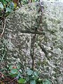
 Old school benchmark - geograph.org.uk - 3796723.jpg 1 704 × 2 304; 1,81 MB
-
 Old School Rooms, Congresbury - geograph.org.uk - 98535.jpg 640 × 419; 86 KB
-
 Old Stone Front, Congresbury - geograph.org.uk - 338126.jpg 640 × 614; 141 KB
-
 Old Weston Road near Congresbury - geograph.org.uk - 2962019.jpg 640 × 504; 66 KB
-

-
 Ordnance Survey Cut Mark - geograph.org.uk - 4866020.jpg 480 × 640; 120 KB
-
 Ordnance Survey Cut Mark - geograph.org.uk - 4866032.jpg 480 × 640; 107 KB
-
 Ordnance Survey Cut Mark - geograph.org.uk - 4866037.jpg 480 × 640; 96 KB
-
 Ordnance Survey Flush Bracket (G2522) - geograph.org.uk - 4866025.jpg 480 × 640; 121 KB
-
 Ordnance Survey Rivet - geograph.org.uk - 4866028.jpg 480 × 640; 78 KB
-
 Oxford House near Congresbury - geograph.org.uk - 2962064.jpg 640 × 436; 65 KB
-
 Part of Smallway, Congresbury - geograph.org.uk - 5071781.jpg 1 600 × 1 200; 725 KB
-

-
 Pauls Causeway, Congresbury - geograph.org.uk - 2960212.jpg 640 × 636; 97 KB
-
 Penfold Car Breakers near Hewish - geograph.org.uk - 2962224.jpg 640 × 402; 83 KB
-
 Petrol Station on Weston Road - geograph.org.uk - 5940481.jpg 1 024 × 765; 162 KB
-
 Picnic tables, Congresbury - geograph.org.uk - 2959655.jpg 640 × 482; 105 KB
-
 Playground, Congresbury - geograph.org.uk - 2420423.jpg 640 × 438; 91 KB
-
 PLOUGH,CONGRESBURY .SOMERSET - Flickr - secret coach park.jpg 3 648 × 2 736; 3,53 MB
-
 Pointing the way - geograph.org.uk - 3796703.jpg 1 704 × 2 304; 1,35 MB
-

-
 Railway bridge over rhyne - geograph.org.uk - 98553.jpg 640 × 480; 162 KB
-
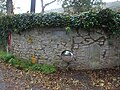
 Remains of a cross, Congresbury - geograph.org.uk - 4986319.jpg 800 × 600; 193 KB
-
 Rhyne, Congresbury - geograph.org.uk - 2420454.jpg 640 × 430; 102 KB
-
 River Yeo - geograph.org.uk - 1392415.jpg 480 × 640; 101 KB
-
 River Yeo - geograph.org.uk - 6255881.jpg 4 032 × 3 024; 4,29 MB
-
 River Yeo from National Cycle Route 26 - geograph.org.uk - 1461386.jpg 486 × 640; 101 KB
-
 River Yeo, Congresbury - geograph.org.uk - 2420475.jpg 640 × 492; 93 KB
-
 River Yeo, Congresbury - geograph.org.uk - 2421097.jpg 640 × 448; 99 KB
-
 Road junction, Congresbury - geograph.org.uk - 2420242.jpg 640 × 332; 48 KB
-
 Road through Congresbury Moor - geograph.org.uk - 2961939.jpg 640 × 480; 69 KB
-
 Road to Honey Hall - geograph.org.uk - 4984091.jpg 1 024 × 768; 210 KB
-
 Sculpture of St Congar of Congresbury at the Museum of Somerset 2.JPG 2 304 × 3 456; 1,67 MB
-
 Sculpture of St Congar of Congresbury at the Museum of Somerset 3.JPG 2 304 × 3 456; 1,65 MB
-
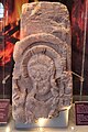 Sculpture of St Congar of Congresbury at the Museum of Somerset 4.JPG 2 304 × 3 456; 1,92 MB
-
 Seat car dealership, Station Road, Congresbury - geograph.org.uk - 5071786.jpg 1 600 × 1 200; 660 KB
-
 Security risk^ - geograph.org.uk - 3797378.jpg 2 304 × 1 704; 1,76 MB
-
 Shaded road at Wrington Hill - geograph.org.uk - 901775.jpg 480 × 640; 137 KB
-
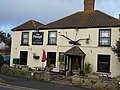
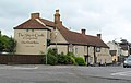 Ship and Castle Inn, Congresbury - geograph.org.uk - 2421197.jpg 640 × 404; 54 KB
-
 Ship and Castle, Congresbury - geograph.org.uk - 5939982.jpg 1 024 × 790; 115 KB
-
 Ship and Castle, Congresbury - geograph.org.uk - 98542.jpg 640 × 492; 124 KB
-
 Side turnings, Strawberry Line - geograph.org.uk - 5061938.jpg 1 920 × 1 178; 1,03 MB
-

-
 Silver Street, Congresbury - geograph.org.uk - 109846.jpg 640 × 426; 131 KB
-
 Site of Congresbury railway station - geograph.org.uk - 2961821.jpg 640 × 480; 107 KB
-
 Site of former rail bridge on River Yeo - geograph.org.uk - 5940461.jpg 1 024 × 768; 230 KB
-
 Smallway, Congresbury - geograph.org.uk - 2615740.jpg 640 × 417; 55 KB
-
 Somerset Levels west of Congresbury - geograph.org.uk - 4937115.jpg 1 920 × 1 162; 695 KB
-


_-_geograph.org.uk_-_4866025.jpg)


