Category:Cornwell, Oxfordshire
Aller à la navigation
Aller à la recherche
localité britannique du comté anglais d'Oxfordshire  | |||||
| Téléverser des médias | |||||
| Nature de l’élément | |||||
|---|---|---|---|---|---|
| Lieu | West Oxfordshire, Oxfordshire, Angleterre du Sud-Est, Angleterre | ||||
 | |||||
Sous-catégories
Cette catégorie comprend 2 sous-catégories, dont les 2 ci-dessous.
C
- Cornwell Manor (11 F)
P
- St Peter's Church, Cornwell (7 F)
Média dans la catégorie « Cornwell, Oxfordshire »
Cette catégorie comprend 70 fichiers, dont les 70 ci-dessous.
-
 A barley field near Cornwell - geograph.org.uk - 5425058.jpg 1 024 × 768 ; 276 kio
-
 A new plantation - geograph.org.uk - 1713622.jpg 4 000 × 3 000 ; 4,52 Mio
-
 A pile of bales - geograph.org.uk - 5584697.jpg 6 000 × 4 000 ; 5,22 Mio
-
 A straw bale in a field entrance - geograph.org.uk - 5425056.jpg 1 024 × 768 ; 254 kio
-
 Ash tree in the hedgerow - geograph.org.uk - 5425155.jpg 768 × 1 024 ; 322 kio
-
 Autumn colours near Cornwell Manor - geograph.org.uk - 5584707.jpg 6 000 × 4 000 ; 7,6 Mio
-
 Autumn in the English Cotswolds (32077133501).jpg 954 × 711 ; 608 kio
-
 Bridleway bridge - geograph.org.uk - 1715007.jpg 4 000 × 3 000 ; 5,15 Mio
-
 Bridleway by the wood - geograph.org.uk - 1715009.jpg 4 000 × 3 000 ; 3,18 Mio
-
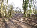
 Bridleway heading towards Cornwell Holt - geograph.org.uk - 1552570.jpg 640 × 480 ; 89 kio
-
 Bridleway meets the road - geograph.org.uk - 1713895.jpg 4 000 × 3 000 ; 5,42 Mio
-
 Bridleway to Cornwell - geograph.org.uk - 1715002.jpg 4 000 × 3 000 ; 2,2 Mio
-
 Bridleway to the fort - geograph.org.uk - 1552602.jpg 640 × 480 ; 120 kio
-
 Bridleway towards Kingham - geograph.org.uk - 5584592.jpg 6 000 × 4 000 ; 6,72 Mio
-
 Channelled stream near to Cornwell, Oxfordshire-geograph-2688994.jpg 640 × 480 ; 118 kio
-
 Glebe Farm, Cornwell - geograph.org.uk - 1712727.jpg 4 000 × 3 000 ; 1,86 Mio
-
 Path to the church - geograph.org.uk - 1713614.jpg 4 000 × 3 000 ; 3,94 Mio
-
 Cornwell - geograph.org.uk - 6192845.jpg 1 600 × 1 252 ; 683 kio
-
 Cornwell church - geograph.org.uk - 5863181.jpg 1 024 × 680 ; 305 kio
-
 Cornwell Manor - geograph.org.uk - 5584722.jpg 6 000 × 4 000 ; 6,03 Mio
-
 Cornwell Manor - geograph.org.uk - 6266775.jpg 1 024 × 768 ; 311 kio
-
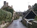 Cornwell village - geograph.org.uk - 1713615.jpg 4 000 × 3 000 ; 3,24 Mio
-
 Cornwell Village centre and Village Hall - geograph.org.uk - 253357.jpg 480 × 640 ; 135 kio
-
 Cornwell village through the trees - geograph.org.uk - 1552539.jpg 640 × 480 ; 88 kio
-
 Cornwell.JPG 1 280 × 960 ; 493 kio
-
 Cottage in Cornwell, Oxfordshire-geograph-3108494.jpg 640 × 480 ; 93 kio
-
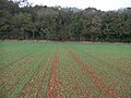
 Cow parsley and arable land - geograph.org.uk - 5425064.jpg 1 024 × 768 ; 367 kio
-
 Cow parsley in a field headland - geograph.org.uk - 5425061.jpg 1 024 × 768 ; 333 kio
-
 Driveway to Glebe Farm, Cornwell - geograph.org.uk - 1712730.jpg 4 000 × 3 000 ; 2,35 Mio
-
 Field entrance near Cornwell - geograph.org.uk - 5586975.jpg 6 000 × 4 000 ; 5,92 Mio
-
 Field entrance near Cornwell - geograph.org.uk - 5586996.jpg 6 000 × 4 000 ; 5,7 Mio
-
 Field with a crop near Swailsford Bridge - geograph.org.uk - 5584640.jpg 6 000 × 4 000 ; 5,01 Mio
-
 Footpath heading to Cornwell - geograph.org.uk - 2681058.jpg 640 × 480 ; 98 kio
-
 Footpath passing Top Farm - geograph.org.uk - 2681067.jpg 640 × 480 ; 92 kio
-
 Footpath to Cornwell - geograph.org.uk - 5425068.jpg 1 024 × 768 ; 259 kio
-
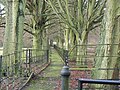
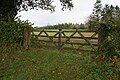
 Gates near Cornwell Manor - geograph.org.uk - 5584730.jpg 6 000 × 4 000 ; 6,82 Mio
-
 Glebe Farm, Cornwell - geograph.org.uk - 1712723.jpg 4 000 × 3 000 ; 1,67 Mio
-
 Hollis Hill Farm - geograph.org.uk - 1736129.jpg 4 000 × 3 000 ; 3,59 Mio
-
 Lane through Cornwell - geograph.org.uk - 5584742.jpg 5 604 × 3 816 ; 6,58 Mio
-
 Minor road junction - geograph.org.uk - 1715001.jpg 4 000 × 3 000 ; 2,72 Mio
-
 Near Cornwell - geograph.org.uk - 4543953.jpg 1 600 × 1 024 ; 479 kio
-
 New gates - geograph.org.uk - 1713629.jpg 4 000 × 3 000 ; 4,52 Mio
-
 Newly planted - geograph.org.uk - 1552591.jpg 640 × 480 ; 84 kio
-
 Orchard north of Cornwell Manor - geograph.org.uk - 3108489.jpg 640 × 480 ; 153 kio
-
 Oxfordshire farmland - geograph.org.uk - 1713626.jpg 4 000 × 3 000 ; 3,63 Mio
-
 Path and field on Kingham Hill - geograph.org.uk - 5587103.jpg 6 000 × 4 000 ; 5,38 Mio
-
 Recently harvested field - geograph.org.uk - 2016928.jpg 640 × 480 ; 80 kio
-
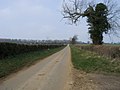
 Road to Cornwell - geograph.org.uk - 1553198.jpg 640 × 480 ; 106 kio
-
 Road to Cornwell - geograph.org.uk - 5425052.jpg 600 × 800 ; 179 kio
-
 Road to Park Farm - geograph.org.uk - 1712732.jpg 3 000 × 4 000 ; 3,42 Mio
-
 Seven Shires Way - geograph.org.uk - 2689024.jpg 640 × 480 ; 57 kio
-
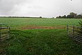
 Soggy field near Cornwell - geograph.org.uk - 5587032.jpg 6 000 × 4 000 ; 6,08 Mio
-
 St Peter's Church, Cornwell - geograph.org.uk - 3108486.jpg 640 × 480 ; 129 kio
-
 St Peter's Church, Cornwell - geograph.org.uk - 4543967.jpg 1 024 × 768 ; 259 kio
-
 The yard at Top Farm - geograph.org.uk - 1552530.jpg 640 × 480 ; 111 kio
-
 Towards Cornwell Holt - geograph.org.uk - 1552582.jpg 640 × 480 ; 79 kio
-
 Valley-bottom land 2 - geograph.org.uk - 989821.jpg 640 × 480 ; 84 kio
-
 Wet farmland near Mill Copse - geograph.org.uk - 5584683.jpg 6 000 × 4 000 ; 6,42 Mio
-
 Wheat Field near Cornwell - geograph.org.uk - 4543987.jpg 1 024 × 643 ; 134 kio
-
 Beech lane in December - geograph.org.uk - 290722.jpg 640 × 427 ; 135 kio
-
 Beside Mill Copse - geograph.org.uk - 234048.jpg 640 × 480 ; 111 kio
-
 Brook at sunset - geograph.org.uk - 322554.jpg 640 × 480 ; 89 kio
-
 Crossroads - geograph.org.uk - 234046.jpg 640 × 480 ; 87 kio
-
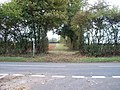
 Entrance to Kingham Hill School - geograph.org.uk - 280069.jpg 640 × 427 ; 126 kio
-
 In the direction of Swailsford Bridge - geograph.org.uk - 322552.jpg 640 × 480 ; 81 kio
-
 Lower Kingham Hill Cottages - geograph.org.uk - 322545.jpg 640 × 480 ; 76 kio
-
 Meeting of the ways - geograph.org.uk - 234047.jpg 640 × 480 ; 109 kio
-
 Towards Sarsden Halt - geograph.org.uk - 322549.jpg 640 × 480 ; 85 kio
-
 Track on old railway line - geograph.org.uk - 280484.jpg 640 × 427 ; 100 kio
-
 Unsuitable for motors^ - geograph.org.uk - 290808.jpg 640 × 427 ; 80 kio


.jpg)


