Category:Coryton, Devon
Aller à la navigation
Aller à la recherche
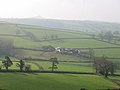
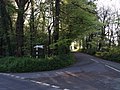
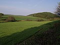
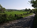
English: Coryton is a village and civil parish in the West Devon district of Devon, England, to the north west of Tavistock.
hameau britannique  | |||||
| Téléverser des médias | |||||
| Nature de l’élément | |||||
|---|---|---|---|---|---|
| Lieu | West Devon, Devon, Angleterre du Sud-Ouest, Angleterre | ||||
 | |||||
Sous-catégories
Cette catégorie comprend seulement la sous-catégorie ci-dessous.
C
- St Andrew's Church, Coryton (3 F)
Média dans la catégorie « Coryton, Devon »
Cette catégorie comprend 47 fichiers, dont les 47 ci-dessous.
-
 142069 C Coryton.JPG 2 576 × 1 932 ; 1,52 Mio
-
 Neale(1818) p1.208 - Coryton, Devonshire.jpg 1 824 × 1 217 ; 693 kio
-
 Bottom of a gunnis in Coryton Slate quarry - geograph.org.uk - 1053182.jpg 640 × 480 ; 74 kio
-
 Bridge over River Lyd south of Perry Spears - geograph.org.uk - 3394901.jpg 1 024 × 766 ; 251 kio
-
 St Andrew's church, Coryton - geograph.org.uk - 316957.jpg 480 × 640 ; 87 kio
-
 Coryton (GWR) former station geograph-3114477-by-Ben-Brooksbank.jpg 2 037 × 1 444 ; 3,02 Mio
-
 Coryton Barton - geograph.org.uk - 430080.jpg 640 × 480 ; 144 kio
-
 Coryton Bridleway 5 - geograph.org.uk - 430084.jpg 640 × 480 ; 154 kio
-
 Coryton from the lane above Broadtown Cross - geograph.org.uk - 432446.jpg 640 × 480 ; 82 kio
-
 Coryton Mill - geograph.org.uk - 418997.jpg 640 × 480 ; 107 kio
-
 Crossroads at Perry Spears - geograph.org.uk - 3394898.jpg 1 024 × 767 ; 156 kio
-
 Eastcottdown Plantation - geograph.org.uk - 430020.jpg 480 × 640 ; 150 kio
-
 Field at Eastcott - geograph.org.uk - 429985.jpg 640 × 480 ; 143 kio
-
 Footpath at Eastcott - geograph.org.uk - 422401.jpg 480 × 640 ; 143 kio
-
 Footpath at Eastcott - geograph.org.uk - 429952.jpg 640 × 480 ; 148 kio
-
 Footpath to Eastcott Beacon - geograph.org.uk - 430033.jpg 640 × 480 ; 160 kio
-
 Ford Cottage - geograph.org.uk - 419071.jpg 640 × 480 ; 100 kio
-
 Ford Farm viewed from Coryton Quarry - geograph.org.uk - 1051629.jpg 640 × 480 ; 39 kio
-
 Froghill Plantation from Cooper's Cross - geograph.org.uk - 3783506.jpg 1 152 × 1 536 ; 1,36 Mio
-
 Huge Open Pit or "Gunnis" on Eastcott Down - geograph.org.uk - 1053167.jpg 640 × 480 ; 100 kio
-
 Ireland - geograph.org.uk - 430056.jpg 640 × 480 ; 87 kio
-
 Junction by the River Lew - geograph.org.uk - 430162.jpg 640 × 480 ; 137 kio
-
 Knowle Wood - geograph.org.uk - 420224.jpg 640 × 480 ; 79 kio
-
 Lane approaching Coryton Station - geograph.org.uk - 427025.jpg 640 × 480 ; 98 kio
-
 Lane at Eastcott - geograph.org.uk - 426833.jpg 480 × 640 ; 130 kio
-
 Lane to Coryton Barton - geograph.org.uk - 430150.jpg 640 × 480 ; 146 kio
-

-
 Lyd Valley House seen from Longham Woods - geograph.org.uk - 1051717.jpg 640 × 480 ; 126 kio
-
 Meadow by River Lyd - geograph.org.uk - 427043.jpg 640 × 480 ; 130 kio
-
 Minor road in valley of River Lew - geograph.org.uk - 3394889.jpg 1 024 × 768 ; 252 kio
-

-

-
 Old Toll House west of Coryton Barton - geograph.org.uk - 6114845.jpg 640 × 543 ; 244 kio
-
 Road to Knowle Farm - geograph.org.uk - 3394892.jpg 1 023 × 1 024 ; 93 kio
-
 Solitary tree near Coryton, at St Curig's - geograph.org.uk - 3784113.jpg 1 152 × 1 536 ; 878 kio
-
 Spoil heaps on Eastcott Down - geograph.org.uk - 1066864.jpg 640 × 480 ; 120 kio
-
 The road to Coryton - geograph.org.uk - 3784099.jpg 1 152 × 1 536 ; 1,06 Mio
-
 The road to Ford Farm - geograph.org.uk - 3783503.jpg 1 536 × 1 152 ; 1,02 Mio
-
 The western corner of Lew Wood - geograph.org.uk - 3394885.jpg 1 024 × 1 023 ; 277 kio
-
 Towards Coryton Mill - geograph.org.uk - 5723249.jpg 1 600 × 1 077 ; 707 kio
-
 Towards Froghill Plantation - geograph.org.uk - 430141.jpg 640 × 480 ; 100 kio
-
 Track into Eastcottdown Plantation - geograph.org.uk - 429961.jpg 640 × 480 ; 143 kio
-
 Track through Eastcottdown Plantation - geograph.org.uk - 3783484.jpg 1 023 × 1 024 ; 261 kio
-
 Trial shaft on Eastcott Down - geograph.org.uk - 1066869.jpg 640 × 480 ; 101 kio
-
 Turning for Coryton - geograph.org.uk - 3784094.jpg 1 536 × 1 150 ; 1,09 Mio
-
 Under Eastcottdown Plantation, near Hartswell - geograph.org.uk - 3783482.jpg 1 536 × 1 152 ; 1,36 Mio
-
 View at Eastcott - geograph.org.uk - 420157.jpg 640 × 480 ; 86 kio

_p1.208_-_Coryton,_Devonshire.jpg)


_former_station_geograph-3114477-by-Ben-Brooksbank.jpg)


