Category:Costock
Aller à la navigation
Aller à la recherche
English: Costock is a village and civil parish in the Rushcliffe district of Nottinghamshire, although its closest town and postal address is Loughborough across the border in Leicestershire. It is situated next to the A60 (Nottingham-Loughborough) road. It has a Church of England primary school. St. Giles' Church built 1350 which stands somewhat back from the main street of the village.
village britannique | |||||
| Téléverser des médias | |||||
| Nature de l’élément | |||||
|---|---|---|---|---|---|
| Lieu | Rushcliffe, Nottinghamshire, Midlands de l'Est, Angleterre | ||||
 | |||||
Sous-catégories
Cette catégorie comprend 4 sous-catégories, dont les 4 ci-dessous.
G
- The Generous Briton, Costock (4 F)
- St Giles' Church, Costock (8 F)
R
- The Red Lion, Costock (6 F)
V
- Costock Village Hall (3 F)
Média dans la catégorie « Costock »
Cette catégorie comprend 91 fichiers, dont les 91 ci-dessous.
-
 25 Church Lane, Costock - geograph.org.uk - 4000844.jpg 1 280 × 960 ; 392 kio
-
 A path through blackthorn - geograph.org.uk - 3433425.jpg 640 × 480 ; 178 kio
-
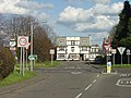
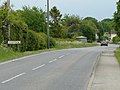
 A60 heading towards Costock - geograph.org.uk - 3320355.jpg 2 256 × 1 504 ; 1,06 Mio
-
 Agricultural art^ - geograph.org.uk - 4906922.jpg 3 264 × 2 448 ; 3,7 Mio
-
 Beginning of a footpath to Church Lane, Costock - geograph.org.uk - 6312124.jpg 1 024 × 768 ; 168 kio
-
 Bone Idle Cottage - geograph.org.uk - 1325651.jpg 640 × 480 ; 40 kio
-
 Bone Idle Cottage - geograph.org.uk - 1325652.jpg 640 × 480 ; 57 kio
-
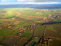 Bunny Hill from the air - geograph.org.uk - 2723117.jpg 640 × 480 ; 93 kio
-
 Bunny Hill Riding Centre - geograph.org.uk - 3775262.jpg 640 × 427 ; 64 kio
-
 Canaan Farm Equestrian Centre - geograph.org.uk - 2870678.jpg 1 280 × 960 ; 538 kio
-
 Canaan Farm Track at Costock - geograph.org.uk - 1331632.jpg 640 × 480 ; 60 kio
-
 Change of road name in Costock - geograph.org.uk - 1325646.jpg 640 × 480 ; 53 kio
-
 Chapel Lane, Costock - geograph.org.uk - 750312.jpg 640 × 480 ; 177 kio
-
 Church Lane - geograph.org.uk - 750297.jpg 480 × 640 ; 191 kio
-
 Church Lane - geograph.org.uk - 750299.jpg 480 × 640 ; 152 kio
-
 Church Lane, Costock - geograph.org.uk - 4000852.jpg 1 280 × 980 ; 319 kio
-

-
 Costock Cross Roads - geograph.org.uk - 750323.jpg 640 × 480 ; 155 kio
-
 Costock fields - geograph.org.uk - 1331608.jpg 640 × 480 ; 91 kio
-
 Costock fields - geograph.org.uk - 1331615.jpg 640 × 480 ; 74 kio
-
 Costock fields - geograph.org.uk - 1331618.jpg 640 × 480 ; 64 kio
-
 Costock hill - geograph.org.uk - 1331620.jpg 640 × 480 ; 46 kio
-
 Costock Main Street - geograph.org.uk - 1325654.jpg 640 × 480 ; 77 kio
-
 Costock Main Street - geograph.org.uk - 1325657.jpg 640 × 480 ; 62 kio
-
 Costock Paths - geograph.org.uk - 1327605.jpg 640 × 480 ; 184 kio
-
 Costock Primary School - geograph.org.uk - 7988.jpg 640 × 279 ; 89 kio
-
 Costock trees - geograph.org.uk - 1331624.jpg 640 × 480 ; 73 kio
-
 Costock Village - geograph.org.uk - 1325639.jpg 640 × 480 ; 53 kio
-
 Costock Village - geograph.org.uk - 1325659.jpg 640 × 480 ; 87 kio
-
 Costock Village - geograph.org.uk - 1325661.jpg 640 × 480 ; 66 kio
-
 Costock Village - geograph.org.uk - 1327594.jpg 640 × 480 ; 168 kio
-
 Costock Village, Bars Hill - geograph.org.uk - 1325643.jpg 640 × 480 ; 53 kio
-
 East Leake Rugby Club - geograph.org.uk - 4324.jpg 640 × 504 ; 55 kio
-
 Edge of Costock - geograph.org.uk - 1325641.jpg 640 × 480 ; 61 kio
-
 Entrance to Bunny Hill Riding Centre - geograph.org.uk - 3845968.jpg 640 × 427 ; 79 kio
-
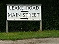
 Farmland off Leake Road - geograph.org.uk - 3606616.jpg 640 × 480 ; 56 kio
-
 Farmland off Wysall Road - geograph.org.uk - 3606633.jpg 640 × 480 ; 75 kio
-
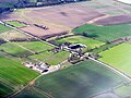 Farms astride Loughborough Road - geograph.org.uk - 4906959.jpg 3 264 × 2 448 ; 3,98 Mio
-
 Fenced path at Costock - geograph.org.uk - 1333161.jpg 640 × 480 ; 84 kio
-
 Fenced path at Costock - geograph.org.uk - 1333166.jpg 640 × 480 ; 76 kio
-
 Field south of Bunny Old Wood - geograph.org.uk - 3132856.jpg 1 024 × 768 ; 144 kio
-
 Gate to Bunny old Wood on The Midshires Way - geograph.org.uk - 1335403.jpg 640 × 480 ; 87 kio
-
 Glebe Farm - geograph.org.uk - 3606632.jpg 640 × 480 ; 68 kio
-
 Glebe farm, Costock - geograph.org.uk - 1327602.jpg 640 × 480 ; 188 kio
-
 Glebe Farm, Costock - geograph.org.uk - 1331626.jpg 640 × 480 ; 80 kio
-
 Glebe Farm, Costock - geograph.org.uk - 1333114.jpg 640 × 480 ; 64 kio
-
 Highfields, Costock - geograph.org.uk - 7981.jpg 640 × 261 ; 77 kio
-
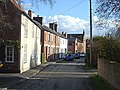
 Houses in Costock - geograph.org.uk - 5881335.jpg 1 600 × 900 ; 471 kio
-
 Jumping arena at Bunny Hill Riding Centre - geograph.org.uk - 3775261.jpg 640 × 410 ; 92 kio
-
 Junction in Costock - geograph.org.uk - 6450812.jpg 768 × 1 024 ; 249 kio
-
 Leake Road heading east - geograph.org.uk - 3606622.jpg 640 × 480 ; 79 kio
-
 Leake Road, Costock - geograph.org.uk - 3606624.jpg 640 × 480 ; 72 kio
-
 Loughborough Road (A60) - geograph.org.uk - 3606629.jpg 640 × 480 ; 57 kio
-
 Monkey Puzzle Tree, Costock - geograph.org.uk - 3322531.jpg 1 504 × 2 256 ; 925 kio
-
 New main road, Costock. - geograph.org.uk - 750294.jpg 640 × 473 ; 121 kio
-
 No entry - geograph.org.uk - 1325626.jpg 640 × 480 ; 62 kio
-
 Old Main Road, Costock - geograph.org.uk - 750289.jpg 640 × 472 ; 118 kio
-
 Old pump. Church Lane, Costock - geograph.org.uk - 4000848.jpg 960 × 1 280 ; 449 kio
-

-
 Path at Costock - geograph.org.uk - 1327601.jpg 640 × 480 ; 161 kio
-
 Path at Costock - geograph.org.uk - 1331627.jpg 640 × 480 ; 44 kio
-
 Path at Costock - geograph.org.uk - 1331630.jpg 640 × 480 ; 69 kio
-
 Path at Costock - geograph.org.uk - 1333119.jpg 640 × 480 ; 71 kio
-
 Path behind The Red Lion at Costock - geograph.org.uk - 1327596.jpg 640 × 480 ; 153 kio
-
 Path over brook at Costock - geograph.org.uk - 1333171.jpg 640 × 480 ; 89 kio
-
 Path through a hedge at Costock - geograph.org.uk - 1333159.jpg 640 × 480 ; 90 kio
-
 Poly tunnels, Costock - geograph.org.uk - 3606628.jpg 640 × 480 ; 60 kio
-
 Pond on the Sheepwash Brook - geograph.org.uk - 5804061.jpg 1 280 × 960 ; 593 kio
-
 Power between Wysall and Bunny - geograph.org.uk - 1335411.jpg 640 × 480 ; 19 kio
-
 Prepared field and Glebe Farm, Costock - geograph.org.uk - 6311035.jpg 1 024 × 768 ; 119 kio
-
 Private road to Holy Cross Convent - geograph.org.uk - 3320363.jpg 2 256 × 1 504 ; 1,01 Mio
-
 Rempstone Hill, Costock - geograph.org.uk - 2870670.jpg 1 280 × 960 ; 470 kio
-
 Rempstone Hill, Costock postbox (ref. LE12 125) - geograph.org.uk - 2870672.jpg 1 280 × 960 ; 510 kio
-
 Rough Plantation and Intake wood - geograph.org.uk - 1335375.jpg 640 × 480 ; 61 kio
-
-
 The end of Chapel Lane - geograph.org.uk - 4000841.jpg 1 280 × 960 ; 565 kio
-
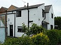
 The White House - geograph.org.uk - 4000824.jpg 1 280 × 960 ; 195 kio
-
 Towel ready oops wrong Beach - geograph.org.uk - 1325630.jpg 640 × 480 ; 63 kio
-
 Track at Costock - geograph.org.uk - 1331636.jpg 640 × 480 ; 62 kio
-
 Track at Costock - geograph.org.uk - 1331639.jpg 640 × 480 ; 62 kio
-
 Track running south from Glebe Farm - geograph.org.uk - 3433387.jpg 640 × 480 ; 94 kio
-
 Track to Brook Furlong Farm - geograph.org.uk - 3606619.jpg 640 × 480 ; 82 kio
-
 Workings near East Leake - geograph.org.uk - 4906908.jpg 3 264 × 2 448 ; 3,93 Mio
-
 Wysall Road - geograph.org.uk - 3606636.jpg 640 × 480 ; 55 kio
-
 Bunny Hill Top - geograph.org.uk - 7991.jpg 640 × 450 ; 156 kio
-
 Glebe Farm, Costock - geograph.org.uk - 7975.jpg 640 × 259 ; 61 kio
-
 Grange Farm, Costock - geograph.org.uk - 7980.jpg 640 × 443 ; 122 kio
-
 Hill Farm, Costock - geograph.org.uk - 15623.jpg 640 × 304 ; 82 kio
-
 Hill Top Farm, Bunny - geograph.org.uk - 25125.jpg 640 × 416 ; 100 kio
-
 Zig-Zag hedge - geograph.org.uk - 3433418.jpg 640 × 480 ; 92 kio
-
 Taft Leys Farm, East Leake - geograph.org.uk - 25148.jpg 640 × 430 ; 112 kio


_-_geograph.org.uk_-_3606629.jpg)


_-_geograph.org.uk_-_2870672.jpg)


