Category:Cothelstone
Aller à la navigation
Aller à la recherche
Deutsch: Cothelstone ist ein Dorf und eine Gemeinde in Somerset im Südwesten Englands im Vereinigten Königreich. Sie befindet sich in den Quantock Hills, etwa zehn Kilometer nördlich von Taunton im Bezirk Taunton Deane. Das Dorf hat 111 Einwohner (Stand 2002).
English: Cothelstone is a village and civil parish in Somerset, England, situated in the Quantock Hills six miles north of Taunton in the Taunton Deane district. The village has a population of 111.
localité britannique du comté anglais de Somerset  | |||||
| Téléverser des médias | |||||
| Nature de l’élément | |||||
|---|---|---|---|---|---|
| Lieu |
| ||||
| Réputé identique à | Cothelstone (page en doublon, paroisse civile) | ||||
 | |||||
Sous-catégories
Cette catégorie comprend 3 sous-catégories, dont les 3 ci-dessous.
C
- Cothelstone Manor (18 F)
G
- Gatehouse, Cothelstone Manor (3 F)
Média dans la catégorie « Cothelstone »
Cette catégorie comprend 175 fichiers, dont les 175 ci-dessous.
-
 9 miles to Bridgewater - geograph.org.uk - 3115009.jpg 640 × 486 ; 351 kio
-
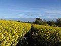
 Arable land, Cothelstone - geograph.org.uk - 3115050.jpg 640 × 360 ; 211 kio
-
 Autumn crop, Toulton Farm - geograph.org.uk - 3712895.jpg 1 024 × 768 ; 270 kio
-
 Ball Lane - geograph.org.uk - 1129571.jpg 640 × 480 ; 155 kio
-
 Barrow and Folly Remains, Cothelstone Hill - geograph.org.uk - 5038545.jpg 1 600 × 1 200 ; 251 kio
-
 Beech trees on Cothelstone Hill - geograph.org.uk - 3251923.jpg 2 592 × 3 888 ; 1,83 Mio
-
 Bishop's Lydeard , Cothelstone Scenery - geograph.org.uk - 6415187.jpg 6 000 × 4 000 ; 7,79 Mio
-
 Bishop's Lydeard , Grassy Field - geograph.org.uk - 6415189.jpg 6 000 × 4 000 ; 5,03 Mio
-
 Channel to Channel (395) - geograph.org.uk - 4467285.jpg 800 × 600 ; 150 kio
-
 Channel to Channel (396) - geograph.org.uk - 4467297.jpg 800 × 600 ; 227 kio
-
 Channel to Channel (397) - geograph.org.uk - 4467306.jpg 800 × 600 ; 222 kio
-
 Channel to Channel (398) - geograph.org.uk - 4467315.jpg 800 × 600 ; 232 kio
-
 Channel to Channel (399) - geograph.org.uk - 4467321.jpg 800 × 600 ; 124 kio
-
 Channel to Channel (400) - geograph.org.uk - 4467327.jpg 600 × 800 ; 254 kio
-
 Channel to Channel (401) - geograph.org.uk - 4467331.jpg 800 × 600 ; 36 kio
-
 Channel to Channel (402) - geograph.org.uk - 4467356.jpg 800 × 600 ; 96 kio
-
 Channel to Channel (403) - geograph.org.uk - 4467362.jpg 800 × 600 ; 148 kio
-
 Channel to Channel (404) - geograph.org.uk - 4467368.jpg 800 × 600 ; 164 kio
-
 Channel to Channel (405) - geograph.org.uk - 4467372.jpg 800 × 600 ; 236 kio
-
 Channel to Channel (406) - geograph.org.uk - 4467374.jpg 800 × 600 ; 140 kio
-
 Channel to Channel (407) - geograph.org.uk - 4467381.jpg 800 × 600 ; 224 kio
-
 Channel to Channel (408) - geograph.org.uk - 4467387.jpg 800 × 645 ; 172 kio
-
 Channel to Channel (409) - geograph.org.uk - 4467392.jpg 800 × 600 ; 169 kio
-
 Channel to Channel (410) - geograph.org.uk - 4467956.jpg 800 × 600 ; 134 kio
-
 Channel to Channel (411) - geograph.org.uk - 4468009.jpg 800 × 600 ; 135 kio
-
 Channel to Channel (414) - geograph.org.uk - 4468057.jpg 1 024 × 768 ; 221 kio
-
 Clearing on Cothelstone Hill - geograph.org.uk - 5489219.jpg 6 000 × 4 000 ; 5,39 Mio
-
 Cothelstone , Bikers - geograph.org.uk - 6415369.jpg 6 000 × 4 000 ; 5,9 Mio
-
 Cothelstone , Bristol Channel Scenery - geograph.org.uk - 6415411.jpg 6 000 × 4 000 ; 6,18 Mio
-
 Cothelstone , Cothelstone Farm - geograph.org.uk - 6415199.jpg 6 000 × 4 000 ; 4,56 Mio
-
 Cothelstone , Cothelstone Farm - geograph.org.uk - 6415200.jpg 6 000 × 4 000 ; 6,55 Mio
-
 Cothelstone , Cothelstone Hill - geograph.org.uk - 6415393.jpg 6 000 × 4 000 ; 6,7 Mio
-
 Cothelstone , Cothelstone Hill - geograph.org.uk - 6415394.jpg 6 000 × 4 000 ; 6,09 Mio
-
 Cothelstone , Cothelstone Hill - geograph.org.uk - 6415399.jpg 6 000 × 4 000 ; 6,52 Mio
-
 Cothelstone , Cothelstone Hill - geograph.org.uk - 6415403.jpg 6 000 × 4 000 ; 4,76 Mio
-
 Cothelstone , Cothelstone Hill - geograph.org.uk - 6415405.jpg 6 000 × 4 000 ; 4,19 Mio
-
 Cothelstone , Cothelstone Hill - geograph.org.uk - 6415406.jpg 6 000 × 4 000 ; 7,49 Mio
-
 Cothelstone , Cothelstone Hill - geograph.org.uk - 6415407.jpg 6 000 × 4 000 ; 4,55 Mio
-
 Cothelstone , Cothelstone Hill - geograph.org.uk - 6415414.jpg 6 000 × 4 000 ; 7,58 Mio
-
 Cothelstone , Cothelstone Hill - geograph.org.uk - 6415440.jpg 6 000 × 4 000 ; 5,55 Mio
-
 Cothelstone , Cothelstone Hill - geograph.org.uk - 6415444.jpg 6 000 × 4 000 ; 4,49 Mio
-
 Cothelstone , Cothelstone Hill - geograph.org.uk - 6415458.jpg 6 000 × 4 000 ; 7,57 Mio
-
 Cothelstone , Cothelstone Road - geograph.org.uk - 6415356.jpg 6 000 × 4 000 ; 7,68 Mio
-
 Cothelstone , Countryside Scenery - geograph.org.uk - 6415367.jpg 6 000 × 4 000 ; 6,87 Mio
-
 Cothelstone , Countryside Scenery - geograph.org.uk - 6415385.jpg 6 000 × 4 000 ; 5,84 Mio
-
 Cothelstone , Countryside Scenery - geograph.org.uk - 6415412.jpg 6 000 × 4 000 ; 6,4 Mio
-
 Cothelstone , Countryside Scenery - geograph.org.uk - 6415415.jpg 6 000 × 4 000 ; 5,27 Mio
-
 Cothelstone , Countryside Scenery - geograph.org.uk - 6415416.jpg 6 000 × 4 000 ; 5,25 Mio
-
 Cothelstone , Countryside Scenery - geograph.org.uk - 6415418.jpg 6 000 × 4 000 ; 6,25 Mio
-
 Cothelstone , Countryside Scenery - geograph.org.uk - 6415419.jpg 6 000 × 4 000 ; 5,91 Mio
-
 Cothelstone , Countryside Scenery - geograph.org.uk - 6415420.jpg 6 000 × 4 000 ; 5,71 Mio
-
 Cothelstone , Countryside Scenery - geograph.org.uk - 6415421.jpg 6 000 × 4 000 ; 4,96 Mio
-
 Cothelstone , Countryside Scenery - geograph.org.uk - 6415424.jpg 6 000 × 4 000 ; 6,17 Mio
-
 Cothelstone , Countryside Scenery - geograph.org.uk - 6415435.jpg 6 000 × 4 000 ; 6,29 Mio
-
 Cothelstone , Countryside Scenery - geograph.org.uk - 6415437.jpg 6 000 × 4 000 ; 6,12 Mio
-
 Cothelstone , Countryside Scenery - geograph.org.uk - 6415443.jpg 6 000 × 4 000 ; 5,39 Mio
-
 Cothelstone , Countryside Scenery - geograph.org.uk - 6415451.jpg 6 000 × 4 000 ; 6,17 Mio
-
 Cothelstone , Countryside Scenery - geograph.org.uk - 6415460.jpg 6 000 × 4 000 ; 6,78 Mio
-
 Cothelstone , Farm Track - geograph.org.uk - 6415198.jpg 6 000 × 4 000 ; 7,47 Mio
-
 Cothelstone , Footpath - geograph.org.uk - 6415358.jpg 6 000 × 4 000 ; 7,66 Mio
-
 Cothelstone , Footpath - geograph.org.uk - 6415361.jpg 6 000 × 4 000 ; 6,85 Mio
-
 Cothelstone , Footpath - geograph.org.uk - 6415363.jpg 6 000 × 4 000 ; 7,32 Mio
-
 Cothelstone , Footpath - geograph.org.uk - 6415366.jpg 6 000 × 4 000 ; 7,51 Mio
-
 Cothelstone , Footpath - geograph.org.uk - 6415368.jpg 6 000 × 4 000 ; 7,07 Mio
-
 Cothelstone , Footpath - geograph.org.uk - 6415370.jpg 6 000 × 4 000 ; 6,81 Mio
-
 Cothelstone , Footpath - geograph.org.uk - 6415371.jpg 4 000 × 6 000 ; 6,36 Mio
-
 Cothelstone , Footpath - geograph.org.uk - 6415373.jpg 6 000 × 4 000 ; 6,51 Mio
-
 Cothelstone , Footpath - geograph.org.uk - 6415376.jpg 6 000 × 4 000 ; 6,51 Mio
-
 Cothelstone , Footpath - geograph.org.uk - 6415379.jpg 6 000 × 4 000 ; 7,69 Mio
-
 Cothelstone , Footpath - geograph.org.uk - 6415380.jpg 6 000 × 4 000 ; 7,25 Mio
-
 Cothelstone , Footpath - geograph.org.uk - 6415382.jpg 6 000 × 4 000 ; 6,62 Mio
-
 Cothelstone , Footpath - geograph.org.uk - 6415383.jpg 6 000 × 4 000 ; 6,08 Mio
-
 Cothelstone , Footpath - geograph.org.uk - 6415384.jpg 6 000 × 4 000 ; 4,56 Mio
-
 Cothelstone , Footpath - geograph.org.uk - 6415387.jpg 6 000 × 4 000 ; 7,72 Mio
-
 Cothelstone , Footpath - geograph.org.uk - 6415388.jpg 6 000 × 4 000 ; 6,92 Mio
-
 Cothelstone , Footpath - geograph.org.uk - 6415389.jpg 6 000 × 4 000 ; 7 Mio
-
 Cothelstone , Footpath - geograph.org.uk - 6415391.jpg 6 000 × 4 000 ; 6,53 Mio
-
 Cothelstone , Footpath - geograph.org.uk - 6415462.jpg 6 000 × 4 000 ; 7,55 Mio
-
 Cothelstone , Footpath - geograph.org.uk - 6415464.jpg 6 000 × 4 000 ; 6,1 Mio
-
 Cothelstone , Footpath - geograph.org.uk - 6415465.jpg 6 000 × 4 000 ; 6,21 Mio
-
 Cothelstone , Footpath - geograph.org.uk - 6415467.jpg 6 000 × 4 000 ; 6,58 Mio
-
 Cothelstone , Footpath - geograph.org.uk - 6415468.jpg 6 000 × 4 000 ; 6,13 Mio
-
 Cothelstone , Footpath - geograph.org.uk - 6415472.jpg 6 000 × 4 000 ; 6,4 Mio
-
 Cothelstone , Grassy Field - geograph.org.uk - 6415190.jpg 6 000 × 4 000 ; 7,09 Mio
-
 Cothelstone , Grassy Field - geograph.org.uk - 6415192.jpg 6 000 × 4 000 ; 4,75 Mio
-
 Cothelstone , Grassy Field - geograph.org.uk - 6415194.jpg 6 000 × 4 000 ; 5,37 Mio
-
 Cothelstone , Grassy Field ^ Pond - geograph.org.uk - 6415191.jpg 6 000 × 4 000 ; 7,69 Mio
-
 Cothelstone , Grassy Path - geograph.org.uk - 6415355.jpg 6 000 × 4 000 ; 6,98 Mio
-
 Cothelstone , Muddy Footpath - geograph.org.uk - 6415395.jpg 6 000 × 4 000 ; 7,01 Mio
-
 Cothelstone , St Thomas of Canterbury - geograph.org.uk - 6415195.jpg 6 000 × 4 000 ; 7,83 Mio
-
 Cothelstone , St Thomas of Canterbury Church - geograph.org.uk - 6415196.jpg 6 000 × 4 000 ; 7,67 Mio
-
 Cothelstone , St Thomas of Canterbury Church - geograph.org.uk - 6415197.jpg 6 000 × 4 000 ; 6,32 Mio
-
 Cothelstone , Track - geograph.org.uk - 6415397.jpg 6 000 × 4 000 ; 7,19 Mio
-
 Cothelstone , Woodland - geograph.org.uk - 6415378.jpg 6 000 × 4 000 ; 5,77 Mio
-
 Cothelstone church - geograph.org.uk - 2349780.jpg 640 × 440 ; 103 kio
-
 Cothelstone Farm, Cothelstone - geograph.org.uk - 3434461.jpg 800 × 538 ; 199 kio
-
 Cothelstone Farm, Cothelstone - geograph.org.uk - 3434464.jpg 1 600 × 1 100 ; 464 kio
-
 Cothelstone farmland - geograph.org.uk - 1075329.jpg 640 × 480 ; 138 kio
-
 Cothelstone Hill - geograph.org.uk - 1140104.jpg 640 × 480 ; 69 kio
-
 Cothelstone Hill - geograph.org.uk - 5273532.jpg 1 024 × 768 ; 172 kio
-
 Cothelstone Hill - geograph.org.uk - 983271.jpg 640 × 480 ; 267 kio
-
 Cothelstone Manor - geograph.org.uk - 5834061.jpg 683 × 1 024 ; 219 kio
-
 Cothelstone Quarry - geograph.org.uk - 2349784.jpg 640 × 427 ; 155 kio
-
 Cothelstone, The Church of St. Thomas of Canterbury - geograph.org.uk - 6131845.jpg 6 031 × 4 021 ; 7,04 Mio
-
 Cothelstone, The Church of St. Thomas of Canterbury - geograph.org.uk - 6131847.jpg 4 137 × 6 205 ; 5,94 Mio
-
 Disused letter box, Cothelstone - geograph.org.uk - 3436103.jpg 764 × 1 024 ; 359 kio
-
 Earthwork, Cothelstone Hill - geograph.org.uk - 1140122.jpg 640 × 480 ; 117 kio
-
 Exmoor ponies on Cothelstone Hill - geograph.org.uk - 5489205.jpg 6 000 × 4 000 ; 7,81 Mio
-
 Farm track at Cothelstone - geograph.org.uk - 5489286.jpg 6 000 × 4 000 ; 5,39 Mio
-
 Farmhouse, Fennington - geograph.org.uk - 3838828.jpg 1 024 × 768 ; 200 kio
-
 Farmyard, Fennington - geograph.org.uk - 3838841.jpg 1 024 × 768 ; 160 kio
-
 Fennington Lane - geograph.org.uk - 3838836.jpg 1 024 × 747 ; 141 kio
-
 Fennington Weir - geograph.org.uk - 3838845.jpg 1 024 × 768 ; 205 kio
-
 Field and gallops, Cothelstone - geograph.org.uk - 2885669.jpg 640 × 360 ; 207 kio
-
 Field beside Ball Lane - geograph.org.uk - 1129618.jpg 640 × 480 ; 105 kio
-
 Field boundary beside Ball Lane - geograph.org.uk - 1129627.jpg 640 × 480 ; 111 kio
-
 Footpath at Cothelstone - geograph.org.uk - 5489296.jpg 6 000 × 4 000 ; 4,93 Mio
-
 Footpath near Middlebrooks - geograph.org.uk - 3514224.jpg 1 024 × 768 ; 205 kio
-
 Gate and post box - geograph.org.uk - 3115044.jpg 360 × 640 ; 106 kio
-
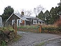
 Gatehouse on the Cothelstone Estate - geograph.org.uk - 1075324.jpg 640 × 480 ; 97 kio
-
 Gates and lodge to Cothelstone House - geograph.org.uk - 1139874.jpg 640 × 480 ; 98 kio
-
 Gates below Cothelstone Hill - geograph.org.uk - 1139950.jpg 640 × 480 ; 99 kio
-
 Gorse on Cothelstone Hill - geograph.org.uk - 4431243.jpg 1 024 × 768 ; 287 kio
-
 House at Cushuish Crossroads - geograph.org.uk - 3514235.jpg 1 024 × 768 ; 128 kio
-
 Lodge, Cothelstone - geograph.org.uk - 2885671.jpg 640 × 360 ; 226 kio
-
 Logs by a muddy track near Paradise - geograph.org.uk - 5489249.jpg 6 000 × 4 000 ; 6,31 Mio
-
 Looking down towards Grub Bottom - geograph.org.uk - 4431538.jpg 1 024 × 768 ; 211 kio
-
 Middlebrooks - geograph.org.uk - 3514209.jpg 1 024 × 768 ; 167 kio
-
 Miscanthus crop at Fennington - geograph.org.uk - 3053065.jpg 4 047 × 2 698 ; 5,1 Mio
-
 Old Plantation, Cothelstone Hill - geograph.org.uk - 2885667.jpg 640 × 360 ; 279 kio
-
 Path across the fields near Cothelstone - geograph.org.uk - 5489305.jpg 6 000 × 4 000 ; 5,62 Mio
-
 Path in Badger Copse - geograph.org.uk - 5489269.jpg 6 000 × 4 000 ; 5,64 Mio
-
 Path near Paradise - geograph.org.uk - 5489228.jpg 6 000 × 4 000 ; 6,18 Mio
-
 Path on Cothelstone Hill - geograph.org.uk - 5489124.jpg 6 000 × 4 000 ; 6,34 Mio
-
 Path through Old Plantation - geograph.org.uk - 4431573.jpg 1 024 × 768 ; 292 kio
-
 Path to Cothelstone - geograph.org.uk - 5489307.jpg 6 000 × 4 000 ; 5,72 Mio
-
 Ponies on Cothelstone Hill - geograph.org.uk - 3251924.jpg 3 888 × 2 592 ; 623 kio
-
 Ponies sheltering under the 'Seven Sisters' - geograph.org.uk - 4431352.jpg 1 024 × 768 ; 157 kio
-
 Pony on Cothelstone Hill - geograph.org.uk - 5489199.jpg 6 000 × 4 000 ; 7,34 Mio
-
 Post box at Cothelstone - geograph.org.uk - 4459991.jpg 600 × 800 ; 187 kio
-
 Proceedings (1849) (14596446010).jpg 2 048 × 1 596 ; 737 kio
-
 Pub for a pub - geograph.org.uk - 3114989.jpg 640 × 360 ; 252 kio
-
 Remains of an ancient lookout tower - geograph.org.uk - 4431359.jpg 1 024 × 768 ; 208 kio
-
 Salt lick post, Cothelstone Hill - geograph.org.uk - 1139966.jpg 480 × 640 ; 116 kio
-
 Seven Sisters, Cothelstone Hill - geograph.org.uk - 1449637.jpg 640 × 480 ; 102 kio
-
 Seven Sisters, Cothelstone Hill - geograph.org.uk - 5038519.jpg 1 600 × 1 200 ; 484 kio
-
 Sheep pasture, Toulton Farm - geograph.org.uk - 3712888.jpg 1 024 × 768 ; 153 kio
-
 Sheep southeast of Cothelstone Hill - geograph.org.uk - 1139942.jpg 640 × 438 ; 104 kio
-
 Slopes of Cothelstone Hill - geograph.org.uk - 1140153.jpg 640 × 480 ; 109 kio
-
 St. Agnes Well, Cothelstone - geograph.org.uk - 3251921.jpg 3 888 × 2 592 ; 1,25 Mio
-
 Stone house, Toulton - geograph.org.uk - 3712900.jpg 1 024 × 768 ; 212 kio
-
 Summit of Cothelstone Hill - geograph.org.uk - 1139982.jpg 640 × 480 ; 108 kio
-
 Sun in the valley from Cothelstone Hill - geograph.org.uk - 3251926.jpg 3 888 × 2 592 ; 689 kio
-
 The Church of St Thomas of Canterbury, Cothelstone - geograph.org.uk - 5489300.jpg 6 000 × 4 000 ; 4,9 Mio
-
 The Lawns, Cothelstone - geograph.org.uk - 3712881.jpg 1 024 × 768 ; 197 kio
-
 The top of Cothelstone Hill - geograph.org.uk - 5489168.jpg 6 000 × 4 000 ; 4,48 Mio
-
 Tumulus on Cothelstone Hill - geograph.org.uk - 5489145.jpg 6 000 × 4 000 ; 5,68 Mio
-
 Vicarage, Cothelstone - geograph.org.uk - 1139920.jpg 640 × 480 ; 127 kio
-
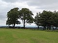
 View From Cothelstone Hill - geograph.org.uk - 2349795.jpg 640 × 427 ; 72 kio
-
 Violets on Cothelstone Hill - geograph.org.uk - 4431339.jpg 1 024 × 806 ; 364 kio
-
 Wavelets on Cothelstone Hill - geograph.org.uk - 3251925.jpg 3 888 × 2 592 ; 926 kio
-
 Weatherbull with dog at Cothelstone - geograph.org.uk - 4459967.jpg 800 × 600 ; 43 kio
-
 West flank of Cothelstone Hill - geograph.org.uk - 983268.jpg 640 × 480 ; 317 kio
-
 Woodland near Cushuish - geograph.org.uk - 1129537.jpg 640 × 448 ; 89 kio
-
 Yeas Cottage - geograph.org.uk - 1611222.jpg 480 × 640 ; 91 kio
-
 Cushuish crossroads - geograph.org.uk - 106801.jpg 568 × 425 ; 68 kio
-
 Kingston St Mary, Fennington Farm - geograph.org.uk - 159295.jpg 640 × 427 ; 140 kio
-
 Path to the top of Cothelstone Hill - geograph.org.uk - 220311.jpg 640 × 425 ; 115 kio
-
 Seven Sisters - geograph.org.uk - 441545.jpg 425 × 640 ; 102 kio
-
 Stoneage Barton Farm. - geograph.org.uk - 148338.jpg 640 × 480 ; 125 kio
-
 The view from the road round Cothelstone Hill - geograph.org.uk - 220305.jpg 640 × 425 ; 109 kio
-
 Toulton House, Toulton - geograph.org.uk - 221073.jpg 640 × 420 ; 77 kio
-
 Toulton House, Toulton - geograph.org.uk - 221074.jpg 640 × 407 ; 99 kio
-
 Wheatfield and Cothelstone Hill - geograph.org.uk - 216847.jpg 640 × 425 ; 86 kio
-
 Woodland near Cothelstone Hill - geograph.org.uk - 85570.jpg 480 × 640 ; 188 kio


_-_geograph.org.uk_-_4467285.jpg)
_-_geograph.org.uk_-_4467297.jpg)
_-_geograph.org.uk_-_4467306.jpg)
_-_geograph.org.uk_-_4467315.jpg)
_-_geograph.org.uk_-_4467321.jpg)
_-_geograph.org.uk_-_4467327.jpg)
_-_geograph.org.uk_-_4467331.jpg)
_-_geograph.org.uk_-_4467356.jpg)
_-_geograph.org.uk_-_4467362.jpg)
_-_geograph.org.uk_-_4467368.jpg)
_-_geograph.org.uk_-_4467372.jpg)
_-_geograph.org.uk_-_4467374.jpg)
_-_geograph.org.uk_-_4467381.jpg)
_-_geograph.org.uk_-_4467387.jpg)
_-_geograph.org.uk_-_4467392.jpg)
_-_geograph.org.uk_-_4467956.jpg)
_-_geograph.org.uk_-_4468009.jpg)
_-_geograph.org.uk_-_4468057.jpg)


_(14596446010).jpg)


