Category:Covingham
Aller à la navigation
Aller à la recherche
village britannique  | |||||
| Téléverser des médias | |||||
| Nature de l’élément | |||||
|---|---|---|---|---|---|
| Lieu | Swindon (borough), Wiltshire, Angleterre du Sud-Ouest, Angleterre | ||||
| site officiel | |||||
 | |||||
Média dans la catégorie « Covingham »
Cette catégorie comprend 29 fichiers, dont les 29 ci-dessous.
-
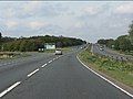
 A419 - minor road overbridge at Covingham - geograph.org.uk - 2088182.jpg 640 × 480 ; 58 kio
-
 A449 - A420 exit, northbound carriageway - geograph.org.uk - 2088189.jpg 640 × 480 ; 57 kio
-

-
 Benchmark on Dorcan Way subway wall - geograph.org.uk - 4421340.jpg 1 024 × 683 ; 332 kio
-
 Benchmark on Kingfisher Drive wall - geograph.org.uk - 4423604.jpg 683 × 1 024 ; 254 kio
-
 Benchmark on Merlin Way wall - geograph.org.uk - 4422828.jpg 683 × 1 024 ; 299 kio
-
 Benchmark on St Paul's Drive wall - geograph.org.uk - 4423506.jpg 683 × 1 024 ; 281 kio
-
 Benchmark on ^1 Larksfield wall - geograph.org.uk - 4421892.jpg 683 × 1 024 ; 357 kio
-
 Benchmark on ^2 Hawkswood garage - geograph.org.uk - 4421925.jpg 683 × 1 024 ; 319 kio
-
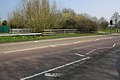 Bridge for Dorcan Way (B4006) over Dorcan Stream - geograph.org.uk - 4424203.jpg 1 024 × 683 ; 196 kio
-
 Bridge over Dorcan Stream from St Paul's Drive - geograph.org.uk - 4423839.jpg 1 024 × 683 ; 266 kio
-
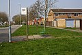 Bus stop on St Paul's Drive - geograph.org.uk - 4423749.jpg 1 024 × 683 ; 209 kio
-
 Covingham shopping centre, Covingham, Swindon - geograph.org.uk - 306811.jpg 640 × 480 ; 94 kio
-
 Dorcan Stream in Covingham, Swindon - geograph.org.uk - 583846.jpg 640 × 480 ; 136 kio
-
 Dorcan Way approaching The Drive roundabout - geograph.org.uk - 4455632.jpg 1 500 × 996 ; 122 kio
-
 Houses in St Pauls Drive, Covingham, Swindon - geograph.org.uk - 306829.jpg 640 × 480 ; 97 kio
-
 Junction of Covingham Drive and Hawkswood - geograph.org.uk - 4421937.jpg 1 024 × 683 ; 181 kio
-
 Junction of Covingham Drive and Larksfield - geograph.org.uk - 4421899.jpg 1 024 × 683 ; 211 kio
-
 Junction of Gantlettdene and St Paul's Drive - geograph.org.uk - 4423535.jpg 1 024 × 683 ; 207 kio
-
 Junction of Kingfisher Drive and Foxbridge - geograph.org.uk - 4423649.jpg 1 024 × 683 ; 176 kio
-
 Junction of Kingfisher Drive and Martinfield - geograph.org.uk - 4423717.jpg 1 024 × 683 ; 218 kio
-
 Junction of Merlin Way and Heronscroft - geograph.org.uk - 4422833.jpg 1 024 × 683 ; 226 kio
-
 Junction of Pinnegar Way and St Paul's Drive - geograph.org.uk - 4590851.jpg 1 024 × 683 ; 233 kio
-
 Junction of St Paul's Drive and Cornmarsh Way - geograph.org.uk - 4423383.jpg 1 024 × 683 ; 178 kio
-
 Row of shops, Covingham Square, Swindon - geograph.org.uk - 3273546.jpg 4 000 × 3 000 ; 2,81 Mio
-
 Swindon, Falconscroft, Covingham - geograph.org.uk - 583844.jpg 640 × 480 ; 91 kio
-
 The Messenger public house, Covingham, Swindon - geograph.org.uk - 306815.jpg 640 × 480 ; 101 kio
-
 Wall above subway under Dorcan Way - geograph.org.uk - 4421355.jpg 1 024 × 683 ; 166 kio
-
 ^21-26 Fieldfare, sheltered housing - geograph.org.uk - 4590829.jpg 1 024 × 683 ; 145 kio


_over_Dorcan_Stream_-_geograph.org.uk_-_4424203.jpg)


