Category:Crail
Vai alla navigazione
Vai alla ricerca
former royal burgh in the East Neuk of Fife, Scotland, UK  | |||||
| Carica un file multimediale | |||||
| Istanza di |
| ||||
|---|---|---|---|---|---|
| Luogo |
| ||||
| Popolazione |
| ||||
 | |||||

English: Crail, Fife, Scotland
Sottocategorie
Questa categoria contiene le 23 sottocategorie indicate di seguito, su un totale di 23.
C
- Crail dovecote (3 F)
- Crail parish church (20 F)
- Crail Tolbooth (8 F)
E
- East Neuk Hotel (2 F)
F
H
- Crail harbour (120 F)
K
- Kirklands, Fife (12 F)
M
P
- The Pans, Fife (17 F)
R
- Rose Wynd, Crail (4 F)
S
- Sauchope standing stone (2 F)
- Ships registered in Crail (3 F)
- Sypsies (3 F)
T
- Troustrie (4 F)
W
- West Ness, Crail (7 F)
File nella categoria "Crail"
Questa categoria contiene 200 file, indicati di seguito, su un totale di 612.
(pagina precedente) (pagina successiva)-
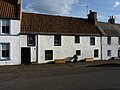
 'Bruce Cottage' 2 Rose Wynd, Crail - geograph.org.uk - 5987862.jpg 2 081 × 2 774; 1,76 MB
-
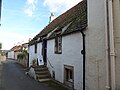
 'Maldon' 69 Nethergate, Crail - geograph.org.uk - 5987848.jpg 2 938 × 2 203; 1,81 MB
-
 'The Custom House' at 35 Shoregate, Crail - geograph.org.uk - 5986412.jpg 2 203 × 2 938; 1,89 MB
-
 1 GEO - geograph.org.uk - 6199566.jpg 1 024 × 768; 204 KB
-
 1 Rose Wynd, Crail - geograph.org.uk - 5987870.jpg 1 958 × 2 611; 1,67 MB
-
 1 Shoregate ^ 1 West Lane, Crail - geograph.org.uk - 5985844.jpg 3 264 × 2 448; 1,74 MB
-
 1 to 4 Castle Terrace, Crail - geograph.org.uk - 6101662.jpg 1 095 × 1 600; 354 KB
-
 1 West Lane and public conveniences - geograph.org.uk - 6174813.jpg 1 600 × 963; 332 KB
-
 1 Westgate, Crail - geograph.org.uk - 6173807.jpg 1 600 × 1 036; 354 KB
-
 10 Castle Street, Crail - geograph.org.uk - 5987876.jpg 2 774 × 2 081; 1,65 MB
-
 11 Westgate, Crail - geograph.org.uk - 6173897.jpg 1 600 × 1 059; 534 KB
-
 12 Castle Street, Crail - geograph.org.uk - 5987891.jpg 2 611 × 1 958; 1,68 MB
-
 13 Shoregate, Crail - geograph.org.uk - 5985865.jpg 2 203 × 2 938; 1,84 MB
-
 13 Shoregate, Crail - geograph.org.uk - 6248822.jpg 1 024 × 784; 607 KB
-
 15 Shoregate, Crail - geograph.org.uk - 5985874.jpg 2 352 × 1 862; 1,21 MB
-
 16 Castle Street, Crail - geograph.org.uk - 5988548.jpg 2 081 × 2 774; 1,77 MB
-
 16 High Street ^ 2 Castle Street, Crail - geograph.org.uk - 5988821.jpg 2 774 × 2 081; 1,56 MB
-
 19 Nethergate North, Crail - geograph.org.uk - 2793961.jpg 640 × 480; 75 KB
-
 20 ^ 22 Castle Street, Crail - geograph.org.uk - 5988554.jpg 3 264 × 2 448; 1,24 MB
-
 24 Castle Street, Crail - geograph.org.uk - 5988559.jpg 2 448 × 1 836; 1,63 MB
-
 24 Shoregate, Crail - geograph.org.uk - 5985885.jpg 2 938 × 2 203; 1,95 MB
-
 25 Shoregate, Crail - geograph.org.uk - 5985896.jpg 2 774 × 2 081; 1,77 MB
-
 26 Castle Street, Crail - geograph.org.uk - 5988562.jpg 2 774 × 2 081; 1,7 MB
-
 26 Shoregate, Crail - geograph.org.uk - 5985887.jpg 2 611 × 1 958; 1,58 MB
-
 27 Shoregate, Crail - geograph.org.uk - 5985901.jpg 2 081 × 2 774; 1,68 MB
-
 28 Castle Street, Crail - geograph.org.uk - 5988782.jpg 3 264 × 2 448; 1,73 MB
-
 28 Shoregate, Crail - geograph.org.uk - 5985893.jpg 2 448 × 3 264; 1,84 MB
-
 29 Nethergate, Crail - geograph.org.uk - 5988815.jpg 1 836 × 2 448; 1,52 MB
-
 29 Shoregate, Crail - geograph.org.uk - 5986171.jpg 2 203 × 2 938; 2,01 MB
-
 3 Shoregate, Crail - geograph.org.uk - 5985853.jpg 3 264 × 2 448; 1,94 MB
-
 31 Shoregate, Crail - geograph.org.uk - 5986410.jpg 3 101 × 2 326; 1,75 MB
-
 33 Shoregate, Crail - geograph.org.uk - 5986411.jpg 2 203 × 2 938; 1,99 MB
-
 36 Shoregate, Crail - geograph.org.uk - 6175636.jpg 1 600 × 1 040; 470 KB
-
 37 Shoregate, Crail - geograph.org.uk - 5986414.jpg 2 081 × 2 774; 1,82 MB
-
 39 Shoregate, Crail - geograph.org.uk - 5986416.jpg 1 958 × 2 611; 1,61 MB
-
 41 Shoregate, Crail - geograph.org.uk - 5986417.jpg 2 774 × 2 081; 1,81 MB
-
 44 Nethergate, Crail - geograph.org.uk - 5988812.jpg 2 938 × 2 203; 1,65 MB
-
 46 High Street, Crail - geograph.org.uk - 5989443.jpg 1 714 × 2 285; 1,53 MB
-
 5 Shoregate, Crail - geograph.org.uk - 5985857.jpg 3 264 × 2 448; 2 MB
-
 50 and 52 Nethergate, Crail - geograph.org.uk - 6175655.jpg 1 067 × 1 600; 366 KB
-
 52 High Street, Crail - geograph.org.uk - 5989447.jpg 2 774 × 2 081; 1,73 MB
-
 54 High Street, Crail - geograph.org.uk - 5989452.jpg 2 611 × 1 958; 1,65 MB
-
 6 Rumford, Crail - geograph.org.uk - 5986424.jpg 2 448 × 3 264; 3,72 MB
-
 63 Nethergate, Crail - geograph.org.uk - 6175571.jpg 1 140 × 1 600; 354 KB
-
 67 Nethergate, Crail - geograph.org.uk - 5987838.jpg 2 611 × 1 958; 1,96 MB
-
 67 Nethergate, Crail - geograph.org.uk - 6175559.jpg 1 128 × 1 600; 408 KB
-
 68 Nethergate, Crail - geograph.org.uk - 5986418.jpg 2 774 × 2 081; 2,12 MB
-
 70 and 72 Nethergate, Crail - geograph.org.uk - 6173050.jpg 1 600 × 949; 234 KB
-
 70 Nethergate, Crail - geograph.org.uk - 5986420.jpg 3 264 × 2 448; 1,59 MB
-
 71 Nethergate, Crail - geograph.org.uk - 5988788.jpg 3 101 × 2 326; 1,76 MB
-
 8 and 10 Castle Street - geograph.org.uk - 6175529.jpg 1 600 × 1 349; 477 KB
-
 8 and 10 Tolbooth Wynd, Crail - geograph.org.uk - 6175661.jpg 1 600 × 885; 294 KB
-
 8 Castle Street, Crail - geograph.org.uk - 5987884.jpg 2 081 × 2 774; 1,59 MB
-
 9 and 7 Westgate, Crail - geograph.org.uk - 6173854.jpg 1 600 × 1 067; 329 KB
-
 9 to 15 Shoregate, Crail - geograph.org.uk - 6103183.jpg 1 600 × 1 067; 319 KB
-
 A heartfelt plea - geograph.org.uk - 6112636.jpg 480 × 640; 240 KB
-
 A lane to the harbour, Crail - geograph.org.uk - 3663633.jpg 786 × 1 024; 253 KB
-
 A railway ran through it - geograph.org.uk - 1240262.jpg 640 × 480; 112 KB
-
 A sand sculpture at Crail - geograph.org.uk - 3623081.jpg 640 × 449; 191 KB
-

-
 A tangled mess - geograph.org.uk - 6336548.jpg 1 600 × 900; 432 KB
-
 A triangular field - geograph.org.uk - 3597943.jpg 640 × 360; 206 KB
-
 A View of Crail - geograph.org.uk - 3285224.jpg 2 703 × 1 810; 4,68 MB
-

-
 A917 at Crail - geograph.org.uk - 95958.jpg 640 × 480; 151 KB
-
 A917 at Crail village boundary - geograph.org.uk - 4558398.jpg 640 × 481; 55 KB
-
 A917 entering Crail - geograph.org.uk - 1036603.jpg 640 × 382; 52 KB
-
 A917 nearing Crail - geograph.org.uk - 4558395.jpg 640 × 481; 46 KB
-

-
 Active - Canmore 272875.jpg 4 032 × 3 024; 7,75 MB
-
 Airdrie House, by Crail - geograph.org.uk - 6190132.jpg 1 024 × 688; 341 KB
-
 Airdrie wind turbine - geograph.org.uk - 6420149.jpg 1 600 × 1 200; 620 KB
-
 Albany Court, Crail - geograph.org.uk - 604073.jpg 640 × 430; 68 KB
-
 Almost like a bathtub - geograph.org.uk - 6351836.jpg 1 600 × 900; 393 KB
-
 An unusual stone stile - geograph.org.uk - 6301949.jpg 640 × 480; 101 KB
-
 And today's flag is . . . - geograph.org.uk - 5447200.jpg 3 716 × 2 744; 1,73 MB
-
 And today's flag is . . . - geograph.org.uk - 5447212.jpg 2 873 × 3 113; 2,05 MB
-
 Anstruther and St Andrews Railway - geograph.org.uk - 3597925.jpg 640 × 360; 183 KB
-
 Approaching Ragfield - geograph.org.uk - 5076013.jpg 2 816 × 2 112; 1,12 MB
-
 Artist at work, Crail Harbour - geograph.org.uk - 6166289.jpg 1 600 × 1 382; 533 KB
-
 At Sauchope Links Caravan Park - geograph.org.uk - 3633207.jpg 3 484 × 2 489; 1,45 MB
-
 Balcomie Castle - geograph.org.uk - 6248645.jpg 1 024 × 768; 205 KB
-
 Balcomie Castle - geograph.org.uk - 6318353.jpg 5 159 × 3 572; 3,98 MB
-
 Balcomie Golf Course - geograph.org.uk - 6110500.jpg 640 × 480; 246 KB
-
 Balcomie Green - geograph.org.uk - 2062645.jpg 2 560 × 1 920; 3,02 MB
-
 Balcomie Green - geograph.org.uk - 483106.jpg 640 × 437; 84 KB
-
 Balcomie Links - geograph.org.uk - 6318366.jpg 5 184 × 3 888; 4,38 MB
-
 Balcomie Links Caravan Park - geograph.org.uk - 6297300.jpg 640 × 480; 243 KB
-
 Balcomie Links Hotel - geograph.org.uk - 487051.jpg 640 × 424; 60 KB
-
 Balcomie Links Hotel, Balcomie Road, Crail - geograph.org.uk - 6103931.jpg 1 600 × 1 067; 278 KB
-
 Balcomie Links Hotel, Crail - geograph.org.uk - 2288169.jpg 640 × 480; 216 KB
-
 Balcomie Links Hotel, Crail - geograph.org.uk - 3990877.jpg 4 608 × 3 456; 3,16 MB
-
 Balcomie Sands - geograph.org.uk - 6110529.jpg 640 × 480; 284 KB
-
 Balcomie Sands at low tide - geograph.org.uk - 6314739.jpg 1 600 × 900; 323 KB
-
 Bathing gulls - geograph.org.uk - 6101650.jpg 1 600 × 1 067; 471 KB
-
 Beach at Kilminning Coast, Fife - geograph.org.uk - 5766540.jpg 4 608 × 3 456; 5,35 MB
-
 Beach at Roome Harbour, Crail - geograph.org.uk - 6100945.jpg 1 600 × 1 067; 444 KB
-
 Beach near Crail Harbour - geograph.org.uk - 3446725.jpg 600 × 450; 69 KB
-
 Beach, Crail - geograph.org.uk - 2153826.jpg 640 × 359; 110 KB
-
 Beach, Crail - geograph.org.uk - 2156831.jpg 640 × 480; 148 KB
-
 Beach, Kilminning Coast - geograph.org.uk - 6166163.jpg 3 968 × 2 976; 2,1 MB
-
 Beach, Roome Harbour, Crail - geograph.org.uk - 6100838.jpg 1 600 × 1 024; 512 KB
-
 Beach, West Ness - geograph.org.uk - 2153793.jpg 640 × 359; 91 KB
-
 Beehive Doocot at Crail - geograph.org.uk - 4039259.jpg 3 264 × 2 448; 3,78 MB
-
 Bench Mark, 19 Nethergate North - geograph.org.uk - 2793962.jpg 480 × 640; 73 KB
-
 Bench Mark, British Legion Club - geograph.org.uk - 2795134.jpg 480 × 640; 76 KB
-

-
 Benchmark on Lochton gatepost - geograph.org.uk - 6424105.jpg 640 × 427; 96 KB
-
 Black goat of the family - geograph.org.uk - 3198731.jpg 2 816 × 2 112; 1,77 MB
-
 Blue Stone Crail - geograph.org.uk - 2289648.jpg 640 × 225; 33 KB
-
 Boat as planter - geograph.org.uk - 6112682.jpg 640 × 480; 318 KB
-
 Brick building beside the shore - geograph.org.uk - 6174089.jpg 1 600 × 1 117; 685 KB
-
 Bridge on B9171 at Ragfield - geograph.org.uk - 6424114.jpg 640 × 427; 95 KB
-
 British Legion Club, Crail - geograph.org.uk - 2795104.jpg 640 × 480; 67 KB
-
 British Legion, Crail - geograph.org.uk - 5414462.jpg 4 400 × 3 017; 3,95 MB
-
 Building site - geograph.org.uk - 483105.jpg 640 × 466; 106 KB
-
 Buildings behind the harbour, Crail - geograph.org.uk - 6103137.jpg 1 600 × 1 047; 378 KB
-
 Buildings on Shoregate, Crail - geograph.org.uk - 5636250.jpg 1 600 × 1 053; 238 KB
-
 Buildings, Hen's Ladder, Crail - geograph.org.uk - 301219.jpg 421 × 640; 73 KB
-
 Burgh Seal of Crail, Fife (reverse).JPG 2 280 × 2 215; 2,01 MB
-
 Burgh Seal of Crail, Fife.JPG 2 248 × 2 220; 839 KB
-
 Burn, Crail - geograph.org.uk - 428283.jpg 480 × 640; 107 KB
-
 Butchers' shop - geograph.org.uk - 6278936.jpg 1 600 × 1 212; 411 KB
-
 By Ragfield - geograph.org.uk - 532865.jpg 640 × 355; 74 KB
-
 Byres and a Boat - geograph.org.uk - 2148631.jpg 2 816 × 2 112; 2,94 MB
-
 Cabbage and Crail - geograph.org.uk - 6305709.jpg 1 600 × 900; 269 KB
-
 Caraille green - geograph.org.uk - 2062713.jpg 2 560 × 1 920; 3,15 MB
-
 Castle Street, Crail - geograph.org.uk - 563621.jpg 471 × 640; 58 KB
-

-
 Castle Walk, Crail - geograph.org.uk - 4891228.jpg 3 264 × 2 448; 2,27 MB
-
 Castle Walk, Crail - geograph.org.uk - 5486855.jpg 4 608 × 3 456; 4,89 MB
-
 Centre of the village - geograph.org.uk - 1231848.jpg 640 × 480; 58 KB
-
 Change of track - geograph.org.uk - 5076011.jpg 2 816 × 2 112; 1,2 MB
-
 Clearing seaweed at Crail Beach - geograph.org.uk - 6036486.jpg 1 024 × 564; 173 KB
-
 Cliff and beach to west of Crail Harbour - geograph.org.uk - 6101781.jpg 1 600 × 1 067; 417 KB
-
 Coast at Crail - geograph.org.uk - 428270.jpg 480 × 640; 97 KB
-
 Coastal erosion - geograph.org.uk - 4419424.jpg 2 048 × 1 536; 1,56 MB
-
 Cocklaw hill - geograph.org.uk - 6424122.jpg 640 × 427; 31 KB
-
 Concrete building, Crail Airfield - geograph.org.uk - 2157177.jpg 640 × 480; 106 KB
-
 Control Tower, Crail Disused Airfield - geograph.org.uk - 6248676.jpg 1 024 × 769; 133 KB
-
 Cottages on Nethergate, Crail - geograph.org.uk - 6100737.jpg 1 600 × 1 067; 458 KB
-
 Cottages on Nethergate, Crail - geograph.org.uk - 6100748.jpg 1 600 × 1 067; 371 KB
-
 Country track following route of dismantled railway line - geograph.org.uk - 5075019.jpg 2 816 × 2 112; 996 KB
-
 Courtyard, Crail Pottery - geograph.org.uk - 6248694.jpg 1 024 × 768; 369 KB
-
 Crags, Crail - geograph.org.uk - 2153808.jpg 640 × 359; 103 KB
-
 Craig Golfing Society premises - geograph.org.uk - 6110498.jpg 640 × 480; 226 KB
-
 Craighead Links Golf Club House - geograph.org.uk - 6248595.jpg 1 024 × 768; 261 KB
-
 Crail (3292511007).jpg 3 488 × 1 844; 3,23 MB
-
 Crail (47584414151).jpg 4 658 × 3 115; 7,92 MB
-
 Crail - Breakwater at harbour - geograph.org.uk - 6472759.jpg 1 754 × 966; 336 KB
-
 Crail - geograph.org.uk - 1660015.jpg 640 × 480; 156 KB
-
 Crail - geograph.org.uk - 2153798.jpg 640 × 359; 106 KB
-
 Crail - houses near the harbour - geograph.org.uk - 6396371.jpg 1 633 × 918; 672 KB
-
 Crail - houses near the harbour - geograph.org.uk - 6396372.jpg 1 622 × 691; 514 KB
-
 Crail - houses near the harbour - geograph.org.uk - 6396459.jpg 1 633 × 918; 645 KB
-
 Crail - houses on Marketgate South - geograph.org.uk - 6396327.jpg 1 633 × 918; 610 KB
-
 Crail - panoramio.jpg 4 320 × 3 240; 5,33 MB
-
 Crail - view towards harbour from Castle Walk - geograph.org.uk - 6472758.jpg 1 448 × 946; 305 KB
-
 Crail Airfield - geograph.org.uk - 6248659.jpg 1 024 × 767; 166 KB
-
 Crail Airfield - geograph.org.uk - 6248665.jpg 1 024 × 768; 204 KB
-
 Crail Bay and Harbour - geograph.org.uk - 6302006.jpg 640 × 480; 85 KB
-
 Crail Beach - geograph.org.uk - 2153864.jpg 640 × 480; 131 KB
-
 Crail Beach - geograph.org.uk - 2155634.jpg 640 × 480; 119 KB
-
 Crail bei Anstruther - panoramio.jpg 4 320 × 3 240; 5,71 MB
-
 Crail Bookshop - geograph.org.uk - 3633041.jpg 640 × 480; 78 KB
-
 Crail Castle and village - geograph.org.uk - 97627.jpg 640 × 480; 89 KB
-
 Crail coastline - geograph.org.uk - 870517.jpg 480 × 640; 107 KB
-
 Crail Community Hall - geograph.org.uk - 3990836.jpg 3 456 × 4 608; 3,3 MB
-
 Crail doocot - geograph.org.uk - 4039263.jpg 2 589 × 1 942; 1,19 MB
-
 Crail doocot - geograph.org.uk - 6321655.jpg 3 888 × 5 184; 3,22 MB
-
 Crail doocot - interior - geograph.org.uk - 6321657.jpg 5 184 × 3 888; 6,02 MB
-
 Crail Doorway - geograph.org.uk - 93677.jpg 640 × 480; 128 KB
-
 Crail Fish Bar ^ Cafe - geograph.org.uk - 6278924.jpg 1 600 × 1 188; 298 KB
-
 Crail Golf Club House - geograph.org.uk - 2289619.jpg 640 × 425; 53 KB
-

-

-

-

-

-

-

-
 Crail Harbour - geograph.org.uk - 2258002.jpg 640 × 480; 78 KB
-
 Crail harbour - geograph.org.uk - 2437038.jpg 640 × 476; 348 KB
-
 Crail Harbour - geograph.org.uk - 3446709.jpg 600 × 450; 79 KB
-
 Crail Harbour - geograph.org.uk - 3446720.jpg 600 × 450; 90 KB
-
 Crail Harbour - geograph.org.uk - 3530196.jpg 640 × 480; 66 KB
-
 Crail Harbour - geograph.org.uk - 3530203.jpg 640 × 462; 72 KB
-
 Crail Harbour - geograph.org.uk - 4309784.jpg 4 911 × 3 274; 7,13 MB
-
 Crail Harbour - geograph.org.uk - 4719090.jpg 640 × 480; 82 KB
-
 Crail Harbour - geograph.org.uk - 4832945.jpg 1 600 × 1 200; 406 KB
-
 Crail Harbour - geograph.org.uk - 4833341.jpg 1 600 × 1 200; 380 KB
-
 Crail Harbour - geograph.org.uk - 4936060.jpg 4 608 × 3 456; 4,25 MB
-
 Crail Harbour - geograph.org.uk - 5486852.jpg 3 974 × 2 772; 2,88 MB
-
 Crail Harbour - geograph.org.uk - 6099548.jpg 1 600 × 1 067; 403 KB
-
 Crail Harbour - geograph.org.uk - 6101726.jpg 1 600 × 998; 403 KB
-
 Crail Harbour - geograph.org.uk - 6101743.jpg 1 147 × 1 600; 458 KB
-
 Crail Harbour - geograph.org.uk - 6103129.jpg 1 600 × 970; 298 KB
-
 Crail Harbour - geograph.org.uk - 6103144.jpg 1 600 × 1 037; 359 KB
-
 Crail Harbour - geograph.org.uk - 6112632.jpg 640 × 480; 291 KB
-
 Crail Harbour - geograph.org.uk - 6166200.jpg 1 600 × 1 031; 525 KB


_-_geograph.org.uk_-_596548.jpg)


.JPG)


.jpg)
.jpg)


