Category:Cranford, London
Aller à la navigation
Aller à la recherche
Article Wikipédia principal : Cranford, London.
établissement humain au Royaume-Uni  | |||||
| Téléverser des médias | |||||
| Nature de l’élément | |||||
|---|---|---|---|---|---|
| Lieu | Borough londonien de Hounslow, Grand Londres, Londres, Angleterre | ||||
| Baigné par | |||||
| Superficie |
| ||||
 | |||||
Sous-catégories
Cette catégorie comprend 2 sous-catégories, dont les 2 ci-dessous.
D
Q
- The Queens Head, Cranford (3 F)
Média dans la catégorie « Cranford, London »
Cette catégorie comprend 58 fichiers, dont les 58 ci-dessous.
-
 A312 - geograph.org.uk - 6021695.jpg 1 024 × 681 ; 117 kio
-
 A4 Bath Road - geograph.org.uk - 1584161.jpg 640 × 480 ; 49 kio
-
 A4 Bath Road, Cranford - geograph.org.uk - 2649403.jpg 4 320 × 3 240 ; 3,67 Mio
-
 A4 Bath Road, Cranford - geograph.org.uk - 2649417.jpg 4 320 × 3 240 ; 3,94 Mio
-
 A4 eastbound, Cranford - geograph.org.uk - 2221006.jpg 1 600 × 1 200 ; 583 kio
-
 A4 westbound, Cranford - geograph.org.uk - 2221003.jpg 1 600 × 1 200 ; 581 kio
-
 Bath Road from the air - geograph.org.uk - 5074408.jpg 640 × 480 ; 191 kio
-
 Bath Road from the air - geograph.org.uk - 5085082.jpg 640 × 480 ; 206 kio
-
 Burnham Gardens - geograph.org.uk - 2603248.jpg 640 × 430 ; 57 kio
-

-
 Cranford - Byron Close - geograph.org.uk - 5085684.jpg 3 264 × 2 448 ; 2,56 Mio
-
 Cranford Bridge where the A4 Bath Road crosses the river Crane - geograph.org.uk - 5911003.jpg 4 000 × 3 000 ; 4,7 Mio
-
 Cranford Community College - geograph.org.uk - 5252441.jpg 544 × 248 ; 27 kio
-
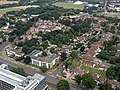
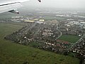
 Cranford from the air - geograph.org.uk - 3785589.jpg 640 × 480 ; 141 kio
-
 Cranford from the air - geograph.org.uk - 3994352.jpg 640 × 382 ; 169 kio
-
 Cranford High Street passes Cranford Community College - geograph.org.uk - 2899159.jpg 3 648 × 2 736 ; 2,11 Mio
-
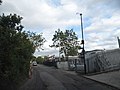
 Cranford Lane, Cranford - geograph.org.uk - 3697212.jpg 2 560 × 1 920 ; 1,98 Mio
-
 Cranford Park - geograph.org.uk - 1219761.jpg 640 × 445 ; 143 kio
-
 Cranford Park - geograph.org.uk - 207177.jpg 640 × 480 ; 108 kio
-
 Cranford Park Open Space - geograph.org.uk - 76699.jpg 640 × 425 ; 122 kio
-
 Cranford Park, Cranford - geograph.org.uk - 1013357.jpg 640 × 426 ; 108 kio
-
 Cranford, A312 The Parkway - geograph.org.uk - 1163198.jpg 640 × 455 ; 69 kio
-
 Crossroads on the A312 - geograph.org.uk - 3144575.jpg 640 × 480 ; 116 kio
-
 Derelict building at Cranford Park - geograph.org.uk - 1012710.jpg 640 × 426 ; 139 kio
-

-

-
 Fields by the A4 from the air. - geograph.org.uk - 3786128.jpg 640 × 480 ; 117 kio
-
 Fields near the A4 from above - geograph.org.uk - 3512697.jpg 2 859 × 2 057 ; 1,27 Mio
-
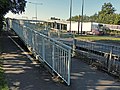 Footbridge across the A312 in Cranford - geograph.org.uk - 4639445.jpg 800 × 602 ; 165 kio
-
 Ha-ha in Cranford Park - geograph.org.uk - 1012673.jpg 640 × 426 ; 117 kio
-
 High Street, Cranford - geograph.org.uk - 2649401.jpg 4 320 × 3 240 ; 3,79 Mio
-
 High Street, Cranford - geograph.org.uk - 2649411.jpg 4 320 × 3 240 ; 4,21 Mio
-
 High Street, Cranford - geograph.org.uk - 2649413.jpg 4 320 × 3 240 ; 3,79 Mio
-
 Hounslow - Bleriot Road - geograph.org.uk - 5085499.jpg 3 264 × 2 448 ; 2,51 Mio
-
 Hounslow West from the air - geograph.org.uk - 5892267.jpg 1 600 × 1 068 ; 754 kio
-
 Houses on Cranford Lane - geograph.org.uk - 3697508.jpg 2 560 × 1 920 ; 2,24 Mio
-
 Interior of the Stable Block, Cranford Park - geograph.org.uk - 1003030.jpg 640 × 423 ; 81 kio
-
 Jolly Waggoner, Cranford, TW5 (13579290385).jpg 3 678 × 2 113 ; 2,43 Mio
-
 Mornington Crescent from the air - geograph.org.uk - 5085081.jpg 640 × 480 ; 212 kio
-
 Park Bench, Cranford Park - geograph.org.uk - 2709032.jpg 1 600 × 1 200 ; 620 kio
-
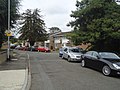
 Park Lane, Cranford - geograph.org.uk - 3972115.jpg 2 560 × 1 920 ; 2 Mio
-
 Pedestrian crossing, A4, Cranford - geograph.org.uk - 2603251.jpg 640 × 430 ; 73 kio
-
 Pegg Road from Cranford Lane - geograph.org.uk - 3697556.jpg 2 560 × 1 920 ; 1,75 Mio
-
 River Crane at Cranford - geograph.org.uk - 78484.jpg 640 × 425 ; 151 kio
-
 River Crane in Cranford Park - geograph.org.uk - 207182.jpg 640 × 480 ; 163 kio
-
 Sandringham Gardens, Cranford - geograph.org.uk - 2649406.jpg 4 320 × 3 240 ; 4,71 Mio
-
 Sheepcote Close, Cranford - geograph.org.uk - 2649399.jpg 4 320 × 3 240 ; 4,11 Mio
-
 Sheepcote Close, Cranford - geograph.org.uk - 3697035.jpg 2 560 × 1 920 ; 2,03 Mio
-
 Site of Cranford House, Cranford Park - geograph.org.uk - 1012634.jpg 640 × 411 ; 142 kio
-
 South Cranford, East of Heathrow - geograph.org.uk - 5253470.jpg 463 × 365 ; 35 kio
-
 Stripy pole Mornington Crescent, Cranford - geograph.org.uk - 2277526.jpg 1 200 × 1 600 ; 375 kio
-
 The Ramada and Berkeley Arms Hotel in Cranford Hounslow - panoramio.jpg 3 566 × 2 622 ; 3,69 Mio
-

-
 Victorian Overnight Prison Cell in Cranford Middlesex - panoramio.jpg 2 788 × 2 120 ; 1,5 Mio
-
 Waye Avenue, Cranford - geograph.org.uk - 1215703.jpg 640 × 427 ; 53 kio
-
 Waye Avenue, Cranford - geograph.org.uk - 2710247.jpg 1 600 × 1 179 ; 443 kio
-
 Waye Avenue, near Heathrow - geograph.org.uk - 2708816.jpg 1 600 × 1 119 ; 385 kio
-
 Waye Avenue, near Heathrow 2 - geograph.org.uk - 2708825.jpg 1 600 × 1 166 ; 407 kio


.jpg)


