Category:Crawley
Vai alla navigazione
Vai alla ricerca
town in West Sussex, England  | |||||
| Carica un file multimediale | |||||
| Istanza di | |||||
|---|---|---|---|---|---|
| Luogo | Crawley, West Sussex, Sud Est dell'Inghilterra, Inghilterra | ||||
| Popolazione |
| ||||
| Superficie |
| ||||
| sito web ufficiale | |||||
 | |||||
Sottocategorie
Questa categoria contiene le 18 sottocategorie indicate di seguito, su un totale di 18.
Pagine nella categoria "Crawley"
Questa categoria contiene un'unica pagina, indicata di seguito.
C
File nella categoria "Crawley"
Questa categoria contiene 200 file, indicati di seguito, su un totale di 2 900.
(pagina precedente) (pagina successiva)-
 "Old Punch Bowl" public house, Crawley - geograph.org.uk - 4153087.jpg 1 600 × 1 068; 472 KB
-

-
 "The Snooty Fox" PH - geograph.org.uk - 4929475.jpg 800 × 600; 140 KB
-
 'New homes coming soon', Crawley - geograph.org.uk - 6321667.jpg 1 024 × 1 024; 289 KB
-
 'Orleton Lodge', Goffs Park Road - geograph.org.uk - 4689192.jpg 1 024 × 683; 195 KB
-
 'Smile more' - geograph.org.uk - 6455501.jpg 1 024 × 1 024; 603 KB
-
 'Tree House', ^103 High Street - geograph.org.uk - 4688380.jpg 685 × 1 024; 197 KB
-
 1 City Place, Gatwick (geograph 1676727).jpg 640 × 480; 55 KB
-
 103 High Street, Crawley - geograph.org.uk - 6305740.jpg 1 024 × 576; 218 KB
-
 108 - 122 Malthouse Road - geograph.org.uk - 5871291.jpg 1 024 × 678; 682 KB
-
 15th fairway, Tilgate Forest Golf Centre - geograph.org.uk - 3600817.jpg 640 × 480; 109 KB
-
 15th tee, Tilgate Forest Golf Centre - geograph.org.uk - 3600786.jpg 640 × 480; 131 KB
-
 17 and 19 Brighton Road, Crawley - geograph.org.uk - 3596196.jpg 640 × 428; 89 KB
-
 17th fairway, Tilgate Forest Golf Centre - geograph.org.uk - 3601462.jpg 640 × 480; 101 KB
-
 17th tee, Tilgate Forest Golf Centre - geograph.org.uk - 3600876.jpg 640 × 480; 107 KB
-
 18dqu072.tif 3 702 × 5 553; 58,85 MB
-
 18th fairway, Tilgate Forest Golf Centre - geograph.org.uk - 3605730.jpg 640 × 480; 126 KB
-
 18th tee, Tilgate Forest Golf Centre - geograph.org.uk - 3601622.jpg 640 × 480; 130 KB
-
 1985 London to Brighton Veteran Car Run (1) - geograph.org.uk - 3209511.jpg 1 799 × 1 215; 2,38 MB
-
 20 - 28 London Road, Northgate, Crawley - geograph.org.uk - 3629690.jpg 640 × 480; 128 KB
-

-
 23 Queensway - geograph.org.uk - 5532828.jpg 1 000 × 662; 613 KB
-
 3rd fairway, Tilgate Forest Golf Centre - geograph.org.uk - 3601555.jpg 640 × 480; 102 KB
-
 4, Gatwick Road, Manor Royal, Crawley - geograph.org.uk - 6095337.jpg 1 024 × 684; 166 KB
-
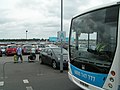
 400 bus on Northgate Avenue, Crawley - geograph.org.uk - 6095217.jpg 1 024 × 684; 283 KB
-
 4th green, Tilgate Forest Golf Centre - geograph.org.uk - 3604375.jpg 640 × 480; 119 KB
-
-
 5th green, Tilgate Forest Golf Centre - geograph.org.uk - 3604251.jpg 640 × 480; 100 KB
-

-
 70 years of Crawley New Town - geograph.org.uk - 5532832.jpg 1 000 × 662; 1,11 MB
-
 7th fairway, Tilgate Forest Golf Centre - geograph.org.uk - 3604273.jpg 640 × 480; 103 KB
-
 7th green, Tilgate Forest Golf Centre - geograph.org.uk - 3604316.jpg 640 × 480; 117 KB
-
 8th fairway, Tilgate Forest Golf Centre - geograph.org.uk - 3606950.jpg 640 × 480; 123 KB
-
 8th green, Tilgate Forest Golf Centre - geograph.org.uk - 3606894.jpg 640 × 480; 103 KB
-

-

-
 A 'Southern' train at Three Bridges station - geograph.org.uk - 6197366.jpg 1 024 × 685; 258 KB
-
 A 5 acre site^ - geograph.org.uk - 1650656.jpg 640 × 428; 86 KB
-
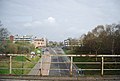
 A busy Turners Hill Road at M23 bridge - geograph.org.uk - 6139094.jpg 1 024 × 768; 221 KB
-

-
 A clearing in Tilgate Forest - geograph.org.uk - 1625296.jpg 640 × 428; 164 KB
-
 A corner of Grattons Park, Crawley - geograph.org.uk - 5840015.jpg 1 024 × 768; 337 KB
-
 A disgraced nursing home - geograph.org.uk - 3594370.jpg 640 × 480; 136 KB
-
 A fine tree by the bridleway - geograph.org.uk - 2849616.jpg 430 × 640; 136 KB
-
-
 A large and stately oak - geograph.org.uk - 3591219.jpg 480 × 640; 98 KB
-
 A misty morning at the airport hotel - geograph.org.uk - 6074768.jpg 2 000 × 1 333; 1,86 MB
-
 A rear First Class coach on an up-train to London - geograph.org.uk - 3462346.jpg 3 648 × 2 736; 1,09 MB
-
 A room with a view - geograph.org.uk - 4994893.jpg 4 014 × 2 972; 3,34 MB
-
 A snowy Central Park, Crawley - geograph.org.uk - 2182905.jpg 640 × 480; 120 KB
-
 A snowy Church Road, Worth - geograph.org.uk - 5321524.jpg 640 × 480; 175 KB
-
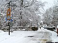
 A snowy Crawley High Street - geograph.org.uk - 3594752.jpg 640 × 480; 73 KB
-
 A snowy Crawley High Street by the Jubilee Oak - geograph.org.uk - 5794193.jpg 1 024 × 768; 305 KB
-
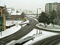
 A snowy Crawley station - geograph.org.uk - 3594758.jpg 640 × 480; 84 KB
-
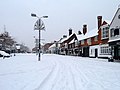
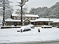
 A snowy day in Crawley town - geograph.org.uk - 3300110.jpg 640 × 480; 114 KB
-
 A snowy day in Crawley town - geograph.org.uk - 3594720.jpg 640 × 480; 134 KB
-
 A snowy Friary Way, Crawley - geograph.org.uk - 5794460.jpg 1 024 × 768; 321 KB
-
 A snowy Memorial Gardens, Crawley - geograph.org.uk - 5794260.jpg 1 024 × 768; 354 KB
-
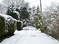
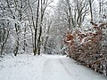 A snowy Worth Way - geograph.org.uk - 5321530.jpg 640 × 480; 190 KB
-
 A snowy Worth Way - geograph.org.uk - 5321533.jpg 640 × 480; 177 KB
-
 A tunnel of trees - geograph.org.uk - 2836847.jpg 640 × 430; 136 KB
-
-
-

-
 A way out of Waterlea Meadow LNR - geograph.org.uk - 6098200.jpg 1 024 × 768; 546 KB
-
 A white Green Lane - geograph.org.uk - 5321517.jpg 640 × 480; 167 KB
-
 A2004 Southgate Avenue, Crawley - geograph.org.uk - 6101036.jpg 1 024 × 768; 208 KB
-
 A2004, Crawley - geograph.org.uk - 2941308.jpg 640 × 430; 59 KB
-
 A2219 - geograph.org.uk - 6504937.jpg 1 024 × 684; 156 KB
-
 A2220 - geograph.org.uk - 2845366.jpg 640 × 430; 69 KB
-

-
 A2220 Bridge, M23 - geograph.org.uk - 2950163.jpg 640 × 392; 38 KB
-
 A2220 Horsham Road, Crawley - geograph.org.uk - 5752781.jpg 640 × 480; 152 KB
-
 A2220 leaving Crawley - geograph.org.uk - 3615204.jpg 640 × 480; 87 KB
-
 A23 - geograph.org.uk - 3665664.jpg 640 × 430; 66 KB
-
 A23 approaching Gatwick Airport South Terminal - geograph.org.uk - 6097416.jpg 1 024 × 684; 180 KB
-
 A23 bridge over the River Mole - geograph.org.uk - 3678375.jpg 640 × 480; 122 KB
-
 A23 crossing the railway line - geograph.org.uk - 3665643.jpg 640 × 430; 41 KB
-
 A23 Gatwick Spur - geograph.org.uk - 4472052.jpg 640 × 426; 55 KB
-
 A23 London Road, Crawley - geograph.org.uk - 3632096.jpg 640 × 480; 90 KB
-
 A23 London Road, Lowfield Heath - geograph.org.uk - 1967035.jpg 640 × 480; 83 KB
-
 A23 near Ifield Roundabout, Crawley - geograph.org.uk - 3630073.jpg 640 × 480; 139 KB
-
 A23 northbound, Gatwick - geograph.org.uk - 6097910.jpg 1 024 × 684; 204 KB
-
 A23 northbound, Gatwick - geograph.org.uk - 6098211.jpg 1 024 × 684; 163 KB
-
 A23 passing Gatwick Airport - geograph.org.uk - 4472050.jpg 640 × 426; 59 KB
-
 A23, Pease Pottage Hill - geograph.org.uk - 2798119.jpg 640 × 430; 48 KB
-
 A23, Pease Pottage Hill - geograph.org.uk - 2802177.jpg 640 × 430; 58 KB
-
 A264 - geograph.org.uk - 2845384.jpg 640 × 430; 75 KB
-
 A264 - geograph.org.uk - 2845398.jpg 640 × 430; 56 KB
-
 A264 - geograph.org.uk - 2950224.jpg 640 × 430; 42 KB
-
 A264 - geograph.org.uk - 2952060.jpg 640 × 430; 40 KB
-
 A264 towards Horsham - geograph.org.uk - 5753063.jpg 640 × 428; 96 KB
-
 A264 towards Horsham - geograph.org.uk - 5753067.jpg 640 × 480; 140 KB
-
 A264 towards Horsham - geograph.org.uk - 5753075.jpg 640 × 480; 137 KB
-
 Access road at Gatwick Airport - geograph.org.uk - 4330463.jpg 640 × 480; 83 KB
-
 Access road, Broadfield Kennels site - geograph.org.uk - 3612854.jpg 640 × 480; 157 KB
-
 Access to Gatwick Airport from M23 - geograph.org.uk - 1175527.jpg 640 × 442; 75 KB
-
 Access track to Ballast Hole - geograph.org.uk - 5838913.jpg 1 024 × 768; 459 KB
-
 Access track to Ballast Hole - geograph.org.uk - 5838917.jpg 1 024 × 768; 496 KB
-
 Across the end of Sandpiper Court - geograph.org.uk - 4883755.jpg 800 × 600; 163 KB
-
 Across the pond - geograph.org.uk - 4883718.jpg 800 × 600; 143 KB
-
 Advertisement at Gatwick Airport - geograph.org.uk - 4330493.jpg 640 × 480; 82 KB
-
 Air traffic Control Tower - geograph.org.uk - 3665753.jpg 640 × 610; 45 KB
-
 Air traffic Control Tower - geograph.org.uk - 3665760.jpg 640 × 453; 45 KB
-

-
 Air Traffic Control Tower at Gatwick - geograph.org.uk - 2982020.jpg 3 264 × 2 448; 2,67 MB
-
 Airborne above the M23 - geograph.org.uk - 1873557.jpg 640 × 427; 143 KB
-

-
 Aircraft at Gatwick North Terminal - geograph.org.uk - 2982489.jpg 3 264 × 2 448; 3,12 MB
-
 Aircraft at Pier 4 - geograph.org.uk - 3305274.jpg 3 264 × 2 448; 2,86 MB
-

-

-

-
 Aircraft under the bridge - geograph.org.uk - 3305293.jpg 3 264 × 2 448; 1,83 MB
-
 Airfield buildings at Gatwick - geograph.org.uk - 2982075.jpg 3 264 × 2 448; 3,03 MB
-

-
 Airparks parking and shuttle bus - geograph.org.uk - 3617208.jpg 640 × 480; 114 KB
-
 Airparks, airport parking - geograph.org.uk - 2322086.jpg 640 × 480; 36 KB
-
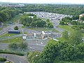
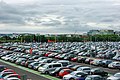 Airport car park, Gatwick - geograph.org.uk - 1951828.jpg 640 × 428; 121 KB
-
 Airport car park, Gatwick - geograph.org.uk - 6059005.jpg 1 024 × 681; 100 KB
-
 Airport runway apron, Gatwick South - geograph.org.uk - 3009878.jpg 1 024 × 768; 90 KB
-
 Aldingbourne Close - geograph.org.uk - 2860964.jpg 640 × 430; 92 KB
-
 All operators lattice tower - Broadfield Stadium, Crawley.jpg 3 072 × 4 080; 1,52 MB
-
 Alley behind Northgate Road, Crawley - geograph.org.uk - 3596533.jpg 640 × 480; 145 KB
-

-
 Alley, Bewbush, Crawley - geograph.org.uk - 3615499.jpg 640 × 480; 128 KB
-
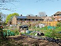
 Allotments behind Baker Close - geograph.org.uk - 2795532.jpg 640 × 430; 89 KB
-
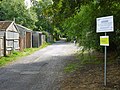
 Allotments by the Worth Way - geograph.org.uk - 3666819.jpg 640 × 430; 106 KB
-
 Allotments off Malthouse Rd - geograph.org.uk - 2795529.jpg 640 × 430; 63 KB
-
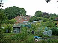 Allotments, Pound Hill, Crawley - geograph.org.uk - 3589486.jpg 640 × 480; 122 KB
-
 Allotments, Pound Hill, Crawley - geograph.org.uk - 5744597.jpg 640 × 480; 157 KB
-
-
-
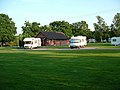
 Amberley Fields Caravan Club site, from the air - geograph.org.uk - 4135577.jpg 1 600 × 1 064; 309 KB
-
 An empty southbound M23 - geograph.org.uk - 6138849.jpg 1 024 × 768; 252 KB
-
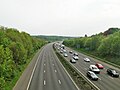 An empty southbound M23 - geograph.org.uk - 6139022.jpg 1 024 × 768; 216 KB
-
 An empty southbound M23 - geograph.org.uk - 6139107.jpg 1 024 × 768; 289 KB
-
 An open area, Wakehurst Drive - geograph.org.uk - 2798100.jpg 640 × 430; 70 KB
-
 Ancient and modern with gull - geograph.org.uk - 2750605.jpg 800 × 592; 243 KB
-
 Anglers' parking area - geograph.org.uk - 5838227.jpg 1 024 × 768; 380 KB
-

-
 Apology not accepted.... - geograph.org.uk - 4867069.jpg 800 × 600; 128 KB
-
 Apple Green Service Station, Crawley Avenue - geograph.org.uk - 3254878.jpg 1 388 × 1 039; 820 KB
-
 Approaching junction 10 M23 - geograph.org.uk - 2761803.jpg 640 × 404; 38 KB
-
 Approaching junction 10a M23 - geograph.org.uk - 2761805.jpg 640 × 369; 37 KB
-
 Approaching Lowfield Heath - geograph.org.uk - 1968176.jpg 640 × 428; 110 KB
-

-
 Apron and storage tanks, Gatwick North - geograph.org.uk - 3768324.jpg 1 536 × 1 152; 920 KB
-
 Apron by pier 4, Gatwick Airport - geograph.org.uk - 3971377.jpg 1 920 × 1 224; 446 KB
-
 Arden Road, Furnace Green, Crawley - geograph.org.uk - 5521107.jpg 640 × 428; 145 KB
-
 Arqiva - Crawley Court - panoramio.jpg 1 024 × 683; 456 KB
-
 Arqiva Crawley Court - Winchester - panoramio.jpg 2 592 × 1 817; 2,47 MB
-
 Articulated lorry in difficulty in snow, Crawley - geograph.org.uk - 5794102.jpg 1 024 × 768; 224 KB
-
 Asda bus and site redevelopment, Crawley - geograph.org.uk - 3784963.jpg 640 × 480; 116 KB
-
 Asda, Crawley - geograph.org.uk - 3594022.jpg 640 × 480; 94 KB
-

-
 Ashdown Drive, Crawley - geograph.org.uk - 4264110.jpg 640 × 428; 126 KB
-
 Ashdown Drive, Crawley - geograph.org.uk - 4264127.jpg 640 × 428; 129 KB
-
 Ashdown Drive, Tilgate, Crawley - geograph.org.uk - 2671363.jpg 4 320 × 3 240; 4,79 MB
-
 Ashurst Drive, Pound Hill, Crawley - geograph.org.uk - 3592438.jpg 640 × 480; 106 KB
-
 Astral Towers - geograph.org.uk - 4266654.jpg 428 × 640; 102 KB
-
 Astral Towers at Crawley - geograph.org.uk - 3090968.jpg 640 × 480; 114 KB
-
-

-

-
 ATC tower and parked aircraft at Gatwick - geograph.org.uk - 3312987.jpg 3 264 × 2 448; 3,24 MB
-
 Atlantic House, Gatwick Airport - geograph.org.uk - 3478779.jpg 640 × 385; 62 KB
-
 Attractions of Crawley Leisure Park - geograph.org.uk - 3629805.jpg 640 × 428; 84 KB
-

-
-

-

-

-

-

-

-

-

-

-

-
-

-
-

-
-

-
-
-
 Autumn in Milton Mount Avenue - geograph.org.uk - 4389617.jpg 7 198 × 4 436; 3,36 MB
-
 Awaiting take-off at Gatwick - geograph.org.uk - 5099643.jpg 4 608 × 3 456; 4,03 MB
-
 Axiom Rail driveway, Three Bridges - geograph.org.uk - 2233892.jpg 640 × 480; 76 KB
-
 B-18915 approaches runway 08R, Gatwick - geograph.org.uk - 5781452.jpg 1 024 × 683; 114 KB
-
 B2036 Balcombe Road, heading north - geograph.org.uk - 5672905.jpg 640 × 428; 144 KB
-
 B2036 Balcombe Road, heading north - geograph.org.uk - 5672921.jpg 640 × 428; 131 KB
-
 B2036 bridge, M23 - geograph.org.uk - 2950187.jpg 640 × 430; 38 KB
-
 B2036 bridge, M23 - geograph.org.uk - 3656131.jpg 640 × 388; 52 KB
-
 B2036, Balcombe Road, Crawley - geograph.org.uk - 3590492.jpg 640 × 480; 137 KB
-
 B2037 bridge, M23 - geograph.org.uk - 3656143.jpg 640 × 430; 43 KB
-
 B2037 Bridge, M23 - geograph.org.uk - 4475122.jpg 640 × 426; 46 KB
-
 Back garden access for Bolton Road - geograph.org.uk - 4986198.jpg 800 × 600; 193 KB


.jpg)


_-_geograph.org.uk_-_3209511.jpg)


_-_geograph.org.uk_-_2554684.jpg)
_-_geograph.org.uk_-_2554685.jpg)
_-_geograph.org.uk_-_2554687.jpg)
_-_geograph.org.uk_-_2554694.jpg)
_-_geograph.org.uk_-_2554695.jpg)
_-_geograph.org.uk_-_2554697.jpg)
_-_geograph.org.uk_-_2554704.jpg)
_-_geograph.org.uk_-_2555335.jpg)
_-_geograph.org.uk_-_2555338.jpg)
_-_geograph.org.uk_-_2555341.jpg)
_-_geograph.org.uk_-_2555342.jpg)
_-_geograph.org.uk_-_2555343.jpg)
_-_geograph.org.uk_-_2555345.jpg)
_-_geograph.org.uk_-_2555348.jpg)
_-_geograph.org.uk_-_2555350.jpg)
_-_geograph.org.uk_-_2555352.jpg)
_-_geograph.org.uk_-_2555356.jpg)
_-_geograph.org.uk_-_2555359.jpg)
_-_geograph.org.uk_-_2555360.jpg)
_-_geograph.org.uk_-_2555362.jpg)


