Category:Creaton
Vai alla navigazione
Vai alla ricerca
English: Creaton is a village and civil parish in the West Northamptonshire district of the shire county of Northamptonshire, England.
village and civil parish in Northamptonshire, United Kingdom  | |||||
| Carica un file multimediale | |||||
| Istanza di | |||||
|---|---|---|---|---|---|
| Luogo | West Northamptonshire, Northamptonshire, Midlands Orientali, Inghilterra | ||||
| Popolazione |
| ||||
| Superficie |
| ||||
| Distinto da | |||||
 | |||||
Sottocategorie
Questa categoria contiene le 2 sottocategorie indicate di seguito, su un totale di 2.
L
- Little Creaton (1 F)
File nella categoria "Creaton"
Questa categoria contiene 31 file, indicati di seguito, su un totale di 31.
-
 Bricklayers Arms, Creaton, Northamptonshire.jpg 640 × 489; 87 KB
-
 Church of St Michael and All Angels, Creaton - geograph.org.uk - 6199762.jpg 1 968 × 1 434; 1,84 MB
-
 Court House - geograph.org.uk - 3884788.jpg 640 × 480; 64 KB
-
 Court House Close - geograph.org.uk - 3884781.jpg 640 × 480; 53 KB
-
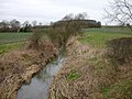
 Creaton - geograph.org.uk - 229811.jpg 640 × 480; 106 KB
-
 Creaton - geograph.org.uk - 324835.jpg 640 × 480; 135 KB
-
 Creaton - geograph.org.uk - 325454.jpg 640 × 480; 128 KB
-
 Creaton - geograph.org.uk - 3437410.jpg 640 × 478; 85 KB
-
 Creaton Cottages - geograph.org.uk - 4731830.jpg 1 600 × 987; 330 KB
-
 Creaton View - geograph.org.uk - 5493170.jpg 2 000 × 1 333; 2,35 MB
-
 Creaton Village - geograph.org.uk - 5493188.jpg 2 000 × 1 333; 2,17 MB
-
 Creaton village green.jpg 2 816 × 2 112; 1 005 KB
-
 Creaton, The Old Bakery - geograph.org.uk - 446675.jpg 640 × 477; 111 KB
-
 Creaton-The Bricklayer's Arms - geograph.org.uk - 1739342.jpg 640 × 480; 62 KB
-
 High Street Creaton - geograph.org.uk - 6199763.jpg 2 034 × 1 526; 1,96 MB
-
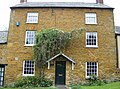
 Highgate House Creaton England.jpg 4 000 × 3 000; 4,64 MB
-
 Houses on Welford Road, Creaton - geograph.org.uk - 6199761.jpg 2 034 × 1 526; 1,76 MB
-
 Looking towards Brixworth - geograph.org.uk - 5493142.jpg 2 000 × 1 333; 3,57 MB
-
 Playing field by Brixworth Road, Creaton - geograph.org.uk - 6199764.jpg 2 034 × 1 526; 1,56 MB
-
 Road to Creaton - geograph.org.uk - 5493161.jpg 2 000 × 1 333; 2,94 MB
-
 Silos at Twigden Barns, Creaton - geograph.org.uk - 1037811.jpg 600 × 414; 235 KB
-
 Teton Road, Creaton - geograph.org.uk - 5370739.jpg 480 × 640; 44 KB
-
 The edge of Creaton - geograph.org.uk - 5493181.jpg 2 000 × 1 333; 2,56 MB
-
 The Road to Creaton - geograph.org.uk - 5493136.jpg 2 000 × 1 333; 3,37 MB
-
 The road to Great Creaton - geograph.org.uk - 5493151.jpg 2 000 × 1 333; 2,7 MB
-
 The Welford Road - geograph.org.uk - 5493201.jpg 2 000 × 1 333; 2,72 MB
-
 Towards Creaton - geograph.org.uk - 5370738.jpg 499 × 640; 53 KB
-
 Cottage in High Street, Creaton - geograph.org.uk - 446676.jpg 640 × 477; 128 KB
-
 Creaton - geograph.org.uk - 232542.jpg 640 × 480; 114 KB
-
 Creaton village green - geograph.org.uk - 446684.jpg 640 × 477; 88 KB
-
 Footpath south west from Creaton - geograph.org.uk - 446692.jpg 640 × 477; 98 KB


