Category:Cropwell Butler
Aller à la navigation
Aller à la recherche

village britannique | |||||
| Téléverser des médias | |||||
| Nature de l’élément | |||||
|---|---|---|---|---|---|
| Lieu | Rushcliffe, Nottinghamshire, Midlands de l'Est, Angleterre | ||||
 | |||||
Sous-catégories
Cette catégorie comprend 2 sous-catégories, dont les 2 ci-dessous.
P
- Plough, Cropwell Butler (3 F)
Média dans la catégorie « Cropwell Butler »
Cette catégorie comprend 236 fichiers, dont les 200 ci-dessous.
(page précédente) (page suivante)-
 A harrowing process - geograph.org.uk - 2589807.jpg 1 280 × 959 ; 370 kio
-
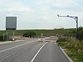
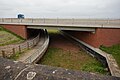 A46 goes over the Grantham Canal - geograph.org.uk - 4966848.jpg 1 600 × 1 065 ; 538 kio
-
 A46 heading north - geograph.org.uk - 1949350.jpg 640 × 480 ; 62 kio
-
 A46 lay-by near Cropwell Grove Farm - geograph.org.uk - 1843970.jpg 640 × 480 ; 81 kio
-
 A46 northbound - geograph.org.uk - 3657422.jpg 640 × 443 ; 49 kio
-
 A46 northbound - geograph.org.uk - 3657538.jpg 640 × 480 ; 41 kio
-
 A46 northbound - geograph.org.uk - 3657561.jpg 640 × 449 ; 50 kio
-
 A46 northbound - geograph.org.uk - 3657568.jpg 640 × 446 ; 51 kio
-
 A46 northbound - geograph.org.uk - 3657576.jpg 640 × 498 ; 48 kio
-
 A46 northbound - geograph.org.uk - 3657584.jpg 640 × 468 ; 49 kio
-
 A52 Approaching Bingham Junction - geograph.org.uk - 4226955.jpg 640 × 480 ; 212 kio
-
 A52 eastbound - geograph.org.uk - 3465001.jpg 2 238 × 1 395 ; 936 kio
-
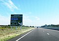
 A52 towards Grantham - geograph.org.uk - 1949381.jpg 640 × 480 ; 47 kio
-
 A52 Westbound - geograph.org.uk - 4226964.jpg 640 × 480 ; 216 kio
-
 Back Lane, Cropwell Butler - geograph.org.uk - 2590718.jpg 1 280 × 959 ; 316 kio
-
 Back Lane, Cropwell Butler - geograph.org.uk - 2590719.jpg 1 280 × 959 ; 495 kio
-
 Back Lane, Cropwell Butler - geograph.org.uk - 2590725.jpg 1 280 × 960 ; 627 kio
-
 Back Lane, Cropwell Butler - geograph.org.uk - 3324602.jpg 4 000 × 3 000 ; 4,73 Mio
-
 Back Lane, Cropwell Butler postbox ref NG12 263 - geograph.org.uk - 2590791.jpg 1 280 × 959 ; 544 kio
-
 Barns at Cropwell Butler - geograph.org.uk - 2590689.jpg 1 280 × 943 ; 389 kio
-
 Beet-en track - geograph.org.uk - 2589858.jpg 1 280 × 959 ; 512 kio
-
 Big Tippers (1) - geograph.org.uk - 1611610.jpg 640 × 451 ; 76 kio
-
 Big Tippers (2) - geograph.org.uk - 1611614.jpg 640 × 394 ; 70 kio
-
 Bus Stop on the A52 - geograph.org.uk - 4226958.jpg 640 × 480 ; 230 kio
-
 Bus stop, The Green, Cropwell Butler - geograph.org.uk - 2590743.jpg 1 280 × 959 ; 473 kio
-
 Bus turning circle, Upper Saxondale - geograph.org.uk - 4294470.jpg 1 024 × 768 ; 172 kio
-
 Butler Close, Cropwell Butler - geograph.org.uk - 2590785.jpg 1 280 × 939 ; 338 kio
-
 Butler Close, Cropwell Butler - geograph.org.uk - 3473063.jpg 1 024 × 768 ; 132 kio
-
 Chapel House, Cropwell Butler - geograph.org.uk - 2589746.jpg 1 280 × 979 ; 403 kio
-
 Cones, water and tippers - geograph.org.uk - 1611613.jpg 640 × 408 ; 88 kio
-
 Cricket field roller - geograph.org.uk - 2589882.jpg 1 280 × 959 ; 555 kio
-
 Crop stripes - geograph.org.uk - 2589845.jpg 1 280 × 959 ; 636 kio
-
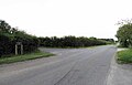
 Cropwell Bishop Road - geograph.org.uk - 3574406.jpg 640 × 480 ; 56 kio
-
 Cropwell Butler - geograph.org.uk - 4966710.jpg 1 600 × 1 065 ; 647 kio
-
 Cropwell Butler civic amenities - geograph.org.uk - 5159169.jpg 600 × 800 ; 155 kio
-
 Cropwell Butler Methodist Chapel - geograph.org.uk - 2590694.jpg 1 280 × 948 ; 347 kio
-
 Cropwell Butler Methodist Chapel - geograph.org.uk - 2590698.jpg 1 280 × 959 ; 261 kio
-
 Cropwell Butler Sewage Pumping Station - geograph.org.uk - 2589753.jpg 1 280 × 959 ; 564 kio
-
 Cropwell Butler village hall - geograph.org.uk - 2589751.jpg 1 280 × 1 002 ; 399 kio
-
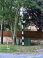
 Cropwell Butler Village Sign - geograph.org.uk - 4966715.jpg 1 600 × 1 065 ; 780 kio
-
 Cropwell Butler village sign - geograph.org.uk - 5609240.jpg 800 × 525 ; 130 kio
-
 Cropwell Butler, Notts. - geograph.org.uk - 3810148.jpg 4 031 × 2 709 ; 2,24 Mio
-
 Cropwell Butler, Notts. - geograph.org.uk - 3810161.jpg 3 677 × 2 382 ; 1,95 Mio
-
 Cropwell Butler, Notts. - geograph.org.uk - 3810190.jpg 3 316 × 2 887 ; 1,55 Mio
-
 Cropwell Butler, Notts. - geograph.org.uk - 3810209.jpg 3 685 × 2 856 ; 2,08 Mio
-
 Cropwell Butler, Notts. - geograph.org.uk - 3810225.jpg 3 279 × 2 211 ; 1,82 Mio
-
 Cropwell Butler, Notts. - geograph.org.uk - 3810236.jpg 3 362 × 2 557 ; 1,55 Mio
-
 Cropwell Butler, Notts. - geograph.org.uk - 3810266.jpg 3 442 × 2 541 ; 1,42 Mio
-
 Cropwell Court Lodges - geograph.org.uk - 2588357.jpg 1 280 × 959 ; 224 kio
-
 Cropwell Grange - geograph.org.uk - 2589785.jpg 1 280 × 959 ; 332 kio
-
 Cropwell Grange - geograph.org.uk - 2589787.jpg 1 280 × 943 ; 342 kio
-
 Cropwell Locks - geograph.org.uk - 4966845.jpg 1 600 × 1 065 ; 745 kio
-
 Cropwell Locks on Grantham Canal - geograph.org.uk - 5276123.jpg 5 376 × 3 024 ; 3,2 Mio
-
 Cropwell Road - geograph.org.uk - 2588372.jpg 1 280 × 959 ; 347 kio
-
 Cropwell Road closure - geograph.org.uk - 2588360.jpg 1 280 × 942 ; 318 kio
-
 Cropwell Road eastwards - geograph.org.uk - 6380450.jpg 640 × 484 ; 78 kio
-
-
 Cropwell Road towards Radcliffe on Trent - geograph.org.uk - 1949354.jpg 640 × 480 ; 65 kio
-
 Cropwell Road westwards - geograph.org.uk - 6380449.jpg 640 × 455 ; 72 kio
-
 Cropwell Top Lock - geograph.org.uk - 3138220.jpg 640 × 427 ; 134 kio
-
 Cropwell Top Lock - geograph.org.uk - 3138255.jpg 640 × 427 ; 127 kio
-
 Cropwell Top Lock - geograph.org.uk - 5158869.jpg 800 × 600 ; 140 kio
-
 Cropwell Top Lock - geograph.org.uk - 5274075.jpg 1 024 × 768 ; 241 kio
-
 Derelict Cropwell Top Lock No 11 - geograph.org.uk - 5598803.jpg 800 × 517 ; 188 kio
-
 Derelict Cropwell Upper Lock No 11 - geograph.org.uk - 6023874.jpg 800 × 570 ; 153 kio
-
 Disused lock, Grantham Canal - geograph.org.uk - 1949347.jpg 640 × 480 ; 101 kio
-
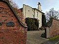
 Dovecote and weather vane at The Court, Cropwell Butler - geograph.org.uk - 2590765.jpg 924 × 1 280 ; 193 kio
-
 Drainage ditch of the road to Tithby - geograph.org.uk - 1902532.jpg 640 × 427 ; 113 kio
-
 Drought cracking - geograph.org.uk - 2589863.jpg 930 × 1 280 ; 625 kio
-
 East end of Henson Lane, south east of Upper Saxondale - geograph.org.uk - 4294578.jpg 1 024 × 768 ; 124 kio
-
 Entering Cropwell Butler on Hardigate Road - geograph.org.uk - 3321378.jpg 2 256 × 1 504 ; 1,37 Mio
-
 Entrance to the Grove, Cropwell Butler - geograph.org.uk - 5271333.jpg 1 024 × 768 ; 208 kio
-
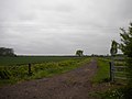
 Farm track - geograph.org.uk - 2589853.jpg 1 280 × 959 ; 507 kio
-
 Farm track near Cropwell Grange - geograph.org.uk - 2589791.jpg 1 280 × 959 ; 416 kio
-
 Farm track near Hoe Hill - geograph.org.uk - 3473027.jpg 1 024 × 768 ; 113 kio
-
 Farmland off the Tithby road - geograph.org.uk - 1902243.jpg 640 × 427 ; 68 kio
-
 Field edge path north east of Cropwell Bishop - geograph.org.uk - 3473143.jpg 1 024 × 768 ; 153 kio
-
 Field edge, Cropwell Butler - geograph.org.uk - 2590776.jpg 1 280 × 959 ; 333 kio
-
 Field footpath near Cropwell Butler - geograph.org.uk - 2589800.jpg 1 280 × 954 ; 440 kio
-
 Field path near Tithby - geograph.org.uk - 5159161.jpg 800 × 600 ; 81 kio
-
 Fields Farm - geograph.org.uk - 1614840.jpg 640 × 479 ; 102 kio
-
 Fields Farm sign - geograph.org.uk - 6380559.jpg 640 × 517 ; 111 kio
-
 Fingerpost, The Green, Cropwell Butler - geograph.org.uk - 2590749.jpg 944 × 1 280 ; 626 kio
-
 Footbridge No 19 - geograph.org.uk - 5609295.jpg 800 × 507 ; 132 kio
-
 Footpath closed - geograph.org.uk - 2588735.jpg 1 280 × 959 ; 409 kio
-
 Footpath fourways - geograph.org.uk - 2589756.jpg 1 280 × 959 ; 734 kio
-
 Footpath near Cropwell Butler - geograph.org.uk - 2589759.jpg 959 × 1 280 ; 634 kio
-
 Footpath near Cropwell Butler - geograph.org.uk - 2589760.jpg 1 280 × 959 ; 499 kio
-
 Footpath near Cropwell Butler - geograph.org.uk - 2590780.jpg 1 280 × 959 ; 457 kio
-
 Footpath north of Cropwell Bishop - geograph.org.uk - 3846928.jpg 640 × 427 ; 74 kio
-
 Footpath off Cropwell Bishop Road - geograph.org.uk - 3574400.jpg 640 × 480 ; 68 kio
-
 Footpath through crop field - geograph.org.uk - 3574412.jpg 640 × 480 ; 62 kio
-
 Footpath to Butler Close - geograph.org.uk - 6406869.jpg 1 024 × 768 ; 208 kio
-
 Footpath to Foss Bridge - geograph.org.uk - 3846932.jpg 640 × 427 ; 70 kio
-
 Foss Bridge - geograph.org.uk - 3138285.jpg 640 × 427 ; 116 kio
-
 Foss Bridge - geograph.org.uk - 5271342.jpg 1 024 × 768 ; 234 kio
-
 Foss Bridge on the Grantham Canal - geograph.org.uk - 5158860.jpg 800 × 600 ; 105 kio
-
 Foss Bridge over Grantham Canal - geograph.org.uk - 3473013.jpg 1 024 × 768 ; 127 kio
-
 Fosse Bridge No 18 - geograph.org.uk - 6023876.jpg 800 × 541 ; 140 kio
-
 Fosse swing bridge - geograph.org.uk - 3138354.jpg 640 × 427 ; 155 kio
-
 Fosse Way - geograph.org.uk - 3548101.jpg 640 × 427 ; 77 kio
-
 Gate near Cropwell Butler - geograph.org.uk - 5276003.jpg 5 376 × 3 024 ; 7,21 Mio
-
 Going for a swim^ - geograph.org.uk - 1611612.jpg 640 × 457 ; 88 kio
-
 Grantham Canal mile marker (geograph 6023872).jpg 800 × 739 ; 292 kio
-
 Grantham Canal, Berry Hill Vicinity, Cropwell Butler, Notts. - geograph.org.uk - 3810300.jpg 3 949 × 2 778 ; 2,16 Mio
-
 Grass field and Cropwell Grange (geograph 7355548).jpg 1 024 × 768 ; 181 kio
-
 Grazing south of Cropwell Butler - geograph.org.uk - 3574403.jpg 640 × 480 ; 53 kio
-
 Hardigate Road, Cropwell Butler - geograph.org.uk - 2590751.jpg 1 280 × 947 ; 448 kio
-
 Hedgerow alongside Cropwell Lane - geograph.org.uk - 2588368.jpg 1 280 × 959 ; 351 kio
-
 Henson Lane (new) - geograph.org.uk - 1614843.jpg 640 × 479 ; 99 kio
-
 Henson Lane - geograph.org.uk - 1614838.jpg 640 × 479 ; 83 kio
-
 Henson Lane - geograph.org.uk - 1615721.jpg 640 × 479 ; 94 kio
-
 Henson Lane, Saxondale - geograph.org.uk - 1611611.jpg 640 × 479 ; 67 kio
-
 Henson Lane, Upper Saxondale - geograph.org.uk - 4294484.jpg 1 024 × 768 ; 153 kio
-
 High Thorpe - geograph.org.uk - 2588218.jpg 1 280 × 959 ; 296 kio
-
 High Thorpe, south east of Upper Saxondale - geograph.org.uk - 4294552.jpg 1 024 × 768 ; 155 kio
-
 Highland Cattle near Cropwell Butler - geograph.org.uk - 3321501.jpg 1 540 × 938 ; 1 003 kio
-
 House next to Meadow Lane - geograph.org.uk - 3846955.jpg 640 × 427 ; 125 kio
-
 House with a strange chimney - geograph.org.uk - 3846938.jpg 640 × 427 ; 44 kio
-
 Housing on Henson Lane, Upper Saxondale - geograph.org.uk - 4294485.jpg 1 024 × 768 ; 131 kio
-

-
 Landscape restoration on the new A46 - geograph.org.uk - 2588211.jpg 1 280 × 959 ; 261 kio
-
 Lane to Cropwell Lings Farm - geograph.org.uk - 1614839.jpg 640 × 479 ; 106 kio
-
 Lane, Saxondale - geograph.org.uk - 1949379.jpg 640 × 480 ; 71 kio
-
 Lings Cottage - geograph.org.uk - 1614845.jpg 640 × 479 ; 116 kio
-
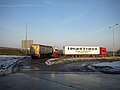 Lorries parked on old A52, Saxondale - geograph.org.uk - 4294664.jpg 1 024 × 768 ; 108 kio
-
 Main Street, Cropwell Butler - geograph.org.uk - 2589748.jpg 1 280 × 868 ; 348 kio
-
 Main Street, Cropwell Butler - geograph.org.uk - 2590711.jpg 1 280 × 959 ; 346 kio
-
 Main Street, Cropwell Butler - geograph.org.uk - 3574409.jpg 640 × 480 ; 80 kio
-
 Main Street, Cropwell Butler postbox ref NG12 30 - geograph.org.uk - 2590767.jpg 1 280 × 950 ; 452 kio
-
 Meadow Lane - geograph.org.uk - 1902443.jpg 427 × 640 ; 134 kio
-
 Meadow Lane - geograph.org.uk - 1902484.jpg 640 × 427 ; 105 kio
-
 Meadow Lane - geograph.org.uk - 3846953.jpg 640 × 427 ; 91 kio
-
 Meadow Lane - geograph.org.uk - 5159164.jpg 800 × 600 ; 120 kio
-
 New A46 from Henson Lane bridge - geograph.org.uk - 4294544.jpg 1 024 × 768 ; 122 kio
-
 New Barn Farm - geograph.org.uk - 2588367.jpg 1 280 × 959 ; 326 kio
-
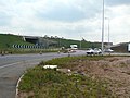 New Saxondale Roundabout - geograph.org.uk - 2588745.jpg 1 280 × 959 ; 258 kio
-
 New Saxondale Roundabout - geograph.org.uk - 2588746.jpg 1 280 × 959 ; 213 kio
-
 New Saxondale Roundabout - geograph.org.uk - 2588751.jpg 1 280 × 959 ; 238 kio
-
 New Saxondale Roundabout - geograph.org.uk - 2588753.jpg 1 280 × 959 ; 188 kio
-
 New Saxondale Roundabout - geograph.org.uk - 2588756.jpg 1 280 × 959 ; 262 kio
-
 New Saxondale Roundabout - geograph.org.uk - 2588761.jpg 1 280 × 959 ; 247 kio
-
 New Saxondale Roundabout - geograph.org.uk - 2588764.jpg 1 280 × 959 ; 249 kio
-
 New Saxondale Roundabout - geograph.org.uk - 2588766.jpg 1 280 × 959 ; 225 kio
-
 New Saxondale Roundabout - geograph.org.uk - 2588771.jpg 1 280 × 613 ; 122 kio
-
 Old A52 at Saxondale - geograph.org.uk - 2588734.jpg 1 280 × 959 ; 225 kio
-
 Old Fosse Way - geograph.org.uk - 2588781.jpg 1 280 × 959 ; 275 kio
-
 Old Saxondale Roundabout - geograph.org.uk - 2588774.jpg 1 280 × 959 ; 312 kio
-
 Paddocks near The Rookery - geograph.org.uk - 2590692.jpg 1 280 × 959 ; 443 kio
-
 Parkland near Cropwell Butler - geograph.org.uk - 2589780.jpg 1 280 × 959 ; 367 kio
-
 Path along the derelict Grantham Canal - geograph.org.uk - 5609322.jpg 800 × 561 ; 138 kio
-
 Path by a drainage ditch - geograph.org.uk - 5276005.jpg 5 376 × 3 024 ; 2,72 Mio
-
 Permissive footpath - geograph.org.uk - 2589792.jpg 1 280 × 945 ; 552 kio
-
 Permissive footpath - geograph.org.uk - 2589856.jpg 1 280 × 959 ; 727 kio
-
 Permissive footpath notice - geograph.org.uk - 2589796.jpg 959 × 1 280 ; 277 kio
-
 Phantom footpath - geograph.org.uk - 2589848.jpg 1 280 × 959 ; 547 kio
-
 Pick a Pallet - geograph.org.uk - 1615715.jpg 640 × 479 ; 104 kio
-
 Ploughed field between the Fosse Way and the A46 - geograph.org.uk - 5274085.jpg 1 024 × 768 ; 208 kio
-
 Ponds, Berry Hill Vicinity, Cropwell Butler, Notts. - geograph.org.uk - 3810277.jpg 3 584 × 2 126 ; 1,48 Mio
-
 Portal frame stile - geograph.org.uk - 2590688.jpg 1 280 × 959 ; 424 kio
-
 Postbox number NG12 59 - geograph.org.uk - 6380560.jpg 640 × 519 ; 121 kio
-
 Power lines cross Meadow Lane - geograph.org.uk - 1902411.jpg 427 × 640 ; 96 kio
-
 Pump and bus shelter at Cropwell Butler - geograph.org.uk - 5275990.jpg 3 072 × 1 728 ; 1,56 Mio
-
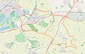 Radcliffe on Trent and Cropwell Butler parishes.jpg 1 765 × 1 125 ; 179 kio
-
 Radcliffe Road - geograph.org.uk - 1611605.jpg 640 × 479 ; 126 kio
-
 Radcliffe Road - geograph.org.uk - 1611606.jpg 640 × 479 ; 132 kio
-
 Radcliffe Road goes under the A46 - geograph.org.uk - 4966844.jpg 1 600 × 1 057 ; 591 kio
-
 Radcliffe Road near Barnsfield Farm - geograph.org.uk - 5609251.jpg 800 × 498 ; 107 kio
-
 Redundant equipment - geograph.org.uk - 2588738.jpg 1 280 × 959 ; 215 kio
-
 Road no longer - geograph.org.uk - 5131851.jpg 1 024 × 768 ; 191 kio
-
 Road to Cropwell Lings - geograph.org.uk - 3321372.jpg 2 031 × 1 316 ; 1,61 Mio
-
 Roadway to Upper Brackendale Farm - geograph.org.uk - 5271327.jpg 1 024 × 768 ; 166 kio
-
 Rookery Farm - geograph.org.uk - 2590702.jpg 1 280 × 959 ; 362 kio
-
 Saxondale access - geograph.org.uk - 2588783.jpg 1 280 × 948 ; 255 kio
-
 Saxondale Filling Station - geograph.org.uk - 2588778.jpg 1 280 × 953 ; 287 kio
-
 Sheldon Field - geograph.org.uk - 2589754.jpg 1 280 × 959 ; 327 kio
-
 Sheldon Field pavilion - geograph.org.uk - 2590685.jpg 1 280 × 959 ; 268 kio
-
 Site of former Fosse Swing Bridge on Grantham Canal - geograph.org.uk - 5276115.jpg 5 376 × 3 024 ; 3,38 Mio
-
 Site of the former Fosse swing bridge - geograph.org.uk - 5609315.jpg 800 × 478 ; 125 kio
-
 Site of the former Fosse Swing Bridge No 19 - geograph.org.uk - 6023871.jpg 800 × 441 ; 183 kio
-
 Stile and Footpath off Tithby Road - geograph.org.uk - 3321513.jpg 1 504 × 2 256 ; 1,15 Mio
-
 The A46 crossing Radcliffe Road - geograph.org.uk - 5274083.jpg 1 024 × 768 ; 198 kio
-
 The Court, Cropwell Butler - geograph.org.uk - 2590729.jpg 959 × 1 280 ; 294 kio
-
 The Court, Cropwell Butler - geograph.org.uk - 2590760.jpg 1 280 × 947 ; 334 kio
-
 The Court, Including Stable Wing And Dovecote, Back Lane, Cropwell Butler (1).jpg 3 784 × 3 037 ; 2,24 Mio
-
 The Court, Including Stable Wing And Dovecote, Back Lane, Cropwell Butler (2).jpg 3 857 × 3 035 ; 2,24 Mio
-
 The Court, Including Stable Wing And Dovecote, Back Lane, Cropwell Butler (3).jpg 4 048 × 3 036 ; 2,92 Mio
-
 The Court, Including Stable Wing And Dovecote, Back Lane, Cropwell Butler (4).jpg 4 048 × 3 036 ; 3,38 Mio
-
 The Court, Including Stable Wing And Dovecote, Back Lane, Cropwell Butler (5).jpg 4 048 × 3 036 ; 2,81 Mio
-
 The Court, Including Stable Wing And Dovecote, Back Lane, Cropwell Butler (6).jpg 3 694 × 3 037 ; 1,9 Mio
-
 The Court, Including Stable Wing And Dovecote, Back Lane, Cropwell Butler (7).jpg 4 048 × 3 036 ; 2,6 Mio
-
 The derelict and overgrown Grantham Canal - geograph.org.uk - 6023689.jpg 800 × 651 ; 202 kio
-
 The Green, Cropwell Butler - geograph.org.uk - 2590754.jpg 1 280 × 959 ; 573 kio
-
 The Grove - geograph.org.uk - 1611608.jpg 640 × 479 ; 204 kio
-
 The Grove near Cropwell Butler - geograph.org.uk - 5609256.jpg 800 × 534 ; 188 kio
-
 The Limes Farm - geograph.org.uk - 1949349.jpg 640 × 480 ; 82 kio
-
 The Limes Farm - geograph.org.uk - 6023691.jpg 800 × 599 ; 130 kio
-
 The new A46 - geograph.org.uk - 2588198.jpg 1 280 × 959 ; 245 kio
-
 The new A46 - geograph.org.uk - 2588206.jpg 1 280 × 959 ; 272 kio
-
 The new Henson Lane - geograph.org.uk - 2588186.jpg 1 280 × 944 ; 304 kio


_-_geograph.org.uk_-_1611610.jpg)
_-_geograph.org.uk_-_1611614.jpg)


.jpg)

.jpg)


_-_geograph.org.uk_-_1614843.jpg)


.jpg)
.jpg)
.jpg)
.jpg)
.jpg)
.jpg)
.jpg)


