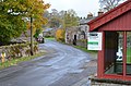
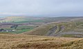
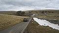
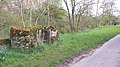
Category:Crosby Garrett
Zur Navigation springen
Zur Suche springen
Gemeinde in der englischen Grafschaft Cumbria  | |||||
| Medium hochladen | |||||
| Ist ein(e) | |||||
|---|---|---|---|---|---|
| Ort | Eden, Cumbria, North West England, England | ||||
 | |||||
Unterkategorien
Es werden 9 von insgesamt 9 Unterkategorien in dieser Kategorie angezeigt:
In Klammern die Anzahl der enthaltenen Kategorien (K), Seiten (S), Dateien (D)
A
C
- Crosby Garrett United Church (2 D)
F
- Far Leases Lane Ford (4 D)
H
- Crosby Garrett Helmet (6 D)
O
R
S
- Smardale Ford (7 D)
- Smardale Gill Viaduct (15 D)
V
- Crosby Garrett viaduct (7 D)
Medien in der Kategorie „Crosby Garrett“
Folgende 200 Dateien sind in dieser Kategorie, von 264 insgesamt.
(vorherige Seite) (nächste Seite)-
 'Sheep may safely graze...' - geograph.org.uk - 3801374.jpg 3.264 × 2.448; 1,53 MB
-
 A heron - geograph.org.uk - 1983543.jpg 2.493 × 1.741; 2,58 MB
-

-
 Barn - geograph.org.uk - 237949.jpg 640 × 480; 208 KB
-
 Barn at Crosby Garrett - geograph.org.uk - 1840643.jpg 2.448 × 3.264; 2,5 MB
-
 Barn conversion in Crosby Garrett - geograph.org.uk - 2180220.jpg 1.024 × 768; 145 KB
-
 Barn near Water Houses - geograph.org.uk - 509686.jpg 640 × 428; 137 KB
-
 Barn seen across Scandal Beck - geograph.org.uk - 1982217.jpg 3.872 × 2.494; 4,87 MB
-
 Barn ^ Farmhouse in Crosby Garret - geograph.org.uk - 1848120.jpg 3.280 × 1.795; 1,49 MB
-
 Barn, Old Rectory, Crosby Garrett.jpg 1.024 × 768; 221 KB
-
 Begin Hill Stile - geograph.org.uk - 208053.jpg 640 × 426; 142 KB
-
 Bents Farm bunkhouse barn - geograph.org.uk - 6349213.jpg 2.592 × 1.944; 1,49 MB
-
 BF Farrant - panoramio.jpg 1.728 × 3.072; 2,53 MB
-
 Brick pillars above Gallansay - geograph.org.uk - 2035139.jpg 640 × 480; 61 KB
-
 Bridge for footpath over dismantled railway - geograph.org.uk - 4188381.jpg 1.024 × 683; 186 KB
-
 Bridge over dismantled railway - geograph.org.uk - 2027971.jpg 640 × 480; 86 KB
-
 Bridge over dismantled railway, Smardale - geograph.org.uk - 1248081.jpg 640 × 480; 190 KB
-
 Bridleway above Crosby Garrett - geograph.org.uk - 5596228.jpg 720 × 540; 77 KB
-
 Bridleway on Crosby Garrett Fell - geograph.org.uk - 1841132.jpg 2.592 × 1.944; 1,61 MB
-
 Bridleway, Great Ewe Fell - geograph.org.uk - 2035091.jpg 640 × 480; 62 KB
-
 Burnt down hut at Sunbiggin Tarn - geograph.org.uk - 2734905.jpg 640 × 480; 66 KB
-
 Cairn on Great Ewe Fell - geograph.org.uk - 5595224.jpg 800 × 600; 131 KB
-
 Cairn on Little Ewe Fell - geograph.org.uk - 5595507.jpg 720 × 540; 152 KB
-

-
 Cattle grid - geograph.org.uk - 1278776.jpg 640 × 480; 46 KB
-
 Church Hill, Crosby Garrett - geograph.org.uk - 4220984.jpg 1.024 × 678; 241 KB
-
 Clouds on the Howgill Fells - geograph.org.uk - 4220509.jpg 1.024 × 678; 96 KB
-
 Coast to Coast route, Crosby Garrett Fell - geograph.org.uk - 4220453.jpg 1.024 × 678; 225 KB
-
 Craigmoor Milk stand - panoramio.jpg 3.072 × 1.728; 2,46 MB
-
 Croft Farm - panoramio.jpg 3.072 × 1.728; 2,43 MB
-
 Croft Farmhouse, Crosby Garrett.jpg 3.238 × 1.742; 1,25 MB
-
 Crosby Garrett - geograph.org.uk - 1839919.jpg 3.264 × 2.448; 2,37 MB
-
 Crosby Garrett - geograph.org.uk - 1971106.jpg 640 × 480; 75 KB
-
 Crosby Garrett - geograph.org.uk - 3010971.jpg 3.008 × 2.000; 944 KB
-
 Crosby Garrett - geograph.org.uk - 3816400.jpg 640 × 408; 56 KB
-
 Crosby Garrett - geograph.org.uk - 4137058.jpg 1.600 × 899; 375 KB
-
 Crosby Garrett - geograph.org.uk - 5485502.jpg 1.024 × 683; 302 KB
-
 Crosby Garrett and viaduct - geograph.org.uk - 6367077.jpg 2.592 × 1.944; 1,37 MB
-
 Crosby Garrett Fell - geograph.org.uk - 1744684.jpg 2.848 × 2.136; 1,46 MB
-
 Crosby Garrett Fell - geograph.org.uk - 2035106.jpg 640 × 480; 70 KB
-
 Crosby Garrett from church - panoramio.jpg 3.072 × 1.728; 2,57 MB
-
 Crosby Garrett from the railway - geograph.org.uk - 3941336.jpg 1.024 × 615; 120 KB
-
 Crosby Garrett from the railway bridge - geograph.org.uk - 5181697.jpg 1.600 × 1.200; 692 KB
-
 Crosby Garrett to church - panoramio.jpg 3.072 × 1.728; 1,74 MB
-

-
 Crosby Garrett viaduct (2) - geograph.org.uk - 4220893.jpg 1.024 × 678; 259 KB
-
 Crosby Garrett viaduct (3) - geograph.org.uk - 4220895.jpg 589 × 1.024; 244 KB
-
 Crosby Garrett viaduct - geograph.org.uk - 4220891.jpg 1.024 × 674; 141 KB
-
 Crosby Garrett View - geograph.org.uk - 5712254.jpg 640 × 422; 92 KB
-
 Crosby Garrett village green - geograph.org.uk - 4640859.jpg 640 × 480; 430 KB
-
 Crosby Garrett Village Hall - panoramio.jpg 3.072 × 1.728; 1,78 MB
-
 Crosby Garrett, view from the viaduct - geograph.org.uk - 5441425.jpg 640 × 427; 277 KB
-
 Crossing Crosby Garrett Fell - geograph.org.uk - 4220566.jpg 1.024 × 678; 147 KB
-
 Crossing Scandal Beck - geograph.org.uk - 5713942.jpg 640 × 457; 92 KB
-
 Crossing the viaduct - geograph.org.uk - 1840537.jpg 3.264 × 2.448; 2,09 MB
-
 Decrepit barn at Fell Head - geograph.org.uk - 2734468.jpg 800 × 487; 76 KB
-
 Derelict cottages, Smardale - geograph.org.uk - 1840461.jpg 3.264 × 2.448; 2,21 MB
-

-
 Descending to Crosby Garrett - geograph.org.uk - 4220888.jpg 1.024 × 678; 145 KB
-
 Destroyed barn, Potts Valley - geograph.org.uk - 3454674.jpg 689 × 480; 120 KB
-
 Detail of Smardale Lime Kiln - geograph.org.uk - 4221293.jpg 1.024 × 782; 206 KB
-
 Detail of Smardale lime kiln - geograph.org.uk - 6156360.jpg 4.320 × 3.240; 4,21 MB
-

-
 Drystone wall climbing Sandy Bank - geograph.org.uk - 3878102.jpg 1.024 × 768; 147 KB
-
 Drystone wall on Begin Hill - geograph.org.uk - 5758548.jpg 1.024 × 768; 207 KB
-
 Dusk at Sunbiggin Tarn - geograph.org.uk - 2734476.jpg 800 × 555; 84 KB
-
 Farm track to Gallansay Lane - geograph.org.uk - 3941309.jpg 1.024 × 768; 169 KB
-
 Farmland south of Keldbank Brow - geograph.org.uk - 3879809.jpg 1.024 × 768; 113 KB
-
 Farmland, Mazon Wath - geograph.org.uk - 3411473.jpg 640 × 360; 190 KB
-
 Farmyard, Crosby Garrett - geograph.org.uk - 3941326.jpg 1.024 × 768; 158 KB
-
 Fell Head - geograph.org.uk - 1278783.jpg 640 × 480; 48 KB
-
 Fell Head - geograph.org.uk - 2734473.jpg 640 × 480; 66 KB
-
 Fell Head - geograph.org.uk - 3411477.jpg 640 × 360; 202 KB
-
 Fell Head Farm - geograph.org.uk - 1236347.jpg 640 × 480; 75 KB
-
 Field barn by Scandal Beck - geograph.org.uk - 3941344.jpg 1.024 × 768; 120 KB
-
 Fields near Crosby Garrett - geograph.org.uk - 1969326.jpg 640 × 480; 63 KB
-
 Footbridge near Smardale Mill - geograph.org.uk - 1969336.jpg 640 × 480; 146 KB
-
 Footbridge over beck - panoramio.jpg 3.072 × 1.728; 2,25 MB
-
 Footbridge over Scandal Beck - geograph.org.uk - 1839926.jpg 3.264 × 2.448; 2,9 MB
-
 Footbridge over Scandal Beck - geograph.org.uk - 1982145.jpg 3.872 × 2.592; 7,1 MB
-
 Footbridge over Severals Gill - geograph.org.uk - 1840446.jpg 2.448 × 3.264; 2,59 MB
-
 Footbridge, Scandal Beck - geograph.org.uk - 4221015.jpg 1.024 × 678; 306 KB
-
 Footpath to Newbiggin-on-Lune - geograph.org.uk - 3517412.jpg 640 × 425; 297 KB
-
 Footpath to Potts - geograph.org.uk - 1842549.jpg 3.264 × 2.448; 1,86 MB
-
 Footpath to tarn lane - geograph.org.uk - 3517469.jpg 640 × 425; 450 KB
-
 Ford at Crosby Garrett - geograph.org.uk - 3893819.jpg 3.872 × 2.592; 4,43 MB
-
 Ford in North West part of Crosby Garrett - panoramio.jpg 3.072 × 1.728; 2,27 MB
-
 Ford near Smardale Mill - geograph.org.uk - 5652686.jpg 1.600 × 900; 460 KB
-
 Former railway cottages - geograph.org.uk - 2342000.jpg 1.024 × 768; 173 KB
-
 Former railway cottages - geograph.org.uk - 2342026.jpg 1.024 × 768; 171 KB
-
 Former railway line, near Severals Gill - geograph.org.uk - 3878093.jpg 1.024 × 768; 203 KB
-
 From Smardalegill Viaduct - geograph.org.uk - 4221287.jpg 1.024 × 678; 207 KB
-
 Gallansay - geograph.org.uk - 1635627.jpg 480 × 640; 87 KB
-
 Gate, Smardalegill Viaduct - geograph.org.uk - 4221290.jpg 1.024 × 678; 216 KB
-
 Goodles, Potts Valley - geograph.org.uk - 2035124.jpg 640 × 480; 85 KB
-
 Goods train, Smardale Viaduct - geograph.org.uk - 4221025.jpg 1.024 × 678; 117 KB
-
 Grazers at Fell Head - geograph.org.uk - 5855628.jpg 1.600 × 1.067; 462 KB
-
 Grazing near Scandal Beck - geograph.org.uk - 3820652.jpg 640 × 425; 54 KB
-
 Greystones - geograph.org.uk - 1744671.jpg 2.848 × 2.136; 1,51 MB
-
 High road over Ravenstonedale Moor - geograph.org.uk - 5855625.jpg 1.600 × 1.067; 366 KB
-
 Highland cattle in Thorn Gill - geograph.org.uk - 5596222.jpg 540 × 720; 257 KB
-
 Hole Four, Crosby Garrett golf course - geograph.org.uk - 4220890.jpg 1.024 × 678; 268 KB
-
 House on the edge of Crosby Garrett - geograph.org.uk - 5181253.jpg 1.600 × 1.200; 717 KB
-
 Houses alongside the beck, Crosby Garrett - geograph.org.uk - 3941332.jpg 1.024 × 768; 146 KB
-
 IHE house, Crosby Garrett - panoramio.jpg 3.072 × 1.728; 2,03 MB
-
 Impromptu lake... - geograph.org.uk - 3770291.jpg 3.264 × 2.448; 1,83 MB
-
 In Crosby Garrett - geograph.org.uk - 4220974.jpg 1.024 × 678; 223 KB
-
 Intake with stone barn - geograph.org.uk - 1844683.jpg 3.264 × 2.448; 1,47 MB
-
 ITET house, Crosby Garrett - panoramio.jpg 1.728 × 3.072; 2,32 MB
-
 Ladle Lane - geograph.org.uk - 1842539.jpg 3.264 × 2.448; 2,86 MB
-
 Lime kiln by the limestone quarry - geograph.org.uk - 2341995.jpg 1.024 × 768; 183 KB
-
 Lime kiln south of Crosby Garrett - geograph.org.uk - 4368090.jpg 1.500 × 1.045; 1,78 MB
-
 Lime kilns and quarry, Smardale - geograph.org.uk - 1294058.jpg 640 × 414; 208 KB
-
 Lime Kilns Crosby Garrett - panoramio.jpg 3.072 × 1.728; 2,63 MB
-
 Limekilns, Smardale.jpg 1.024 × 683; 214 KB
-

-
 Limestone quarry and kiln - geograph.org.uk - 2342035.jpg 1.024 × 768; 167 KB
-
 Limestone scar near Mazon Wath - geograph.org.uk - 4220557.jpg 1.024 × 618; 110 KB
-
 Limestone shelf - geograph.org.uk - 1984850.jpg 3.872 × 2.499; 3,54 MB
-
 Line of an old railway - geograph.org.uk - 5758549.jpg 1.024 × 768; 293 KB
-
 Lone walker above Scandal Beck - geograph.org.uk - 3879792.jpg 1.024 × 768; 173 KB
-
 Lower Smardale and the Smardale Viaduct - geograph.org.uk - 1982229.jpg 3.872 × 2.494; 3,75 MB
-
 Mains Farm, Crosby Garrett.jpg 640 × 488; 118 KB
-

-
 Moorland road, Fell Head - geograph.org.uk - 3411470.jpg 640 × 360; 197 KB
-
 Moorland, Mask Hill - geograph.org.uk - 3411481.jpg 640 × 360; 229 KB
-

-
 Nameless pond on Begin Hill - geograph.org.uk - 1744636.jpg 2.848 × 2.136; 1,59 MB
-
 Nettle Hill - geograph.org.uk - 3344419.jpg 2.592 × 1.944; 1,74 MB
-
 Nettle Hill summit, 382m - geograph.org.uk - 5595513.jpg 800 × 600; 128 KB
-
 Nettle Hill Trig (Crosby Garret Fell).JPG 2.032 × 1.524; 928 KB
-
 Nettle Hill trig point in snow - geograph.org.uk - 6346789.jpg 2.592 × 1.944; 1,05 MB
-
 Newclose Lane - geograph.org.uk - 1106089.jpg 640 × 480; 83 KB
-
 Newclose Lane - geograph.org.uk - 1842561.jpg 3.264 × 2.448; 1,85 MB
-
 Newclose Lane - geograph.org.uk - 2162683.jpg 640 × 480; 38 KB
-
 Old Lime Kiln above Crosby Garrett - geograph.org.uk - 3517441.jpg 640 × 425; 290 KB
-
 Old limekilns, Smardale - geograph.org.uk - 1840484.jpg 3.264 × 2.448; 2,26 MB
-
 Old quarry house, Smardale - geograph.org.uk - 1406754.jpg 640 × 480; 91 KB
-
 Old School Toilet Block, Crosby Garrett - panoramio.jpg 3.072 × 1.728; 1,98 MB
-
 On Crosby Garrett Fell - geograph.org.uk - 1278845.jpg 640 × 480; 54 KB
-
 On Nettle Hill - geograph.org.uk - 2035115.jpg 640 × 480; 73 KB
-
 Passenger train, Smardale Viaduct - geograph.org.uk - 4221011.jpg 1.024 × 719; 171 KB
-
 Path on Nettle Hill - geograph.org.uk - 4220538.jpg 1.024 × 678; 162 KB
-
 Path through Potts Valley - geograph.org.uk - 1844670.jpg 3.264 × 2.448; 1,98 MB
-
 Path to Crosby Garrett - geograph.org.uk - 1840615.jpg 2.448 × 3.264; 2,98 MB
-
 Pausing for a break on Smardale Bridge - geograph.org.uk - 2593598.jpg 720 × 960; 250 KB
-
 Pile of stones atop Great Ewe Fell - geograph.org.uk - 1744711.jpg 2.848 × 2.136; 1,62 MB
-
 Pinfold Crosby Garrett - panoramio.jpg 3.072 × 1.728; 2,67 MB
-
 Plodding through Potts Valley - geograph.org.uk - 1844674.jpg 3.264 × 2.448; 1,9 MB
-

-
 Potts - geograph.org.uk - 1106163.jpg 640 × 480; 97 KB
-
 Potts Valley - geograph.org.uk - 1844665.jpg 3.264 × 2.448; 2,34 MB
-
 Potts Valley - geograph.org.uk - 2035121.jpg 640 × 480; 61 KB
-
 Potts Valley - geograph.org.uk - 6346780.jpg 2.592 × 1.944; 1,06 MB
-
 Pylons on Crosby Garrett Fell - geograph.org.uk - 1744657.jpg 2.848 × 2.136; 1,47 MB
-
 Railway bridge, Gallansay - geograph.org.uk - 1969366.jpg 640 × 480; 98 KB
-
 Re-built bridge over Severals Gill - geograph.org.uk - 3878095.jpg 1.024 × 768; 181 KB
-
 Road, Mask Hill - geograph.org.uk - 3411485.jpg 640 × 360; 213 KB
-
 Rock outcrop above Scandal Beck (2) - geograph.org.uk - 1406761.jpg 640 × 480; 162 KB
-
 Rock outcrop above Scandal Beck - geograph.org.uk - 1406686.jpg 640 × 480; 132 KB
-
 Rocky outcrop, western edge, Smardale Fell - geograph.org.uk - 3879797.jpg 1.024 × 768; 164 KB
-
 Ruin by Potts Beck - geograph.org.uk - 1106121.jpg 640 × 480; 113 KB
-
 Sandstone outcrops at Bents Farm - geograph.org.uk - 5758547.jpg 1.024 × 768; 240 KB
-
 Scandal Beck - geograph.org.uk - 1406743.jpg 640 × 480; 216 KB
-
 Scandal Beck - geograph.org.uk - 2035156.jpg 640 × 480; 133 KB
-
 Scandal Beck - geograph.org.uk - 614526.jpg 640 × 480; 120 KB
-
 Scandal Beck and Smardale Bridge - geograph.org.uk - 2597589.jpg 960 × 622; 155 KB
-

-

-
 School House, Crosby Garrett - panoramio.jpg 3.072 × 1.728; 1,74 MB
-
 Settle - Carlisle line at Crosby Garrett - geograph.org.uk - 1840650.jpg 2.448 × 3.264; 2,24 MB
-
 Settle and Carlisle Railway Line - geograph.org.uk - 596223.jpg 640 × 625; 106 KB
-
 Settle to Carlisle line near Gallansay - geograph.org.uk - 3220894.jpg 1.200 × 803; 350 KB
-
 Settle-Carlisle Railway from Smardale Fell - geograph.org.uk - 5083503.jpg 767 × 1.024; 209 KB
-
 Sheep at Severals - geograph.org.uk - 3878097.jpg 925 × 694; 115 KB
-
 Sheep grazing at Severals - geograph.org.uk - 5596230.jpg 720 × 540; 65 KB
-
 Sheep grazing north-west of Smardale Bridge - geograph.org.uk - 3879781.jpg 1.024 × 768; 157 KB
-
 Site of a Romano-British settlement - geograph.org.uk - 1984816.jpg 3.872 × 2.480; 3,64 MB
-
 Slopes of Nettle Hill - geograph.org.uk - 1106111.jpg 640 × 480; 65 KB
-
 Small pond at Social Howe - geograph.org.uk - 1744700.jpg 2.848 × 2.136; 1,6 MB
-
 Smardale - geograph.org.uk - 1983550.jpg 3.872 × 2.494; 3,92 MB
-
 Smardale Beck - geograph.org.uk - 2035185.jpg 480 × 640; 94 KB
-
 Smardale Bridge - geograph.org.uk - 4221297.jpg 1.024 × 678; 154 KB
-
 Smardale Bridge - geograph.org.uk - 5758553.jpg 1.024 × 768; 258 KB
-
 Smardale Bridge interpreted - geograph.org.uk - 3879787.jpg 1.024 × 768; 135 KB
-
 Smardale Bridge over Scandal Beck - geograph.org.uk - 2027963.jpg 640 × 480; 122 KB
-
 Smardale from the quarry - geograph.org.uk - 6156369.jpg 3.240 × 4.320; 2,46 MB
-
 Smardale from the viaduct - geograph.org.uk - 1840497.jpg 2.448 × 3.264; 1,73 MB
-
 Smardale Gill from Smardalegill Viaduct - geograph.org.uk - 1983521.jpg 3.727 × 2.503; 4,18 MB
-
 Smardale Gill upstream of the viaduct - geograph.org.uk - 2341984.jpg 1.024 × 768; 171 KB
-
 Smardale Gill Viaduct - geograph.org.uk - 4033961.jpg 3.264 × 2.448; 3,68 MB
-
 Smardale Gill viaduct. - geograph.org.uk - 5405482.jpg 640 × 427; 94 KB
-
 Smardale lime kilns - geograph.org.uk - 6362551.jpg 1.944 × 2.592; 1,42 MB
-
 Smardale lime kilns and quarry - geograph.org.uk - 6156350.jpg 4.320 × 3.240; 2,58 MB
-
 Smardale lime kilns and quarry - geograph.org.uk - 6362554.jpg 2.592 × 1.944; 1,33 MB
-
 Smardalegill Viaduct - geograph.org.uk - 3517423.jpg 640 × 425; 431 KB
-
 Smardalegill Viaduct - geograph.org.uk - 4188436.jpg 1.024 × 683; 212 KB
-
 Smardalegill Viaduct - geograph.org.uk - 4221280.jpg 1.024 × 743; 207 KB
-
 Smardalegill viaduct - geograph.org.uk - 6156382.jpg 3.083 × 4.111; 3,1 MB
-
 St Andrew's church , Crosby Garrett - geograph.org.uk - 6430635.jpg 3.264 × 1.836; 2,45 MB


_-_geograph.org.uk_-_4220893.jpg)
_-_geograph.org.uk_-_4220895.jpg)


_on_Wainwright%27s_Coast_to_Coast_walk_-_geograph.org.uk_-_1928473.jpg)


.JPG)


_-_geograph.org.uk_-_1406761.jpg)


