Category:Crostwick
Aller à la navigation
Aller à la recherche
English: Crostwick is a village and civil parish in the county of Norfolk and district of Broadland.
localité britannique du comté anglais de Norfolk  | |||||
| Téléverser des médias | |||||
| Nature de l’élément | |||||
|---|---|---|---|---|---|
| Lieu | Broadland, Norfolk, Angleterre de l'Est, Angleterre | ||||
| Superficie |
| ||||
 | |||||
Sous-catégories
Cette catégorie comprend 2 sous-catégories, dont les 2 ci-dessous.
P
Média dans la catégorie « Crostwick »
Cette catégorie comprend 12 fichiers, dont les 12 ci-dessous.
-

-
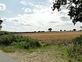 Barley field on gently sloping land at Crostwick - geograph.org.uk - 4557579.jpg 1 024 × 768 ; 357 kio
-
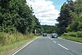 Northbound B1150 - geograph.org.uk - 5877264.jpg 1 024 × 684 ; 292 kio
-
 Northbound B1150, North Walsham Road - geograph.org.uk - 5877258.jpg 1 024 × 684 ; 216 kio
-
 Primrose Lane near Primrose Hole, Crostwick - geograph.org.uk - 4557583.jpg 1 024 × 768 ; 315 kio
-
 The White Horse Crostwick - geograph.org.uk - 3027892.jpg 1 600 × 1 200 ; 384 kio
-
 This is supposed to be a drain. Totally choked^ - geograph.org.uk - 4557564.jpg 1 024 × 768 ; 675 kio
-
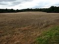 View across stubble - geograph.org.uk - 558348.jpg 640 × 480 ; 67 kio
-
 View east from Dobb's plantation - geograph.org.uk - 558344.jpg 480 × 640 ; 99 kio
-
 View east towards Low Carr from Primrose Lane - geograph.org.uk - 549364.jpg 640 × 480 ; 54 kio
-

-
 Wet patch in field - geograph.org.uk - 558350.jpg 640 × 480 ; 72 kio


