Category:Crowland
Zur Navigation springen
Zur Suche springen
Gemeinde in der englischen Grafschaft Lincolnshire  | |||||
| Medium hochladen | |||||
| Ist ein(e) | |||||
|---|---|---|---|---|---|
| Ort | South Holland, Lincolnshire, East Midlands, England | ||||
| Einwohnerzahl |
| ||||
| Eventuell gleichwertig | Crowland (Wikimedia-Dublette, Civil Parish in England) | ||||
 | |||||
Unterkategorien
Es werden 10 von insgesamt 10 Unterkategorien in dieser Kategorie angezeigt:
In Klammern die Anzahl der enthaltenen Kategorien (K), Seiten (S), Dateien (D)
Medien in der Kategorie „Crowland“
Folgende 200 Dateien sind in dieser Kategorie, von 674 insgesamt.
(vorherige Seite) (nächste Seite)-
 "Thames Tunnel" sign - geograph.org.uk - 4615677.jpg 2.736 × 1.824; 2,04 MB
-
 100 of '(Our own country. Descriptive, historical, pictorial.)' (11292897346).jpg 1.168 × 1.326; 397 KB
-
 96 of '(Our own country. Descriptive, historical, pictorial.)' (11297886383).jpg 1.161 × 1.326; 348 KB
-
 98 of '(Our own country. Descriptive, historical, pictorial.)' (11286908935).jpg 1.201 × 1.355; 372 KB
-
 A Back Alley - geograph.org.uk - 5859373.jpg 6.032 × 4.014; 3,65 MB
-
 A bus on Hall Street - geograph.org.uk - 5265581.jpg 800 × 534; 181 KB
-
 A cold seat - geograph.org.uk - 2205033.jpg 640 × 480; 120 KB
-
 A day in the fields - geograph.org.uk - 2243834.jpg 640 × 480; 75 KB
-
 A distant view of Whaplode Drove, Lincolnshire - geograph.org.uk - 2430174.jpg 2.848 × 2.136; 3,1 MB
-
 A jumble of roofs - geograph.org.uk - 5857033.jpg 6.032 × 4.014; 4,04 MB
-
 A private track at the end of Stowgate - geograph.org.uk - 4178801.jpg 4.320 × 3.240; 5,81 MB
-
 A track that became a road near Crowland - geograph.org.uk - 2840155.jpg 4.320 × 3.240; 5,15 MB
-
 A tree, a sheep and a gate - geograph.org.uk - 3101770.jpg 4.320 × 3.240; 5,32 MB
-
 A watchfull eye - geograph.org.uk - 2250782.jpg 640 × 480; 90 KB
-
 A1073, Crowland - geograph.org.uk - 2306891.jpg 640 × 336; 37 KB
-
 A16 Crowland Bypass - geograph.org.uk - 4415466.jpg 640 × 480; 56 KB
-
 A16 heading north - geograph.org.uk - 4415472.jpg 640 × 480; 52 KB
-
 A16 lay-by - geograph.org.uk - 4536476.jpg 640 × 480; 54 KB
-
 A16 lay-by - geograph.org.uk - 4536495.jpg 640 × 480; 54 KB
-
 A16 northbound - geograph.org.uk - 3766495.jpg 640 × 316; 41 KB
-
 A16 northbound - geograph.org.uk - 4536452.jpg 640 × 480; 46 KB
-
 A16 northbound - geograph.org.uk - 4536483.jpg 640 × 429; 41 KB
-
 A16 northbound - geograph.org.uk - 4536496.jpg 640 × 473; 42 KB
-
 A16 road junction - geograph.org.uk - 4536489.jpg 640 × 426; 42 KB
-
 A16 towards Spalding - geograph.org.uk - 4412944.jpg 640 × 480; 49 KB
-
 A16 westbound - geograph.org.uk - 5697022.jpg 640 × 425; 33 KB
-
 Abandoned compound - geograph.org.uk - 5856977.jpg 6.032 × 4.014; 4,27 MB
-
 Abbey Mews sign - geograph.org.uk - 5038024.jpg 3.072 × 2.304; 1,99 MB
-
 Abbey Mews, Crowland - geograph.org.uk - 5038023.jpg 3.072 × 2.304; 1,91 MB
-
 Abbey Walk sign - geograph.org.uk - 5038041.jpg 3.072 × 2.304; 1,89 MB
-
 Abbey Walk, Crowland - geograph.org.uk - 5037992.jpg 3.072 × 2.304; 1,89 MB
-
 Abbey Walk, Crowland - geograph.org.uk - 5038027.jpg 3.072 × 2.304; 1,89 MB
-
 Abbey Walk, Crowland - geograph.org.uk - 5038866.jpg 3.072 × 2.304; 1,8 MB
-
 Abbey Walk, Crowland - geograph.org.uk - 5039087.jpg 3.072 × 2.304; 1,72 MB
-
 Abbey, Summer Gold, and Houses - geograph.org.uk - 5857391.jpg 20.991 × 2.687; 7,5 MB
-
 Access from Low Road - geograph.org.uk - 593445.jpg 640 × 427; 69 KB
-
 Adams Farm - geograph.org.uk - 3118426.jpg 640 × 480; 57 KB
-
 Afternoon tea - geograph.org.uk - 4615651.jpg 2.736 × 1.824; 1,25 MB
-
 Agricultural building with a mid-air crash memorial - geograph.org.uk - 6515606.jpg 4.608 × 3.072; 3,25 MB
-
 Airfield and wheatfield, Crowland, Lincolnshire - geograph.org.uk - 3069060.jpg 4.320 × 3.240; 5,67 MB
-
 Algae on The River Welland near Crowland - geograph.org.uk - 5847861.jpg 5.184 × 3.888; 4,79 MB
-
 Ancient alignment - geograph.org.uk - 4616019.jpg 2.736 × 1.824; 1,79 MB
-
 Arable land by Crowland - geograph.org.uk - 5265541.jpg 800 × 450; 206 KB
-
 Avena fatua - geograph.org.uk - 5857926.jpg 6.032 × 4.014; 5,71 MB
-
 B1040 - geograph.org.uk - 5265543.jpg 800 × 450; 195 KB
-
 B1040 Hall Street, Crowland - geograph.org.uk - 5054741.jpg 3.072 × 2.304; 1,97 MB
-
 B1040 southbound - geograph.org.uk - 5445680.jpg 640 × 480; 56 KB
-
 B1040 southbound - geograph.org.uk - 5445684.jpg 640 × 480; 41 KB
-
 B1040 southbound - geograph.org.uk - 5445686.jpg 640 × 378; 38 KB
-
 B1040 southbound - geograph.org.uk - 5445968.jpg 640 × 461; 37 KB
-
 B1040 Thorney Road, Crowland - geograph.org.uk - 5038049.jpg 3.072 × 2.304; 1,8 MB
-
 B1040 Thorney Road, Crowland - geograph.org.uk - 5038050.jpg 3.072 × 2.304; 2 MB
-
 B1040 Thorney Road, Crowland - geograph.org.uk - 5038921.jpg 3.072 × 2.304; 1,91 MB
-
 B1040 Thorney Road, Crowland - geograph.org.uk - 5038942.jpg 3.072 × 2.304; 1,88 MB
-
 B1040 towards Crowland - geograph.org.uk - 2920424.jpg 640 × 480; 49 KB
-
 B1040 towards Crowland - geograph.org.uk - 2920427.jpg 640 × 480; 76 KB
-
 B1040 towards Crowland - geograph.org.uk - 2920434.jpg 640 × 480; 46 KB
-
 B1166 towards Crowland - geograph.org.uk - 4415091.jpg 640 × 480; 33 KB
-
 B1166 towards Market Deeping - geograph.org.uk - 3118459.jpg 640 × 480; 68 KB
-
 B1166 towards Market Deeping - geograph.org.uk - 3118473.jpg 640 × 480; 62 KB
-
 Backs (geograph 4615725).jpg 2.736 × 1.824; 1,62 MB
-
 Barber's Drove Crowland - geograph.org.uk - 2183172.jpg 640 × 480; 67 KB
-
 Barns at Broadlands - geograph.org.uk - 2240380.jpg 640 × 480; 58 KB
-
 Barns by Hollies Farm - geograph.org.uk - 6645209.jpg 1.600 × 1.067; 531 KB
-
 Barns in the spinney - geograph.org.uk - 2192087.jpg 640 × 480; 93 KB
-
 Bean field near Little Lodge Farm - geograph.org.uk - 3081714.jpg 1.024 × 768; 227 KB
-
 Beekens Yard sign - geograph.org.uk - 5056143.jpg 3.072 × 2.304; 1,99 MB
-
 Beekens Yard, Crowland - geograph.org.uk - 5056123.jpg 3.072 × 2.304; 1,76 MB
-
 Bend in the River - geograph.org.uk - 2240164.jpg 640 × 480; 52 KB
-
 Bend in the road - geograph.org.uk - 2243867.jpg 640 × 480; 66 KB
-
 Beware of the Dogs - geograph.org.uk - 2191271.jpg 640 × 480; 127 KB
-
 Big Crane - geograph.org.uk - 5855875.jpg 5.789 × 6.901; 7,56 MB
-
 Bilingual sign - geograph.org.uk - 5856981.jpg 6.032 × 4.014; 2,99 MB
-
 Blocked field entrance on Spalding Road south of Cowbit - geograph.org.uk - 2894302.jpg 4.320 × 3.240; 5,66 MB
-
 Borden House Farm - geograph.org.uk - 2920423.jpg 640 × 399; 40 KB
-
 Borden House Farm, Nene Terrace - geograph.org.uk - 2840125.jpg 4.320 × 3.240; 5,52 MB
-
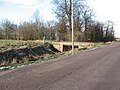
 Bridge over New River - geograph.org.uk - 2920646.jpg 640 × 480; 70 KB
-
 Bridleway near Brotherhouse Bar - geograph.org.uk - 3080816.jpg 1.024 × 768; 133 KB
-
 Broadway, Crowland - geograph.org.uk - 2920520.jpg 640 × 480; 88 KB
-
 Bush in a dike between harvested rape fields near Crowland - geograph.org.uk - 3093404.jpg 4.320 × 3.240; 5,68 MB
-
 Business entrance - geograph.org.uk - 5857004.jpg 6.032 × 4.014; 3,15 MB
-
 Carrington Drove South - geograph.org.uk - 4536448.jpg 640 × 436; 48 KB
-
 Cate's Cove Corner near Whaplode Drove - geograph.org.uk - 2430158.jpg 2.848 × 2.136; 3,01 MB
-
 Cereal crop near St James' Farm, Crowland - geograph.org.uk - 2859474.jpg 4.320 × 3.240; 5,37 MB
-
 Chapel Street, Crowland - geograph.org.uk - 2920518.jpg 640 × 480; 53 KB
-
 Church Lane sign - geograph.org.uk - 5055011.jpg 3.072 × 2.304; 1,78 MB
-
 Church Lane ^ footpath - geograph.org.uk - 5037855.jpg 3.072 × 2.304; 1,85 MB
-
 Church Lane, Crowland - geograph.org.uk - 3081751.jpg 1.024 × 768; 165 KB
-
 Church Lane, Crowland - geograph.org.uk - 5037853.jpg 3.072 × 2.304; 1,62 MB
-
 Church Lane, Crowland - geograph.org.uk - 5037877.jpg 3.072 × 2.304; 1,81 MB
-
 Church Lane, Crowland - geograph.org.uk - 5037882.jpg 3.072 × 2.304; 1,94 MB
-
 Church Lane, Crowland - geograph.org.uk - 5038005.jpg 3.072 × 2.304; 1,77 MB
-
 Church Lane, Crowland - geograph.org.uk - 5055014.jpg 3.072 × 2.304; 1,7 MB
-
 Church path, Crowland - geograph.org.uk - 2206828.jpg 689 × 1.024; 125 KB
-
 Cloot Drove near Crowland (1) - geograph.org.uk - 5887131.jpg 480 × 640; 169 KB
-
 Cloot Drove near Crowland (2) - geograph.org.uk - 5887132.jpg 640 × 472; 142 KB
-
 Cloot Drove near Crowland (3) - geograph.org.uk - 5887135.jpg 571 × 640; 170 KB
-
 Close to the waters edge, The River Welland - geograph.org.uk - 3081318.jpg 4.320 × 3.240; 5,4 MB
-
 Closed garden centre, Crowland - geograph.org.uk - 6645147.jpg 1.600 × 1.067; 448 KB
-
 Commercial premises - geograph.org.uk - 4614884.jpg 5.000 × 3.355; 6,65 MB
-
 Common Drain - geograph.org.uk - 3118428.jpg 640 × 480; 99 KB
-
 Common Drain - geograph.org.uk - 3118441.jpg 640 × 480; 82 KB
-
 Common Drove Farm - geograph.org.uk - 2246659.jpg 640 × 480; 90 KB
-
 Common Farm - geograph.org.uk - 2243804.jpg 640 × 480; 58 KB
-
 Common Farm - geograph.org.uk - 2243828.jpg 640 × 480; 73 KB
-
 Common, Common, Common - geograph.org.uk - 3081408.jpg 4.320 × 3.240; 6,03 MB
-
 Copper Kettle - geograph.org.uk - 4615642.jpg 2.736 × 1.824; 1,76 MB
-
 Corrugated metal shed near Hollies Farm - geograph.org.uk - 2840699.jpg 4.320 × 3.240; 5,51 MB
-
 Course of a disused railway - geograph.org.uk - 4415501.jpg 640 × 480; 102 KB
-
 Cowbit Road north of Crowland - geograph.org.uk - 6571471.jpg 1.858 × 1.180; 1,02 MB
-
 Cowbit Wash Pumping Station - geograph.org.uk - 2204748.jpg 640 × 480; 68 KB
-
 Cox's Corner - geograph.org.uk - 2191296.jpg 640 × 480; 94 KB
-
 Cox's Drove - geograph.org.uk - 4413251.jpg 640 × 480; 65 KB
-
 Cox's Drove - geograph.org.uk - 6645683.jpg 1.600 × 1.067; 645 KB
-
 Crease Drove, Crowland - geograph.org.uk - 6645077.jpg 1.600 × 1.146; 449 KB
-
 Crop field beside drain - geograph.org.uk - 4415493.jpg 640 × 480; 70 KB
-
 Crop field off Cox's Drove - geograph.org.uk - 4413255.jpg 640 × 480; 52 KB
-
 Crop field off Cox's Drove - geograph.org.uk - 4413263.jpg 640 × 480; 75 KB
-
 Crop field off Hull's Drove (B1166) - geograph.org.uk - 4415095.jpg 640 × 480; 71 KB
-
 Crop field off Speechley's Drove - geograph.org.uk - 3119036.jpg 640 × 480; 82 KB
-
 Crop field west of the A16 - geograph.org.uk - 4415470.jpg 640 × 480; 61 KB
-
 Crop field, Crowland Common - geograph.org.uk - 3118431.jpg 640 × 480; 134 KB
-

-

-

-

-

-
 Crowland Abbey - A view from the south - geograph.org.uk - 5847584.jpg 5.184 × 3.888; 3,07 MB
-
 Crowland Abbey - Headstones and ruins - geograph.org.uk - 5847589.jpg 5.184 × 3.888; 5,15 MB
-
 Crowland Abbey - Ruins of the east window - geograph.org.uk - 5847580.jpg 3.888 × 5.184; 3,77 MB
-
 Crowland Abbey - The ruined nave - geograph.org.uk - 5847578.jpg 3.888 × 5.184; 4,53 MB
-
 Crowland airfield - geograph.org.uk - 3480848.jpg 640 × 427; 55 KB
-
 Crowland bridge - geograph.org.uk - 4818216.jpg 6.000 × 4.000; 6,55 MB
-
 Crowland Charm Tree - geograph.org.uk - 2250018.jpg 640 × 480; 49 KB
-
 Crowland charm tree on Corporation bank - geograph.org.uk - 3101725.jpg 4.320 × 3.240; 5,77 MB
-
 Crowland Common - geograph.org.uk - 2243638.jpg 640 × 480; 75 KB
-
 Crowland Falls - geograph.org.uk - 593486.jpg 640 × 427; 69 KB
-
 Crowland Falls - geograph.org.uk - 593511.jpg 640 × 427; 76 KB
-
 Crowland from Welland Bank - geograph.org.uk - 364549.jpg 640 × 427; 49 KB
-
 Crowland Health Centre Car Park - geograph.org.uk - 5038947.jpg 3.072 × 2.304; 1,87 MB
-
 Crowland High Wash - geograph.org.uk - 4664437.jpg 1.280 × 858; 262 KB
-
 Crowland Low Wash - geograph.org.uk - 443744.jpg 640 × 427; 83 KB
-
 Crowland Low Wash - geograph.org.uk - 4819210.jpg 6.000 × 4.000; 7 MB
-

-
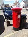
 Crowland Post Office Postbox - geograph.org.uk - 5056072.jpg 3.072 × 2.304; 1,65 MB
-
 Crowland Post Office Postbox - geograph.org.uk - 5056073.jpg 2.304 × 3.072; 3,08 MB
-
 Crowland Post Office Postbox - geograph.org.uk - 5056074.jpg 2.273 × 3.031; 3,53 MB
-
 Crowland Post Office Postbox - geograph.org.uk - 5056106.jpg 2.304 × 3.072; 2,56 MB
-
 Crowland Recreation Ground - geograph.org.uk - 5038990.jpg 3.072 × 2.304; 1,9 MB
-
 Crowland Recreation Ground - geograph.org.uk - 5038992.jpg 3.072 × 2.304; 1,79 MB
-
 Crowland Recreation Ground - geograph.org.uk - 5039002.jpg 3.072 × 2.304; 2,08 MB
-
 Crowland sign - geograph.org.uk - 4818416.jpg 6.000 × 4.000; 4,86 MB
-
 Crowland Tennis Courts - geograph.org.uk - 5038917.jpg 3.072 × 2.304; 1,92 MB
-
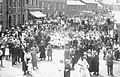 Crowland United Sunday Schools' Treat 1921.jpg 1.585 × 1.017; 987 KB
-
 Crowland Water Tower by B1166 Welland Bank - geograph.org.uk - 6649955.jpg 4.858 × 3.238; 4,87 MB
-
 Crowland, aerial 2018 (2) - geograph.org.uk - 5937725.jpg 640 × 427; 100 KB
-
 Crowland, aerial 2018 (3) - geograph.org.uk - 5937739.jpg 640 × 390; 55 KB
-
 Crowland, aerial 2018 - geograph.org.uk - 5937715.jpg 640 × 427; 94 KB
-
 Custom Fencing - geograph.org.uk - 5856995.jpg 6.032 × 4.014; 3,1 MB
-
 Danger of death at Brotherhouse Bar - geograph.org.uk - 3080844.jpg 1.024 × 768; 191 KB
-
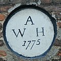 Datestone - geograph.org.uk - 4614777.jpg 1.629 × 1.629; 520 KB
-
 Development site off Harvester Way, Crowland - geograph.org.uk - 6645066.jpg 1.600 × 1.035; 403 KB
-
 Development site off Harvester Way, Crowland - geograph.org.uk - 6645069.jpg 1.600 × 1.067; 619 KB
-
 Dike and farmland off Whipchicken Road - geograph.org.uk - 2859804.jpg 4.320 × 3.240; 5,7 MB
-
 Dismantled railway north of Postland near Crowland - geograph.org.uk - 2894481.jpg 4.320 × 3.240; 5,7 MB
-

-
 Ditch alongside the Gravel Causeway - geograph.org.uk - 4943961.jpg 640 × 480; 343 KB
-
 Ditch by Poplars Farm Cottage - geograph.org.uk - 6645680.jpg 1.600 × 1.067; 798 KB
-
 Ditch north of Little Lodge Farm - geograph.org.uk - 2306879.jpg 640 × 480; 66 KB
-
 Ditch north of Willow Falls Farm - geograph.org.uk - 2309881.jpg 640 × 450; 46 KB
-
 Ditch off Hundreds Road - geograph.org.uk - 6645182.jpg 1.600 × 1.067; 690 KB
-
 Ditch off Hundreds Road - geograph.org.uk - 6645189.jpg 1.600 × 1.067; 707 KB
-
 Dodgy Bridge - geograph.org.uk - 2204985.jpg 640 × 480; 95 KB
-
 Double bends - geograph.org.uk - 2204941.jpg 640 × 480; 80 KB
-
 Drain along the southern edge of a stubble field - geograph.org.uk - 3081711.jpg 1.024 × 768; 224 KB
-
 Drain and farm track near Whipchicken Farm - geograph.org.uk - 2896171.jpg 4.320 × 3.240; 5,84 MB
-
 Drain beside Common Drove - geograph.org.uk - 3118418.jpg 640 × 480; 102 KB
-
 Drain beside Martins Road - geograph.org.uk - 4415510.jpg 640 × 480; 105 KB
-
 Drain beside Queen's Bank - geograph.org.uk - 4415482.jpg 640 × 480; 80 KB
-
 Drain beside Whipchicken Road - geograph.org.uk - 4415148.jpg 640 × 480; 90 KB
-
 Drain near St James's Farm - geograph.org.uk - 4412984.jpg 640 × 480; 84 KB
-
 Drain near Whipchicken Farm - geograph.org.uk - 4415131.jpg 640 × 480; 80 KB
-
 Drain off Cox's Drove - geograph.org.uk - 4413254.jpg 640 × 480; 63 KB
-
 Drain off Hull's Drove (B1166) - geograph.org.uk - 4415094.jpg 640 × 480; 66 KB
-
 Drain off Hull's Drove (B1166) - geograph.org.uk - 4415117.jpg 640 × 480; 84 KB
-
 Drain on the east side of Cloot Drove (1) - geograph.org.uk - 3081518.jpg 1.024 × 768; 177 KB
-
 Drain through Crowland Common - geograph.org.uk - 1164436.jpg 640 × 480; 54 KB
-
 Drain west of Cloot Drove - geograph.org.uk - 3081513.jpg 1.024 × 768; 164 KB
-
 Drain, Great Postland - geograph.org.uk - 4415126.jpg 640 × 480; 75 KB
-
 Drainage Channel - geograph.org.uk - 2345934.jpg 640 × 480; 61 KB
-
 Drainage ditch, Poplars Farm - geograph.org.uk - 2920542.jpg 640 × 480; 90 KB
-

-
 Drove and ditch - geograph.org.uk - 754334.jpg 640 × 480; 67 KB
-
 Dry drain beside Cox's Drove - geograph.org.uk - 4413265.jpg 640 × 480; 103 KB
-
 Dry drain beside Eaugate Road - geograph.org.uk - 4415736.jpg 640 × 480; 78 KB
-
 Dry drainage ditch beside Renew's Drove - geograph.org.uk - 3118450.jpg 640 × 480; 115 KB
-
 Eardley Grange - geograph.org.uk - 2203616.jpg 640 × 480; 58 KB
-
 Eastern approach to Crowland over Crowland Wash - geograph.org.uk - 3081274.jpg 4.320 × 3.240; 5,98 MB
-
 Eastern edge of a wheatfield - geograph.org.uk - 3081441.jpg 1.024 × 768; 151 KB
-
 Eaugate Road - geograph.org.uk - 4415731.jpg 640 × 480; 75 KB

%27_(11292897346).jpg)
%27_(11297886383).jpg)
%27_(11286908935).jpg)


.jpg)


_-_geograph.org.uk_-_5887131.jpg)
_-_geograph.org.uk_-_5887132.jpg)
_-_geograph.org.uk_-_5887135.jpg)


_-_geograph.org.uk_-_4415095.jpg)


_-_geograph.org.uk_-_5937662.jpg)
_-_geograph.org.uk_-_5937596.jpg)
_-_geograph.org.uk_-_5937608.jpg)


_-_geograph.org.uk_-_5937725.jpg)
_-_geograph.org.uk_-_5937739.jpg)


_-_geograph.org.uk_-_4415094.jpg)
_-_geograph.org.uk_-_4415117.jpg)
_-_geograph.org.uk_-_3081518.jpg)


