Category:Croxton Kerrial
Aller à la navigation
Aller à la recherche
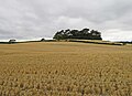
English: Croxton Kerrial (pronounced "crow-sun kerry-ul") is a small village, civil parish and electoral ward within the Melton borough of Leicestershire, England. It is northeast of Melton Mowbray.
localité britannique du comté anglais de Leicestershire  | |||||
| Téléverser des médias | |||||
| Nature de l’élément | |||||
|---|---|---|---|---|---|
| Lieu | Melton, Leicestershire, Midlands de l'Est, Angleterre | ||||
| Réputé identique à | Croxton Kerrial (page en doublon, paroisse civile) | ||||
 | |||||
Sous-catégories
Cette catégorie comprend 4 sous-catégories, dont les 4 ci-dessous.
Média dans la catégorie « Croxton Kerrial »
Cette catégorie comprend 391 fichiers, dont les 200 ci-dessous.
(page précédente) (page suivante)-

-
 36 Main Street, Branston - geograph.org.uk - 5181821.jpg 1 280 × 960 ; 372 kio
-
 A bend in Croxton Lane - geograph.org.uk - 3610511.jpg 640 × 480 ; 74 kio
-
 A lane along Cooper's Plantation - geograph.org.uk - 3496921.jpg 1 504 × 2 256 ; 2,34 Mio
-
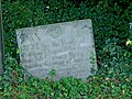
 A Seaman's grave - geograph.org.uk - 5985584.jpg 6 032 × 4 014 ; 6,98 Mio
-
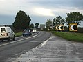
 A607 enters Croxton Kerrial in Leicestershire - geograph.org.uk - 808290.jpg 640 × 404 ; 54 kio
-
 A607 near Croxton Kerrial - geograph.org.uk - 67715.jpg 640 × 480 ; 122 kio
-
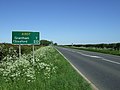
 A607 towards Grantham - geograph.org.uk - 2966412.jpg 640 × 480 ; 70 kio
-
 A607 towards Grantham - geograph.org.uk - 2966417.jpg 640 × 480 ; 63 kio
-
 A607 towards Grantham - geograph.org.uk - 2966426.jpg 640 × 480 ; 63 kio
-
 A607 towards Grantham - geograph.org.uk - 2966430.jpg 640 × 480 ; 109 kio
-
 A607 towards Grantham - geograph.org.uk - 2966444.jpg 640 × 480 ; 71 kio
-
 A607 towards Grantham - geograph.org.uk - 2966459.jpg 640 × 480 ; 79 kio
-
 A607 towards Grantham - geograph.org.uk - 5990298.jpg 640 × 425 ; 39 kio
-
 A607 towards Melton Mowbray - geograph.org.uk - 5990299.jpg 640 × 490 ; 41 kio
-
 A607, near Croxton Kerrial - geograph.org.uk - 104599.jpg 640 × 427 ; 83 kio
-
 Abandoned track, Croxton Kerrial - geograph.org.uk - 30069.jpg 640 × 480 ; 135 kio
-
 Animal pen by Branston Road - geograph.org.uk - 5879547.jpg 640 × 456 ; 73 kio
-
 April showers 1 - geograph.org.uk - 2913683.jpg 640 × 427 ; 52 kio
-
 April showers 2 - geograph.org.uk - 2913685.jpg 640 × 427 ; 62 kio
-
 Autumn near Branston - geograph.org.uk - 3229360.jpg 1 024 × 768 ; 296 kio
-
 Awaiting harvest - geograph.org.uk - 3350129.jpg 640 × 452 ; 61 kio
-
 Behind the hedge near Heath Farm - geograph.org.uk - 5134639.jpg 1 024 × 768 ; 183 kio
-
 Belvoir Angel - geograph.org.uk - 4416805.jpg 1 024 × 683 ; 378 kio
-
 Belvoir Angel - geograph.org.uk - 4416826.jpg 1 024 × 683 ; 324 kio
-
 Belvoir Angel headstone, Branston Churchyard - geograph.org.uk - 5181807.jpg 1 280 × 960 ; 522 kio
-
 Belvoir Angel headstone, Branston Churchyard - geograph.org.uk - 5181811.jpg 1 280 × 960 ; 461 kio
-
 Belvoir Angel headstone, Branston Churchyard - geograph.org.uk - 5181812.jpg 1 280 × 960 ; 576 kio
-
 Belvoir Angel headstone, Croxton Kerrial churchyard - geograph.org.uk - 5183220.jpg 1 280 × 960 ; 527 kio
-
 Belvoir Angel headstone, Croxton Kerrial churchyard - geograph.org.uk - 5183223.jpg 1 280 × 862 ; 355 kio
-
 Belvoir Castle, aerial 2018 (1) - geograph.org.uk - 5846275.jpg 1 024 × 683 ; 179 kio
-
 Belvoir Estate Woodlands sign - geograph.org.uk - 3350136.jpg 640 × 281 ; 51 kio
-
 Belvoir road - geograph.org.uk - 3492277.jpg 2 256 × 1 504 ; 2,44 Mio
-
 Belvoir Road - geograph.org.uk - 4040983.jpg 640 × 480 ; 40 kio
-
 Belvoir Road approaching crossroads - geograph.org.uk - 4040986.jpg 640 × 480 ; 48 kio
-
 Belvoir Road near Terrace Hills Farm - geograph.org.uk - 2027396.jpg 1 625 × 974 ; 650 kio
-
 Belvoir Road towards High Leys - geograph.org.uk - 2031142.jpg 2 728 × 1 775 ; 2,16 Mio
-
 Bench mark, 36 Main Street, Branston - geograph.org.uk - 5181825.jpg 916 × 1 280 ; 384 kio
-
 Bench mark, 6 Main Street, Branston - geograph.org.uk - 5181827.jpg 1 148 × 1 280 ; 435 kio
-
 Bench mark, Church of St Guthlac, Branston - geograph.org.uk - 5181806.jpg 960 × 1 280 ; 494 kio
-
 Bench mark, The Old Forge, Croxton Kerrial - geograph.org.uk - 5194304.jpg 1 160 × 1 280 ; 527 kio
-
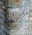
 Bench mark,St Botolph's church, Croxton Kerrial - geograph.org.uk - 5183217.jpg 1 049 × 1 280 ; 510 kio
-
 Benchmark on 'The Old Forge' - geograph.org.uk - 6230947.jpg 683 × 1 024 ; 274 kio
-
 Benchmark on St John the Baptist's Church - geograph.org.uk - 6230658.jpg 678 × 1 024 ; 301 kio
-
 Benchmark on ^6 Top Road - geograph.org.uk - 6230882.jpg 620 × 1 024 ; 163 kio
-
 Branston Lane towards Branston - geograph.org.uk - 5879550.jpg 640 × 462 ; 82 kio
-
 Branston Lane towards Knipton - geograph.org.uk - 3350137.jpg 640 × 479 ; 74 kio
-
 Branston Lane towards Knipton - geograph.org.uk - 5879554.jpg 640 × 478 ; 91 kio
-
 Branston Road near to Eaton Grange - geograph.org.uk - 5879548.jpg 640 × 435 ; 87 kio
-
 Branston Road towards Branston - geograph.org.uk - 5879549.jpg 640 × 458 ; 98 kio
-
 Branston Village Hall - geograph.org.uk - 4416693.jpg 1 024 × 683 ; 225 kio
-
 Branston Village Hall - geograph.org.uk - 5181786.jpg 1 280 × 960 ; 347 kio
-
 Bridge at the foot of the hill - geograph.org.uk - 998873.jpg 640 × 427 ; 145 kio
-
 Bridge over the River Devon - geograph.org.uk - 3350120.jpg 640 × 421 ; 74 kio
-
 Bridleway over fields towards Station Farm - geograph.org.uk - 2966400.jpg 640 × 480 ; 120 kio
-
 Broken oak, Mary Lane - geograph.org.uk - 6032785.jpg 3 776 × 2 520 ; 3,78 Mio
-
 Bulls in field on west side of Saltby Road - geograph.org.uk - 6175874.jpg 1 024 × 683 ; 149 kio
-
 By Branston Lane - geograph.org.uk - 3350138.jpg 640 × 481 ; 72 kio
-
 Carved poppyhead, Ss Botolph and John the Baptist church - geograph.org.uk - 5051178.jpg 4 272 × 2 848 ; 3,93 Mio
-
 Cattlegrid on the track leading out of Croxton Park - geograph.org.uk - 6033036.jpg 3 776 × 2 520 ; 3,95 Mio
-
 Cedar Hill - geograph.org.uk - 5981050.jpg 5 822 × 3 874 ; 5,63 Mio
-
 Cedar Hill - geograph.org.uk - 999406.jpg 640 × 427 ; 113 kio
-
 Cedar Hill, near Croxton Kerrial - geograph.org.uk - 67671.jpg 640 × 480 ; 126 kio
-
 Chancel, Ss Botolph and John the Baptist church, Croxton Kerrial - geograph.org.uk - 5051171.jpg 4 176 × 2 704 ; 5,2 Mio
-
 Change in field levels caused by quarrying - geograph.org.uk - 2369118.jpg 640 × 480 ; 90 kio
-
 Chapel Lane, Croxton Kerrial - geograph.org.uk - 6032996.jpg 3 776 × 2 520 ; 3,96 Mio
-

-

-

-

-
 Church of St Botolph and St John the Baptist, Croxton Kerrial - geograph.org.uk - 5186947.jpg 1 280 × 1 280 ; 476 kio
-
 Church of St Botolph and St John the Baptist, Croxton Kerrial - geograph.org.uk - 5186950.jpg 1 280 × 1 280 ; 580 kio
-

-

-

-
 Church of St Botolph and St John the Baptist, Croxton Kerrial - geograph.org.uk - 6032986.jpg 3 776 × 2 520 ; 3,99 Mio
-
 Church of St Guthlac, Branston - geograph.org.uk - 5181787.jpg 1 280 × 957 ; 327 kio
-
 Church of St Guthlac, Branston - geograph.org.uk - 5181789.jpg 1 280 × 865 ; 315 kio
-
 Church of St Guthlac, Branston - geograph.org.uk - 5181791.jpg 844 × 1 280 ; 306 kio
-
 Church of St Guthlac, Branston - geograph.org.uk - 5181793.jpg 1 280 × 1 066 ; 326 kio
-
 Church of St Guthlac, Branston - geograph.org.uk - 5181794.jpg 960 × 1 280 ; 291 kio
-
 Church of St Guthlac, Branston - geograph.org.uk - 5181796.jpg 901 × 1 280 ; 294 kio
-
 Church of St Guthlac, Branston - geograph.org.uk - 5181799.jpg 1 280 × 960 ; 306 kio
-
 Church of St Guthlac, Branston - geograph.org.uk - 5181816.jpg 926 × 1 280 ; 306 kio
-
 Church of St. John the Baptist, Croxton Kerrial - geograph.org.uk - 5202580.jpg 1 024 × 768 ; 149 kio
-
 Cottage in Branston - geograph.org.uk - 3229378.jpg 1 024 × 768 ; 170 kio
-
 Cottage in Branston - geograph.org.uk - 3610345.jpg 640 × 480 ; 81 kio
-
 Cottages in Croxton Kerrial - geograph.org.uk - 2168705.jpg 756 × 1 024 ; 207 kio
-
 Cottages off Main Street, Branston - geograph.org.uk - 998138.jpg 640 × 427 ; 99 kio
-
 Cottages on the edge of the village - geograph.org.uk - 5202600.jpg 1 024 × 768 ; 143 kio
-
 Cottages, Middle Street, Croxton Kerrial - geograph.org.uk - 5134624.jpg 1 024 × 768 ; 158 kio
-
 Cracks in field west of Croxton Lane - geograph.org.uk - 5879551.jpg 640 × 477 ; 136 kio
-
 Crop field and woodland - geograph.org.uk - 4040993.jpg 640 × 480 ; 85 kio
-
 Crop field near Branston - geograph.org.uk - 3610348.jpg 640 × 480 ; 100 kio
-
 Crossing of the paths - geograph.org.uk - 2051220.jpg 2 576 × 1 822 ; 2,04 Mio
-
 Crossroads of Belvoir Road and Wood Lane - geograph.org.uk - 3492270.jpg 2 256 × 1 504 ; 2,34 Mio
-
 Croxton Kerrial - geograph.org.uk - 5982917.jpg 6 032 × 4 014 ; 6,18 Mio
-

-

-

-

-

-

-

-

-
-

-

-

-

-

-
 Croxton Kerrial playing field - geograph.org.uk - 1002003.jpg 640 × 427 ; 72 kio
-
 Croxton Kerrial Village Hall - geograph.org.uk - 5186973.jpg 1 280 × 960 ; 471 kio
-
 Croxton Kerrial water spout, ice feature - geograph.org.uk - 3162648.jpg 420 × 640 ; 120 kio
-
 Croxton Kerrial, Church Lane - 1 - geograph.org.uk - 2044168.jpg 800 × 600 ; 417 kio
-
 Croxton Kerrial, Church Lane - 2 - geograph.org.uk - 2044166.jpg 800 × 600 ; 487 kio
-
 Croxton Kerrial, Leicestershire - geograph.org.uk - 67371.jpg 640 × 480 ; 108 kio
-
 Croxton Kerrial.jpg 477 × 325 ; 146 kio
-
 Croxton Lane - geograph.org.uk - 2999871.jpg 640 × 484 ; 84 kio
-
 Croxton Lane towards Croxton Kerrial - geograph.org.uk - 5879555.jpg 640 × 465 ; 58 kio
-
 Croxton Lane towards Harston - geograph.org.uk - 2999872.jpg 640 × 489 ; 120 kio
-
 Croxton Lane towards Knipton - geograph.org.uk - 5879556.jpg 640 × 480 ; 70 kio
-
 Croxton Park - geograph.org.uk - 608503.jpg 640 × 480 ; 102 kio
-
 Croxton Park, near Croxton Kerrial - geograph.org.uk - 67369.jpg 640 × 480 ; 150 kio
-
 Croxton-Knipton Lane - geograph.org.uk - 999411.jpg 640 × 427 ; 139 kio
-
 Donations brass of 1683, Croxton Kerrial Church - geograph.org.uk - 3108715.jpg 2 256 × 1 504 ; 2,44 Mio
-
 Double manhole - geograph.org.uk - 5982927.jpg 6 032 × 4 014 ; 6,86 Mio
-
 Down the hill - geograph.org.uk - 5982911.jpg 6 032 × 4 014 ; 6,72 Mio
-
 Down the hill to Branston - geograph.org.uk - 3492306.jpg 1 504 × 2 256 ; 3,25 Mio
-
 Dry stone wall, Croxton Park - geograph.org.uk - 2129219.jpg 1 600 × 1 227 ; 454 kio
-
 Entrance to field west of Croxton Lane - geograph.org.uk - 5879557.jpg 640 × 500 ; 83 kio
-
 Entrance to Highfield Farm Croxton Kerrial - geograph.org.uk - 4433704.jpg 1 024 × 768 ; 130 kio
-
 Entrance to Keeper's Cottage - geograph.org.uk - 3350139.jpg 640 × 557 ; 90 kio
-

-
 Farm track and footpath towards Branston - geograph.org.uk - 2966419.jpg 640 × 480 ; 88 kio
-
 Farm track at Croxton Kerrial - geograph.org.uk - 999417.jpg 640 × 427 ; 117 kio
-
 Farm track near Branston - geograph.org.uk - 3229390.jpg 1 024 × 768 ; 144 kio
-
 Farm track near Croxton Kerrial - geograph.org.uk - 2966440.jpg 640 × 480 ; 74 kio
-
 Farm track near Harston - geograph.org.uk - 5183197.jpg 1 280 × 960 ; 396 kio
-
 Farm Track off Croxton Lane - geograph.org.uk - 3488225.jpg 1 504 × 2 256 ; 2,07 Mio
-
 Farm track to Nursery Plantation - geograph.org.uk - 3229355.jpg 1 024 × 768 ; 253 kio
-
 Farmland above Knipton Reservoir - geograph.org.uk - 998177.jpg 640 × 427 ; 114 kio
-
 Farmland and Hill Top Farm - geograph.org.uk - 5240974.jpg 800 × 602 ; 159 kio
-
 Farmland and woodland - geograph.org.uk - 3610354.jpg 640 × 480 ; 73 kio
-
 Farmland in Croxton Kerrial - geograph.org.uk - 1002047.jpg 640 × 427 ; 102 kio
-
 Farmland near Blackwell Lodge - geograph.org.uk - 2966456.jpg 640 × 480 ; 88 kio
-
 Farmland near Croxson Kerrial - geograph.org.uk - 999414.jpg 640 × 427 ; 99 kio
-
 Farmland near Croxton Kerrial - geograph.org.uk - 2966425.jpg 640 × 435 ; 56 kio
-
 Farmland near Croxton Kerrial - geograph.org.uk - 2966428.jpg 640 × 480 ; 89 kio
-
 Farmland near Croxton Kerrial - geograph.org.uk - 2966442.jpg 640 × 480 ; 71 kio
-
 Farmland near Croxton Kerrial - geograph.org.uk - 2991481.jpg 640 × 427 ; 83 kio
-
 Farmland near Croxton Kerrial - geograph.org.uk - 2991485.jpg 640 × 427 ; 70 kio
-
 Farmland near Croxton Kerrial, Leicestershire - geograph.org.uk - 67374.jpg 640 × 480 ; 183 kio
-
 Farmland near Croxton Park - geograph.org.uk - 3016400.jpg 640 × 480 ; 63 kio
-
 Farmland to the north of Knipton Reservoir - geograph.org.uk - 998838.jpg 640 × 427 ; 106 kio
-
 Farmland towards Harston Wood - geograph.org.uk - 3610501.jpg 640 × 480 ; 86 kio
-
 Farmland towards Lings Covert - geograph.org.uk - 2966406.jpg 640 × 480 ; 106 kio
-
 Farmland, Barn Lodge Farm - geograph.org.uk - 3016394.jpg 640 × 480 ; 48 kio
-
 Farmland, Tipping's Lodge - geograph.org.uk - 3016388.jpg 640 × 480 ; 50 kio
-
 Field entrance - geograph.org.uk - 3610448.jpg 640 × 480 ; 98 kio
-
 Field entrance, with Geese - geograph.org.uk - 5982900.jpg 6 032 × 4 014 ; 8 Mio
-
 Field near Terrace Hills Farm - geograph.org.uk - 1840957.jpg 640 × 480 ; 94 kio
-
 Field side track - geograph.org.uk - 3350125.jpg 640 × 489 ; 56 kio
-
 Field track off Gorse Lane, near Croxton Kerrial - geograph.org.uk - 69359.jpg 480 × 640 ; 134 kio
-
 Field west of Croxton Lane - geograph.org.uk - 5879552.jpg 640 × 514 ; 83 kio
-
-
 Fields above Knipton Reservoir - geograph.org.uk - 998162.jpg 640 × 427 ; 128 kio
-
 Fields by Croxton Lane - geograph.org.uk - 2999873.jpg 640 × 475 ; 73 kio
-
 Fish pond, fed by the headwaters of the River Devon - geograph.org.uk - 2129991.jpg 1 600 × 1 200 ; 571 kio
-
 Fish-ponds of the former Croxton Abbey - geograph.org.uk - 2128777.jpg 1 600 × 1 200 ; 294 kio
-
 Flooding at Croxton Kerrial - geograph.org.uk - 6382850.jpg 1 024 × 768 ; 186 kio
-
 Flooding at Croxton Kerrial - geograph.org.uk - 6382859.jpg 1 024 × 768 ; 288 kio
-
 Font, Ss Botolph ^ John the Baptist church, Croxton Kerrial - geograph.org.uk - 5051181.jpg 2 656 × 4 164 ; 5,16 Mio
-
 Footpath from Knipton Lane - geograph.org.uk - 4416670.jpg 1 024 × 683 ; 222 kio
-
 Footpath in old ironstone workings - geograph.org.uk - 1567594.jpg 480 × 640 ; 129 kio
-
 Footpath stile on Windmill Hill - geograph.org.uk - 1745419.jpg 4 000 × 3 000 ; 2,95 Mio
-
 Footpath to Branston - geograph.org.uk - 4040978.jpg 640 × 480 ; 65 kio
-
 Footpath to Croxton Kerrial - geograph.org.uk - 6032793.jpg 3 776 × 2 520 ; 4,09 Mio
-
 Footpath to Croxton Kerrial - geograph.org.uk - 6032835.jpg 3 776 × 2 520 ; 4,08 Mio
-
 Footpath towards Harston - geograph.org.uk - 5202622.jpg 1 024 × 768 ; 261 kio
-
 Free Range Geese, Croxton Kerrial - geograph.org.uk - 69356.jpg 640 × 480 ; 123 kio
-
 Gap through the trees - geograph.org.uk - 2051226.jpg 2 813 × 1 751 ; 1,67 Mio
-
 Geese, as far as the eye can see - geograph.org.uk - 5982903.jpg 6 032 × 4 014 ; 6,04 Mio
-
 Geese, Croxton Kerrial - geograph.org.uk - 5202589.jpg 1 024 × 768 ; 230 kio
-
 Goose farm - geograph.org.uk - 5982914.jpg 6 032 × 4 014 ; 4,93 Mio
-
 Grave slabs, Croxton Kerrial churchyard - geograph.org.uk - 5183216.jpg 1 280 × 960 ; 410 kio
-
 Graveyard at Croxton Kerrial - geograph.org.uk - 1000509.jpg 640 × 427 ; 105 kio
-
 Grazing, Eaton Grange - geograph.org.uk - 3610340.jpg 640 × 480 ; 77 kio
-
 Green Lane - geograph.org.uk - 3492296.jpg 2 256 × 1 504 ; 2,43 Mio
-
 Green Lane - geograph.org.uk - 5990300.jpg 640 × 359 ; 36 kio
-
 Green Lane westwards - geograph.org.uk - 5935590.jpg 640 × 473 ; 71 kio
-
 Hall Farmhouse, Main Street, Branston - geograph.org.uk - 5181820.jpg 1 280 × 960 ; 427 kio
-
 Haylage harvest - geograph.org.uk - 4670016.jpg 1 024 × 683 ; 231 kio
-
 Heading north along The Drift - geograph.org.uk - 5240931.jpg 800 × 575 ; 158 kio
-
 Hedge tidy on right untidy on left - geograph.org.uk - 4433695.jpg 1 024 × 768 ; 94 kio
-
 Hillside Farmhouse, Croxton Kerrial - geograph.org.uk - 5186969.jpg 1 280 × 960 ; 339 kio
-
 House on west side of Middle Street - geograph.org.uk - 6175868.jpg 1 024 × 683 ; 150 kio
-
 Houses on Main Street, Branston - geograph.org.uk - 5183096.jpg 1 280 × 960 ; 361 kio
-
 Hungerton sheep - geograph.org.uk - 4670010.jpg 1 024 × 683 ; 233 kio
-
 Information board at The Drift - geograph.org.uk - 5240913.jpg 800 × 592 ; 214 kio


_-_geograph.org.uk_-_5846275.jpg)


_-_geograph.org.uk_-_5474581.jpg)
_-_geograph.org.uk_-_5476594.jpg)
_-_geograph.org.uk_-_5476674.jpg)
_-_geograph.org.uk_-_5476692.jpg)
_-_geograph.org.uk_-_5476707.jpg)
_-_geograph.org.uk_-_5476765.jpg)
_-_geograph.org.uk_-_5474613.jpg)
_-_geograph.org.uk_-_5474654.jpg)
_-_geograph.org.uk_-_5474673.jpg)
_-_geograph.org.uk_-_5474691.jpg)
_-_geograph.org.uk_-_5476464.jpg)
_-_geograph.org.uk_-_5476474.jpg)
_-_geograph.org.uk_-_5476555.jpg)
_-_geograph.org.uk_-_5476575.jpg)


