Category:Croxton Kerrial
Vai alla navigazione
Vai alla ricerca
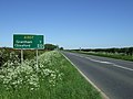
English: Croxton Kerrial (pronounced "crow-sun kerry-ul") is a small village, civil parish and electoral ward within the Melton borough of Leicestershire, England. It is northeast of Melton Mowbray.
village and civil parish in Leicestershire, United Kingdom  | |||||
| Carica un file multimediale | |||||
| Istanza di | |||||
|---|---|---|---|---|---|
| Luogo | Melton, Leicestershire, Midlands Orientali, Inghilterra | ||||
| Considerato essere uguale a | Croxton Kerrial (pagina Wikimedia duplicata, parrocchia civile dell'Inghilterra) | ||||
 | |||||
Sottocategorie
Questa categoria contiene le 4 sottocategorie indicate di seguito, su un totale di 4.
File nella categoria "Croxton Kerrial"
Questa categoria contiene 200 file, indicati di seguito, su un totale di 401.
(pagina precedente) (pagina successiva)-

-
 36 Main Street, Branston - geograph.org.uk - 5181821.jpg 1 280 × 960; 372 KB
-
 A bend in Croxton Lane - geograph.org.uk - 3610511.jpg 640 × 480; 74 KB
-
 A lane along Cooper's Plantation - geograph.org.uk - 3496921.jpg 1 504 × 2 256; 2,34 MB
-
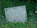
 A Seaman's grave - geograph.org.uk - 5985584.jpg 6 032 × 4 014; 6,98 MB
-

-
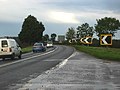 A607 near Croxton Kerrial - geograph.org.uk - 67715.jpg 640 × 480; 122 KB
-
 A607 towards Grantham - geograph.org.uk - 2966412.jpg 640 × 480; 70 KB
-
 A607 towards Grantham - geograph.org.uk - 2966417.jpg 640 × 480; 63 KB
-
 A607 towards Grantham - geograph.org.uk - 2966426.jpg 640 × 480; 63 KB
-
 A607 towards Grantham - geograph.org.uk - 2966430.jpg 640 × 480; 109 KB
-
 A607 towards Grantham - geograph.org.uk - 2966444.jpg 640 × 480; 71 KB
-
 A607 towards Grantham - geograph.org.uk - 2966459.jpg 640 × 480; 79 KB
-
 A607 towards Grantham - geograph.org.uk - 5990298.jpg 640 × 425; 39 KB
-
 A607 towards Melton Mowbray - geograph.org.uk - 5990299.jpg 640 × 490; 41 KB
-
 A607, near Croxton Kerrial - geograph.org.uk - 104599.jpg 640 × 427; 83 KB
-
 Abandoned track, Croxton Kerrial - geograph.org.uk - 30069.jpg 640 × 480; 135 KB
-
 Animal pen by Branston Road - geograph.org.uk - 5879547.jpg 640 × 456; 73 KB
-
 April showers 1 - geograph.org.uk - 2913683.jpg 640 × 427; 52 KB
-
 April showers 2 - geograph.org.uk - 2913685.jpg 640 × 427; 62 KB
-
 Autumn near Branston - geograph.org.uk - 3229360.jpg 1 024 × 768; 296 KB
-
 Awaiting harvest - geograph.org.uk - 3350129.jpg 640 × 452; 61 KB
-
 Barley field by The Drift - geograph.org.uk - 6481175.jpg 1 024 × 768; 155 KB
-
 Behind the hedge near Heath Farm - geograph.org.uk - 5134639.jpg 1 024 × 768; 183 KB
-
 Belvoir Angel - geograph.org.uk - 4416805.jpg 1 024 × 683; 378 KB
-
 Belvoir Angel - geograph.org.uk - 4416826.jpg 1 024 × 683; 324 KB
-
 Belvoir Angel headstone, Branston Churchyard - geograph.org.uk - 5181807.jpg 1 280 × 960; 522 KB
-
 Belvoir Angel headstone, Branston Churchyard - geograph.org.uk - 5181811.jpg 1 280 × 960; 461 KB
-
 Belvoir Angel headstone, Branston Churchyard - geograph.org.uk - 5181812.jpg 1 280 × 960; 576 KB
-

-

-
 Belvoir Castle, aerial 2018 (1) - geograph.org.uk - 5846275.jpg 1 024 × 683; 179 KB
-
 Belvoir Estate Woodlands sign - geograph.org.uk - 3350136.jpg 640 × 281; 51 KB
-
 Belvoir road - geograph.org.uk - 3492277.jpg 2 256 × 1 504; 2,44 MB
-
 Belvoir Road - geograph.org.uk - 4040983.jpg 640 × 480; 40 KB
-
 Belvoir Road approaching crossroads - geograph.org.uk - 4040986.jpg 640 × 480; 48 KB
-
 Belvoir Road near Terrace Hills Farm - geograph.org.uk - 2027396.jpg 1 625 × 974; 650 KB
-
 Belvoir Road towards High Leys - geograph.org.uk - 2031142.jpg 2 728 × 1 775; 2,16 MB
-
 Bench mark, 36 Main Street, Branston - geograph.org.uk - 5181825.jpg 916 × 1 280; 384 KB
-
 Bench mark, 6 Main Street, Branston - geograph.org.uk - 5181827.jpg 1 148 × 1 280; 435 KB
-
 Bench mark, Church of St Guthlac, Branston - geograph.org.uk - 5181806.jpg 960 × 1 280; 494 KB
-
 Bench mark, The Old Forge, Croxton Kerrial - geograph.org.uk - 5194304.jpg 1 160 × 1 280; 527 KB
-
 Bench mark,St Botolph's church, Croxton Kerrial - geograph.org.uk - 5183217.jpg 1 049 × 1 280; 510 KB
-
 Benchmark on 'The Old Forge' - geograph.org.uk - 6230947.jpg 683 × 1 024; 274 KB
-
 Benchmark on St John the Baptist's Church - geograph.org.uk - 6230658.jpg 678 × 1 024; 301 KB
-
 Benchmark on ^6 Top Road - geograph.org.uk - 6230882.jpg 620 × 1 024; 163 KB
-
 Branston Lane towards Branston - geograph.org.uk - 5879550.jpg 640 × 462; 82 KB
-
 Branston Lane towards Knipton - geograph.org.uk - 3350137.jpg 640 × 479; 74 KB
-
 Branston Lane towards Knipton - geograph.org.uk - 5879554.jpg 640 × 478; 91 KB
-
 Branston Road near to Eaton Grange - geograph.org.uk - 5879548.jpg 640 × 435; 87 KB
-
 Branston Road towards Branston - geograph.org.uk - 5879549.jpg 640 × 458; 98 KB
-
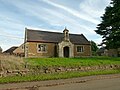
 Branston Village Hall - geograph.org.uk - 4416693.jpg 1 024 × 683; 225 KB
-
 Branston Village Hall - geograph.org.uk - 5181786.jpg 1 280 × 960; 347 KB
-
 Bridge at the foot of the hill - geograph.org.uk - 998873.jpg 640 × 427; 145 KB
-
 Bridge over the River Devon - geograph.org.uk - 3350120.jpg 640 × 421; 74 KB
-

-
 Broken oak, Mary Lane - geograph.org.uk - 6032785.jpg 3 776 × 2 520; 3,78 MB
-
 Bulls in field on west side of Saltby Road - geograph.org.uk - 6175874.jpg 1 024 × 683; 149 KB
-
 By Branston Lane - geograph.org.uk - 3350138.jpg 640 × 481; 72 KB
-
 Carved poppyhead, Ss Botolph and John the Baptist church - geograph.org.uk - 5051178.jpg 4 272 × 2 848; 3,93 MB
-
 Cattlegrid on the track leading out of Croxton Park - geograph.org.uk - 6033036.jpg 3 776 × 2 520; 3,95 MB
-
 Cedar Hill - geograph.org.uk - 5981050.jpg 5 822 × 3 874; 5,63 MB
-
 Cedar Hill - geograph.org.uk - 999406.jpg 640 × 427; 113 KB
-
 Cedar Hill, near Croxton Kerrial - geograph.org.uk - 67671.jpg 640 × 480; 126 KB
-

-

-
 Chapel Lane, Croxton Kerrial - geograph.org.uk - 6032996.jpg 3 776 × 2 520; 3,96 MB
-

-

-

-

-

-

-

-

-

-

-
 Church of St Guthlac, Branston - geograph.org.uk - 5181787.jpg 1 280 × 957; 327 KB
-
 Church of St Guthlac, Branston - geograph.org.uk - 5181789.jpg 1 280 × 865; 315 KB
-
 Church of St Guthlac, Branston - geograph.org.uk - 5181791.jpg 844 × 1 280; 306 KB
-
 Church of St Guthlac, Branston - geograph.org.uk - 5181793.jpg 1 280 × 1 066; 326 KB
-
 Church of St Guthlac, Branston - geograph.org.uk - 5181794.jpg 960 × 1 280; 291 KB
-
 Church of St Guthlac, Branston - geograph.org.uk - 5181796.jpg 901 × 1 280; 294 KB
-
 Church of St Guthlac, Branston - geograph.org.uk - 5181799.jpg 1 280 × 960; 306 KB
-
 Church of St Guthlac, Branston - geograph.org.uk - 5181816.jpg 926 × 1 280; 306 KB
-
 Church of St. John the Baptist, Croxton Kerrial - geograph.org.uk - 5202580.jpg 1 024 × 768; 149 KB
-
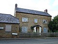
 Cottage in Branston - geograph.org.uk - 3229378.jpg 1 024 × 768; 170 KB
-
 Cottage in Branston - geograph.org.uk - 3610345.jpg 640 × 480; 81 KB
-
 Cottages in Croxton Kerrial - geograph.org.uk - 2168705.jpg 756 × 1 024; 207 KB
-
 Cottages off Main Street, Branston - geograph.org.uk - 998138.jpg 640 × 427; 99 KB
-
 Cottages on the edge of the village - geograph.org.uk - 5202600.jpg 1 024 × 768; 143 KB
-
 Cottages, Middle Street, Croxton Kerrial - geograph.org.uk - 5134624.jpg 1 024 × 768; 158 KB
-
 Cracks in field west of Croxton Lane - geograph.org.uk - 5879551.jpg 640 × 477; 136 KB
-
 Crop field and woodland - geograph.org.uk - 4040993.jpg 640 × 480; 85 KB
-
 Crop field near Branston - geograph.org.uk - 3610348.jpg 640 × 480; 100 KB
-
 Crossing of the paths - geograph.org.uk - 2051220.jpg 2 576 × 1 822; 2,04 MB
-
 Crossroads of Belvoir Road and Wood Lane - geograph.org.uk - 3492270.jpg 2 256 × 1 504; 2,34 MB
-
 Croxton Kerrial - geograph.org.uk - 5982917.jpg 6 032 × 4 014; 6,18 MB
-

-

-

-

-

-

-

-

-
-

-

-

-

-

-
 Croxton Kerrial playing field - geograph.org.uk - 1002003.jpg 640 × 427; 72 KB
-
 Croxton Kerrial Village Hall - geograph.org.uk - 5186973.jpg 1 280 × 960; 471 KB
-
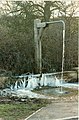 Croxton Kerrial water spout, ice feature - geograph.org.uk - 3162648.jpg 420 × 640; 120 KB
-
 Croxton Kerrial, Church Lane - 1 - geograph.org.uk - 2044168.jpg 800 × 600; 417 KB
-
 Croxton Kerrial, Church Lane - 2 - geograph.org.uk - 2044166.jpg 800 × 600; 487 KB
-
 Croxton Kerrial, Leicestershire - geograph.org.uk - 67371.jpg 640 × 480; 108 KB
-
 Croxton Kerrial.jpg 477 × 325; 146 KB
-
 Croxton Lane - geograph.org.uk - 2999871.jpg 640 × 484; 84 KB
-
 Croxton Lane towards Croxton Kerrial - geograph.org.uk - 5879555.jpg 640 × 465; 58 KB
-
 Croxton Lane towards Harston - geograph.org.uk - 2999872.jpg 640 × 489; 120 KB
-
 Croxton Lane towards Knipton - geograph.org.uk - 5879556.jpg 640 × 480; 70 KB
-
 Croxton Park - geograph.org.uk - 608503.jpg 640 × 480; 102 KB
-
 Croxton Park, near Croxton Kerrial - geograph.org.uk - 67369.jpg 640 × 480; 150 KB
-
 Croxton-Knipton Lane - geograph.org.uk - 999411.jpg 640 × 427; 139 KB
-
 Donations brass of 1683, Croxton Kerrial Church - geograph.org.uk - 3108715.jpg 2 256 × 1 504; 2,44 MB
-
 Double manhole - geograph.org.uk - 5982927.jpg 6 032 × 4 014; 6,86 MB
-
 Down the hill - geograph.org.uk - 5982911.jpg 6 032 × 4 014; 6,72 MB
-
 Down the hill to Branston - geograph.org.uk - 3492306.jpg 1 504 × 2 256; 3,25 MB
-
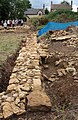
 Dry stone wall, Croxton Park - geograph.org.uk - 2129219.jpg 1 600 × 1 227; 454 KB
-

-
 Entrance to Highfield Farm Croxton Kerrial - geograph.org.uk - 4433704.jpg 1 024 × 768; 130 KB
-
 Entrance to Keeper's Cottage - geograph.org.uk - 3350139.jpg 640 × 557; 90 KB
-

-

-
 Farm track at Croxton Kerrial - geograph.org.uk - 999417.jpg 640 × 427; 117 KB
-
 Farm track near Branston - geograph.org.uk - 3229390.jpg 1 024 × 768; 144 KB
-
 Farm track near Croxton Kerrial - geograph.org.uk - 2966440.jpg 640 × 480; 74 KB
-
 Farm track near Harston - geograph.org.uk - 5183197.jpg 1 280 × 960; 396 KB
-
 Farm Track off Croxton Lane - geograph.org.uk - 3488225.jpg 1 504 × 2 256; 2,07 MB
-
 Farm track to Nursery Plantation - geograph.org.uk - 3229355.jpg 1 024 × 768; 253 KB
-
 Farmland above Knipton Reservoir - geograph.org.uk - 998177.jpg 640 × 427; 114 KB
-
 Farmland and Hill Top Farm - geograph.org.uk - 5240974.jpg 800 × 602; 159 KB
-
 Farmland and woodland - geograph.org.uk - 3610354.jpg 640 × 480; 73 KB
-
 Farmland in Croxton Kerrial - geograph.org.uk - 1002047.jpg 640 × 427; 102 KB
-
 Farmland near Blackwell Lodge - geograph.org.uk - 2966456.jpg 640 × 480; 88 KB
-
 Farmland near Croxson Kerrial - geograph.org.uk - 999414.jpg 640 × 427; 99 KB
-
 Farmland near Croxton Kerrial - geograph.org.uk - 2966425.jpg 640 × 435; 56 KB
-
 Farmland near Croxton Kerrial - geograph.org.uk - 2966428.jpg 640 × 480; 89 KB
-
 Farmland near Croxton Kerrial - geograph.org.uk - 2966442.jpg 640 × 480; 71 KB
-
 Farmland near Croxton Kerrial - geograph.org.uk - 2991481.jpg 640 × 427; 83 KB
-
 Farmland near Croxton Kerrial - geograph.org.uk - 2991485.jpg 640 × 427; 70 KB
-

-
 Farmland near Croxton Park - geograph.org.uk - 3016400.jpg 640 × 480; 63 KB
-

-
 Farmland towards Harston Wood - geograph.org.uk - 3610501.jpg 640 × 480; 86 KB
-
 Farmland towards Lings Covert - geograph.org.uk - 2966406.jpg 640 × 480; 106 KB
-
 Farmland, Barn Lodge Farm - geograph.org.uk - 3016394.jpg 640 × 480; 48 KB
-
 Farmland, Tipping's Lodge - geograph.org.uk - 3016388.jpg 640 × 480; 50 KB
-
 Field entrance - geograph.org.uk - 3610448.jpg 640 × 480; 98 KB
-
 Field entrance, with Geese - geograph.org.uk - 5982900.jpg 6 032 × 4 014; 8 MB
-
 Field margin - geograph.org.uk - 6492815.jpg 1 024 × 768; 188 KB
-
 Field near Terrace Hills Farm - geograph.org.uk - 1840957.jpg 640 × 480; 94 KB
-
 Field side track - geograph.org.uk - 3350125.jpg 640 × 489; 56 KB
-

-
 Field west of Croxton Lane - geograph.org.uk - 5879552.jpg 640 × 514; 83 KB
-
-
 Fields above Knipton Reservoir - geograph.org.uk - 998162.jpg 640 × 427; 128 KB
-
 Fields by Croxton Lane - geograph.org.uk - 2999873.jpg 640 × 475; 73 KB
-
 Fish pond, fed by the headwaters of the River Devon - geograph.org.uk - 2129991.jpg 1 600 × 1 200; 571 KB
-
 Fish-ponds of the former Croxton Abbey - geograph.org.uk - 2128777.jpg 1 600 × 1 200; 294 KB
-
 Flooding at Croxton Kerrial - geograph.org.uk - 6382850.jpg 1 024 × 768; 186 KB
-
 Flooding at Croxton Kerrial - geograph.org.uk - 6382859.jpg 1 024 × 768; 288 KB
-
 Font, Ss Botolph ^ John the Baptist church, Croxton Kerrial - geograph.org.uk - 5051181.jpg 2 656 × 4 164; 5,16 MB
-
 Footpath from Knipton Lane - geograph.org.uk - 4416670.jpg 1 024 × 683; 222 KB
-
 Footpath in old ironstone workings - geograph.org.uk - 1567594.jpg 480 × 640; 129 KB
-
 Footpath stile on Windmill Hill - geograph.org.uk - 1745419.jpg 4 000 × 3 000; 2,95 MB
-
 Footpath to Branston - geograph.org.uk - 4040978.jpg 640 × 480; 65 KB
-
 Footpath to Croxton Kerrial - geograph.org.uk - 6032793.jpg 3 776 × 2 520; 4,09 MB
-
 Footpath to Croxton Kerrial - geograph.org.uk - 6032835.jpg 3 776 × 2 520; 4,08 MB
-
 Footpath to Croxton Kerrial - geograph.org.uk - 6484778.jpg 1 024 × 768; 194 KB
-
 Footpath towards Harston - geograph.org.uk - 5202622.jpg 1 024 × 768; 261 KB
-
 Free Range Geese, Croxton Kerrial - geograph.org.uk - 69356.jpg 640 × 480; 123 KB
-
 Gap through the trees - geograph.org.uk - 2051226.jpg 2 813 × 1 751; 1,67 MB
-
 Geese, as far as the eye can see - geograph.org.uk - 5982903.jpg 6 032 × 4 014; 6,04 MB
-
 Geese, Croxton Kerrial - geograph.org.uk - 5202589.jpg 1 024 × 768; 230 KB
-
 Goose farm - geograph.org.uk - 5982914.jpg 6 032 × 4 014; 4,93 MB
-
 Grave slabs, Croxton Kerrial churchyard - geograph.org.uk - 5183216.jpg 1 280 × 960; 410 KB
-
 Graveyard at Croxton Kerrial - geograph.org.uk - 1000509.jpg 640 × 427; 105 KB
-
 Grazing, Eaton Grange - geograph.org.uk - 3610340.jpg 640 × 480; 77 KB
-
 Green Lane - geograph.org.uk - 3492296.jpg 2 256 × 1 504; 2,43 MB
-
 Green Lane - geograph.org.uk - 5990300.jpg 640 × 359; 36 KB
-
 Green Lane westwards - geograph.org.uk - 5935590.jpg 640 × 473; 71 KB
-
 Hall Farmhouse, Main Street, Branston - geograph.org.uk - 5181820.jpg 1 280 × 960; 427 KB
-
 Haylage harvest - geograph.org.uk - 4670016.jpg 1 024 × 683; 231 KB
-
 Heading north along The Drift - geograph.org.uk - 5240931.jpg 800 × 575; 158 KB
-
 Hedge tidy on right untidy on left - geograph.org.uk - 4433695.jpg 1 024 × 768; 94 KB
-
 Hillside Farmhouse, Croxton Kerrial - geograph.org.uk - 5186969.jpg 1 280 × 960; 339 KB
-
 House on west side of Middle Street - geograph.org.uk - 6175868.jpg 1 024 × 683; 150 KB


_-_geograph.org.uk_-_5846275.jpg)


_-_geograph.org.uk_-_5474581.jpg)
_-_geograph.org.uk_-_5476594.jpg)
_-_geograph.org.uk_-_5476674.jpg)
_-_geograph.org.uk_-_5476692.jpg)
_-_geograph.org.uk_-_5476707.jpg)
_-_geograph.org.uk_-_5476765.jpg)
_-_geograph.org.uk_-_5474613.jpg)
_-_geograph.org.uk_-_5474654.jpg)
_-_geograph.org.uk_-_5474673.jpg)
_-_geograph.org.uk_-_5474691.jpg)
_-_geograph.org.uk_-_5476464.jpg)
_-_geograph.org.uk_-_5476474.jpg)
_-_geograph.org.uk_-_5476555.jpg)
_-_geograph.org.uk_-_5476575.jpg)


