Category:Crumlin, Caerphilly
Vai alla navigazione
Vai alla ricerca
town and community in Caerphilly County Borough   | |||||
| Carica un file multimediale | |||||
| Istanza di | |||||
|---|---|---|---|---|---|
| Luogo | Caerphilly, Galles | ||||
| Popolazione |
| ||||
| Superficie |
| ||||
 | |||||
Български: 300px|мини|Изглед от Кръмлин
Cymraeg: Tref ym mwrdeisdref sirol Caerffili yn ne Cymru yw Crymlyn (Saesneg: Crumlin). Saif yn nyffryn Afon Ebwy, bum milltir i'r gorllewin o dref Pont-y-pŵl.
English: Crumlin is a town in Caerphilly county borough in south Wales, situated in the Ebbw River valley [1], five miles west of Pontypool, within the historic boundaries of Monmouthshire.
Sottocategorie
Questa categoria contiene le 6 sottocategorie indicate di seguito, su un totale di 6.
File nella categoria "Crumlin, Caerphilly"
Questa categoria contiene 200 file, indicati di seguito, su un totale di 665.
(pagina precedente) (pagina successiva)-
 2010 Wales Caerphilly Community Crumlin map.svg 512 × 725; 375 KB
-
 2024 Wales Caerphilly Community Crumlin map.svg 512 × 725; 345 KB
-

-

-
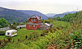
 A house off the Park Way - geograph.org.uk - 4015077.jpg 1 600 × 1 064; 607 KB
-
 A view from Sofrydd Road, Sofrydd - geograph.org.uk - 2635159.jpg 640 × 572; 123 KB
-
 A467 near Aberbeeg - geograph.org.uk - 2751435.jpg 640 × 480; 59 KB
-
 A467 near Glandwr - geograph.org.uk - 2751450.jpg 640 × 453; 66 KB
-

-
 A467-Kendon Road junction - geograph.org.uk - 2751473.jpg 640 × 480; 57 KB
-
 A472 east of Hafodyrynys - geograph.org.uk - 5646764.jpg 800 × 594; 202 KB
-
 A472 eastbound - geograph.org.uk - 2751506.jpg 640 × 454; 49 KB
-
 A472 pelican crossing, Hafodyrynys - geograph.org.uk - 5647149.jpg 800 × 530; 86 KB
-
 A472-A467 junction, Crumlin - geograph.org.uk - 5081589.jpg 5 184 × 3 456; 6,05 MB
-
 A487 heads north from Crumlin - geograph.org.uk - 5651382.jpg 640 × 481; 53 KB
-
 Aberbeeg Hospital, Aberbeeg - geograph.org.uk - 5228978.jpg 5 179 × 3 451; 3,83 MB
-
 Abertillery bus in Trinant - geograph.org.uk - 5231742.jpg 800 × 552; 103 KB
-
 ACF hut dwarfed by pylon, Sofrydd - geograph.org.uk - 2482500.jpg 568 × 640; 74 KB
-
 Across the valley towards Lewis Street, Swffryd - geograph.org.uk - 5081802.jpg 5 184 × 3 456; 3,1 MB
-

-
 Albertina Road, Treowen - geograph.org.uk - 2299843.jpg 640 × 414; 57 KB
-

-

-

-
 B4251 nears Oakdale Industrial Park - geograph.org.uk - 5651345.jpg 640 × 480; 41 KB
-

-

-
 Beech tree in field off Mynydd Llwyd Common - geograph.org.uk - 6509850.jpg 5 179 × 3 451; 5,13 MB
-
 Beehive Buildings, Crumlin - geograph.org.uk - 2752270.jpg 640 × 480; 68 KB
-
 Belvedere Close, Pentwyn - geograph.org.uk - 5229772.jpg 800 × 725; 100 KB
-
 Bench in Pen-y-fan Pond Country Park - geograph.org.uk - 4326368.jpg 800 × 542; 132 KB
-
 Bench overlooking Aberbeeg - geograph.org.uk - 1218438.jpg 640 × 480; 96 KB
-
 Bench with a view, Trinant - geograph.org.uk - 5234338.jpg 800 × 600; 161 KB
-

-

-
 Bends in road to Trinant - geograph.org.uk - 4717876.jpg 5 120 × 3 451; 5,31 MB
-
 Bethel Baptist Chapel, Crumlin - geograph.org.uk - 2752214.jpg 640 × 480; 79 KB
-
 Bont Pren boundary sign - geograph.org.uk - 5529692.jpg 800 × 605; 169 KB
-
 Bont Pren boundary sign detail - geograph.org.uk - 5529696.jpg 457 × 800; 137 KB
-

-

-
 Boundary of Mynydd Llwyd Common - geograph.org.uk - 6510612.jpg 5 179 × 3 451; 5,16 MB
-
 Bowling green, Llanhilleth - geograph.org.uk - 2765949.jpg 640 × 480; 83 KB
-
 Breakfast in Bread, Hafodyrynys - geograph.org.uk - 5529605.jpg 741 × 800; 152 KB
-
 Bridge over a railway line, Crumlin - geograph.org.uk - 2713163.jpg 640 × 480; 111 KB
-
 Bridge over dry overflow channel, Pen-y-fan Pond - geograph.org.uk - 6498938.jpg 5 179 × 3 451; 4,62 MB
-
 Bridleway near Pentrapeod - geograph.org.uk - 5236951.jpg 4 000 × 3 000; 4,53 MB
-
 Bridleway near Pentrapeod - geograph.org.uk - 5236958.jpg 4 000 × 3 000; 5,53 MB
-
 Bridleway to Manmoel Road - geograph.org.uk - 4616427.jpg 4 926 × 3 344; 5,95 MB
-
 Bridleway to Pen-y-fan Pond - geograph.org.uk - 4955610.jpg 5 048 × 3 366; 6,79 MB
-
 Bridleway, Sycamore House - geograph.org.uk - 4676367.jpg 5 062 × 3 371; 3,99 MB
-

-
 Bryn Brithdir, Oakdale - geograph.org.uk - 3986496.jpg 800 × 612; 159 KB
-
 BT phonebox, Trinant Terrace, Pentwyn - geograph.org.uk - 5233800.jpg 800 × 641; 113 KB
-

-

-

-
 Bute Place, Cwm Nant Gwynt - geograph.org.uk - 5220751.jpg 699 × 800; 145 KB
-
 Byway down hillside to Crumlin - geograph.org.uk - 5174696.jpg 5 179 × 3 451; 5,61 MB
-
 Byway to Pentrapeod - geograph.org.uk - 4987049.jpg 5 184 × 3 456; 6,19 MB
-
 Byway to Trinant from Crumlin - geograph.org.uk - 5236458.jpg 5 179 × 3 451; 5,48 MB
-
 Byway up to Ebbw Valley Walk - geograph.org.uk - 5174855.jpg 5 179 × 3 451; 6,31 MB
-
 Caer-ynys-isha, Kendon Road,Crumlin - geograph.org.uk - 1931787.jpg 640 × 480; 81 KB
-
 Caerphilly UK community map (Crumlin).svg 894 × 1 266; 474 KB
-
 Caravan storage at Kendon Farm - geograph.org.uk - 4717851.jpg 5 184 × 3 456; 5,49 MB
-
 Cattle behind Horeb Chapel, Trinant - geograph.org.uk - 5236000.jpg 5 179 × 3 451; 4,96 MB
-
 Cattle ^ old building, Tir-hunt - geograph.org.uk - 5157268.jpg 5 179 × 3 451; 5,14 MB
-
 Cedar Road, Pentwyn - geograph.org.uk - 5229695.jpg 800 × 566; 87 KB
-

-
 Cefn-crib Road, Hafodyrynys - geograph.org.uk - 4924115.jpg 5 184 × 3 456; 6,02 MB
-

-
 Checkpoint 10 on The Valleys 100 - geograph.org.uk - 4015085.jpg 1 600 × 1 064; 471 KB
-
 Checkpoint 10 on The Valleys 100 - geograph.org.uk - 4015088.jpg 1 600 × 1 064; 485 KB
-
 Checkpoint 10 on The Valleys 100 - geograph.org.uk - 4015104.jpg 1 600 × 1 064; 903 KB
-
 Checkpoint 10 on The Valleys 100, the marshals tent - geograph.org.uk - 4015094.jpg 1 600 × 1 064; 475 KB
-
 Cherry Tree House, Oakdale Business Park - geograph.org.uk - 3982904.jpg 800 × 656; 140 KB
-
 Cherry Trees, Cherry Grove, Croespenmaen - geograph.org.uk - 4627778.jpg 3 072 × 2 304; 1,75 MB
-
 Cherry Trees, Crossfields, Croespenmaen - geograph.org.uk - 4629552.jpg 3 072 × 2 304; 1,83 MB
-
 Chimney, Crumlin Navigation Colliery - geograph.org.uk - 5539629.jpg 5 184 × 3 456; 6,63 MB
-
 Christ Church, Aberbeeg - geograph.org.uk - 4807940.jpg 5 179 × 3 451; 4,52 MB
-
 Christ Church, Aberbeeg - geograph.org.uk - 4926307.jpg 5 184 × 3 456; 4,91 MB
-
 Cilffordd Mynydd Pen y Fan Ridgeway - geograph.org.uk - 3850001.jpg 640 × 480; 84 KB
-
 Clear-felled hillside, Cwm y Glyn - geograph.org.uk - 6208092.jpg 5 179 × 3 451; 4,4 MB
-

-
 Coffer dam, River Ebbw, Crumlin - geograph.org.uk - 5081872.jpg 5 179 × 3 451; 4,44 MB
-
 Conway Road houses, Pentwyn - geograph.org.uk - 5230062.jpg 800 × 634; 97 KB
-

-

-

-
 Crumlin (High Level) station site geograph-3341574-by-Ben-Brooksbank.jpg 2 395 × 1 436; 3,13 MB
-

-

-

-

-

-
 Crumlin cricket ground - geograph.org.uk - 2299928.jpg 640 × 457; 74 KB
-
 Crumlin High Level Primary School - geograph.org.uk - 2297654.jpg 625 × 640; 74 KB
-
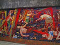
 Crumlin mural (geograph 1206348).jpg 640 × 480; 101 KB
-
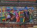
 Crumlin mural (geograph 1206355).jpg 640 × 480; 110 KB
-
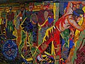
 Crumlin mural (geograph 1206375).jpg 640 × 480; 105 KB
-
 Crumlin mural.jpg 640 × 480; 116 KB
-
 Crumlin Navigation Colliery - Chimney, Powerhouse and North Winding House.jpg 1 280 × 960; 1,41 MB
-
 Crumlin Navigation Colliery - geograph.org.uk - 4037230.jpg 640 × 422; 85 KB
-
 Crumlin post office - geograph.org.uk - 2297548.jpg 640 × 512; 93 KB
-
 Crumlin RFC club and headquarters - geograph.org.uk - 2712499.jpg 640 × 399; 61 KB
-
 Crumlin Road permanently closed ahead - geograph.org.uk - 2751916.jpg 640 × 480; 105 KB
-

-
 Crumlin viaduct from Celynen North - geograph.org.uk - 3390008.jpg 640 × 480; 568 KB
-
 Crumlin Viaduct site geograph-3342868-by-Ben-Brooksbank.jpg 2 320 × 1 533; 4,44 MB
-
 Crumlin Viaduct.jpg 2 930 × 2 249; 1,73 MB
-
 Crumlin Workmen's Club and Institute - geograph.org.uk - 3179095.jpg 640 × 480; 64 KB
-
 Crumlin, Mural.jpg 640 × 477; 91 KB
-
 Culvert, Hafod-yr-ynys Road, Crumlin - geograph.org.uk - 5081558.jpg 5 179 × 3 451; 4,47 MB
-
 Cwm Nant Gwynt boundary sign detail - geograph.org.uk - 5220627.jpg 800 × 405; 47 KB
-
 Cwm Nant Gwynt name sign - geograph.org.uk - 5220954.jpg 800 × 593; 202 KB
-
 Cwm Nant Gwynt side road - geograph.org.uk - 5220738.jpg 800 × 570; 127 KB
-
 Damaged stile to footpath, Gelli - geograph.org.uk - 5316377.jpg 5 179 × 3 429; 4,19 MB
-
 Dark green lockup garages, Hafodyrynys - geograph.org.uk - 5647538.jpg 714 × 800; 120 KB
-

-
 Derelict colliery, Crumlin - geograph.org.uk - 1157312.jpg 640 × 480; 75 KB
-
 Derelict historic farmhouse, Gelli - geograph.org.uk - 5316379.jpg 5 179 × 3 451; 6,02 MB
-

-
 Derelict Pen-y-Graig Farm - geograph.org.uk - 5214753.jpg 5 179 × 3 451; 6,62 MB
-
 Derelict stone building - geograph.org.uk - 6486493.jpg 5 184 × 3 456; 7,65 MB
-
 Descent towards Cwm Nant Gwynt - geograph.org.uk - 5234240.jpg 800 × 721; 151 KB
-

-

-
 Dilapidated stone wall - geograph.org.uk - 4988142.jpg 5 184 × 3 456; 7,15 MB
-

-
 Drought-affected shore, Pen-y-fan Pond - geograph.org.uk - 6498917.jpg 5 179 × 3 451; 5,77 MB
-
 Ducks on Pen-y-fan Pond - geograph.org.uk - 4326329.jpg 800 × 434; 101 KB
-

-

-
 Eastern boundary of Sofrydd - geograph.org.uk - 2482433.jpg 640 × 505; 101 KB
-
 Eastern end of Kendon Road, Crumlin - geograph.org.uk - 2751649.jpg 640 × 480; 85 KB
-

-
 Ebbw river, Aberbeeg - geograph.org.uk - 1932317.jpg 640 × 516; 145 KB
-
 Ebbw River, Aberbeeg - geograph.org.uk - 5823135.jpg 5 179 × 3 451; 5,26 MB
-
 Ebbw River, Station Road, Crumlin - geograph.org.uk - 4793208.jpg 5 179 × 3 451; 6,2 MB
-
 Ebbw River, under A467 bridge, Aberbeeg - geograph.org.uk - 4842517.jpg 5 179 × 3 451; 4,31 MB
-
 Ebbw Valley Railway, Crumlin - geograph.org.uk - 4793239.jpg 5 179 × 3 451; 4,88 MB
-
 Ebbw Valley Walk above Treowen - geograph.org.uk - 4779639.jpg 5 163 × 3 387; 5,11 MB
-
 Ebbw Valley Walk from Kendon Road, Kendon - geograph.org.uk - 4785845.jpg 5 043 × 3 361; 6,09 MB
-
 Ebbw Valley Walk from pond at Tir-hunt - geograph.org.uk - 5157339.jpg 5 184 × 3 456; 7,63 MB
-
 Ebbw Valley Walk near Load of Hay Lane - geograph.org.uk - 4715681.jpg 5 133 × 3 451; 4,89 MB
-
 Ebbw Valley Walk on minor road from Treowen - geograph.org.uk - 4779653.jpg 5 184 × 3 456; 7,32 MB
-
 Ebbw Valley Walk towards Tir hunt - geograph.org.uk - 5157243.jpg 5 179 × 3 451; 6,03 MB
-
 Ebbw Valley Walk, Load of Hay Lane - geograph.org.uk - 4715147.jpg 5 144 × 3 451; 5,06 MB
-
 Ebbw Valley Walk, Pen-y-fan-fach - geograph.org.uk - 5228263.jpg 5 179 × 3 451; 5,72 MB
-
 Ebbw Valley Walk, Pen-y-fan-fach Farm - geograph.org.uk - 5228656.jpg 5 184 × 3 456; 7,58 MB
-
 Ebbw Valley Walk, Ty-mawr - geograph.org.uk - 4648670.jpg 5 184 × 3 456; 7,32 MB
-
 Edge of Coed Llwyn-du - geograph.org.uk - 2021032.jpg 640 × 480; 94 KB
-

-
 Edge of Pen-y-fan Pond - geograph.org.uk - 2828662.jpg 640 × 480; 138 KB
-

-

-

-

-
 End of byway down from Pen-y-fan Pond - geograph.org.uk - 6485875.jpg 5 243 × 3 545; 5,15 MB
-

-

-
 End of the 20 zone, Trinant - geograph.org.uk - 5234341.jpg 800 × 558; 118 KB
-

-

-
 Entrance gate to Crumlin cricket ground - geograph.org.uk - 2299903.jpg 640 × 527; 117 KB
-

-
 Entrance to Brace's Bakery, Pen-y-fan - geograph.org.uk - 3986508.jpg 800 × 632; 144 KB
-
 Entrance to Coetir Graig Fawr Woodland, Aberbeeg - geograph.org.uk - 5051954.jpg 5 179 × 3 451; 5,98 MB
-

-
 Entry Sign -' Croespenmaen', Lon Maes Yr Haf, - geograph.org.uk - 4582224.jpg 2 516 × 1 558; 794 KB
-
 Fanhouse and Winding House, Crumlin Navigation Colliery - geograph.org.uk - 5539381.jpg 5 184 × 3 456; 7,03 MB
-
 Fanhouse, Crumlin Navigation Colliery - geograph.org.uk - 5540111.jpg 5 179 × 3 451; 4,82 MB
-
 Farm at Gelli - geograph.org.uk - 5730660.jpg 5 184 × 3 456; 6,38 MB
-
 Farm buildings near Pentrapeod - geograph.org.uk - 5236955.jpg 4 000 × 3 000; 4,98 MB
-
 Farm pond, Tir-hunt - geograph.org.uk - 5157303.jpg 5 179 × 3 451; 6,72 MB
-
 Farmyard, Lower Ton-y-Felin - geograph.org.uk - 4570939.jpg 3 072 × 2 304; 2,2 MB
-
 Felled hedgerow trees - geograph.org.uk - 5248030.jpg 5 179 × 3 451; 4,35 MB
-
 Felled hedgerow, Manmoel Road - geograph.org.uk - 5248102.jpg 5 179 × 3 451; 4,49 MB
-
 Fence by Ebbw Valley Walk near Tir-hunt - geograph.org.uk - 5157214.jpg 5 179 × 3 451; 5,03 MB
-

-
 Fern Close, Pen-y-fan - geograph.org.uk - 3986441.jpg 800 × 600; 131 KB
-
 Fflorens Road, Treowen - geograph.org.uk - 2299755.jpg 640 × 480; 59 KB
-
 Field alongside Kendon to Trinant road - geograph.org.uk - 4713430.jpg 5 179 × 3 429; 4,04 MB
-
 Field behind Pen-y-fan Industrial Estate - geograph.org.uk - 4694561.jpg 5 174 × 3 288; 4,83 MB
-
 Field footpath from Pen-y-fan-fach - geograph.org.uk - 5214725.jpg 5 179 × 3 451; 6,35 MB
-
 Field footpath going south to Pen-y-fan-fach - geograph.org.uk - 5214581.jpg 5 179 × 3 451; 5,65 MB
-
 Field footpath to Kendon Farm - geograph.org.uk - 4717867.jpg 5 096 × 3 451; 4,91 MB
-
 Field in winter, Pen-y-fan - geograph.org.uk - 4798974.jpg 5 179 × 3 451; 4,23 MB
-
 Field near Cefn-coch - geograph.org.uk - 4693872.jpg 5 069 × 3 387; 5,27 MB
-
 Field on Ebbw Valley Walk, near Treowen - geograph.org.uk - 5153132.jpg 5 179 × 3 451; 4,03 MB
-
 Field under transmission lines, Load of Hay Lane - geograph.org.uk - 4717833.jpg 5 128 × 3 451; 4,04 MB
-
 Field ^ fallen tree, near Croespenmaen - geograph.org.uk - 4954493.jpg 5 179 × 3 451; 5,49 MB
-
 Field, Load of Hay Lane - geograph.org.uk - 4715699.jpg 5 160 × 3 451; 4,77 MB
-
 Fly fishing in Pen-y-fan Pond - geograph.org.uk - 4326335.jpg 800 × 551; 139 KB
-
 Fly-fisherman at Pen-y-fan Pond - geograph.org.uk - 2512104.jpg 640 × 480; 83 KB
-

-
 Footbridge into Pen-y-fan Country Park - geograph.org.uk - 2512405.jpg 640 × 480; 104 KB
-
 Footbridge on overflow channel, Pen-y-Fan Pond - geograph.org.uk - 5386125.jpg 5 179 × 3 451; 6,41 MB
-
 Footbridge on path to Ty-Brachty Terrace, Kendon - geograph.org.uk - 4717908.jpg 5 123 × 3 451; 4,31 MB
-
 Footpath behind Pen-y-fan Industrial Estate - geograph.org.uk - 6485840.jpg 5 179 × 3 451; 4,1 MB


.svg)


_station_site_geograph-3341574-by-Ben-Brooksbank.jpg)


.jpg)
.jpg)
.jpg)


