Category:Crymych
Aller à la navigation
Aller à la recherche
village au Royaume-Uni, située dans le comté du Pembrokeshire   | |||||
| Téléverser des médias | |||||
| Nature de l’élément | |||||
|---|---|---|---|---|---|
| Lieu | Pembrokeshire, pays de Galles | ||||
| Population |
| ||||
| Superficie |
| ||||
 | |||||
Brezhoneg: Crymych zo ur gêr vihan eus mervent Kembre, e kontelezh Penfro. Gevellet eo gant Ploveilh.
Cymraeg: Pentref a chymuned yng ngogledd Sir Benfro yw Crymych. I'r gogledd saif bryn Y Frenni Fawr (1269 troedfedd). Mae Afon Nyfer yn llifo trwy Grymych ar ddechrau ei thaith i'r môr ym Mae Ceredigion.
English: Crymych is a small village of around 400 inhabitants in the north of Pembrokeshire, Wales. The village developed around the former Crymmych Arms railway station on the now closed line, nicknamed the Cardi Bach (Little Cardi), which ran from Whitland to Cardigan.
Sous-catégories
Cette catégorie comprend 5 sous-catégories, dont les 5 ci-dessous.
Média dans la catégorie « Crymych »
Cette catégorie comprend 295 fichiers, dont les 200 ci-dessous.
(page précédente) (page suivante)-
 'No biffs or butts' - geograph.org.uk - 539573.jpg 640 × 480 ; 105 kio
-
 160412 W Preseli Hills from NE (Tony Holkham).jpg 4 000 × 3 000 ; 8,22 Mio
-
 160927 Churn stand nr Hermon (Tony Holkham).jpg 3 200 × 2 400 ; 2,3 Mio
-
 2010 Wales Pembrokeshire Community Crymych map.svg 512 × 393 ; 1 018 kio
-
 2024 Wales Pembrokeshire Community Crymych map.svg 512 × 393 ; 1,19 Mio
-
 A478 approaching Crymych - geograph.org.uk - 3751576.jpg 640 × 480 ; 37 kio
-
 A478 heading for Crymych - geograph.org.uk - 3751575.jpg 640 × 480 ; 94 kio
-
 A478 heading for Pentre Galar - geograph.org.uk - 3751565.jpg 640 × 480 ; 39 kio
-
 Ancient bridleway leading towards Coedcefnlas-uchaf Farm - geograph.org.uk - 2448260.jpg 857 × 1 142 ; 375 kio
-
 Ancient bridleway north of Foel Drygarn - geograph.org.uk - 2448267.jpg 1 240 × 930 ; 357 kio
-
 Ancient trackway on Foel Drygarn - geograph.org.uk - 2448251.jpg 955 × 1 273 ; 369 kio
-
 Ancient trackway ^ - geograph.org.uk - 1878799.jpg 640 × 480 ; 146 kio
-
 Bedford "J" type breakdown truck - geograph.org.uk - 3154986.jpg 2 639 × 2 063 ; 1,15 Mio
-
 Black cat at Blue Rock - geograph.org.uk - 516789.jpg 640 × 480 ; 82 kio
-
 Blaen-cwm, Mynachlog-ddu - geograph.org.uk - 3564008.jpg 2 400 × 1 800 ; 2,25 Mio
-
 Blue Rock festival entrance point - geograph.org.uk - 516049.jpg 640 × 480 ; 75 kio
-
 Boundary stone detail^ - geograph.org.uk - 3012582.jpg 2 448 × 3 264 ; 1,64 Mio
-
 Bridge name stone - geograph.org.uk - 3012530.jpg 3 264 × 2 448 ; 1,87 Mio
-
 Bridge over the Afon Clun-maen - geograph.org.uk - 2448792.jpg 1 044 × 783 ; 334 kio
-
 Bwlch sais plantation - geograph.org.uk - 3017577.jpg 3 264 × 2 448 ; 3,58 Mio
-
 Bwlch Sais Plantation - geograph.org.uk - 3814989.jpg 3 264 × 2 448 ; 3,87 Mio
-
 Bwlch Sais trees - geograph.org.uk - 4737164.jpg 3 264 × 2 448 ; 3,13 Mio
-
 Cae gwair - A hayfield - geograph.org.uk - 888585.jpg 640 × 527 ; 70 kio
-
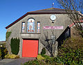
 Canolfan Hermon - geograph.org.uk - 3574140.jpg 640 × 480 ; 82 kio
-
 Capel Hermon - geograph.org.uk - 4461774.jpg 640 × 480 ; 62 kio
-
 Capel Seion. Crymych - geograph.org.uk - 1941285.jpg 640 × 478 ; 66 kio
-
 Car park stone with name plaque - geograph.org.uk - 3352557.jpg 2 855 × 1 529 ; 841 kio
-
 Carn Ddafad-las - geograph.org.uk - 1948696.jpg 1 024 × 768 ; 241 kio
-
 Carn Ddafad-las - geograph.org.uk - 4973471.jpg 4 000 × 3 000 ; 3,07 Mio
-
 Carn Ddafad-las - geograph.org.uk - 4973472.jpg 4 000 × 3 000 ; 3,57 Mio
-
 Carn Ferched - a ruined cairn - geograph.org.uk - 2448230.jpg 1 044 × 783 ; 330 kio
-
 Carn Wen - geograph.org.uk - 2789796.jpg 3 264 × 2 448 ; 3,41 Mio
-
 Carn Wen - geograph.org.uk - 4737191.jpg 3 264 × 2 448 ; 3,27 Mio
-
 Carnalw, Meline - geograph.org.uk - 3982392.jpg 2 560 × 1 920 ; 2,25 Mio
-
 Children's playground - geograph.org.uk - 3352493.jpg 3 264 × 2 448 ; 1,16 Mio
-
 Close up of date stone - geograph.org.uk - 2804391.jpg 2 448 × 3 264 ; 1,89 Mio
-
 Close view of the triangulation pillar on Foeldrygarn - geograph.org.uk - 5192321.jpg 1 500 × 2 000 ; 741 kio
-
 Clwb Rygbi Crymych - geograph.org.uk - 3352549.jpg 3 264 × 2 448 ; 1,03 Mio
-
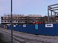
 Construction site - geograph.org.uk - 3174736.jpg 3 236 × 1 975 ; 780 kio
-
 Construction site - geograph.org.uk - 3222742.jpg 3 264 × 2 448 ; 3,17 Mio
-
 Construction site - geograph.org.uk - 3222748.jpg 3 264 × 2 448 ; 3,83 Mio
-
 Construction site - geograph.org.uk - 3244596.jpg 3 261 × 1 399 ; 699 kio
-
 Construction site - geograph.org.uk - 3244604.jpg 3 116 × 1 341 ; 670 kio
-
 Construction site - geograph.org.uk - 3278248.jpg 3 264 × 2 448 ; 2,56 Mio
-
 Construction site - geograph.org.uk - 3278292.jpg 3 264 × 2 448 ; 938 kio
-
 Cornerstones entrance - geograph.org.uk - 3259790.jpg 3 264 × 2 448 ; 4,62 Mio
-
 Corrugated moorland on the lower slopes of Foeldrygarn, Eglwyswrw - geograph.org.uk - 5192465.jpg 2 000 × 1 500 ; 1 021 kio
-
 Cottages at Pontyglasier - geograph.org.uk - 2448813.jpg 1 044 × 783 ; 317 kio
-
 Crymych - geograph.org.uk - 4724332.jpg 1 600 × 1 064 ; 212 kio
-
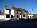 Crymych Arms public house, Crymych, Pembrokeshire, 2014.jpg 4 000 × 3 000 ; 4,02 Mio
-
 Crymych chicken (Unsplash).jpg 5 472 × 3 648 ; 2,14 Mio
-
 Crymych Fire Brigade in action - geograph.org.uk - 3012376.jpg 3 264 × 2 448 ; 3,16 Mio
-
 Crymych Fire Brigade in action^ - geograph.org.uk - 3012396.jpg 3 033 × 1 785 ; 723 kio
-
 Crymych from Frenni fawr - geograph.org.uk - 3876571.jpg 2 816 × 2 112 ; 3,12 Mio
-
 Crymych Market Hall 140310.jpg 3 250 × 2 548 ; 8,68 Mio
-
 Crymych redevelopment 1 - geograph.org.uk - 3352502.jpg 3 264 × 2 448 ; 3,8 Mio
-
 Crymych redevelopment 2 - geograph.org.uk - 3352510.jpg 3 264 × 2 448 ; 3,59 Mio
-
 Crymych redevelopment 3 - geograph.org.uk - 3352517.jpg 3 264 × 2 448 ; 3,58 Mio
-
 Crymych redevelopment 4 - geograph.org.uk - 3352534.jpg 3 264 × 2 448 ; 3,34 Mio
-
 Crymych, Pembrokeshire - geograph.org.uk - 3982184.jpg 2 491 × 1 851 ; 1,62 Mio
-
 Crymych.jpg 640 × 480 ; 82 kio
-
 Cut slate wall of a shed at Glogue - geograph.org.uk - 3086304.jpg 3 264 × 2 448 ; 3,41 Mio
-
 Cylch Meithrin A Ti a Fi Hermon - geograph.org.uk - 3574122.jpg 3 264 × 2 448 ; 3,51 Mio
-
 Date plaque on the chapel. Glandwr - geograph.org.uk - 5192569.jpg 2 000 × 1 921 ; 756 kio
-
 Date stone in bridge over Afon Taf - geograph.org.uk - 2804332.jpg 3 264 × 2 448 ; 5,11 Mio
-
 Development Finished - geograph.org.uk - 4740525.jpg 3 264 × 2 448 ; 3,52 Mio
-
 Development Finished - geograph.org.uk - 4740531.jpg 3 264 × 2 448 ; 3,24 Mio
-
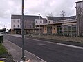
 Development in Crymych - geograph.org.uk - 3437446.jpg 3 264 × 2 448 ; 3,66 Mio
-
 Development in Crymych - geograph.org.uk - 3437464.jpg 3 264 × 2 448 ; 3,78 Mio
-
 Development in Crymych - geograph.org.uk - 3815926.jpg 3 264 × 2 448 ; 1,33 Mio
-
 Development in Crymych - geograph.org.uk - 3815928.jpg 3 264 × 2 448 ; 1,2 Mio
-
 Development in Crymych - geograph.org.uk - 3819970.jpg 3 264 × 2 448 ; 2,95 Mio
-
 Development in Crymych - geograph.org.uk - 3819977.jpg 3 264 × 2 448 ; 3,01 Mio
-
 Distant Ffrenni Fawr - geograph.org.uk - 3056827.jpg 3 264 × 2 448 ; 2,99 Mio
-
 Down stream from bridge over Afon Taf - geograph.org.uk - 2804361.jpg 3 264 × 2 448 ; 4,35 Mio
-
 Eisteddfod yr Urdd - geograph.org.uk - 3815919.jpg 2 555 × 1 614 ; 496 kio
-
 Entrance to Blaen-waun - geograph.org.uk - 3012517.jpg 3 264 × 2 448 ; 3,24 Mio
-
 Entrance to Tir-y-Gafel - geograph.org.uk - 2804412.jpg 3 264 × 2 448 ; 3,82 Mio
-
 Extinct railway line - geograph.org.uk - 481288.jpg 640 × 480 ; 102 kio
-
 Fallen tree near Foel Drygarn - geograph.org.uk - 4973469.jpg 4 000 × 3 000 ; 3,48 Mio
-
 Festive display - geograph.org.uk - 3259779.jpg 3 264 × 2 448 ; 4,25 Mio
-
 Field bank near Crymych - geograph.org.uk - 3692313.jpg 2 560 × 1 920 ; 2,24 Mio
-
 Field near Bribwll, Llanfyrnach - geograph.org.uk - 982413.jpg 640 × 480 ; 102 kio
-
 Field near Bryn-howel, Llanfyrnach - geograph.org.uk - 961751.jpg 640 × 480 ; 114 kio
-
 Field near Waun-aeron, Llanfyrnach - geograph.org.uk - 925528.jpg 640 × 480 ; 89 kio
-
 Field of oats near Cefn-du, Llanfyrnach - geograph.org.uk - 935177.jpg 640 × 480 ; 73 kio
-
 Field on the slopes of Frenni Fawr - geograph.org.uk - 925544.jpg 640 × 480 ; 100 kio
-
 Field, Eglwyswen - geograph.org.uk - 3560872.jpg 2 000 × 1 500 ; 1,65 Mio
-
 Fields before Foel Drygarn - geograph.org.uk - 3012557.jpg 3 264 × 2 448 ; 3,03 Mio
-
 Fields near Blaengorwen, Llanfyrnach - geograph.org.uk - 961753.jpg 640 × 480 ; 98 kio
-
 Fish Chips Teas - geograph.org.uk - 540402.jpg 640 × 484 ; 81 kio
-
 Flags are waving - geograph.org.uk - 3120565.jpg 3 023 × 1 854 ; 744 kio
-
 Flags at the festival - geograph.org.uk - 516171.jpg 640 × 466 ; 75 kio
-
 Foel Drych - geograph.org.uk - 2789774.jpg 3 264 × 2 448 ; 3,35 Mio
-
 Foeldrygarn - geograph.org.uk - 1948724.jpg 1 024 × 768 ; 246 kio
-
 Foeldrygarn from Carn Ddafad-las - geograph.org.uk - 1347755.jpg 640 × 480 ; 84 kio
-
 Footbridge and path to Llanfyrnach - geograph.org.uk - 2451588.jpg 4 000 × 3 000 ; 3,34 Mio
-
 Ford through the Afon Clun-maen - geograph.org.uk - 2448784.jpg 1 077 × 808 ; 365 kio
-
 From Carn Ddafad-las to Foel Drygarn - geograph.org.uk - 4973473.jpg 4 000 × 3 000 ; 3,36 Mio
-
 Garnwen Quarry - geograph.org.uk - 3818561.jpg 3 264 × 2 448 ; 875 kio
-
 Gate on the 'Golden Road' bridleway - geograph.org.uk - 5192476.jpg 2 000 × 1 500 ; 875 kio
-
 Gate remains of the railway level crossing - geograph.org.uk - 3086249.jpg 3 264 × 2 448 ; 5,04 Mio
-
 Gateway to Foel Drygarn - geograph.org.uk - 4973461.jpg 4 000 × 3 000 ; 3,52 Mio
-
 Glandwr garage - geograph.org.uk - 3259749.jpg 3 264 × 2 448 ; 4,7 Mio
-
 Gullies at the base of Foel Drygarn - geograph.org.uk - 4269255.jpg 1 600 × 1 067 ; 326 kio
-
 Hebron looking over boundary bridge - geograph.org.uk - 2804454.jpg 3 264 × 2 448 ; 4,79 Mio
-
 Heol eithinog - geograph.org.uk - 4042708.jpg 640 × 480 ; 82 kio
-
 Hermon Community Centre "story" - geograph.org.uk - 3811407.jpg 2 522 × 1 640 ; 556 kio
-
 Hermon road crosses Afon Gafel - geograph.org.uk - 2804493.jpg 3 264 × 2 448 ; 4,93 Mio
-
 High stocking rate^ - geograph.org.uk - 3016182.jpg 3 264 × 2 448 ; 3,44 Mio
-

-
 House roof with dragon on it^ - geograph.org.uk - 2804173.jpg 3 264 × 2 448 ; 4,86 Mio
-
 Huge bubbles in Playground - geograph.org.uk - 2759704.jpg 3 264 × 2 448 ; 2,43 Mio
-
 In Hermon village - geograph.org.uk - 6283847.jpg 2 592 × 1 944 ; 1,14 Mio
-
 In Llanfyrnach village - geograph.org.uk - 6285243.jpg 2 592 × 1 944 ; 1,85 Mio
-
 Is this the old clapper bridge^ - geograph.org.uk - 2378146.jpg 1 280 × 960 ; 598 kio
-
 Lane leading to the 'Golden Road' bridleway and Foeldrygarn - geograph.org.uk - 5192490.jpg 2 000 × 1 500 ; 1,23 Mio
-
 Large pasture near Pont-faen, Eglwyswen - geograph.org.uk - 3560863.jpg 2 000 × 1 500 ; 1,61 Mio
-
 Last day of Glandwr School, Mosaic in Playground - geograph.org.uk - 2756849.jpg 3 264 × 2 448 ; 3,76 Mio
-
 Leaving the Foeldrygarn hillfort to the south-west - geograph.org.uk - 5192275.jpg 2 000 × 1 500 ; 714 kio
-
 Lleban Hermon - geograph.org.uk - 2805720.jpg 3 264 × 2 448 ; 3,92 Mio
-
 Looking in to Glandwr from Hebron - geograph.org.uk - 2804232.jpg 3 264 × 2 448 ; 3,63 Mio
-
 Looking towards Rhydowen over bridge - geograph.org.uk - 2804377.jpg 3 264 × 2 448 ; 4,92 Mio
-

-
 Lower part of Preseli mast - geograph.org.uk - 2792232.jpg 2 448 × 3 264 ; 912 kio
-
 Main Street, Crymych (geograph 6876545).jpg 2 166 × 1 462 ; 2,09 Mio
-
 Marginal fields, Eglwyswen - geograph.org.uk - 3697289.jpg 2 560 × 1 850 ; 2,25 Mio
-
 Memorial slab on the chapel, Glandwr - geograph.org.uk - 5192576.jpg 2 000 × 1 370 ; 658 kio
-
 Milk stand on Hermon Road - geograph.org.uk - 2804510.jpg 3 264 × 2 448 ; 5,23 Mio
-
 Monument to "Siams Dafi" 1758-1844 - geograph.org.uk - 2792159.jpg 3 264 × 2 448 ; 4,78 Mio
-
 Monument to "Siams Dafi" 1758-1844 - geograph.org.uk - 2792206.jpg 3 264 × 2 448 ; 5,02 Mio
-
 Moorland on the northern slope of the Preseli - geograph.org.uk - 1948709.jpg 1 024 × 768 ; 214 kio
-
 Mosaic in Playground of Glandwr School - geograph.org.uk - 2756868.jpg 3 264 × 2 448 ; 4,01 Mio
-
 Mosaic in Playground of Glandwr School - geograph.org.uk - 2756884.jpg 3 264 × 2 448 ; 4,26 Mio
-
 Mountain Bach - geograph.org.uk - 4042720.jpg 640 × 480 ; 76 kio
-
 Mr. James's new wall^ - geograph.org.uk - 3012443.jpg 3 264 × 2 448 ; 3,34 Mio
-
 Mr. James's new wall^ - geograph.org.uk - 3012465.jpg 3 264 × 2 448 ; 3,48 Mio
-
 Mynydd Preseli in the distance - geograph.org.uk - 3154545.jpg 2 447 × 956 ; 307 kio
-
 Neuadd y Farchnad-Market Hall - geograph.org.uk - 482070.jpg 640 × 480 ; 123 kio
-
 Ogham Stone Glandwr - geograph.org.uk - 3155479.jpg 2 448 × 3 264 ; 1,91 Mio
-
 Old Council Yard - geograph.org.uk - 3016246.jpg 3 264 × 2 448 ; 3,88 Mio
-
 Old Council Yard - geograph.org.uk - 3017561.jpg 3 264 × 2 448 ; 3,62 Mio
-
 Old garage of Glandwr - geograph.org.uk - 2804253.jpg 3 264 × 2 448 ; 4,49 Mio
-
 Old Mart ground Crymych - geograph.org.uk - 3119386.jpg 3 264 × 2 448 ; 3,36 Mio
-
 Old milk stand at Castell - geograph.org.uk - 3154955.jpg 3 264 × 2 448 ; 1,68 Mio
-
 Old Village Water Pump, Crymych - geograph.org.uk - 4906459.jpg 2 576 × 1 932 ; 1,24 Mio
-
 Old Village Water Pump, Crymych - geograph.org.uk - 4906460.jpg 2 576 × 1 932 ; 1,23 Mio
-
 Old Village Water Pump, Crymych - geograph.org.uk - 4906472.jpg 2 576 × 1 932 ; 1,25 Mio
-
 Old Village Water Pump, Crymych - geograph.org.uk - 4906473.jpg 2 576 × 1 932 ; 1,26 Mio
-
 Old Village Water Pump, Crymych - name plate detail - geograph.org.uk - 4906468.jpg 2 576 × 1 932 ; 1,25 Mio
-

-
 Ordnance Survey Cut Mark - geograph.org.uk - 4461771.jpg 480 × 640 ; 104 kio
-
 Ordnance Survey Cut Mark - geograph.org.uk - 4461780.jpg 480 × 640 ; 100 kio
-
 Ordnance Survey Cut Mark - geograph.org.uk - 4461783.jpg 480 × 640 ; 109 kio
-
 Ordnance Survey Cut Mark - geograph.org.uk - 4461795.jpg 480 × 640 ; 109 kio
-
 Ordnance Survey Cut Mark - geograph.org.uk - 6394837.jpg 1 024 × 684 ; 214 kio
-
 Ordnance Survey Cut Mark - geograph.org.uk - 6394839.jpg 1 024 × 778 ; 315 kio
-
 Ordnance Survey Cut Mark - geograph.org.uk - 6394841.jpg 1 024 × 965 ; 289 kio
-
 Ordnance Survey Flush Bracket 12021 - geograph.org.uk - 3482745.jpg 4 000 × 3 000 ; 4,08 Mio
-
 Ordnance Survey Trig Pillar S5963 - geograph.org.uk - 3482819.jpg 4 000 × 3 000 ; 1,99 Mio
-
 Pant-têg, Penrydd - geograph.org.uk - 925549.jpg 640 × 480 ; 109 kio
-
 Parc Gwynfryn - geograph.org.uk - 2792094.jpg 3 264 × 2 448 ; 4,68 Mio
-
 Parc Lloyd Thomas - geograph.org.uk - 3174726.jpg 2 794 × 1 382 ; 421 kio
-
 Parc-y-Botty on the northern side of Foel Drygarn - geograph.org.uk - 2448777.jpg 1 077 × 808 ; 388 kio
-
 Pasture land near Blaenbanon - geograph.org.uk - 3213171.jpg 4 315 × 2 160 ; 1,09 Mio
-
 Path to Foel Drygarn - geograph.org.uk - 4973462.jpg 4 000 × 3 000 ; 4,22 Mio
-
 Pembrokeshire UK wards - Crymych locator.png 765 × 830 ; 165 kio
-
 Pembrokeshire uplands - geograph.org.uk - 525254.jpg 640 × 480 ; 96 kio
-
 Penygroes Chapel - geograph.org.uk - 647659.jpg 640 × 480 ; 79 kio
-
 Penyrallt Uchaf farm. - geograph.org.uk - 1878805.jpg 640 × 480 ; 106 kio
-
 Plaque commemorating the Millennium - geograph.org.uk - 3086269.jpg 3 264 × 2 448 ; 4,23 Mio
-
 Plaque on gate into playground - geograph.org.uk - 3352479.jpg 2 365 × 1 529 ; 612 kio
-
 Playground in Hermon School and Community Centre grounds - geograph.org.uk - 3811376.jpg 3 217 × 1 838 ; 1,19 Mio
-
 Pombren Melin y Glog Footbridge, Tegryn - geograph.org.uk - 2147503.jpg 690 × 518 ; 216 kio
-
 Pont Rhyd-Owen - geograph.org.uk - 6283881.jpg 2 592 × 1 944 ; 2,29 Mio
-
 Pont Rhydishe - geograph.org.uk - 3012533.jpg 3 264 × 2 448 ; 1,14 Mio
-
 Preseli Hills - geograph.org.uk - 4269251.jpg 960 × 276 ; 21 kio
-
 Preseli Mast - geograph.org.uk - 2792226.jpg 2 448 × 3 264 ; 893 kio
-
 Preseli Mast anchor^ - geograph.org.uk - 2792246.jpg 3 264 × 2 448 ; 3,55 Mio
-
 Preseli Mast anchor^ - geograph.org.uk - 2792295.jpg 3 264 × 2 448 ; 3,5 Mio
-
 Profusion of Signs - geograph.org.uk - 3819996.jpg 3 264 × 2 448 ; 3,21 Mio
-
 Public footpath over stone stile - geograph.org.uk - 2935013.jpg 2 448 × 3 264 ; 1,39 Mio
-
 Quarry at Ietwen - geograph.org.uk - 2774807.jpg 3 264 × 2 448 ; 4,59 Mio
-
 Redundant stone gate post (number ) - geograph.org.uk - 3154475.jpg 2 448 × 3 264 ; 1,56 Mio
-
 Remains of Lletty Farm - geograph.org.uk - 3154293.jpg 3 264 × 2 448 ; 4,9 Mio
-
 Remains of Lletty Farm house - geograph.org.uk - 3154304.jpg 1 052 × 529 ; 170 kio
-
 Road Junction near Crymych - geograph.org.uk - 3752680.jpg 640 × 480 ; 86 kio
-
 Road Junction near Pentre Galar. - geograph.org.uk - 3751569.jpg 640 × 480 ; 60 kio
-
 Rocky outcrops of the Preseli Hills - geograph.org.uk - 3448366.jpg 640 × 480 ; 87 kio
-
 Rocky outcrops on Foel Drygarn - geograph.org.uk - 4973466.jpg 4 000 × 3 000 ; 3,28 Mio
-
 Rocky outcrops on Foel Drygarn - geograph.org.uk - 4973467.jpg 4 000 × 3 000 ; 3,48 Mio
-
 Rocky tor near Carn Gyfrwy - geograph.org.uk - 2448216.jpg 1 240 × 930 ; 326 kio
-
 Rough pasture near Pentre Galar, Llanfyrnach - geograph.org.uk - 935169.jpg 640 × 480 ; 117 kio
-
 Sheep at Blaengorwen - geograph.org.uk - 2931956.jpg 3 264 × 2 448 ; 3,08 Mio
-
 Sheep graze on Crug-yr-hwch, Mynachlog-ddu - geograph.org.uk - 3693037.jpg 2 560 × 1 684 ; 2,31 Mio
-
 Sheep pasture, Eglwyswen - geograph.org.uk - 3697358.jpg 2 560 × 1 830 ; 2,31 Mio
-
 Sheepfolds old and new(ish) - geograph.org.uk - 2448245.jpg 1 208 × 906 ; 383 kio
-
 Sign "in" tree by old garage of Glandwr - geograph.org.uk - 2804279.jpg 2 448 × 3 264 ; 1,65 Mio
-
 Small bridge over the Afon Nyfer - geograph.org.uk - 3560844.jpg 2 000 × 1 500 ; 2,02 Mio
-
 Small holding on the slopes of Foel Drygarn - geograph.org.uk - 3016150.jpg 1 258 × 646 ; 117 kio

.jpg)
.jpg)


.jpg)


.jpg)


_-_geograph.org.uk_-_3154475.jpg)


_-_geograph.org.uk_-_2448245.jpg)


