Category:Cubert
Aller à la navigation
Aller à la recherche
village britannique  | |||||
| Téléverser des médias | |||||
| Nature de l’élément | |||||
|---|---|---|---|---|---|
| Lieu | Cornouailles, Angleterre du Sud-Ouest, Angleterre | ||||
| Population |
| ||||
| Réputé identique à | Cubert (page en doublon, paroisse civile) | ||||
 | |||||
English: Category for files related to the village of Cubert in Cornwall.
Sous-catégories
Cette catégorie comprend 7 sous-catégories, dont les 7 ci-dessous.
C
- St Cubert's Church, Cubert (9 F)
- Cubert War Memorial (4 F)
H
K
- Kelsey Head (16 F)
M
- Minerals of Wheal Golden (4 F)
P
- Porth Joke, Cornwall (24 F)
S
- Smuggler's Den Inn, Cubert (1 F)
Média dans la catégorie « Cubert »
Cette catégorie comprend 136 fichiers, dont les 136 ci-dessous.
-
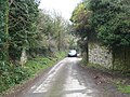
 A Country Lane near Cubert - geograph.org.uk - 138087.jpg 640 × 427 ; 119 kio
-
 A wealth of information - geograph.org.uk - 4154570.jpg 4 000 × 2 664 ; 5,75 Mio
-
 A3075 near Trevemper - geograph.org.uk - 1816954.jpg 640 × 480 ; 61 kio
-
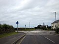
 A3075 Turn For Holywell and Cubert - geograph.org.uk - 5022902.jpg 640 × 480 ; 37 kio
-
 Approaching Cubert - geograph.org.uk - 4154554.jpg 4 000 × 2 664 ; 5,89 Mio
-
 Approaching Cubert Village Cornwall - geograph.org.uk - 5022920.jpg 640 × 480 ; 50 kio
-
 Approaching Holywell - geograph.org.uk - 4154581.jpg 3 000 × 1 998 ; 6,38 Mio
-
 Approaching Holywell - geograph.org.uk - 5022974.jpg 640 × 480 ; 42 kio
-
 Bedruthan Steps from from Kelsey Head (6094).jpg 4 288 × 2 848 ; 4,53 Mio
-
 Bedruthan Steps from Kelsey Head (6095).jpg 4 288 × 2 848 ; 4,54 Mio
-
 Bluebells on the cliff top at Porth Joke. - geograph.org.uk - 1864863.jpg 640 × 480 ; 105 kio
-
 Boggy Ground at Crantock Plains - geograph.org.uk - 138080.jpg 640 × 427 ; 109 kio
-
 Cattle by the old barn - geograph.org.uk - 1710246.jpg 640 × 480 ; 119 kio
-
 Church Room Cubert.jpg 5 664 × 3 776 ; 3,13 Mio
-
 Cliffs at Porth Joke - geograph.org.uk - 1844780.jpg 640 × 480 ; 76 kio
-
 Cliffs at Porth Joke - geograph.org.uk - 1845555.jpg 640 × 480 ; 88 kio
-
 Coastline at Kelsey Head - geograph.org.uk - 6277535.jpg 1 024 × 768 ; 717 kio
-

-
 Cornwall Trevemper Roundabout - geograph.org.uk - 3644125.jpg 640 × 452 ; 60 kio
-
 Crantock Plains Touring Park - geograph.org.uk - 1775611.jpg 640 × 480 ; 90 kio
-
 Cubert - geograph.org.uk - 904446.jpg 640 × 439 ; 107 kio
-
 Cubert Churchyard - geograph.org.uk - 904476.jpg 640 × 424 ; 108 kio
-
 Cubert Methodist Church - geograph.org.uk - 904449.jpg 640 × 447 ; 104 kio
-
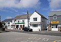 Cubert Post Office - geograph.org.uk - 904440.jpg 640 × 437 ; 82 kio
-
 Cubert Round - geograph.org.uk - 1709653.jpg 640 × 480 ; 71 kio
-
 Cubert School - geograph.org.uk - 1013720.jpg 640 × 480 ; 65 kio
-
 Cubert Village Cornwall - geograph.org.uk - 5022986.jpg 640 × 480 ; 63 kio
-
 Dunes at Holywell Bay (6121).jpg 4 288 × 2 848 ; 6,58 Mio
-
 Dunes at Holywell Bay (6122).jpg 2 848 × 4 288 ; 6,24 Mio
-
 Dunes at Holywell Bay (6123).jpg 4 288 × 2 848 ; 6,47 Mio
-
 Dunes at Holywell Bay (6125).jpg 4 288 × 2 848 ; 6,91 Mio
-
 Dunes at Holywell Bay (6126).jpg 4 288 × 2 848 ; 6,36 Mio
-
 Dunes at Holywell Bay (6127).jpg 4 288 × 2 848 ; 6,52 Mio
-
 Dunes at Holywell Bay (6129).jpg 4 288 × 2 848 ; 6,51 Mio
-
 Ellenglaze millstone.jpg 3 024 × 4 032 ; 5,64 Mio
-

-
 Entrance to Trevornick Fun Park Holywell - geograph.org.uk - 5022954.jpg 640 × 469 ; 61 kio
-
 Farmland, Cubert - geograph.org.uk - 6144413.jpg 1 024 × 768 ; 196 kio
-
 Farmland, Cubert - geograph.org.uk - 6144418.jpg 1 024 × 768 ; 248 kio
-
 Farmland, Cubert - geograph.org.uk - 6144419.jpg 1 024 × 768 ; 285 kio
-
 Farmland, Cubert - geograph.org.uk - 6144423.jpg 1 024 × 768 ; 311 kio
-
 Farmland, Cubert - geograph.org.uk - 6165334.jpg 1 024 × 768 ; 198 kio
-
 Flowers in dunes at Holywell Bay (6128).jpg 4 288 × 2 848 ; 6,36 Mio
-
 Flowers near Holywell Bay (6110).jpg 4 288 × 2 848 ; 5,85 Mio
-
 Footbridge at head of Porth Joke near W Pentire - geograph.org.uk - 5247219.jpg 5 184 × 2 920 ; 5,56 Mio
-
 Footbridge at Porth Joke - geograph.org.uk - 5538950.jpg 1 024 × 768 ; 428 kio
-
 Footbridge over the stream - geograph.org.uk - 2510304.jpg 1 500 × 1 000 ; 170 kio
-
 Footpath down to Porth Joke - geograph.org.uk - 2510310.jpg 1 500 × 1 000 ; 257 kio
-
 Freshwater Stream, Holywell Bay - geograph.org.uk - 6040128.jpg 2 592 × 1 936 ; 1,8 Mio
-
 Grass covered dunes at Perran Sands - geograph.org.uk - 747856.jpg 640 × 480 ; 67 kio
-
 Gull Rocks and Penhale Point (6108).jpg 4 288 × 2 848 ; 5,44 Mio
-
 Haven Cottage Cubert.jpg 5 505 × 3 670 ; 3,47 Mio
-
 High Lane Near Cubert Cornwall - geograph.org.uk - 5022909.jpg 640 × 480 ; 43 kio
-
 Holywell Bay Beach - geograph.org.uk - 6040116.jpg 2 592 × 1 936 ; 1,1 Mio
-
 Holywell Bay Sand Dunes - geograph.org.uk - 5538930.jpg 1 024 × 768 ; 389 kio
-
 Holywell Beach - geograph.org.uk - 1846396.jpg 640 × 480 ; 50 kio
-
 Holywell Beach - geograph.org.uk - 4240696.jpg 640 × 480 ; 71 kio
-
 Holywell Beach - geograph.org.uk - 5585873.jpg 453 × 640 ; 37 kio
-
 Holywell Beach, Cornwall - geograph.org.uk - 4975718.jpg 1 386 × 1 015 ; 475 kio
-
 Holywell Dunes, Holywell, Cornwall - geograph.org.uk - 4975742.jpg 1 500 × 1 125 ; 364 kio
-
 Holywell Village Sign - geograph.org.uk - 5022979.jpg 640 × 480 ; 41 kio
-
 In Cubert - geograph.org.uk - 4154557.jpg 4 000 × 2 664 ; 5,02 Mio
-
 Kelsey Head - geograph.org.uk - 1845530.jpg 640 × 480 ; 88 kio
-
 Kelsey Head and The Chick - geograph.org.uk - 2608214.jpg 640 × 480 ; 49 kio
-
 Leaving Cubert Village - geograph.org.uk - 5022937.jpg 640 × 480 ; 44 kio
-
 Maize Field - geograph.org.uk - 214373.jpg 640 × 427 ; 116 kio
-
 Mining the lode - geograph.org.uk - 138287.jpg 427 × 640 ; 109 kio
-
 Near Porth Joke. - panoramio.jpg 3 648 × 2 736 ; 3,61 Mio
-
 Northern end of Perran Sands - geograph.org.uk - 137732.jpg 640 × 427 ; 50 kio
-
 NT car park Cubert Common, for Porth Joke - geograph.org.uk - 5165905.jpg 800 × 541 ; 200 kio
-
 Old Barn at Treworthen Farm - geograph.org.uk - 216287.jpg 640 × 427 ; 135 kio
-
 Old railway bridge abutments at Rejerrah - geograph.org.uk - 1776236.jpg 640 × 480 ; 126 kio
-
 On the A30 - geograph.org.uk - 4156354.jpg 4 000 × 2 664 ; 4,79 Mio
-
 Outskirts of Cubert Village - geograph.org.uk - 5022927.jpg 640 × 480 ; 65 kio
-
 Pasture, Cubert - geograph.org.uk - 6144416.jpg 1 024 × 768 ; 245 kio
-
 Pentire Point West and Porth Joke (6091).jpg 4 288 × 2 848 ; 6,33 Mio
-
 Pentire Point West and Porth Joke (6092).jpg 4 288 × 2 848 ; 6,36 Mio
-
 Polygonia c-album - geograph.org.uk - 214451.jpg 640 × 640 ; 78 kio
-
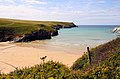
 Porth (or "Polly") Joke beach, Cornwall 1979 - geograph.org.uk - 5165859.jpg 800 × 527 ; 164 kio
-
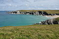
 Porth Joke - geograph.org.uk - 1844775.jpg 640 × 480 ; 70 kio
-
 Porth Joke - geograph.org.uk - 1844777.jpg 640 × 480 ; 87 kio
-
 Porth Joke - geograph.org.uk - 1864851.jpg 640 × 480 ; 106 kio
-
 Porth Joke - geograph.org.uk - 2608268.jpg 640 × 480 ; 50 kio
-
 Porth Joke - geograph.org.uk - 2806871.jpg 1 944 × 2 592 ; 1,63 Mio
-
 Porth Joke beach - geograph.org.uk - 2510239.jpg 1 500 × 993 ; 314 kio
-
 Porth Joke from the Southwest Coast Path - geograph.org.uk - 2510224.jpg 1 500 × 983 ; 220 kio
-
 Porth Joke near W Pentire - geograph.org.uk - 5247221.jpg 5 184 × 2 920 ; 5,1 Mio
-
 Public footpath from Cubert to Colgrease - geograph.org.uk - 1775674.jpg 480 × 640 ; 61 kio
-
 Pyronia tithonus - geograph.org.uk - 214455.jpg 640 × 480 ; 83 kio
-
 Road junction near Trewolla - geograph.org.uk - 4875084.jpg 1 024 × 680 ; 255 kio
-

-
 Sand blow on Holywell Dunes - geograph.org.uk - 5585862.jpg 640 × 480 ; 73 kio
-
 Sand dunes behind Holywell Beach - geograph.org.uk - 6277537.jpg 1 024 × 768 ; 641 kio
-
 Settlement on Kelsey Head (6101).jpg 4 288 × 2 848 ; 6,6 Mio
-
 Settlement on Kelsey Head (6104).jpg 4 288 × 2 848 ; 6,37 Mio
-
 Shop off Holywell Road - geograph.org.uk - 2592114.jpg 1 500 × 1 000 ; 162 kio
-
 South West Coast Path in dunes at Holywell Bay (6120).jpg 4 288 × 2 848 ; 6,54 Mio
-
 St Cubert's Church - geograph.org.uk - 4473613.jpg 2 560 × 1 920 ; 2,16 Mio
-
 St Cubert's Church, Cubert - geograph.org.uk - 6040111.jpg 2 592 × 1 936 ; 1,48 Mio
-
 Stream across Porth Joke beach - geograph.org.uk - 2510260.jpg 1 500 × 986 ; 298 kio
-
 The A3075 north of Rejerrah - geograph.org.uk - 4875086.jpg 800 × 531 ; 124 kio
-
 The common, Cubert - geograph.org.uk - 6144399.jpg 1 024 × 768 ; 271 kio
-
 The common, Cubert - geograph.org.uk - 6144401.jpg 1 024 × 768 ; 248 kio
-
 The Goose and Mawgan Porth from Kelsey Head (6093).jpg 4 288 × 2 848 ; 4,58 Mio
-
 The lane from Cubert to Treworthal - geograph.org.uk - 1775681.jpg 640 × 480 ; 68 kio
-
 The stream to Porth Joke beach - geograph.org.uk - 2510266.jpg 1 500 × 1 000 ; 290 kio
-
 TrevemperBridge.jpg 5 470 × 3 647 ; 10,98 Mio
-
 Trevose Head from Kelsey Head (6097).jpg 4 288 × 2 848 ; 4,48 Mio
-
 Tumulus on Cubert Common - geograph.org.uk - 1709575.jpg 640 × 480 ; 65 kio
-
 Two Pots Cottage - geograph.org.uk - 1775876.jpg 640 × 480 ; 91 kio
-
 Valley and footpath above Porth Joke (6090).jpg 4 288 × 2 848 ; 6,47 Mio
-
 Vanessa atalanta - geograph.org.uk - 216275.jpg 640 × 640 ; 162 kio
-
 View over Porth Joke, 1977 - geograph.org.uk - 2457160.jpg 640 × 428 ; 109 kio
-
 View towards Cubert from Penhale Army Camp - geograph.org.uk - 780180.jpg 640 × 480 ; 76 kio
-
 View towards Ellenglaze from Penhale Sands - geograph.org.uk - 780182.jpg 640 × 480 ; 69 kio
-
 Wild Arum Fruit - geograph.org.uk - 216283.jpg 531 × 640 ; 150 kio
-
 Wychwood Cottage Cubert.jpg 4 783 × 3 189 ; 4,32 Mio
-
 Caravans in the Valley - geograph.org.uk - 214377.jpg 640 × 426 ; 113 kio
-
 Cottage at Hendra Croft, Rejerrah - geograph.org.uk - 80488.jpg 640 × 480 ; 101 kio
-
 Cubert Common from The Kelseys - geograph.org.uk - 690211.jpg 640 × 427 ; 229 kio
-
 Entrance to a Mining Adit - geograph.org.uk - 138272.jpg 640 × 427 ; 133 kio
-
 Entrance to Penhale Military Training Area - geograph.org.uk - 216353.jpg 640 × 427 ; 131 kio
-
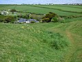
 Farm at Trenissick - geograph.org.uk - 138081.jpg 640 × 427 ; 89 kio
-
 Farm north of Cubert - geograph.org.uk - 138092.jpg 640 × 427 ; 84 kio
-
 Karting Track - geograph.org.uk - 138036.jpg 640 × 427 ; 83 kio
-
 On the A3075 near Rejerrah - geograph.org.uk - 169704.jpg 640 × 426 ; 80 kio
-
 Rejerrah turning off the A3075 - geograph.org.uk - 169701.jpg 640 × 426 ; 76 kio
-
 Sand Dunes - geograph.org.uk - 558222.jpg 640 × 427 ; 54 kio
-
 Semi-derelict Farm Buildings - geograph.org.uk - 216355.jpg 640 × 427 ; 111 kio
-
 Stream in open grassland - geograph.org.uk - 138049.jpg 640 × 427 ; 122 kio
-
 The inland edge of Penhale Sands - geograph.org.uk - 138095.jpg 640 × 427 ; 87 kio
-

-
 The turning to Crantock and West Pentire - geograph.org.uk - 169719.jpg 640 × 426 ; 74 kio
-
 To Trewolla from the A3075 - geograph.org.uk - 169712.jpg 640 × 426 ; 48 kio
-
 Valley Bottom Land near Rejerrah - geograph.org.uk - 216270.jpg 640 × 427 ; 123 kio
-
 Wartime buildings mouldering off the A3075 - geograph.org.uk - 169716.jpg 640 × 426 ; 46 kio


.jpg)
.jpg)


.jpg)
.jpg)
.jpg)
.jpg)
.jpg)
.jpg)
.jpg)


.jpg)
.jpg)


.jpg)


.jpg)
.jpg)

_Joke_beach,_Cornwall_1979_-_geograph.org.uk_-_5165859.jpg)


.jpg)
.jpg)

.jpg)


.jpg)


.jpg)


.jpg)


