Category:Cullercoats
Vai alla navigazione
Vai alla ricerca
town in Tyne and Wear, England, United Kingdom   | |||||
| Carica un file multimediale | |||||
| Istanza di | |||||
|---|---|---|---|---|---|
| Luogo | North Tyneside, Tyne and Wear, Nord Est dell'Inghilterra, Inghilterra | ||||
 | |||||
English: Cullercoats is an urban area of North East England, with a population 9,407 in 2004.cite web
Sottocategorie
Questa categoria contiene le 7 sottocategorie indicate di seguito, su un totale di 7.
B
C
- Cullercoats fishing fleet (7 F)
- Cullercoats Metro station (2 P, 20 F)
- Cullercoats War Memorial (6 F)
S
File nella categoria "Cullercoats"
Questa categoria contiene 43 file, indicati di seguito, su un totale di 43.
-
 'Iron House', 5 Marden Terrace, Cullercoats - geograph.org.uk - 4746919.jpg 750 × 1 024; 211 KB
-
 A smuggler's cave, Cullercoats - geograph.org.uk - 5912453.jpg 2 702 × 3 837; 1,91 MB
-
 Bear's Head Rocks - geograph.org.uk - 3256560.jpg 3 620 × 2 579; 1,12 MB
-

-

-
 Cullercoats Bay - geograph.org.uk - 2897142.jpg 640 × 480; 98 KB
-
 Cullercoats Bay - geograph.org.uk - 3260389.jpg 3 648 × 2 736; 914 KB
-
 Cullercoats Bay - geograph.org.uk - 4041987.jpg 640 × 480; 285 KB
-
 Cullercoats Bay - geograph.org.uk - 5821110.jpg 1 600 × 1 011; 266 KB
-
 Cullercoats Bay - geograph.org.uk - 5832516.jpg 1 600 × 1 107; 339 KB
-
 Cullercoats Bay with its Lifeboat Station (geograph 5377961).jpg 1 600 × 1 039; 242 KB
-
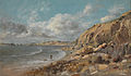
 Cullercoats from the South by John Wilson Carmichael.jpg 1 000 × 689; 78 KB
-
 Cullercoats Harbour - geograph.org.uk - 5173527.jpg 3 072 × 1 728; 1,17 MB
-

-

-
 Cullercoats shoreline - geograph.org.uk - 868830.jpg 640 × 420; 85 KB
-
 Dial House Cullercoates by Thomas Eyre Macklin (2).JPG 3 472 × 2 384; 3,57 MB
-
 Dial House Cullercoates by Thomas Eyre Macklin (3).jpg 2 229 × 1 476; 356 KB
-
 Drawing, Men and Women Looking Out to Sea, Cullercoats, England, 1881 (CH 18174631).jpg 3 328 × 4 000; 7,38 MB
-
 Floral Arrangements Cullercoates - geograph.org.uk - 905119.jpg 640 × 480; 132 KB
-
 Floral display at Cullercoats - geograph.org.uk - 2619348.jpg 3 872 × 2 592; 3,42 MB
-
 Footpath - geograph.org.uk - 78742.jpg 640 × 475; 86 KB
-
 George Smith alias Lamb (19460976355).jpg 573 × 770; 359 KB
-
 Houses and Shops - geograph.org.uk - 78023.jpg 640 × 475; 112 KB
-

-
 John Linnell - Coast Scene at Cullercoats near Whitley Bay - Google Art Project.jpg 6 254 × 3 630; 7,54 MB
-
 Long Sands, Cullercoats - geograph.org.uk - 2897124.jpg 640 × 480; 70 KB
-
 Looking Southeast to Tynemouth from Table Rocks - geograph.org.uk - 2079323.jpg 4 000 × 3 000; 2,97 MB
-
 Margaret Road, Cullercoats - geograph.org.uk - 1707651.jpg 1 024 × 641; 138 KB
-
 Name- Richard Chater (20511607353).jpg 606 × 827; 199 KB
-
 Once a smart paddling pool - geograph.org.uk - 5173706.jpg 3 072 × 1 728; 1,25 MB
-
 Sea View from the Long Sands - geograph.org.uk - 3260398.jpg 3 648 × 2 736; 803 KB
-
 Simpson Street, Cullercoats - geograph.org.uk - 1711055.jpg 1 024 × 768; 164 KB
-
 Simpson Street, Cullercoats, Northumberland.jpg 290 × 218; 27 KB
-
 South Cliff, Cullercoats - geograph.org.uk - 1634082.jpg 640 × 480; 94 KB
-
 South Pier at Cullercoats Bay - geograph.org.uk - 5869920.jpg 640 × 414; 50 KB
-
 St George's Church, Cullercoats - geograph.org.uk - 2479114.jpg 1 280 × 960; 538 KB
-
 The Co-op, John Street, Cullercoats (203177907).jpg 2 592 × 1 944; 1,39 MB
-
 The Entrance to Cullercoates Harbour - geograph.org.uk - 5691671.jpg 4 876 × 3 616; 2,97 MB
-
 Towards Cullercoats, from Longsands - geograph.org.uk - 1184630.jpg 640 × 428; 49 KB
-
 Tynemouth beach in winter - geograph.org.uk - 2840399.jpg 4 752 × 3 168; 4,5 MB
-
 View south across Cullercoats Bay - geograph.org.uk - 5898268.jpg 640 × 439; 105 KB
-
 Windsor Crescent in Cullercoats - geograph.org.uk - 2926543.jpg 1 500 × 1 000; 173 KB


.jpg)


.JPG)
.jpg)
.jpg)


.jpg)

.jpg)


.jpg)


.jpg)


