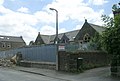
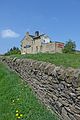
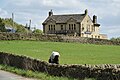
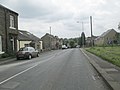
Category:Cullingworth
Aller à la navigation
Aller à la recherche
village britannique  | |||||
| Téléverser des médias | |||||
| Nature de l’élément | |||||
|---|---|---|---|---|---|
| Lieu | cité de Bradford, Yorkshire de l'Ouest, Yorkshire-et-Humber, Angleterre | ||||
 | |||||
English: Cullingworth is a village and civil parish in West Yorkshire, England, between Bradford and Haworth.
- The village is well known locally for holding events such as the Brontë Vintage Gathering every year and the Great Yorkshire Bike Show in 2005. The surrounding countryside is mainly used for sheep and cattle farming, with areas of moorland located nearby as well. The village has seen some new development recently, such as a new primary school, housing estates and shops.
- Cullingworth was once home to olympic swimmer Duncan Goodhew. In 2007 The Cricket club had a highly successful season, with the first team winning the "Treble", 1st Division championship, and winning both the Keighley Cup and the league cup. In 2008 this was repeated with the 1st team retaining the League championship and cup and retaining the Keighley cup whach had been revised to a 20/20 format. For more information on the cricket club go to their web page on [1]
Nederlands: Cullingworth is een dorp (village) en civil parish in het bestuurlijke gebied City of Bradford, in het Engelse graafschap West Yorkshire. De civil parish telt
Sous-catégories
Cette catégorie comprend 10 sous-catégories, dont les 10 ci-dessous.
B
C
- Cullingworth railway station (2 F)
F
- Flappit Quarry (9 F)
G
- Goit Stock Falls (6 F)
H
- Hewenden Reservoir (7 F)
- Hewenden Viaduct (21 F)
L
- Lees Moor Tunnel (1 F)
S
W
- Cullingworth War Memorial (6 F)
Média dans la catégorie « Cullingworth »
Cette catégorie comprend 344 fichiers, dont les 200 ci-dessous.
(page précédente) (page suivante)-
 A crop of thistles at Staples Brow - geograph.org.uk - 2504110.jpg 1 024 × 768 ; 192 kio
-
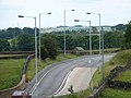 A well-lit bend on the A629 - geograph.org.uk - 2504133.jpg 1 024 × 768 ; 115 kio
-
 A629 at Flappit Quarry - geograph.org.uk - 5414899.jpg 640 × 481 ; 58 kio
-
 A629 bend near Staples Brow - geograph.org.uk - 5414917.jpg 640 × 481 ; 49 kio
-
 A629 Halifax Road near Flappit - geograph.org.uk - 5414909.jpg 640 × 480 ; 45 kio
-
 A629 Keighley Road south of Cullingworth - geograph.org.uk - 5414884.jpg 640 × 479 ; 88 kio
-
 Ainsdale Grove - Greenside Lane - geograph.org.uk - 3835206.jpg 640 × 480 ; 59 kio
-
 And I in heaven you all may see (8186036894).jpg 4 176 × 2 784 ; 6,69 Mio
-
 Ashdene Court - Station Road - geograph.org.uk - 4002733.jpg 640 × 480 ; 63 kio
-
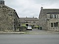
 Baptist Chapel - viewed from Croftside Court - geograph.org.uk - 4002891.jpg 640 × 480 ; 71 kio
-

-
 Barclay Close - Greenside Lane - geograph.org.uk - 3835204.jpg 640 × 480 ; 60 kio
-
 Barn below Hunter Hill - geograph.org.uk - 38285.jpg 640 × 480 ; 152 kio
-
 Benchmark on Bingley Road gatepost - geograph.org.uk - 5788193.jpg 1 024 × 683 ; 359 kio
-
 Benchmark on Butterfly Hall, Bingley Road - geograph.org.uk - 5788252.jpg 1 024 × 683 ; 302 kio
-
 Benchmark on Ryecroft Road gatepost - geograph.org.uk - 5787748.jpg 683 × 1 024 ; 288 kio
-
 Benchmark on Ryecroft Road wall at Hunter Hill - geograph.org.uk - 5787863.jpg 1 024 × 683 ; 335 kio
-
 Benchmark on The Guide Inn - geograph.org.uk - 5787601.jpg 677 × 1 024 ; 200 kio
-
 Bilberry patch along the bridleway - geograph.org.uk - 2504103.jpg 1 024 × 768 ; 205 kio
-
 Bingley Road - viewed from Halifax Road - geograph.org.uk - 4002825.jpg 640 × 480 ; 104 kio
-
 Bingley Road, Haworth - Cullingworth - geograph.org.uk - 5731975.jpg 2 000 × 1 328 ; 727 kio
-
 Birkdale Close - Greenside Lane - geograph.org.uk - 3835194.jpg 640 × 480 ; 50 kio
-

-
 Black Moor - geograph.org.uk - 5036519.jpg 1 600 × 1 067 ; 605 kio
-
 Bowling Green - off Highfield Terrace - geograph.org.uk - 4002721.jpg 640 × 480 ; 62 kio
-
 Bridge (No not known) - Haworth Road - geograph.org.uk - 3835381.jpg 640 × 458 ; 74 kio
-
 Bridge BRB- SDK 51 - Manywells Brow - geograph.org.uk - 840556.jpg 640 × 525 ; 64 kio
-
 Bridge BRB-SDK 51 - Haworth Road - geograph.org.uk - 840562.jpg 640 × 497 ; 63 kio
-
 Bridge BRB-SDK51 - Manywells Brow - geograph.org.uk - 3835375.jpg 640 × 480 ; 92 kio
-
 Bridge House - Manywells Brow - geograph.org.uk - 3835379.jpg 640 × 505 ; 81 kio
-
 Bridleway - Manywells Brow - geograph.org.uk - 840547.jpg 640 × 480 ; 89 kio
-
 Bridleway - Manywells Brow - geograph.org.uk - 840549.jpg 640 × 480 ; 55 kio
-
 Bridleway at Keighley Road, Cullingworth - geograph.org.uk - 5732442.jpg 2 000 × 1 480 ; 852 kio
-
 Bridleway at Staples Brow - geograph.org.uk - 2504090.jpg 1 024 × 768 ; 200 kio
-
 Bridleway between Manywells Height and Cullingworth (1) - geograph.org.uk - 5036808.jpg 1 600 × 1 067 ; 783 kio
-
 Bridleway between Manywells Height and Cullingworth (2) - geograph.org.uk - 5036809.jpg 1 600 × 1 067 ; 694 kio
-
 Bridleway dropping down the hillside - geograph.org.uk - 2504095.jpg 1 024 × 768 ; 167 kio
-
 Bridleway east of Manywells Height - geograph.org.uk - 4189275.jpg 1 600 × 1 200 ; 1 016 kio
-
 Bridleway from West Manywells to Coldspring Mill - geograph.org.uk - 5445751.jpg 4 000 × 3 000 ; 3,43 Mio
-
 Bridleway leading to Manywells Height - geograph.org.uk - 5036533.jpg 1 600 × 1 067 ; 795 kio
-
 Bridleway near Field Head Farm - geograph.org.uk - 2757977.jpg 3 072 × 2 304 ; 1,18 Mio
-
 Bridleway on Black Moor, Cullingworth - geograph.org.uk - 2372351.jpg 2 000 × 1 500 ; 1,02 Mio
-
 Bridleway sign at Staples Brow - geograph.org.uk - 2504084.jpg 1 024 × 768 ; 136 kio
-
 Bridleway west of Hunter Hill Farm - geograph.org.uk - 4234832.jpg 1 600 × 1 200 ; 642 kio
-
 Buildings at Butterfly Hall, Bingley Road - geograph.org.uk - 5788264.jpg 1 024 × 683 ; 143 kio
-
 Cafe at Staples Brow - geograph.org.uk - 2504039.jpg 1 024 × 768 ; 101 kio
-
 Catstones End - geograph.org.uk - 2505746.jpg 1 024 × 768 ; 150 kio
-
 Chimney for the former Goit Stock Mill, Harden - geograph.org.uk - 5593447.jpg 1 500 × 2 000 ; 1,13 Mio
-
 Church Street - Halifax Road - geograph.org.uk - 3835431.jpg 640 × 480 ; 69 kio
-
 Church Street - looking towards Halifax Road - geograph.org.uk - 4002808.jpg 640 × 480 ; 66 kio
-
 Clayton Terrace - Cullingworth Gate - geograph.org.uk - 3835372.jpg 640 × 480 ; 94 kio
-
 Cliffe House from the Staples Brow bridleway - geograph.org.uk - 2757916.jpg 3 072 × 2 304 ; 1,09 Mio
-
 Closed public toilets, Station Road, Cullingworth - geograph.org.uk - 5584606.jpg 1 024 × 768 ; 226 kio
-
 Coldspring Mill - geograph.org.uk - 1824994.jpg 640 × 480 ; 154 kio
-
 Coldspring Mill - geograph.org.uk - 1825288.jpg 640 × 480 ; 153 kio
-
 Coldspring Mill cafe and shop - geograph.org.uk - 801005.jpg 640 × 480 ; 95 kio
-
 Confluence - geograph.org.uk - 3334428.jpg 4 320 × 3 240 ; 4,7 Mio
-
 Cricket Ground - off Halifax Road - geograph.org.uk - 4002882.jpg 640 × 480 ; 64 kio
-

-

-
 Crossroads at the Guide Inn - geograph.org.uk - 1830488.jpg 1 024 × 768 ; 106 kio
-
 Cullingworth Conservative Club - geograph.org.uk - 5584694.jpg 1 024 × 768 ; 107 kio
-
 Cullingworth Fisheries - Halifax Road - geograph.org.uk - 4002886.jpg 593 × 640 ; 81 kio
-
 Cullingworth Gate - geograph.org.uk - 1827006.jpg 640 × 480 ; 114 kio
-
 Cullingworth Gate - geograph.org.uk - 840563.jpg 640 × 480 ; 52 kio
-
 Cullingworth Medical Centre - Mill Street - geograph.org.uk - 840582.jpg 640 × 481 ; 54 kio
-

-
 Cullingworth mills - entrance archway - geograph.org.uk - 5584598.jpg 1 024 × 768 ; 155 kio
-
 Cullingworth Mills - geograph.org.uk - 1826986.jpg 640 × 480 ; 98 kio
-
 Cullingworth mills - geograph.org.uk - 5584594.jpg 1 024 × 768 ; 176 kio
-
 Cullingworth Mills - geograph.org.uk - 5629307.jpg 1 600 × 1 200 ; 230 kio
-
 Cullingworth primary school - geograph.org.uk - 5584715.jpg 1 024 × 768 ; 194 kio
-
 Cullingworth telephone exchange - geograph.org.uk - 5584832.jpg 1 024 × 768 ; 214 kio
-
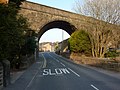
 Cullingworth Viaduct.jpg 640 × 480 ; 158 kio
-
 Cullingworth Village Hall - geograph.org.uk - 1826984.jpg 640 × 480 ; 91 kio
-
 Cullingworth village hall - geograph.org.uk - 5584692.jpg 1 024 × 768 ; 122 kio
-
 Dead tree above Cow House Beck - geograph.org.uk - 5584784.jpg 1 024 × 768 ; 230 kio
-
 Dell - off Dellside Fold - geograph.org.uk - 3835172.jpg 640 × 480 ; 131 kio
-
 Dellside Fold - Greenside Lane - geograph.org.uk - 3835122.jpg 640 × 480 ; 70 kio
-
 Dellside Gardens - Dellside Fold - geograph.org.uk - 3835123.jpg 640 × 447 ; 54 kio
-
 Descending to East Manywells Farm - geograph.org.uk - 5036825.jpg 1 600 × 1 067 ; 600 kio
-
 Doe Park reservoir - geograph.org.uk - 39658.jpg 640 × 480 ; 129 kio
-
 East Manywells Farm, Cullingworth - geograph.org.uk - 224413.jpg 640 × 480 ; 76 kio
-
 Electricity Substation No 1074 - Greenside Lane - geograph.org.uk - 3835201.jpg 640 × 479 ; 104 kio
-
 Ellar Carr - geograph.org.uk - 917199.jpg 480 × 640 ; 183 kio
-
 Ellar Carr Gorge - panoramio.jpg 2 592 × 1 952 ; 2,3 Mio
-
 Ellisons Butchers - Halifax Road - geograph.org.uk - 4002885.jpg 640 × 425 ; 57 kio
-
 End of the urban speed limit, Keighley Road - geograph.org.uk - 2505717.jpg 1 024 × 768 ; 116 kio
-
 Entrance to Hunter Hill Plantation from Ryecroft Road - geograph.org.uk - 5787825.jpg 1 024 × 683 ; 276 kio
-
 Ewe and lambs (26369116533).jpg 1 704 × 1 217 ; 2,16 Mio
-
 Farm track emerging onto Bingley Road - geograph.org.uk - 5788225.jpg 1 024 × 683 ; 143 kio
-
 Fenton Court, Cullingworth.jpg 640 × 480 ; 56 kio
-
 Field and woodland - geograph.org.uk - 1830998.jpg 1 024 × 768 ; 165 kio
-
 Field boundary, off Ryecroft Road - geograph.org.uk - 1830479.jpg 1 024 × 768 ; 160 kio
-

-
 Field Head House - geograph.org.uk - 2505212.jpg 1 024 × 768 ; 164 kio
-
 Fields east of Hallas Cote Farm - geograph.org.uk - 5584812.jpg 1 024 × 768 ; 185 kio
-
 Five Flags Hotel, Manywells Heights - geograph.org.uk - 2505223.jpg 1 024 × 768 ; 108 kio
-
 Flappi Spring Sewage Works and a valley, Cullingworth - geograph.org.uk - 5731959.jpg 2 000 × 1 391 ; 877 kio
-
 Flappit Spring - geograph.org.uk - 40350.jpg 640 × 421 ; 69 kio
-
 Flue of the Goit Stock Chimney, Harden - geograph.org.uk - 5593457.jpg 1 500 × 2 000 ; 1,65 Mio
-
 Footbridge over disused railway line - geograph.org.uk - 5584839.jpg 1 024 × 768 ; 416 kio
-
 Footbridge over disused railway line - geograph.org.uk - 5584840.jpg 1 024 × 768 ; 391 kio
-
 Footbridge over the Cow House Beck - geograph.org.uk - 5584793.jpg 1 024 × 768 ; 373 kio
-
 Footpath - Cullingworth Road - geograph.org.uk - 3835321.jpg 640 × 480 ; 118 kio
-
 Footpath - Dellside Gardens - geograph.org.uk - 3835126.jpg 480 × 640 ; 124 kio
-
 Footpath - from The Dell - geograph.org.uk - 3835178.jpg 480 × 640 ; 119 kio
-
 Footpath - Hallas Lane - geograph.org.uk - 3835319.jpg 480 × 640 ; 93 kio
-
 Footpath - Lees Close - geograph.org.uk - 4002700.jpg 480 × 640 ; 110 kio
-
 Footpath - Station Road - geograph.org.uk - 4002730.jpg 480 × 640 ; 104 kio
-
 Footpath below Rough Plantation - geograph.org.uk - 5584788.jpg 800 × 600 ; 249 kio
-
 Footpath crossing field, Ryecroft - geograph.org.uk - 1830991.jpg 1 024 × 768 ; 105 kio
-

-
 Footpath off Halifax Road, Cullingworth - geograph.org.uk - 5731951.jpg 2 000 × 1 448 ; 782 kio
-
 Footpath off Haworth Road, Flappit Spring, Cullingworth - geograph.org.uk - 5731955.jpg 2 000 × 1 455 ; 774 kio
-
 Footpath towards Little Ridge Wood - geograph.org.uk - 5584797.jpg 1 024 × 768 ; 345 kio
-
 Former Primary School - School Street - geograph.org.uk - 840595.jpg 640 × 430 ; 43 kio
-
 Former Wesleyan Methodist Chapel in Cullingworth - geograph.org.uk - 1825296.jpg 640 × 480 ; 123 kio
-

-
 Former Wesleyan Methodist Chapel, Church Street - geograph.org.uk - 5629407.jpg 1 600 × 1 200 ; 318 kio
-

-

-
 George's Square, Cullingworth - geograph.org.uk - 5732429.jpg 2 000 × 1 414 ; 707 kio
-
 GNRT (2124586429).jpg 2 195 × 1 435 ; 2,61 Mio
-
 Goff Well Lane - geograph.org.uk - 1830497.jpg 1 024 × 768 ; 147 kio
-
 Goitstock Mill chimney - geograph.org.uk - 1923025.jpg 1 600 × 1 200 ; 516 kio
-
 Grade II Listed Cottages, Station Road, Cullingworth - geograph.org.uk - 5639194.jpg 1 600 × 1 200 ; 260 kio
-
 Grassy field (1) - geograph.org.uk - 2505728.jpg 1 024 × 768 ; 126 kio
-
 Grassy field (2) - geograph.org.uk - 2505735.jpg 1 024 × 768 ; 175 kio
-
 Grassy field and small wood - geograph.org.uk - 2505217.jpg 1 024 × 768 ; 200 kio
-
 Great Northern Rail Trail approaching Cullingworth - geograph.org.uk - 5584842.jpg 1 024 × 768 ; 440 kio
-
 Great Northern Railway Trail - Cullingworth viaduct - geograph.org.uk - 5584745.jpg 1 024 × 768 ; 172 kio
-
 Great Ridge Wood - geograph.org.uk - 5584790.jpg 1 024 × 768 ; 161 kio
-
 Greenfield Crescent - Greenside Lane - geograph.org.uk - 3835189.jpg 640 × 422 ; 47 kio
-

-
 Greenside Lane - Halifax Road - geograph.org.uk - 3835426.jpg 640 × 442 ; 45 kio
-
 Greenside Lane - Hallas Lane - geograph.org.uk - 3835310.jpg 640 × 480 ; 67 kio
-

-

-
 Guide Inn (26371668144).jpg 2 602 × 3 903 ; 9,12 Mio
-
 Hainworth - Keighley - geograph.org.uk - 5834573.jpg 1 024 × 683 ; 187 kio
-
 Hainworth, Guide Inn Crossroads - geograph.org.uk - 5834576.jpg 1 024 × 683 ; 164 kio
-
 Hallas Bridge - geograph.org.uk - 4854872.jpg 4 320 × 3 240 ; 6,54 Mio
-
 Hallas Bridge Mill - geograph.org.uk - 359012.jpg 440 × 640 ; 105 kio
-
 Hallas Cote Farm - geograph.org.uk - 5584824.jpg 1 024 × 768 ; 112 kio
-
 Hallas Equestrian - geograph.org.uk - 5584827.jpg 1 024 × 768 ; 172 kio
-
 Hallas Hall - geograph.org.uk - 5584818.jpg 1 024 × 768 ; 170 kio
-
 Hallas Lane - geograph.org.uk - 3738534.jpg 4 320 × 3 240 ; 4,45 Mio
-
 Hallas Lane - geograph.org.uk - 5584822.jpg 1 024 × 768 ; 310 kio
-
 Hallas Lane - viewed from Greenside Lane - geograph.org.uk - 3835312.jpg 640 × 480 ; 87 kio
-
 Hallas Lane - viewed from Greenside Lane - geograph.org.uk - 3835315.jpg 640 × 480 ; 104 kio
-
 Hallas Lane near Cullingworth - geograph.org.uk - 5222387.jpg 4 000 × 3 000 ; 4,6 Mio
-
 Hallas Lane Stables - Hallas Lane - geograph.org.uk - 3835317.jpg 640 × 480 ; 56 kio
-
 Hallas Lane, residential end - geograph.org.uk - 5584829.jpg 1 024 × 768 ; 221 kio
-
 Hallas Mill (4595797373).jpg 2 498 × 1 674 ; 5,08 Mio
-
 Hallas Rough Park (1) - geograph.org.uk - 2505233.jpg 1 024 × 768 ; 142 kio
-
 Hallas Rough Park (2) - geograph.org.uk - 2505236.jpg 1 024 × 768 ; 195 kio
-
 Hallas Rough Park (3) - geograph.org.uk - 2505239.jpg 1 024 × 768 ; 148 kio
-
 Hallowes Grove - Hallowes Park Road - geograph.org.uk - 3835105.jpg 640 × 480 ; 49 kio
-

-
 Hallowes Park Road - Cullingworth Road - geograph.org.uk - 4002586.jpg 640 × 480 ; 46 kio
-
 Hallowes Park Road - Greenside Lane - geograph.org.uk - 3835120.jpg 640 × 480 ; 30 kio
-
 Harden Beck - geograph.org.uk - 1271504.jpg 428 × 640 ; 144 kio
-
 Hardgate Lane, Cullingworth Moor (4951511495).jpg 2 545 × 1 691 ; 4,18 Mio
-
 Haworth Rd Cullingworth.jpg 3 024 × 4 032 ; 4,29 Mio
-
 Haworth Road - viewed from Turf Lane - geograph.org.uk - 4002594.jpg 640 × 480 ; 50 kio
-
 Haworth Road - viewed from Turf Lane - geograph.org.uk - 4002596.jpg 640 × 480 ; 50 kio
-
 Haworth Road, Cullingworth - geograph.org.uk - 1826991.jpg 640 × 480 ; 127 kio
-
 Haworth Road, Cullingworth - geograph.org.uk - 1826997.jpg 640 × 480 ; 158 kio
-
 Haworth Road, Cullingworth - geograph.org.uk - 1827003.jpg 640 × 480 ; 116 kio
-
 Haworth Road, Cullingworth - geograph.org.uk - 4854894.jpg 3 240 × 4 320 ; 2,97 Mio
-
 Heather Bank Close - Haworth Road - geograph.org.uk - 3835385.jpg 640 × 480 ; 52 kio
-
 Hewenden Beck - geograph.org.uk - 358938.jpg 640 × 473 ; 155 kio
-
 Hewenden Reservoir dam - geograph.org.uk - 4854815.jpg 4 320 × 3 240 ; 3,51 Mio
-
 Hewenden Viaduct - geograph.org.uk - 4854855.jpg 3 240 × 4 320 ; 3,38 Mio
-
 Hewenden Viaduct - geograph.org.uk - 5036810.jpg 1 600 × 1 067 ; 667 kio
-
 Hewenden Viaduct and Reservoir, aerial - geograph.org.uk - 3096256.jpg 640 × 427 ; 59 kio
-
 Hewenden Viaduct from East Manywells Farm - geograph.org.uk - 5036811.jpg 1 600 × 1 067 ; 583 kio
-
 Hewenden Viaduct, aerial - geograph.org.uk - 3096248.jpg 640 × 427 ; 59 kio
-
 Highfield Terrace - off Station Road - geograph.org.uk - 4002727.jpg 640 × 480 ; 51 kio
-
 Hill End Lane (B6429) at the border of both Cullingworth and Harden - geograph.org.uk - 6020284.jpg 4 000 × 3 000 ; 2,82 Mio
-
 Hill End Lane (B6429) near to Cow House Bridge - geograph.org.uk - 6020288.jpg 4 000 × 3 000 ; 4,02 Mio
-
 Hill End Lane - geograph.org.uk - 3735779.jpg 4 320 × 3 240 ; 3,05 Mio
-
 Hillside field near Flappit Spring - geograph.org.uk - 2504120.jpg 1 024 × 768 ; 145 kio
-
 House on Ellar Carr Road - geograph.org.uk - 2757990.jpg 3 072 × 2 304 ; 1,48 Mio
-
 Houses - Turf Lane - geograph.org.uk - 4002599.jpg 640 × 480 ; 69 kio
-
 Hunter Hill Farm - geograph.org.uk - 38283.jpg 640 × 480 ; 210 kio
-
 Hunter Hill Farm - geograph.org.uk - 4854889.jpg 4 320 × 3 240 ; 4,73 Mio
-
 John Street - Kaye Hill - geograph.org.uk - 4002806.jpg 480 × 640 ; 100 kio
-
 Kaye Hill - Old Lane - geograph.org.uk - 840598.jpg 640 × 480 ; 63 kio
-
 Kaye Hill, Cullingworth (12195030123).jpg 1 840 × 2 300 ; 3,97 Mio
-
 Kaye Hill, Cullingworth (4592862012).jpg 1 834 × 2 416 ; 3,81 Mio
-
 Kaye Hill, Cullingworth - geograph.org.uk - 3735766.jpg 4 320 × 3 240 ; 3,45 Mio
-
 Keighley Road - viewed from Bingley Road - geograph.org.uk - 4002817.jpg 640 × 480 ; 107 kio
-
 Keighley Road, Cullingworth, at Ellar Carr - geograph.org.uk - 5732437.jpg 2 000 × 1 443 ; 697 kio
-
 Lane to Crag View Farm off Bingley Road, Cullingworth - geograph.org.uk - 5732005.jpg 1 646 × 2 000 ; 1,08 Mio
-
 Layby at Staples Brow - geograph.org.uk - 2504031.jpg 1 024 × 768 ; 107 kio
-
 Lees Close - Lees Moor Road - geograph.org.uk - 4002693.jpg 640 × 480 ; 66 kio
-
 Lees Close - looking towards Lees Moor Road - geograph.org.uk - 4002696.jpg 640 × 480 ; 52 kio
-
 Lees Moor Meadows - Lees Moor Road - geograph.org.uk - 4002691.jpg 640 × 480 ; 67 kio


.jpg)


_-_Croftside_Court_-_geograph.org.uk_-_4002888.jpg)


_-_Haworth_Road_-_geograph.org.uk_-_3835381.jpg)


_-_geograph.org.uk_-_5036808.jpg)
_-_geograph.org.uk_-_5036809.jpg)


_-_geograph.org.uk_-_4002883.jpg)


.jpg)


_from_Ryecroft_Road_-_geograph.org.uk_-_5787667.jpg)


.jpg)


_-_geograph.org.uk_-_2505728.jpg)
_-_geograph.org.uk_-_2505735.jpg)


.jpg)


.jpg)
_-_geograph.org.uk_-_2505233.jpg)
_-_geograph.org.uk_-_2505236.jpg)
_-_geograph.org.uk_-_2505239.jpg)


.jpg)


_at_the_border_of_both_Cullingworth_and_Harden_-_geograph.org.uk_-_6020284.jpg)
_near_to_Cow_House_Bridge_-_geograph.org.uk_-_6020288.jpg)


.jpg)
.jpg)


