Category:Cumberland River
Vai alla navigazione
Vai alla ricerca
river in Kentucky and Tennessee, United States   | |||||
| Carica un file multimediale | |||||
| Istanza di | |||||
|---|---|---|---|---|---|
| Luogo | |||||
| Consiste di | |||||
| Lunghezza |
| ||||
| Foce | |||||
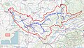
| Bacino di drenaggio |
| ||||
| Affluente |
| ||||
 | |||||
Sottocategorie
Questa categoria contiene le 8 sottocategorie indicate di seguito, su un totale di 8.
Pagine nella categoria "Cumberland River"
Questa categoria contiene un'unica pagina, indicata di seguito.
File nella categoria "Cumberland River"
Questa categoria contiene 49 file, indicati di seguito, su un totale di 49.
-

-

-
 Aerial view of Clarksville, Tennessee, October 2020.JPG 5 184 × 3 888; 6,23 MB
-
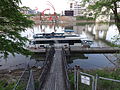
 American Queen Clarksville Riverfront.jpg 2 560 × 1 440; 1,05 MB
-

-
 Bridge across the Cumberland at Chattanooga - NARA - 524709.jpg 3 000 × 2 314; 1,46 MB
-

-

-
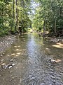
 Cumberland River (Clay County, Tennessee, USA) 1.jpg 4 000 × 3 000; 6,89 MB
-
 Cumberland River (Clay County, Tennessee, USA) 2.jpg 4 000 × 3 000; 8,43 MB
-
 Cumberland River above Nashville, Nashville, Tenn (74051).jpg 3 274 × 2 082; 2,87 MB
-
 Cumberland River at confluence with Ohio.jpg 2 816 × 1 584; 944 KB
-
 Cumberland River at Mill Springs.jpg 6 016 × 4 000; 4,64 MB
-
 Cumberland River barge traffic.jpg 1 500 × 1 001; 586 KB
-
 Cumberland river confluence baxter kentucky april 2017.jpg 5 312 × 2 988; 2,89 MB
-
 Cumberland River Meets the Ohio River (Pan).jpg 4 516 × 2 174; 1,56 MB
-
 Cumberland River Mouth.JPG 800 × 600; 72 KB
-

-
 Cumberland River watershed.jpg 1 483 × 851; 406 KB
-
 Cumberland River Watershed.png 296 × 246; 76 KB
-
 Cumberland river.jpg 3 264 × 1 836; 2,15 MB
-
 Cumberland, Harpeth, Mill Creek feasibility studies kick off (9576160063).jpg 4 288 × 2 848; 7,19 MB
-
 Cumberland, Harpeth, Mill Creek feasibility studies kick off (9576160497).jpg 4 288 × 2 848; 5,9 MB
-
 CumberlandRivInBigSouthForkNRA.jpg 848 × 720; 210 KB
-
 D-Day vessel navigates through Cheatham Lock - 7996403785.jpg 4 288 × 2 848; 5,04 MB
-
 D-Day vessel navigates through Cheatham Lock - 7996409706.jpg 4 288 × 2 848; 4,6 MB
-
 Field notes, Cumberland River and Tennessee, 1899 (IA fieldnotescumbe00foer).pdf 1 366 × 2 097, 50 pagine; 10,61 MB
-

-
 Fort Donelson river battery.jpg 800 × 600; 108 KB
-
 Fort-blount-ferry-site-tn1.jpg 3 840 × 2 160; 1,72 MB
-
 Ghost Ballet with Broadway Background.jpg 4 032 × 3 024; 1,76 MB
-
 Girl on paddleboard.jpg 4 032 × 3 024; 3,13 MB
-
 ISS-66 Nashville, Tennessee and Cumberland River.jpg 5 568 × 3 712; 4,68 MB
-
 Kentucky and Barkley Lakes aerial view.jpg 1 500 × 1 000; 448 KB
-
 Loyall-Cumberland-River-ky.jpg 1 500 × 1 000; 633 KB
-
 LP Field from across Cumberland River.JPG 4 608 × 3 456; 4,66 MB
-
 Nissan Stadium 2022.jpg 6 240 × 4 160; 9,77 MB
-
 Old nashville riverfront.jpg 800 × 426; 136 KB
-
 Poor Fork Cumberland River.jpg 487 × 649; 188 KB
-
 Smithland Lock and Dam at Cumberland confluence.jpg 2 816 × 1 584; 836 KB
-

-

-

-
 US Naval Fleet at Fort Donelson.jpg (29c79ccc-ce6a-45c9-abb3-9a4ed483c561).jpg 4 000 × 3 000; 5,33 MB
-
 USACE Barkley Lock and Dam.jpg 1 500 × 1 000; 725 KB
-

-
 View of Nashville from Seigenthaler Bridge.png 4 032 × 3 024; 12,39 MB
-
 Wells Creek crater 1953 A001080535879.jpg 4 600 × 4 600; 8,41 MB
-
 Yacht on Cumberland River.JPG 4 608 × 3 456; 6 MB
.JPG)
.JPG)


_1.jpg)
_2.jpg)
.jpg)


.jpg)

.jpg)


.jpg)
.jpg)


_(14760501954).jpg)
_(14762647172).jpg)
.jpg)

.JPG)


.jpg)