Category:Cwmbach
Aller à la navigation
Aller à la recherche
Cymraeg: Pentref a chymuned ym mwrdeisdref sirol Rhondda Cynon Taf yw Cwmbach. Saif gerllaw tref Aberdâr.
English: Cwmbach is a village near Aberdare, in Rhondda Cynon Taf, Wales, United Kingdom. Cwmbach has a population of 4,283.
village britannique   | |||||
| Téléverser des médias | |||||
| Nature de l’élément | |||||
|---|---|---|---|---|---|
| Lieu | Rhondda Cynon Taf, pays de Galles | ||||
 | |||||
Sous-catégories
Cette catégorie comprend seulement la sous-catégorie ci-dessous.
C
- Cwmbach railway station (5 F)
Média dans la catégorie « Cwmbach »
Cette catégorie comprend 196 fichiers, dont les 196 ci-dessous.
-
 2010 Wales Rhondda Cynon Taf Community Cwmbach map.svg 512 × 737 ; 416 kio
-
 2024 Wales Rhondda Cynon Taf Community Cwmbach map.svg 512 × 737 ; 369 kio
-
 Aberdare Canal - geograph.org.uk - 2745972.jpg 2 000 × 1 328 ; 3,45 Mio
-
 Aberdare Canal at Cwmbach, circa 1920.jpg 1 024 × 690 ; 232 kio
-
 Aberdare Canal near Aberdare - geograph.org.uk - 4950651.jpg 4 000 × 3 000 ; 4,47 Mio
-
 Aberdare Canal near Aberdare - geograph.org.uk - 4950653.jpg 3 000 × 4 000 ; 4,53 Mio
-
 Aberdare Car Sales, Cwmbach - geograph.org.uk - 3825823.jpg 800 × 662 ; 136 kio
-
 Across a disused railway bridge near Cwmbach - geograph.org.uk - 4692087.jpg 800 × 600 ; 188 kio
-
 Across a railway bridge in Cwmbach - geograph.org.uk - 3947760.jpg 800 × 521 ; 119 kio
-
 Afon Cynon upstream from the A4059 in Cwmbach - geograph.org.uk - 3947753.jpg 800 × 675 ; 171 kio
-
 Bend in the river near Cwmbach - geograph.org.uk - 4692112.jpg 800 × 651 ; 137 kio
-
 Beneath the A4059 in Cwmbach - geograph.org.uk - 5293101.jpg 4 000 × 3 000 ; 3,36 Mio
-
 Best-One in Cwmbach - geograph.org.uk - 6021187.jpg 1 024 × 837 ; 177 kio
-
 Bethania Place, Cwmbach - geograph.org.uk - 3865706.jpg 800 × 545 ; 138 kio
-
 Bike Park Wales, summit of Mynydd Gethin - geograph.org.uk - 4132710.jpg 1 024 × 768 ; 161 kio
-
 Bikepark Wales (geograph 7037561).jpg 2 048 × 1 536 ; 1,42 Mio
-
 Bilingual street name sign, Larkfield Avenue, Cwmbach - geograph.org.uk - 6020403.jpg 1 024 × 768 ; 297 kio
-
 Blaen-nant-y-groes Farm, Cwmbach - geograph.org.uk - 4324443.jpg 800 × 799 ; 225 kio
-
 Blaennantygroes Road houses in Cwmbach - geograph.org.uk - 4324396.jpg 800 × 565 ; 159 kio
-
 Blaennantygroes Road NE of Incline Road, Cwmbach - geograph.org.uk - 3967865.jpg 800 × 799 ; 166 kio
-
 Blaennantygroes Road, Cwmbach - geograph.org.uk - 3967781.jpg 800 × 540 ; 141 kio
-
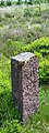
 Boundary Stone - geograph.org.uk - 5797135.jpg 292 × 640 ; 91 kio
-
 Boundary Stone - geograph.org.uk - 5797136.jpg 299 × 640 ; 87 kio
-
 Boundary Stone - geograph.org.uk - 5797138.jpg 241 × 640 ; 76 kio
-
 Bridge across remains of the Aberdare Canal - geograph.org.uk - 4950648.jpg 4 000 × 3 000 ; 4,8 Mio
-
 Bridge Road houses, Cwmbach - geograph.org.uk - 3865803.jpg 800 × 648 ; 159 kio
-
 Bridge Road towards St Mary Magdalene, Cwmbach - geograph.org.uk - 6020600.jpg 770 × 1 024 ; 202 kio
-
 Bridge St, Cwmbach - geograph.org.uk - 949234.jpg 640 × 480 ; 45 kio
-
 Bro Teg, Cwmbach - geograph.org.uk - 3856713.jpg 800 × 515 ; 95 kio
-
 Brookbank Close, Cwmbach - geograph.org.uk - 6020361.jpg 1 024 × 704 ; 159 kio
-
 Bryn Glas, Cwmbach - geograph.org.uk - 3864173.jpg 800 × 620 ; 169 kio
-
 Builders' Bitz in Cwmbach - geograph.org.uk - 6023815.jpg 1 024 × 739 ; 160 kio
-

-
 Car and Van Rental Wales, Cwmbach - geograph.org.uk - 3825803.jpg 800 × 386 ; 72 kio
-

-
 Cerddwyr ar Heol Cwmbach - Walkers on Cwmbach Road - geograph.org.uk - 5849849.jpg 1 024 × 768 ; 164 kio
-
 Children's play area, Ynyscynon Inn, Cwmbach - geograph.org.uk - 6020445.jpg 1 024 × 601 ; 172 kio
-
 Children's playground, Cwmbach - geograph.org.uk - 3967820.jpg 800 × 573 ; 144 kio
-
 Church of St Mary Magdalene, Cwmbach - geograph.org.uk - 949225.jpg 640 × 480 ; 46 kio
-
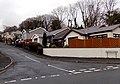
 Coal train at Cwmbach - geograph.org.uk - 5293103.jpg 3 017 × 2 262 ; 4,1 Mio
-
 Coal train at Cwmbach - geograph.org.uk - 5293104.jpg 4 000 × 3 000 ; 5,82 Mio
-
 Cornerstone Church, Cwmbach - geograph.org.uk - 3865692.jpg 800 × 502 ; 135 kio
-
 Cornerstone Church, Sion Terrace, Cwmbach - geograph.org.uk - 6028132.jpg 1 024 × 920 ; 286 kio
-
 Country lane near Cwmbach Llechrhyd - geograph.org.uk - 827221.jpg 640 × 426 ; 114 kio
-
 Crown Row, Cwmbach - geograph.org.uk - 3865681.jpg 800 × 497 ; 161 kio
-
 Cwmbach Chippy, Cwmbach - geograph.org.uk - 6023802.jpg 1 024 × 741 ; 166 kio
-
 Cwmbach Food Store, Cwmbach - geograph.org.uk - 3856699.jpg 800 × 535 ; 120 kio
-
 Cwmbach Industrial Estate building - geograph.org.uk - 3864030.jpg 800 × 558 ; 89 kio
-
 Cwmbach Library - geograph.org.uk - 3865847.jpg 800 × 504 ; 126 kio
-
 Cwmbach police station - geograph.org.uk - 3864000.jpg 800 × 618 ; 190 kio
-
 Cwmbach Post Office - geograph.org.uk - 3856698.jpg 800 × 624 ; 130 kio
-
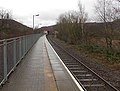 Cwmbach railway station platform - geograph.org.uk - 3891538.jpg 800 × 610 ; 156 kio
-
 Cwmbach Street Party (8386496570).jpg 600 × 447 ; 85 kio
-

-
 Cwrt Glanwern, Cwmbach - geograph.org.uk - 6021196.jpg 1 024 × 820 ; 143 kio
-

-

-
 Cynon Trail towards Mountain Ash - geograph.org.uk - 4692067.jpg 800 × 584 ; 187 kio
-
 Daniel Street, Cwmbach - geograph.org.uk - 3967857.jpg 800 × 613 ; 115 kio
-
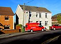 Dare Heating van, Bridge Road, Cwmbach - geograph.org.uk - 6021116.jpg 1 024 × 742 ; 208 kio
-
 Down Bridge Road, Cwmbach - geograph.org.uk - 3864155.jpg 800 × 681 ; 163 kio
-
 East side of the Ynyscynon Inn, Cwmbach - geograph.org.uk - 6020433.jpg 1 024 × 673 ; 153 kio
-
 Elan Close, Cwmbach - geograph.org.uk - 949213.jpg 640 × 480 ; 66 kio
-
 Entrance to Cwmbach railway station - geograph.org.uk - 3825764.jpg 800 × 563 ; 91 kio
-
 Fairfield Close bungalows, Cwmbach - geograph.org.uk - 3953518.jpg 800 × 562 ; 142 kio
-
 Fairfield Close, Cwmbach - geograph.org.uk - 6028223.jpg 1 024 × 952 ; 208 kio
-
 Fenced-off area in Cwmbach - geograph.org.uk - 3864117.jpg 800 × 629 ; 163 kio
-
 Fenced-off site of a former school, Bridge Road, Cwmbach - geograph.org.uk - 6021123.jpg 1 024 × 653 ; 163 kio
-

-
 Foot crossing on the Aberdare line - geograph.org.uk - 4950646.jpg 4 000 × 3 000 ; 4,87 Mio
-
 Ford on the Cynon Trail, Cwmbach - geograph.org.uk - 3953852.jpg 800 × 740 ; 245 kio
-
 Forestry track on Mynydd Gethin - geograph.org.uk - 5063481.jpg 4 000 × 3 000 ; 3,4 Mio
-
 Forestry track on Mynydd Gethin - geograph.org.uk - 5063484.jpg 4 000 × 3 000 ; 3,62 Mio
-
 Former Cwmbach Infants School, Cwmbach - geograph.org.uk - 3856701.jpg 800 × 653 ; 139 kio
-
 Former Focus in Aberaman Industrial Estate - geograph.org.uk - 3856726.jpg 800 × 552 ; 112 kio
-
 Four-lamp lamppost on a Cwmbach roundabout - geograph.org.uk - 6023822.jpg 3 098 × 2 266 ; 1,21 Mio
-
 Gerry Hill Car Sales in Cwmbach - geograph.org.uk - 3825838.jpg 800 × 538 ; 80 kio
-
 Glam in Cwmbach - geograph.org.uk - 3865813.jpg 800 × 507 ; 118 kio
-
 Green cabinets and a bench alongside Canal Road, Cwmbach - geograph.org.uk - 6023829.jpg 965 × 1 024 ; 303 kio
-
 Gulf filling station and shop, Cwmbach - geograph.org.uk - 3825783.jpg 800 × 432 ; 72 kio
-
 Head of the Aberdare Canal - geograph.org.uk - 2743103.jpg 1 600 × 1 038 ; 896 kio
-
 Heath Close, Cwmbach - geograph.org.uk - 6020353.jpg 1 024 × 759 ; 206 kio
-
 Hedge-lined Blaennantygroes Road, Cwmbach - geograph.org.uk - 6021222.jpg 1 024 × 844 ; 188 kio
-
 Hel's Kitchen in Cwmbach - geograph.org.uk - 3864063.jpg 638 × 640 ; 104 kio
-
 Hen ddramffordd - Former tramline - geograph.org.uk - 5849834.jpg 1 024 × 768 ; 332 kio
-

-
 Hire One in Cwmbach - geograph.org.uk - 3825818.jpg 800 × 560 ; 112 kio
-
 Houses above Canal Road, Cwmbach - geograph.org.uk - 6023817.jpg 1 024 × 675 ; 158 kio
-
 Houses at a bend in Bridge Road, Cwmbach - geograph.org.uk - 3865798.jpg 800 × 716 ; 161 kio
-
 Houses at a bend in Bridge Road, Cwmbach - geograph.org.uk - 6021107.jpg 1 024 × 572 ; 144 kio
-
 Houses on the north side of Brookbank Close, Cwmbach - geograph.org.uk - 6020368.jpg 1 024 × 652 ; 157 kio
-
 Howdens Joinery, Cwmbach - geograph.org.uk - 3825842.jpg 800 × 435 ; 66 kio
-
 Incline Street, Cwmbach - geograph.org.uk - 3967852.jpg 800 × 765 ; 158 kio
-
 Industrial units in Cwmbach - geograph.org.uk - 3947737.jpg 800 × 776 ; 183 kio
-
 Information board alongside Canal Road, Cwmbach - geograph.org.uk - 6028191.jpg 1 024 × 723 ; 237 kio
-
-
 Junction of Cwmbach Road and Blaennantygroes Road, Cwmbach - geograph.org.uk - 6021200.jpg 1 024 × 1 003 ; 351 kio
-
 Junction of Tre Telynog and Bridge Road, Cwmbach - geograph.org.uk - 6020554.jpg 1 024 × 941 ; 175 kio
-
 K ^ H Groundworks Ltd in Cwmbach - geograph.org.uk - 3825847.jpg 800 × 583 ; 119 kio
-

-

-

-
 Long bilingual name sign in Cwmbach - geograph.org.uk - 6021236.jpg 1 024 × 647 ; 190 kio
-
 Long row of houses, Cwmbach Road, Cwmbach - geograph.org.uk - 3953556.jpg 800 × 545 ; 131 kio
-
 Low bridge over a canal path, Cwmbach - geograph.org.uk - 3953808.jpg 800 × 705 ; 255 kio
-
 Marpol Vehicles, Cwmbach - geograph.org.uk - 3825794.jpg 800 × 598 ; 100 kio
-
 Meadowbank Close, Cwmbach - geograph.org.uk - 6020384.jpg 1 024 × 655 ; 163 kio
-
 Mendhams, Cwmbach - geograph.org.uk - 3865588.jpg 800 × 629 ; 146 kio
-
 Metal barriers near the Railway Path, Cwmbach - geograph.org.uk - 4324471.jpg 800 × 600 ; 262 kio
-
 Muddy track through woodland, Cwmbach - geograph.org.uk - 6020398.jpg 1 024 × 768 ; 369 kio
-
 Mynydd Gethin - geograph.org.uk - 4560255.jpg 2 560 × 1 920 ; 3,14 Mio
-
-
 New Image in Cwmbach - geograph.org.uk - 3865739.jpg 800 × 613 ; 147 kio
-
 No dogs on playing fields notice, Cwmbach - geograph.org.uk - 3967840.jpg 800 × 502 ; 152 kio
-
 No motorcycling sign near Cwmbach - geograph.org.uk - 4692068.jpg 800 × 550 ; 197 kio
-
 No parking on this green in Cwmbach - geograph.org.uk - 3825835.jpg 800 × 485 ; 103 kio
-
 Northern end of Parkfield Road, Cwmbach - geograph.org.uk - 6020357.jpg 1 024 × 882 ; 384 kio
-
 NW boundary of Cwmbach - geograph.org.uk - 3865950.jpg 735 × 735 ; 155 kio
-
 NW from Cwmbach railway station - geograph.org.uk - 3891515.jpg 798 × 800 ; 251 kio
-
 O dan bont reilffordd - Under a railway bridge - geograph.org.uk - 5849814.jpg 1 024 × 768 ; 191 kio
-
 Ordnance Survey Cut Mark - geograph.org.uk - 5797308.jpg 640 × 554 ; 105 kio
-
 Ordnance Survey Cut Mark - geograph.org.uk - 5797310.jpg 640 × 467 ; 102 kio
-
 Ordnance Survey Cut Mark - geograph.org.uk - 6247825.jpg 1 024 × 948 ; 449 kio
-
 Ordnance Survey Cut Mark - geograph.org.uk - 6247827.jpg 1 024 × 708 ; 220 kio
-
 Ordnance Survey Cut Mark - geograph.org.uk - 6247830.jpg 1 024 × 814 ; 189 kio
-
 Ordnance Survey Rivet - geograph.org.uk - 5797139.jpg 640 × 522 ; 133 kio
-
 Ordnance Survey Rivet - geograph.org.uk - 5797300.jpg 401 × 640 ; 109 kio
-
 Ordnance Survey Rivet - geograph.org.uk - 6247832.jpg 1 024 × 772 ; 282 kio
-
 Overgrown concrete base near Cwmbach - geograph.org.uk - 4692098.jpg 800 × 600 ; 149 kio
-
 Overgrown deck of bridge across the Aberdare Canal - geograph.org.uk - 4950650.jpg 4 000 × 3 000 ; 5,21 Mio
-
 Passenger shelter at Cwmbach railway station - geograph.org.uk - 5510277.jpg 1 024 × 794 ; 199 kio
-
 Phillip Row, Cwmbach - geograph.org.uk - 3865857.jpg 800 × 513 ; 106 kio
-
 Pond Place, Cwmbach - geograph.org.uk - 3865850.jpg 800 × 606 ; 109 kio
-
 Posh Wash in Cwmbach - geograph.org.uk - 6023819.jpg 1 024 × 825 ; 204 kio
-
 Postbox in a stone wall, Well Place, Cwmbach - geograph.org.uk - 6028250.jpg 1 024 × 859 ; 155 kio
-

-
 Prospect House, Cwmbach - geograph.org.uk - 6028160.jpg 1 024 × 858 ; 250 kio
-
 Public footpath and private land, Cwmbach - geograph.org.uk - 3967872.jpg 681 × 800 ; 240 kio
-
 Public footpath north of Cwmbach Road, Cwmbach - geograph.org.uk - 3953534.jpg 800 × 700 ; 199 kio
-
 Public footpath towards Aberdare from Cwmbach - geograph.org.uk - 3967891.jpg 800 × 600 ; 180 kio
-

-
 Queen Elizabeth II postbox on a Cwmbach corner - geograph.org.uk - 6021208.jpg 768 × 1 024 ; 388 kio
-
 Queen Victoria in Cwmbach (geograph 6020471).jpg 1 600 × 1 166 ; 469 kio
-
 Queen Victoria, Cwmbach - geograph.org.uk - 3864141.jpg 800 × 621 ; 130 kio
-
 Railway bridge over the Afon Cynon in Cwmbach - geograph.org.uk - 3947783.jpg 800 × 800 ; 214 kio
-
 Railway Path notice, Cwmbach - geograph.org.uk - 4324495.jpg 691 × 700 ; 101 kio
-
 Relic of a demolished school, Bridge Road, Cwmbach - geograph.org.uk - 6021133.jpg 1 735 × 2 375 ; 805 kio
-
 Remains of a dismantled railway near Cwmbach - geograph.org.uk - 4692121.jpg 800 × 599 ; 243 kio
-

-
 Rhiw Ceris, Cwmbach - geograph.org.uk - 3953580.jpg 800 × 568 ; 141 kio
-
 Richard's Terrace houses, Cwmbach - geograph.org.uk - 6028172.jpg 1 024 × 712 ; 164 kio
-
 River and track, Cwmbach - geograph.org.uk - 3947757.jpg 800 × 674 ; 182 kio
-
 River near Cwmbach - geograph.org.uk - 4692072.jpg 800 × 639 ; 213 kio
-
 Road bridge near Cwmbach railway station - geograph.org.uk - 3825755.jpg 800 × 494 ; 95 kio
-
 Sawn logs and a damaged field gate in Cwmbach - geograph.org.uk - 3865873.jpg 800 × 638 ; 263 kio
-
 Signs facing Cwmbach railway station - geograph.org.uk - 6023500.jpg 1 024 × 879 ; 233 kio
-
 Sion Terrace church and houses, Cwmbach - geograph.org.uk - 6028152.jpg 1 024 × 970 ; 277 kio
-
 Southern boundary of Cwmbach - geograph.org.uk - 3863950.jpg 800 × 738 ; 208 kio
-
 Speed limits through Cwmbach railway station - geograph.org.uk - 3891558.jpg 800 × 558 ; 176 kio
-
 St Mary Magdalene viewed from the north, Cwmbach - geograph.org.uk - 3864214.jpg 800 × 639 ; 168 kio
-
 St Mary Magdalene viewed from the south, Cwmbach - geograph.org.uk - 3864209.jpg 800 × 613 ; 174 kio
-
 St Mary Magdalene, Bridge Road, Cwmbach - geograph.org.uk - 6020596.jpg 1 024 × 704 ; 222 kio
-
 Stagecoach Bus Garage in Cwmbach - geograph.org.uk - 3864099.jpg 800 × 512 ; 91 kio
-
 Stone semis, Bridge Road, Cwmbach - geograph.org.uk - 6021168.jpg 1 021 × 1 024 ; 243 kio
-

-
 Tacklesmart fishing superstore in Cwmbach - geograph.org.uk - 3825828.jpg 800 × 510 ; 79 kio
-
 The Royal Oak nameboard, Cwmbach - geograph.org.uk - 6021057.jpg 1 024 × 778 ; 196 kio
-
 The Royal Oak, 14 Morgan Row, Cwmbach - geograph.org.uk - 6021043.jpg 1 600 × 1 109 ; 302 kio
-
 Total Garage in Cwmbach - geograph.org.uk - 3865935.jpg 800 × 518 ; 111 kio
-

-
 Track NW from Blaennantygroes Road, Cwmbach - geograph.org.uk - 3967882.jpg 800 × 746 ; 241 kio
-
 Tre Telynog flats, Cwmbach - geograph.org.uk - 3865569.jpg 800 × 637 ; 139 kio
-
 Tre Telynog flats, Cwmbach - geograph.org.uk - 3865573.jpg 800 × 523 ; 113 kio
-
 Tregwilym, Cwmbach - geograph.org.uk - 3953568.jpg 800 × 610 ; 139 kio
-
 Uninviting bus shelter in Cwmbach - geograph.org.uk - 3865971.jpg 800 × 578 ; 122 kio
-
 Up Bro Deg, Cwmbach - geograph.org.uk - 6023812.jpg 1 024 × 880 ; 214 kio
-
 Up Morgan Row, Cwmbach - geograph.org.uk - 6021070.jpg 1 600 × 1 403 ; 605 kio
-
 Upper Skynlais - geograph.org.uk - 588387.jpg 640 × 480 ; 106 kio
-

-
 Waterloo Street, Cwmbach - geograph.org.uk - 3967841.jpg 800 × 752 ; 179 kio
-
 Welcome to Pen-y-Bryn House ^ Cottages, Cwmbach - geograph.org.uk - 3967849.jpg 800 × 696 ; 183 kio
-
 Well Place houses in Cwmbach - geograph.org.uk - 3953682.jpg 800 × 725 ; 124 kio
-
 Well Place houses, Cwmbach - geograph.org.uk - 6028245.jpg 1 024 × 642 ; 121 kio
-
 Welsh inscription on the former Ebenezer chapel, Cwmbach - geograph.org.uk - 6028141.jpg 1 624 × 810 ; 284 kio
-
 Western end of Cefnpennar Road, Cwmbach - geograph.org.uk - 6021077.jpg 1 024 × 901 ; 153 kio
-

-
 Wetland near Aberaman - geograph.org.uk - 4950645.jpg 4 000 × 3 000 ; 3,69 Mio
-
 Wires over Sion Terrace, Cwmbach - geograph.org.uk - 6028205.jpg 1 024 × 785 ; 162 kio
-
 Wooded section of Cwmbach Road, Aberdare - geograph.org.uk - 3854668.jpg 800 × 741 ; 274 kio
-
 Ynyscynon electricity substation, Cwmbach - geograph.org.uk - 6028243.jpg 1 024 × 1 008 ; 199 kio
-
 Ynyscynon Inn car park, Cwmbach - geograph.org.uk - 6020436.jpg 1 024 × 612 ; 130 kio
-
 Ynyscynon Inn, Cwmbach - geograph.org.uk - 3865913.jpg 800 × 514 ; 88 kio
-
 Ynyscynon St, Cwmbach - geograph.org.uk - 949236.jpg 640 × 480 ; 63 kio
-
 Ynyscynon Street houses, Cwmbach - geograph.org.uk - 6028229.jpg 1 024 × 937 ; 176 kio
-
 Ynyscynon Street, Cwmbach - geograph.org.uk - 3953637.jpg 800 × 676 ; 130 kio
-
 Zigzag markings on Bridge Road, Cwmbach - geograph.org.uk - 6021181.jpg 1 024 × 785 ; 200 kio


.jpg)


.jpg)


.jpg)


