Category:Danby, North Yorkshire
Vai alla navigazione
Vai alla ricerca
village and civil parish in Scarborough, North Yorkshire, England  | |||||
| Carica un file multimediale | |||||
| Istanza di | |||||
|---|---|---|---|---|---|
| Luogo | Scarborough, North Yorkshire, Yorkshire e Humber, Inghilterra | ||||
| Considerato essere uguale a | Danby (pagina Wikimedia duplicata, parrocchia civile dell'Inghilterra) | ||||
 | |||||
English: Danby is a civil parish in the Scarborough district of North Yorkshire, England. Contains the villages of Danby, Ainthorpe and Castleton
Sottocategorie
Questa categoria contiene le 20 sottocategorie indicate di seguito, su un totale di 20.
A
- Ainthorpe, North Yorkshire (29 F)
B
C
D
- Danby Castle (13 F)
- Danby railway station (9 F)
- Danby Rigg, North Yorkshire (11 F)
F
- Fat Betty, North Yorkshire (15 F)
- Fryup (4 F)
G
H
L
File nella categoria "Danby, North Yorkshire"
Questa categoria contiene 200 file, indicati di seguito, su un totale di 624.
(pagina precedente) (pagina successiva)-
-

-

-
 A frosty start to 2018 - geograph.org.uk - 5651102.jpg 1 024 × 626; 341 KB
-
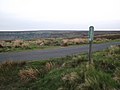
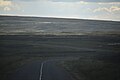
 A road leading to Danby Beacon - geograph.org.uk - 2657750.jpg 800 × 600; 243 KB
-
 A severely pruned tree - geograph.org.uk - 5745176.jpg 1 600 × 1 067; 288 KB
-
 A track leading to Clitherbeck Farm - geograph.org.uk - 2657745.jpg 800 × 600; 238 KB
-

-
 Access to the moor^ - geograph.org.uk - 4165452.jpg 3 872 × 2 592; 5,07 MB
-
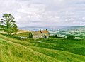
 Across the valley from Castleton - geograph.org.uk - 2811705.jpg 1 024 × 650; 307 KB
-
 Ainthorpe - Tennis courts - geograph.org.uk - 5266113.jpg 1 500 × 895; 226 KB
-
 Ainthorpe Bridge, Danby - geograph.org.uk - 4567366.jpg 1 600 × 1 424; 1,6 MB
-
 Ainthorpe Rigg - geograph.org.uk - 6078943.jpg 2 048 × 1 536; 938 KB
-
 Ancient Bank and Ditch, Cross Dyke - geograph.org.uk - 5269009.jpg 3 000 × 4 000; 3,49 MB
-
 Approaching Box Hall - geograph.org.uk - 5908844.jpg 1 600 × 1 200; 564 KB
-
 Ashfield Pastures - geograph.org.uk - 5268949.jpg 4 000 × 3 000; 2,91 MB
-
 At the edge of the moor - geograph.org.uk - 3484653.jpg 4 320 × 3 240; 1,85 MB
-
 Barn Near Castle Houses - geograph.org.uk - 442114.jpg 640 × 427; 61 KB
-
 Barns at Castleton quarries - geograph.org.uk - 2702961.jpg 640 × 421; 238 KB
-
 Birds of Prey at The Moors Centre - geograph.org.uk - 1602701.jpg 640 × 480; 91 KB
-
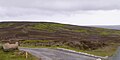
 Blakey Road is Blocked - geograph.org.uk - 4674218.jpg 1 024 × 683; 175 KB
-
 Blakey road is closed - geograph.org.uk - 2182187.jpg 800 × 600; 164 KB
-
 Blakey to Castleton - geograph.org.uk - 3203301.jpg 640 × 427; 91 KB
-
 Boletus mushroom in Danby Park - geograph.org.uk - 576486.jpg 640 × 480; 130 KB
-
 Botton - geograph.org.uk - 2736827.jpg 3 400 × 2 592; 1,31 MB
-
 Botton view - geograph.org.uk - 5333539.jpg 2 048 × 1 536; 1 000 KB
-
 Boulders and ribs on heather moorland - geograph.org.uk - 3445728.jpg 1 500 × 843; 1,01 MB
-
 Boundary Stone and Trig Point - geograph.org.uk - 3830688.jpg 640 × 427; 245 KB
-
 Boundary Stone at Danby Beacon - geograph.org.uk - 2710286.jpg 850 × 567; 50 KB
-
 Boundary stone on Castleton Rigg - geograph.org.uk - 4567334.jpg 1 600 × 1 067; 982 KB
-
 Boundary stone on Castleton Rigg - geograph.org.uk - 5266795.jpg 3 240 × 4 320; 3,63 MB
-
 Boundary Stone, Liverton Moor - geograph.org.uk - 4874735.jpg 640 × 480; 95 KB
-
 Bramble Carr - geograph.org.uk - 2737902.jpg 3 888 × 2 592; 1,04 MB
-
 Briar Hill Danby - geograph.org.uk - 2005554.jpg 800 × 600; 227 KB
-
 Briar Hill, Danby - geograph.org.uk - 2005543.jpg 800 × 600; 282 KB
-
 Bridge over the River Esk - geograph.org.uk - 136048.jpg 640 × 427; 78 KB
-
 Bridlepath to Danby - geograph.org.uk - 908584.jpg 640 × 427; 317 KB
-
 Bridleway descending towards Ainthorpe - geograph.org.uk - 3445874.jpg 1 500 × 843; 1,17 MB
-
 Bridleway junction near Park End Cottage - geograph.org.uk - 5908833.jpg 1 600 × 1 200; 461 KB
-
 Bridleway Marker - geograph.org.uk - 1906864.jpg 1 600 × 1 200; 449 KB
-
 Bridleway south of Ainthorpe - geograph.org.uk - 5825439.jpg 1 024 × 770; 263 KB
-
 Bridleway to Ainthorpe and Danby - geograph.org.uk - 1800599.jpg 640 × 427; 302 KB
-
 Bridleway to Box Hall - geograph.org.uk - 5908840.jpg 1 600 × 1 200; 595 KB
-
 Bridleway to Crossley House Farm - geograph.org.uk - 1800575.jpg 640 × 427; 365 KB
-
 Bridleway to Danby - geograph.org.uk - 1950548.jpg 2 816 × 2 112; 2,62 MB
-
 Bridleway to Glaisdale - geograph.org.uk - 1861025.jpg 3 088 × 2 056; 3,09 MB
-
 Buttressed wall in Longlands Lane - geograph.org.uk - 1601135.jpg 640 × 480; 71 KB
-
 By Longlands Lane - geograph.org.uk - 2703284.jpg 640 × 434; 238 KB
-
 Cairn on Ainthorpe Rigg - geograph.org.uk - 3445872.jpg 1 500 × 843; 1,19 MB
-
 Castle Houses and Danby Castle - geograph.org.uk - 5266105.jpg 1 500 × 941; 240 KB
-
 Castle Lane, Little Fryup Dale - geograph.org.uk - 4792855.jpg 1 600 × 1 064; 342 KB
-
 Castle Lane, Little Fryup Dale - geograph.org.uk - 4793802.jpg 1 600 × 1 064; 332 KB
-
 Castleton - geograph.org.uk - 4758871.jpg 640 × 360; 84 KB
-
 Castleton and the Upper Esk Valley - geograph.org.uk - 5986165.jpg 640 × 427; 106 KB
-
 Castleton Castle - geograph.org.uk - 5871222.jpg 640 × 427; 114 KB
-
 Castleton main street - geograph.org.uk - 5266816.jpg 2 998 × 3 433; 1,81 MB
-
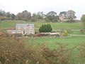
 Castleton Methodist Church - geograph.org.uk - 5802992.jpg 1 024 × 683; 161 KB
-
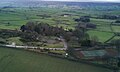
 Castleton Moor railway station, Yorkshire - geograph.org.uk - 3272934.jpg 1 024 × 768; 176 KB
-
 Castleton Moor railway station, Yorkshire - geograph.org.uk - 3272943.jpg 1 024 × 768; 173 KB
-
 Castleton Moor station - geograph.org.uk - 2811693.jpg 1 024 × 647; 202 KB
-
 Castleton Moor Station - geograph.org.uk - 5138759.jpg 1 800 × 1 013; 1,66 MB
-
 Castleton Moor station - geograph.org.uk - 5908838.jpg 1 600 × 1 200; 522 KB
-
 Castleton Panorama - geograph.org.uk - 4102511.jpg 2 500 × 759; 433 KB
-
 Castleton Rigg - geograph.org.uk - 4567328.jpg 2 400 × 1 201; 1,38 MB
-

-
 Castleton Tea Rooms - geograph.org.uk - 4519165.jpg 1 024 × 768; 163 KB
-
 Castleton view - geograph.org.uk - 2886966.jpg 1 024 × 683; 290 KB
-
 Cattle at Parsonage Farm - geograph.org.uk - 2703288.jpg 640 × 426; 271 KB
-
 Cattle Grid at the top of Park Bank - geograph.org.uk - 122023.jpg 640 × 427; 65 KB
-
 Cattle grid by Danby School - geograph.org.uk - 1997524.jpg 3 755 × 2 503; 3,18 MB
-
 Cattle grid on Castleton Rigg - geograph.org.uk - 4567336.jpg 1 600 × 800; 745 KB
-

-
 Church in Danby - geograph.org.uk - 5710621.jpg 1 024 × 683; 158 KB
-
 Cleveland Search and Rescue exercise - geograph.org.uk - 3878550.jpg 1 024 × 741; 505 KB
-
 Clitherbeck - geograph.org.uk - 6151731.jpg 640 × 427; 130 KB
-
 Collecting wool sheets - geograph.org.uk - 2630358.jpg 800 × 643; 376 KB
-
 Commondale - geograph.org.uk - 6241491.jpg 640 × 360; 79 KB
-
 Commondale valley - geograph.org.uk - 5451463.jpg 2 560 × 1 440; 2,06 MB
-
 Controlled burning Rosedale Moor - geograph.org.uk - 3878557.jpg 1 024 × 768; 540 KB
-
 Converted Chapel, Castleton - geograph.org.uk - 4519171.jpg 1 024 × 822; 169 KB
-
 Cottage near Danby - geograph.org.uk - 2672055.jpg 800 × 600; 96 KB
-
 Cottage near West Green Farm - geograph.org.uk - 2052827.jpg 2 048 × 1 536; 1,34 MB
-
 Cotton Grass on Danby High Moor - geograph.org.uk - 2432662.jpg 1 024 × 768; 213 KB
-

-
 Country Road - geograph.org.uk - 1899055.jpg 1 200 × 1 600; 464 KB
-
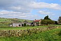
 Crag Farm - geograph.org.uk - 2737403.jpg 3 888 × 2 592; 1,24 MB
-
 Crag Farm - geograph.org.uk - 5570786.jpg 640 × 427; 81 KB
-
 Crag House Farm - geograph.org.uk - 2736807.jpg 3 616 × 2 108; 1,07 MB
-
 Crag House Farm - geograph.org.uk - 2940899.jpg 1 024 × 768; 236 KB
-
 Crossley Side - geograph.org.uk - 3396556.jpg 640 × 480; 86 KB
-
 Crow Wood - geograph.org.uk - 2737375.jpg 3 524 × 2 498; 1,54 MB
-
 Cyclist heading up from Danby - geograph.org.uk - 4588078.jpg 640 × 480; 63 KB
-
 Daffodils near Botton - geograph.org.uk - 5333534.jpg 2 048 × 1 536; 2,05 MB
-
 Dale View and Fryup Hall - geograph.org.uk - 1863360.jpg 640 × 426; 272 KB
-
 Danby (geograph 2736784).jpg 3 725 × 2 353; 1,36 MB
-
 Danby - geograph.org.uk - 6007809.jpg 640 × 360; 103 KB
-
 Danby Beacon from the radar station - geograph.org.uk - 5701421.jpg 1 024 × 683; 131 KB
-
 Danby Botton - geograph.org.uk - 2736826.jpg 3 756 × 2 496; 1,43 MB
-
 Danby Castle - geograph.org.uk - 4500428.jpg 640 × 360; 60 KB
-
 Danby Castle - geograph.org.uk - 5266111.jpg 1 500 × 921; 295 KB
-
 Danby Dale - geograph.org.uk - 5333544.jpg 2 048 × 1 536; 1,23 MB
-
 Danby Dale and Castleton - geograph.org.uk - 5918065.jpg 640 × 360; 75 KB
-
 Danby Dale from Danby Head - geograph.org.uk - 4614769.jpg 2 000 × 1 090; 271 KB
-
 Danby Dale from the moor - geograph.org.uk - 2261245.jpg 800 × 533; 260 KB
-
 Danby Dale view - geograph.org.uk - 6078941.jpg 2 048 × 1 536; 1 022 KB
-
 Danby fire station - geograph.org.uk - 1393314.jpg 640 × 427; 223 KB
-
 Danby Fire Station, Ainthorpe Lane - geograph.org.uk - 5826148.jpg 1 024 × 770; 257 KB
-
 Danby from across the valley - geograph.org.uk - 1626253.jpg 640 × 428; 64 KB
-
 Danby Head - geograph.org.uk - 5710759.jpg 1 600 × 1 067; 122 KB
-
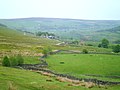
 Danby High Moor - geograph.org.uk - 2243143.jpg 4 000 × 3 000; 2,43 MB
-
 Danby High Moor - geograph.org.uk - 2432648.jpg 1 024 × 768; 138 KB
-
 Danby High Moor - geograph.org.uk - 2736814.jpg 3 792 × 2 412; 1,4 MB
-
 Danby High Moor - geograph.org.uk - 4319636.jpg 1 400 × 1 050; 1,5 MB
-
 Danby High Moor - geograph.org.uk - 4523705.jpg 640 × 578; 80 KB
-
 Danby High Moor - geograph.org.uk - 6080848.jpg 2 048 × 1 536; 1,03 MB
-
 Danby High Moor 2 - geograph.org.uk - 6080849.jpg 2 048 × 1 536; 931 KB
-
 Danby Lodge - geograph.org.uk - 2736780.jpg 3 706 × 2 296; 1,56 MB
-
 Danby Lodge - geograph.org.uk - 5823787.jpg 1 024 × 770; 315 KB
-
 Danby Lodge, The Moors Centre - geograph.org.uk - 2703311.jpg 640 × 370; 167 KB
-
 Danby Low Moor - geograph.org.uk - 4524314.jpg 640 × 470; 54 KB
-
 Danby Low Moor - geograph.org.uk - 4587645.jpg 640 × 480; 46 KB
-
 Danby Low Moor - geograph.org.uk - 4587651.jpg 640 × 480; 45 KB
-
 Danby Low Moor - geograph.org.uk - 4587655.jpg 640 × 480; 48 KB
-
 Danby Low Moor - geograph.org.uk - 5504786.jpg 2 048 × 1 536; 1,55 MB
-
 Danby Methodist Church - geograph.org.uk - 14657.jpg 419 × 640; 105 KB
-
 Danby Methodist church - geograph.org.uk - 2702935.jpg 640 × 427; 226 KB
-
 Danby Moor - geograph.org.uk - 2702946.jpg 640 × 388; 244 KB
-

-
 Danby old fire station - geograph.org.uk - 1393319.jpg 640 × 427; 249 KB
-
 Danby Park - geograph.org.uk - 2702955.jpg 640 × 474; 313 KB
-
 Danby railway station - geograph.org.uk - 5316780.jpg 1 600 × 1 200; 409 KB
-
 Danby Rigg road - geograph.org.uk - 2310540.jpg 800 × 600; 139 KB
-
 Danby Rigg view - geograph.org.uk - 6078949.jpg 2 048 × 1 536; 971 KB
-
 Danby Road - geograph.org.uk - 129950.jpg 530 × 640; 61 KB
-
 Danby to Lealholm - geograph.org.uk - 908597.jpg 640 × 420; 395 KB
-
 Danby Vicarage - geograph.org.uk - 2737900.jpg 3 888 × 2 592; 1,75 MB
-
 Danby Village, North Yorkshire.jpg 640 × 480; 60 KB
-
 Danby, North Yorkshire - geograph.org.uk - 4424964.jpg 2 816 × 2 112; 3,37 MB
-
 Danby, North Yorkshire UK parish locator map.svg 1 425 × 1 037; 4,3 MB
-
 Decorations for the Royal wedding - geograph.org.uk - 2396546.jpg 800 × 802; 388 KB
-
 Dibble Bridge Farm - geograph.org.uk - 2667588.jpg 640 × 427; 245 KB
-
 Didderhowe Farm, Castleton - geograph.org.uk - 2745771.jpg 1 978 × 1 483; 1,83 MB
-
 Distant view of Roseberry Topping - geograph.org.uk - 2607785.jpg 1 000 × 557; 111 KB
-
 Disused Lawn Roller, The Moors Centre - geograph.org.uk - 120545.jpg 640 × 427; 76 KB
-
 Disused Quarry in Little Fryup Dale - geograph.org.uk - 3830681.jpg 640 × 427; 257 KB
-
 Disused workings - geograph.org.uk - 4614760.jpg 1 024 × 539; 114 KB
-
 Downhill towards Esk Dale - geograph.org.uk - 4647943.jpg 4 320 × 3 240; 2,82 MB
-
 Drainage ditch near Danby Head - geograph.org.uk - 4165460.jpg 3 872 × 2 592; 5,25 MB
-
 Drainage gulley near Ainthorpe - geograph.org.uk - 1601143.jpg 640 × 480; 111 KB
-
 Dry Stone Wall Corner - geograph.org.uk - 3830550.jpg 640 × 427; 262 KB
-
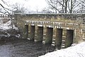
 Duck Bridge - geograph.org.uk - 2737373.jpg 3 883 × 2 585; 2,03 MB
-
 Duck Bridge - geograph.org.uk - 3396559.jpg 640 × 480; 125 KB
-
 Duck Bridge - geograph.org.uk - 5570754.jpg 640 × 308; 75 KB
-
 Duck Bridge and adjacent Irish Ford - geograph.org.uk - 4662469.jpg 1 024 × 767; 225 KB
-
 Duck Bridge, near Danby - geograph.org.uk - 4567391.jpg 1 600 × 1 067; 1 MB
-
 East Side - geograph.org.uk - 2737322.jpg 3 837 × 2 380; 1,44 MB
-
 Easton Lane with footpath sign - geograph.org.uk - 4567387.jpg 1 600 × 1 066; 1,1 MB
-
 Elm Ledge road - geograph.org.uk - 5504778.jpg 2 048 × 1 536; 914 KB
-
 Enclosures on Castleton Rigg - geograph.org.uk - 4104439.jpg 1 500 × 1 125; 700 KB
-
 Entering Cleveland - geograph.org.uk - 2657758.jpg 800 × 600; 203 KB
-
 Entrance to Ellers Farm - geograph.org.uk - 1863358.jpg 640 × 426; 307 KB
-
 Entrance to Woodhead farm - geograph.org.uk - 1863062.jpg 640 × 426; 273 KB
-
 Esk Dale - geograph.org.uk - 442095.jpg 640 × 427; 70 KB
-
 Esk Dale from the side of Little Fryup Dale - geograph.org.uk - 4792012.jpg 1 600 × 1 064; 314 KB
-
 Esk Mill - geograph.org.uk - 2737899.jpg 3 723 × 2 565; 1,11 MB
-
 Esk Mill, Danby - geograph.org.uk - 1067531.jpg 640 × 414; 137 KB
-
 Esk Mill, Danby - geograph.org.uk - 1067536.jpg 640 × 418; 79 KB
-
 Esk Valley - geograph.org.uk - 2702967.jpg 640 × 391; 189 KB
-
 Esk Valley - geograph.org.uk - 2703300.jpg 640 × 431; 237 KB
-
 Esk valley at Castleton - geograph.org.uk - 5266821.jpg 4 320 × 3 240; 3,35 MB
-
 Esk Valley from Eston Lane - geograph.org.uk - 5823814.jpg 1 024 × 769; 314 KB
-

-
 Esk Valley south-east of Danby - geograph.org.uk - 5823807.jpg 1 024 × 768; 282 KB
-
 Eskdale Inn - geograph.org.uk - 2009775.jpg 640 × 480; 246 KB
-

-
 Ever felt you were being watched^ - geograph.org.uk - 553240.jpg 640 × 480; 85 KB
-
 Ewe Crag Beck - geograph.org.uk - 6250001.jpg 640 × 360; 109 KB
-
 Exit from Shooting Butt - geograph.org.uk - 3830666.jpg 427 × 640; 256 KB
-
 Fairy Cross Plain - geograph.org.uk - 5562400.jpg 640 × 427; 104 KB
-
 Farm, near Moors Centre Danby - geograph.org.uk - 1808280.jpg 1 013 × 1 280; 578 KB
-
 Farmland near Commondale - geograph.org.uk - 2672069.jpg 800 × 600; 58 KB
-
 Farmland near Danby - geograph.org.uk - 2672047.jpg 800 × 600; 70 KB
-
 Field beside Esk Mill - geograph.org.uk - 234789.jpg 640 × 480; 62 KB
-

-
 Field of molehills, Clitherbeck Farm - geograph.org.uk - 121262.jpg 480 × 640; 126 KB
-
 Fields North of Easton Lane - geograph.org.uk - 442111.jpg 640 × 427; 68 KB
-
 Filling station, Castleton - geograph.org.uk - 4567337.jpg 1 600 × 1 067; 1,17 MB
-
 Flood plain near Duck Bridge - geograph.org.uk - 4662468.jpg 1 500 × 1 124; 493 KB
-
 Flooded areas above Duck Bridge - geograph.org.uk - 4662467.jpg 1 500 × 1 124; 482 KB
-

-

-

-

-
 FLT M17 11.42 mi - Large Abbott Loop Map Sign - E end loop - panoramio.jpg 1 536 × 2 048; 805 KB
-

-
 FLT M17 12.9 mi - Register near Fisher Settlement Rd - panoramio.jpg 1 536 × 2 048; 893 KB
-

-
 FLT M17 13.7 mi - Puncheon 8' long, 2 2x6s, RR tie sills - panoramio.jpg 1 536 × 2 048; 816 KB
-
 FLT M17 14.0 mi - Puncheon, two 2x6's, 8' long, RR tie sills - panoramio.jpg 1 536 × 2 048; 816 KB
-
 FLT M17 14.1 mi - Two puncheons, two 2x6's, 8' long, RR tie sills - panoramio.jpg 1 536 × 2 048; 816 KB


%27_(11213461846).jpg)


.jpg)


,_3%27_to_drainage,_near_Smiley_Rd_-_panoramio.jpg)


