Category:Daresbury
Vai alla navigazione
Vai alla ricerca
villaggio nel Cheshire, Inghilterra  | |||||
| Carica un file multimediale | |||||
| Istanza di | |||||
|---|---|---|---|---|---|
| Luogo | Halton, Cheshire, Nord Ovest dell'Inghilterra, Inghilterra | ||||
 | |||||
Sottocategorie
Questa categoria contiene le 5 sottocategorie indicate di seguito, su un totale di 5.
File nella categoria "Daresbury"
Questa categoria contiene 81 file, indicati di seguito, su un totale di 81.
-
 A field entrance at Red Brow - geograph.org.uk - 3418527.jpg 4 517 × 2 289; 6,89 MB
-
 A558 Road Bridge - geograph.org.uk - 2524425.jpg 640 × 401; 101 KB
-
 A56 looking west - geograph.org.uk - 2749930.jpg 640 × 452; 52 KB
-
 Chester Road - geograph.org.uk - 2749943.jpg 640 × 453; 57 KB
-
 Commonside Farm, Daresbury, from the air - geograph.org.uk - 5025947.jpg 1 024 × 681; 181 KB
-
 Daresbury - Telephone Box At Junction With Chester Road - 20220927113837.jpg 4 032 × 3 024; 4,99 MB
-
 Daresbury Black Jane Farm.jpg 2 544 × 1 859; 1,05 MB
-
 Daresbury Expressway - geograph.org.uk - 2749912.jpg 640 × 480; 42 KB
-

-
 Daresbury Firs - geograph.org.uk - 3418173.jpg 4 592 × 3 056; 7,9 MB
-
 Daresbury Hall, Warrington - derelict estate housing - geograph.org.uk - 4419619.jpg 2 175 × 1 449; 1,89 MB
-
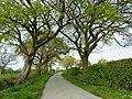
 Daresbury Lane - geograph.org.uk - 2779961.jpg 3 056 × 2 016; 1,42 MB
-
 Daresbury Lane - geograph.org.uk - 2843144.jpg 640 × 481; 76 KB
-
 Daresbury Phone Box 2.jpg 1 353 × 2 210; 1,06 MB
-
 Daresbury Sessions House.jpg 2 524 × 1 541; 943 KB
-
 Daresbury station site geograph-3402496-by-Ben-Brooksbank.jpg 2 334 × 1 360; 3,73 MB
-
 Daresbury Tower - geograph.org.uk - 4883451.jpg 1 000 × 748; 568 KB
-
 Daresbury Village - geograph.org.uk - 2806437.jpg 640 × 480; 152 KB
-
 Dilapidated barn at Crow's Nest - geograph.org.uk - 4391725.jpg 1 024 × 768; 263 KB
-
 Eastbound off slip at J11 of M56 - geograph.org.uk - 5228016.jpg 1 600 × 1 065; 492 KB
-
 Entrance to Daresbury Firs - geograph.org.uk - 4391720.jpg 1 024 × 768; 322 KB
-

-
 Foden S21 (1962) - 15478500631.jpg 2 000 × 1 333; 453 KB
-
 Glebe Farm - geograph.org.uk - 805636.jpg 600 × 450; 76 KB
-

-
 Horses near Daresbury - geograph.org.uk - 4883468.jpg 1 000 × 699; 709 KB
-
 K6 phone box in Daresbury - geograph.org.uk - 3111612.jpg 640 × 480; 50 KB
-
 Land at Poplar farm - geograph.org.uk - 2562710.jpg 640 × 409; 48 KB
-
 Life and Letters of Lewis Carroll - Darsbury Parsonage.jpg 2 791 × 1 795; 1,36 MB
-
 Low bridge on Delph Lane - geograph.org.uk - 4883442.jpg 1 000 × 703; 665 KB
-
 M56 Bridge - geograph.org.uk - 2427815.jpg 640 × 429; 74 KB
-

-
 M56 Motorway - junction 11 bridges - geograph.org.uk - 2253142.jpg 640 × 480; 47 KB
-
 M56 Motorway - Newton Lane bridge - geograph.org.uk - 2253149.jpg 640 × 480; 52 KB
-
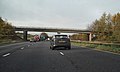
 M56 Motorway approaching Junction 11 - geograph.org.uk - 3390613.jpg 3 695 × 1 842; 1,52 MB
-
 M56 Motorway east of junction 11 - geograph.org.uk - 2253145.jpg 640 × 480; 41 KB
-

-
 M56 near Newton Cross - geograph.org.uk - 5610749.jpg 640 × 427; 420 KB
-

-
 M56, Junction 11 - geograph.org.uk - 2153827.jpg 640 × 480; 129 KB
-
 M56, Newton Cross - geograph.org.uk - 2153816.jpg 799 × 480; 149 KB
-
 Morphany Lane - geograph.org.uk - 2936590.jpg 640 × 480; 132 KB
-
 Morphany Lane - geograph.org.uk - 2936593.jpg 640 × 480; 230 KB
-
 Morphany Lane - geograph.org.uk - 2936596.jpg 640 × 480; 131 KB
-
-
 Newton Cross - geograph.org.uk - 805646.jpg 615 × 461; 112 KB
-
 Newton Lane - geograph.org.uk - 3418580.jpg 4 414 × 2 616; 7,86 MB
-
 Newton Lane at Black Jane Farm - geograph.org.uk - 2842355.jpg 640 × 480; 109 KB
-
 Newton Lane at Daresbury Fruit Farm - geograph.org.uk - 2842354.jpg 640 × 481; 73 KB
-
 Norton level crossing - geograph.org.uk - 4263200.jpg 1 600 × 1 200; 621 KB
-
 Please remove your boots - geograph.org.uk - 3111614.jpg 770 × 1 024; 174 KB
-
 Ring 'O' Bells Public House, Daresbury - panoramio - Joe Blundell.jpg 3 648 × 2 736; 4,01 MB
-
 Ring 'O' Bells Public House, Daresbury - panoramio.jpg 3 648 × 2 736; 3,81 MB
-
 Ring O Bells Public House.jpg 240 × 180; 19 KB
-
 Road junction at Newton Cross - geograph.org.uk - 2936602.jpg 640 × 479; 174 KB
-
 Roadblock on Daresbury Lane - geograph.org.uk - 3111607.jpg 1 024 × 768; 232 KB
-
 Steam on the West Coast Main Line - geograph.org.uk - 81634.jpg 640 × 426; 110 KB
-

-
 Stile near Daresbury Park - geograph.org.uk - 4391727.jpg 1 024 × 768; 189 KB
-
 Stylish barn on Hall Lane - geograph.org.uk - 4141332.jpg 1 024 × 768; 161 KB
-
 The Dental Academy, Daresbury - geograph.org.uk - 3419348.jpg 4 586 × 2 008; 7,85 MB
-
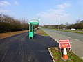
 The M56 approaching Junction 11 - geograph.org.uk - 6169679.jpg 2 700 × 2 025; 304 KB
-
 The M56 runs under Chester Road - geograph.org.uk - 6169689.jpg 2 700 × 2 025; 314 KB
-
 The M56 runs under Newton Lane - geograph.org.uk - 6169670.jpg 2 700 × 2 025; 397 KB
-
 The Mersey Valley Trail - geograph.org.uk - 3419382.jpg 4 336 × 2 886; 5,79 MB
-
 The Quarterly journal of the Geological Society of London (13070917805).jpg 1 211 × 2 069; 560 KB
-
 The Ring 'O' Bells - geograph.org.uk - 1725651.jpg 2 816 × 2 112; 1,58 MB
-
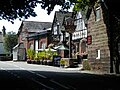
 The Ring 'O' Bells Pub Restaurant, Daresbury - geograph.org.uk - 2779975.jpg 3 072 × 2 016; 1,25 MB
-
 The Ring O Bells pub at Daresbury - geograph.org.uk - 4141190.jpg 1 024 × 768; 162 KB
-
 The Sessions House in Daresbury - geograph.org.uk - 3111611.jpg 1 024 × 768; 120 KB
-
 View over open countryside to Daresbury Laboratory Tower - geograph.org.uk - 3313164.jpg 1 600 × 1 200; 391 KB
-
 Waymarker on Red Brow Lane, Daresbury Park - geograph.org.uk - 4391729.jpg 1 024 × 768; 162 KB
-
 Weak Bridge - geograph.org.uk - 3418240.jpg 4 592 × 3 056; 7,02 MB
-
 Westbound M56 approaching Junction 11 - geograph.org.uk - 5610751.jpg 640 × 427; 405 KB
-
 Footpath near Hatton - geograph.org.uk - 70428.jpg 640 × 480; 178 KB
-
 Hatton Lodge Cottages, Hatton - geograph.org.uk - 113026.jpg 640 × 426; 143 KB
-
 Horses at New Farm, Moore - geograph.org.uk - 711969.jpg 640 × 480; 63 KB
-
 Junction of the A56 and Hobb Lane - geograph.org.uk - 113022.jpg 640 × 426; 130 KB
-
 Little Manor Farm - geograph.org.uk - 89280.jpg 640 × 426; 141 KB
-
 Out in the country - geograph.org.uk - 89260.jpg 640 × 426; 128 KB
-
 Owl's Nest Farm - geograph.org.uk - 89251.jpg 640 × 426; 69 KB


_-_15478500631.jpg)


.jpg)


