Category:Darley Dale
Jump to navigation
Jump to search
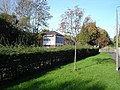
town and civil parish in Derbyshire Dales district, Derbyshire, England ,_Darley_Dale_-_geograph.org.uk_-_3997982.jpg) Lime Tree Avenue in Darley Dale | |||||
| Վերբեռնել մեդիա նիշք | |||||
| Հասկացության մասնավոր դեպք | |||||
|---|---|---|---|---|---|
| Վայր | Derbyshire Dales, Դերբիշիր, Արևելյան Միդլենդ, Անգլիա | ||||
| Բնակչություն |
| ||||
| Մակերես |
| ||||
| Բարձրություն ծովի մակարդակից |
| ||||
| պաշտոնական կայք | |||||
 | |||||
Darley Dale, Derbyshire, England
Ենթակատեգորիաներ
Ստորև բերված է այս կատեգորիայի 9 ենթակատեգորիա՝ 9-ից։
B
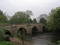
- Bridge at Darley Bridge (7 F)
D
- Darley Dale War Memorial (1 F)
- Darwin Forest Country Park (10 F)
F
- Farley, Derbyshire (3 F)
H
- Hackney, Derbyshire (11 F)
- St Helen's Church, Darley Dale (32 F)
R
- Darley Dale railway station (54 F)
T
- Two Dales (35 F)
U
- Upper Hackney (3 F)
«Darley Dale» կատեգորիայի մեդիան
Ստորև բերված է այս կատեգորիայի 200 նիշք՝ 487-ից։
(նախորդ էջ) (հաջորդ էջ)-
 "Darley Discounts" store, Darley Dale - geograph.org.uk - 3750498.jpg 3781 × 5041; 5,28 ՄԲ
-
 "The Grouse Inn", Darley Dale - geograph.org.uk - 3750497.jpg 4964 × 3723; 5,26 ՄԲ
-
 "The Plough Inn" pub sign - Two Dales - geograph.org.uk - 3750511.jpg 3618 × 5065; 5,4 ՄԲ
-
 "The Plough Inn", Two Dales - geograph.org.uk - 3750510.jpg 5006 × 3755; 4,96 ՄԲ
-
 "The Square and Compass", Darley Bridge - geograph.org.uk - 4076754.jpg 2541 × 1815; 1,55 ՄԲ
-
 "Woodlands", Whitworth Road - geograph.org.uk - 3750493.jpg 4978 × 3556; 4,11 ՄԲ
-
 31270 at Darley Dale Railway Station - geograph.org.uk - 5633828.jpg 640 × 480; 229 ԿԲ
-

-
 A pair of trees in the Derwent valley - geograph.org.uk - 4537214.jpg 1024 × 768; 174 ԿԲ
-

-
 A Stack of Stones in Hallmoor Wood - geograph.org.uk - 4486034.jpg 1600 × 899; 383 ԿԲ
-
 A6 Bakewell Road and sign for Whitworth Hospital - geograph.org.uk - 5561762.jpg 1600 × 1066; 704 ԿԲ
-
 A6 southbound in Darley Dale - geograph.org.uk - 4281722.jpg 640 × 480; 93 ԿԲ
-
 Abbey Farm, near Churchtown - geograph.org.uk - 5606068.jpg 5202 × 3465; 3,19 ՄԲ
-
 Above Fallinge Edge - geograph.org.uk - 2906408.jpg 3934 × 2908; 2,25 ՄԲ
-
 Above Tax Farm - geograph.org.uk - 4594387.jpg 3753 × 4946; 4,8 ՄԲ
-
 Ameycroft Lane near Upper Hackney - geograph.org.uk - 2726990.jpg 3246 × 2404; 884 ԿԲ
-
 An impromptu pond - geograph.org.uk - 1737235.jpg 640 × 480; 103 ԿԲ
-
 Approaching Abbey Farm - geograph.org.uk - 3473607.jpg 2048 × 1536; 518 ԿԲ
-
 Approaching Woodside Farm - geograph.org.uk - 3370904.jpg 850 × 638; 182 ԿԲ
-
 Arable Grassland near Upper Hackney - geograph.org.uk - 2726983.jpg 3252 × 2412; 877 ԿԲ
-
 At Darley Dale Station - geograph.org.uk - 6275812.jpg 640 × 453; 117 ԿԲ
-
 Autumn colour in Darley Forest - geograph.org.uk - 4215694.jpg 800 × 600; 162 ԿԲ
-
 Autumn leaves on a path above Potter Dam - geograph.org.uk - 3204376.jpg 3648 × 2736; 4,98 ՄԲ
-
 Autumn view of the old chapel in Two Dales - geograph.org.uk - 3751775.jpg 3632 × 4842; 3,91 ՄԲ
-
 B5057 by Sydnopehill Farm - geograph.org.uk - 4281726.jpg 640 × 481; 90 ԿԲ
-
 B5057 near Sydnope Hall - geograph.org.uk - 4281730.jpg 640 × 480; 67 ԿԲ
-
 B5057 near Two Dales - geograph.org.uk - 4281725.jpg 640 × 481; 60 ԿԲ
-
 B5057 nears Ashover parish boundary - geograph.org.uk - 4281732.jpg 640 × 480; 80 ԿԲ
-
 B5057 towards Darley Dale - geograph.org.uk - 3997954.jpg 640 × 480; 71 ԿԲ
-
 Back Lane - geograph.org.uk - 313730.jpg 640 × 480; 156 ԿԲ
-
 Back Lane - geograph.org.uk - 3371080.jpg 850 × 638; 227 ԿԲ
-
 Back Lane - geograph.org.uk - 4213309.jpg 4000 × 2248; 6,61 ՄԲ
-
 Back Lane - geograph.org.uk - 547147.jpg 640 × 480; 157 ԿԲ
-
 Back Lane - geograph.org.uk - 547150.jpg 640 × 480; 161 ԿԲ
-
 Back Lane above Woodside Farm - geograph.org.uk - 3370911.jpg 850 × 638; 145 ԿԲ
-
 Back Lane above Woodside Farm - geograph.org.uk - 4213325.jpg 4000 × 2248; 4,44 ՄԲ
-
 Back Lane approaching Woodside Farm - geograph.org.uk - 4216380.jpg 600 × 800; 201 ԿԲ
-
 Back Lane approaching Woodside Farm - geograph.org.uk - 547174.jpg 640 × 480; 109 ԿԲ
-
 Back Lane below Sydnope Hall Farm - geograph.org.uk - 4213327.jpg 4000 × 2248; 7,02 ՄԲ
-
 Back Lane near Wayne Corner Plantation - geograph.org.uk - 2303566.jpg 3296 × 2472; 1,1 ՄԲ
-
 Back Lane near Woodside Farm - geograph.org.uk - 4216381.jpg 600 × 800; 202 ԿԲ
-
 Back Lane view towards Bumper Castle - geograph.org.uk - 547183.jpg 640 × 480; 119 ԿԲ
-
 Bakewell Road and Morledge junction - geograph.org.uk - 6203238.jpg 1600 × 901; 550 ԿԲ
-
 Bakewell Road, Upper Hackney. New development - geograph.org.uk - 5606942.jpg 5202 × 3465; 3,39 ՄԲ
-
 Barn north of Abbey Farm - geograph.org.uk - 3473605.jpg 2048 × 1536; 691 ԿԲ
-
 Barringtons, Darley Dale - geograph.org.uk - 5339950.jpg 1600 × 1200; 400 ԿԲ
-

-
 Below Cock's Head at Two Dales - geograph.org.uk - 3751770.jpg 4761 × 3571; 4,37 ՄԲ
-

-
 Bent Lane - Footpath - geograph.org.uk - 567142.jpg 640 × 480; 154 ԿԲ
-
 Bent Lane - Footpath - geograph.org.uk - 567198.jpg 640 × 480; 144 ԿԲ
-
 Bent Lane - View - geograph.org.uk - 567107.jpg 640 × 480; 187 ԿԲ
-
 Bent Lane - View - geograph.org.uk - 567118.jpg 640 × 480; 127 ԿԲ
-
 Bent Lane - View across Fields - geograph.org.uk - 567087.jpg 640 × 480; 128 ԿԲ
-
 Bent Lane - View across Fields - geograph.org.uk - 567186.jpg 640 × 480; 126 ԿԲ
-

-

-

-
 Bent Lane - View towards Black Hill - geograph.org.uk - 567134.jpg 640 × 480; 78 ԿԲ
-
 Bent Lane near Bumper Castle - geograph.org.uk - 2303540.jpg 3296 × 2472; 1,08 ՄԲ
-
 Bent Lane, above Darley Dale - geograph.org.uk - 4213288.jpg 4000 × 2248; 7,25 ՄԲ
-
 Bent Lane, Darley Hillside - geograph.org.uk - 2394773.jpg 640 × 480; 123 ԿԲ
-
 Bent Lane, Darley Hillside - geograph.org.uk - 3370790.jpg 850 × 638; 236 ԿԲ
-
 Big Bumper Piece Moor - geograph.org.uk - 2566675.jpg 3648 × 2736; 1,5 ՄԲ
-
 BJ Waters, EMR Erith.jpg 3024 × 4032; 1,02 ՄԲ
-
 Boundary of Farley Moor and Matlock Moor - geograph.org.uk - 254869.jpg 475 × 640; 134 ԿԲ
-
 Bridge over Halldale Brook - geograph.org.uk - 562325.jpg 640 × 480; 189 ԿԲ
-
 Bridge over Sydnope Brook - geograph.org.uk - 4213345.jpg 4000 × 2248; 7 ՄԲ
-
 Bridleway at Little Bumper Piece - geograph.org.uk - 2350525.jpg 640 × 480; 144 ԿԲ
-
 Broken finger post - geograph.org.uk - 2337133.jpg 427 × 640; 69 ԿԲ
-
 Building work suspended - geograph.org.uk - 1637967.jpg 640 × 480; 53 ԿԲ
-
 Buildings at Abbey Farm - geograph.org.uk - 3102601.jpg 1024 × 614; 84 ԿԲ
-
 Bumper Castle - Entrance - geograph.org.uk - 567079.jpg 640 × 480; 166 ԿԲ
-
 Bus shelter and shops, A6 in Darley Dale - geograph.org.uk - 5562320.jpg 1600 × 1198; 817 ԿԲ
-
 Bus stop on Bakewell Road - geograph.org.uk - 1831881.jpg 640 × 480; 65 ԿԲ
-
 Butcher's shop, Darley Dale - geograph.org.uk - 3750505.jpg 3677 × 4596; 3,84 ՄԲ
-
 Caravan site, Darley Bridge - geograph.org.uk - 3997950.jpg 640 × 480; 88 ԿԲ
-
 Cat on a wall - Two Dales - geograph.org.uk - 3750512.jpg 4858 × 3886; 4,83 ՄԲ
-
 Chain pump - geograph.org.uk - 1336216.jpg 640 × 480; 124 ԿԲ
-
 Chesterfield Road - Beeley Moor - geograph.org.uk - 539688.jpg 640 × 480; 134 ԿԲ
-
 Chesterfield Road in Darley Dale - geograph.org.uk - 2303579.jpg 3296 × 2472; 1,06 ՄԲ
-
 Church Inn - geograph.org.uk - 6275781.jpg 640 × 428; 124 ԿԲ
-
 Church Inn, Churchtown - geograph.org.uk - 5606093.jpg 5202 × 3465; 3,34 ՄԲ
-
 Church Inn, Darley Dale - geograph.org.uk - 4332049.jpg 1600 × 1062; 458 ԿԲ
-
 Church Inn, Darley Dale - geograph.org.uk - 4332051.jpg 1062 × 1600; 484 ԿԲ
-
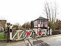
 Church Lane Crossing - geograph.org.uk - 298021.jpg 640 × 480; 136 ԿԲ
-
 Church Lane Crossing - geograph.org.uk - 5396199.jpg 899 × 1600; 388 ԿԲ
-
 Church Lane Crossing - geograph.org.uk - 5633838.jpg 640 × 480; 204 ԿԲ
-
 Church Lane Crossing - geograph.org.uk - 6275788.jpg 640 × 430; 123 ԿԲ
-
 Church Lane Crossing - geograph.org.uk - 87885.jpg 640 × 480; 153 ԿԲ
-
 Church Lane Crossing, Darley Dale - geograph.org.uk - 4332042.jpg 1600 × 1062; 797 ԿԲ
-
 Church Lane Crossing, Darley Dale - geograph.org.uk - 4332046.jpg 1600 × 1144; 482 ԿԲ
-
 Church Lane in Darley Dale - geograph.org.uk - 2084227.jpg 3296 × 2472; 1,1 ՄԲ
-
 Church Road crossing and signal box - geograph.org.uk - 5606087.jpg 5202 × 3465; 3,89 ՄԲ
-
 ChurchLaneCrossing.jpg 2592 × 1944; 2,45 ՄԲ
-
 Churchtown playground - geograph.org.uk - 5606099.jpg 5202 × 3465; 3,77 ՄԲ
-
 Churchyard of St Helen's Church, Darley - geograph.org.uk - 3903188.jpg 2000 × 1500; 1,33 ՄԲ
-
 Conifers on Farley Moor - geograph.org.uk - 1803353.jpg 640 × 480; 66 ԿԲ
-
 Construction Company HQ - geograph.org.uk - 1637699.jpg 640 × 480; 87 ԿԲ
-
 Cottage by Farley Lane - geograph.org.uk - 4594416.jpg 3888 × 5184; 5,7 ՄԲ
-
 Cottage by Greenaway Lane - geograph.org.uk - 4594449.jpg 5077 × 3644; 4,98 ՄԲ
-
 Cottages on Farley Hill - geograph.org.uk - 4594422.jpg 4814 × 3509; 4,45 ՄԲ
-
 Country views above Two Dales - geograph.org.uk - 3370883.jpg 850 × 638; 163 ԿԲ
-
 Cricket ground at Darley Bridge - geograph.org.uk - 1991237.jpg 640 × 480; 127 ԿԲ
-
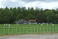 Cricket ground, Darley Dale (geograph 3997958).jpg 640 × 433; 68 ԿԲ
-
 Cricket pavilion - geograph.org.uk - 2337366.jpg 640 × 427; 79 ԿԲ
-

-
 Dale Road North (A6) - geograph.org.uk - 3998339.jpg 640 × 480; 86 ԿԲ
-
 Darley - Church Lane Crossing - geograph.org.uk - 961161.jpg 640 × 480; 94 ԿԲ
-
 Darley Bridge - flood wall - geograph.org.uk - 1942089.jpg 1600 × 1200; 420 ԿԲ
-
 Darley Bridge - footpath choice - geograph.org.uk - 1942065.jpg 1600 × 1200; 442 ԿԲ
-
 Darley Bridge - geograph.org.uk - 3473621.jpg 2048 × 1536; 584 ԿԲ
-
 Darley Bridge - geograph.org.uk - 4249517.jpg 640 × 427; 671 ԿԲ
-
 Darley Churchtown CE(C) Primary School - geograph.org.uk - 1336209.jpg 640 × 480; 120 ԿԲ
-
 Darley cricket ground - geograph.org.uk - 4909749.jpg 3068 × 1722; 3,22 ՄԲ
-
 Darley cricket ground - geograph.org.uk - 4909757.jpg 3046 × 1682; 3,2 ՄԲ
-
 Darley Dale - Barrington's.jpg 1600 × 1236; 492 ԿԲ
-
 Darley Dale - Church Inn - geograph.org.uk - 1943350.jpg 1600 × 1200; 432 ԿԲ
-
 Darley Dale - Dale Road Methodist Church - geograph.org.uk - 3568282.jpg 1600 × 1174; 669 ԿԲ
-

-
 Darley Dale - Footpath next to railway - geograph.org.uk - 961177.jpg 640 × 480; 102 ԿԲ
-
 Darley Dale - former bus garage - geograph.org.uk - 3706848.jpg 1600 × 1016; 484 ԿԲ
-
 Darley Dale - Four Lane Ends - geograph.org.uk - 961582.jpg 640 × 480; 61 ԿԲ
-
 Darley Dale - Four Lane Ends - geograph.org.uk - 961590.jpg 640 × 480; 55 ԿԲ
-
 Darley Dale - geograph.org.uk - 2155525.jpg 800 × 600; 73 ԿԲ
-
 Darley Dale - Grouse Inn - geograph.org.uk - 1943360.jpg 1600 × 1200; 465 ԿԲ
-
 Darley Dale - monument in Whitworth Park.jpg 1600 × 1200; 757 ԿԲ
-
 Darley Dale - railway foot crossing near Holt Drive - geograph.org.uk - 4183893.jpg 1600 × 1200; 1,03 ՄԲ
-
 Darley Dale - Red House - geograph.org.uk - 3788651.jpg 1600 × 1185; 753 ԿԲ
-
 Darley Dale - Stancliffe View Terrace - geograph.org.uk - 3646396.jpg 1600 × 1200; 589 ԿԲ
-
 Darley Dale - view across River Derwent - geograph.org.uk - 4183886.jpg 1600 × 1200; 790 ԿԲ
-
 Darley Dale - Warney Mill - geograph.org.uk - 3756262.jpg 1600 × 1208; 480 ԿԲ
-
 Darley Dale - West Lodge to Stancliffe Hall - geograph.org.uk - 3646408.jpg 1600 × 1472; 809 ԿԲ
-
 Darley Dale - Whitworth Hospital.jpg 1600 × 1230; 560 ԿԲ
-
 Darley Dale - Whitworth Institute (rear) - geograph.org.uk - 3788663.jpg 1600 × 1228; 647 ԿԲ
-
 Darley Dale - Whitworth Institute (turret) - geograph.org.uk - 3788665.jpg 1200 × 1600; 407 ԿԲ
-
 Darley Dale - Whitworth Institute - geograph.org.uk - 961157.jpg 640 × 480; 123 ԿԲ
-

-

-

-
 Darley Dale - Whitworth Memorial - geograph.org.uk - 961608.jpg 480 × 640; 59 ԿԲ
-
 Darley Dale croquet club shelter - geograph.org.uk - 3751783.jpg 3700 × 4933; 5,46 ՄԲ
-
 Darley Dale Crossing - geograph.org.uk - 876371.jpg 640 × 480; 54 ԿԲ
-
 Darley Dale Crossing - geograph.org.uk - 876378.jpg 640 × 480; 54 ԿԲ
-
 Darley Dale lake - geograph.org.uk - 5606108.jpg 5202 × 3465; 3,53 ՄԲ
-
 Darley Dale Post Office - geograph.org.uk - 3750494.jpg 3627 × 4533; 3,41 ՄԲ
-
 Darley Dale Post Office - geograph.org.uk - 3998337.jpg 640 × 480; 63 ԿԲ
-
 Darley Dale Railway Station, Peak Rail - geograph.org.uk - 6126035.jpg 1024 × 768; 281 ԿԲ
-
 Darley Dale Signal Box - geograph.org.uk - 3997975.jpg 640 × 480; 62 ԿԲ
-
 Darley Dale station - geograph.org.uk - 3473616.jpg 2048 × 1536; 587 ԿԲ
-
 Darley Dale station looking north - geograph.org.uk - 5606105.jpg 5202 × 3465; 3,51 ՄԲ
-
 Darley Dale station looking south - geograph.org.uk - 5606106.jpg 5202 × 3465; 3,34 ՄԲ
-
 Darley Dale station, Peak Rail - geograph.org.uk - 2869775.jpg 3845 × 2351; 1,82 ՄԲ
-
 Darley Dale Telephone Exchange - geograph.org.uk - 4311628.jpg 3072 × 2304; 1,76 ՄԲ
-
 Darley Forest Grange - geograph.org.uk - 1737247.jpg 640 × 480; 92 ԿԲ
-
 Darley Forest Grange - geograph.org.uk - 3750060.jpg 4888 × 3666; 5,19 ՄԲ
-
 Darley Forest Grange - geograph.org.uk - 5338091.jpg 1600 × 1200; 342 ԿԲ
-

-
 Darley Hillside - geograph.org.uk - 3370777.jpg 850 × 617; 154 ԿԲ
-
 Demolition of Cornmill - geograph.org.uk - 362732.jpg 640 × 480; 65 ԿԲ
-
 Denacre Lane and Ladygrove Mill - geograph.org.uk - 3370859.jpg 638 × 850; 178 ԿԲ
-
 Derbyshire moorland view - geograph.org.uk - 6273139.jpg 640 × 482; 123 ԿԲ
-
 Derbyshire UK parish map highlighting Darley Dale.svg 888 × 1308; 2,34 ՄԲ
-
 Derwent Valley barn - geograph.org.uk - 2336954.jpg 640 × 421; 83 ԿԲ
-
 Derwent valley farmland (3) - geograph.org.uk - 3102586.jpg 1024 × 768; 102 ԿԲ
-
 Derwent valley farmland (4) - geograph.org.uk - 3102619.jpg 1024 × 768; 138 ԿԲ
-
 Derwent valley farmland (5) - geograph.org.uk - 3102635.jpg 1024 × 768; 115 ԿԲ
-
 Derwent valley farmland (6) - geograph.org.uk - 3102668.jpg 1024 × 768; 123 ԿԲ
-
 Derwent valley farmland (7) - geograph.org.uk - 3102689.jpg 1024 × 768; 107 ԿԲ
-
 Derwent valley farmland (8) - geograph.org.uk - 3102692.jpg 1024 × 768; 94 ԿԲ
-
 Derwent Valley footpath - geograph.org.uk - 6275821.jpg 640 × 448; 124 ԿԲ
-
 Derwent Valley from Holt Wood - geograph.org.uk - 4213557.jpg 4000 × 2248; 5,84 ՄԲ
-

-
 Detail on Whitworth Memorial, Darley Dale - geograph.org.uk - 3750504.jpg 3679 × 4599; 4,99 ՄԲ
-
 Diamonds and Shadows - geograph.org.uk - 362703.jpg 640 × 480; 121 ԿԲ
-
 Diesel shunters in store at Darley Dale - geograph.org.uk - 5606118.jpg 5202 × 3465; 3,67 ՄԲ
-
 Down Denacre Lane, Two Dales - geograph.org.uk - 3370850.jpg 850 × 647; 161 ԿԲ
-

-
 Enthovens in the mist - geograph.org.uk - 642150.jpg 640 × 480; 33 ԿԲ
-
 Entrance Gates at West Lodge, Stancliffe Hall - geograph.org.uk - 4332083.jpg 1600 × 1062; 813 ԿԲ
-
 Entrance to the Whitesprings Plantation - geograph.org.uk - 2303551.jpg 3296 × 2472; 1,18 ՄԲ
-
 Evening Meal - geograph.org.uk - 298592.jpg 640 × 480; 51 ԿԲ
-

-
 Farley Lane - geograph.org.uk - 2726980.jpg 3286 × 2458; 1,25 ՄԲ
-
 Farley Lane - geograph.org.uk - 332881.jpg 640 × 480; 107 ԿԲ
-
 Farley Lane - geograph.org.uk - 333434.jpg 640 × 480; 111 ԿԲ
-
 Farley Lane View - geograph.org.uk - 813287.jpg 640 × 480; 100 ԿԲ
-

-
 Farley Moor - Field and Woodland - geograph.org.uk - 337390.jpg 640 × 480; 116 ԿԲ
-
 Farley Moor - Forestry Commission Sign - geograph.org.uk - 315407.jpg 640 × 480; 164 ԿԲ
-
 Farley Moor - Woodland and Field - geograph.org.uk - 337395.jpg 640 × 480; 155 ԿԲ
-
 Farley Moor - Woodland Boundary - geograph.org.uk - 333830.jpg 640 × 480; 181 ԿԲ
-
 Farley Moor - Woodland Entrance - geograph.org.uk - 332880.jpg 640 × 480; 143 ԿԲ
-
 Farley Moor - Woodland Path - geograph.org.uk - 333454.jpg 640 × 480; 130 ԿԲ
-
 Farley Moor - Woodland Path - geograph.org.uk - 333462.jpg 640 × 480; 145 ԿԲ
-
 Farley Moor - Woodland Path - geograph.org.uk - 333822.jpg 640 × 480; 104 ԿԲ
-
 Farley Moor - Woodland Path - geograph.org.uk - 333838.jpg 640 × 480; 173 ԿԲ
-
 Farley Moor - Woodland Path - geograph.org.uk - 333840.jpg 640 × 480; 159 ԿԲ
-
 Farley Moor - Woodland Path - geograph.org.uk - 333843.jpg 640 × 480; 188 ԿԲ


.jpg)

_towards_Forty_Acre_and_Seventy_Acre_Woods_-_geograph.org.uk_-_329518.jpg)
_-_geograph.org.uk_-_3998339.jpg)


_Primary_School_-_geograph.org.uk_-_1336209.jpg)


_-_geograph.org.uk_-_3788663.jpg)
_-_geograph.org.uk_-_3788665.jpg)


_-_geograph.org.uk_-_3102586.jpg)
_-_geograph.org.uk_-_3102619.jpg)
_-_geograph.org.uk_-_3102635.jpg)
_-_geograph.org.uk_-_3102668.jpg)
_-_geograph.org.uk_-_3102689.jpg)
_-_geograph.org.uk_-_3102692.jpg)


