Category:Deenethorpe
Aller à la navigation
Aller à la recherche
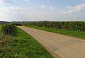
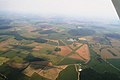
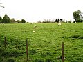
English: Deenethorpe is a village and civil parish in the East Northamptonshire district of Northamptonshire, England. It is situated north-east of Corby and near the A43 road between Corby and Stamford. Nearby villages are Deene, Bulwick and Upper Benefield. At the time of the 2001 census, the parish's population was 103 people.
village britannique  | |||||
| Téléverser des médias | |||||
| Nature de l’élément | |||||
|---|---|---|---|---|---|
| Lieu | North Northamptonshire, Northamptonshire, Midlands de l'Est, Angleterre | ||||
| Population |
| ||||
 | |||||
Sous-catégories
Cette catégorie comprend seulement la sous-catégorie ci-dessous.
R
Média dans la catégorie « Deenethorpe »
Cette catégorie comprend 63 fichiers, dont les 63 ci-dessous.
-
 1881 Occupations in Deenethorpe graph.jpg 479 × 286 ; 24 kio
-
 1881 Occupations in Deenethorpe.png 481 × 289 ; 13 kio
-
 20th century map of Deenethorpe.PNG 552 × 430 ; 470 kio
-
 Beginning of a footpath towards Bulwick Lodge - geograph.org.uk - 6669287.jpg 1 024 × 768 ; 204 kio
-
 Benefield Road - geograph.org.uk - 2364818.jpg 640 × 480 ; 88 kio
-
 Benefield Road eastwards - geograph.org.uk - 2364819.jpg 640 × 515 ; 81 kio
-
 Benefield Road eastwards - geograph.org.uk - 2364831.jpg 640 × 470 ; 76 kio
-
 Benefield Road westwards - geograph.org.uk - 2364820.jpg 640 × 438 ; 65 kio
-
 Benefield Road westwards - geograph.org.uk - 2364832.jpg 640 × 443 ; 76 kio
-
 Bridleway near Barratt's Coppice - geograph.org.uk - 4843364.jpg 480 × 640 ; 67 kio
-
 Deenethorpe airfield, aerial 2014 - geograph.org.uk - 4057244.jpg 1 024 × 683 ; 111 kio
-
 Deenethorpe NN17, UK - panoramio (1).jpg 4 608 × 3 456 ; 3,79 Mio
-
 Deenethorpe NN17, UK - panoramio (2).jpg 4 608 × 3 456 ; 4,88 Mio
-
 Deenethorpe NN17, UK - panoramio (3).jpg 4 608 × 3 456 ; 4,73 Mio
-
 Deenethorpe NN17, UK - panoramio (4).jpg 4 608 × 3 456 ; 5,99 Mio
-
 Deenethorpe NN17, UK - panoramio (5).jpg 4 608 × 3 456 ; 4,59 Mio
-
 Deenethorpe NN17, UK - panoramio (6).jpg 4 608 × 3 456 ; 4,49 Mio
-
 Deenethorpe NN17, UK - panoramio (7).jpg 5 184 × 3 456 ; 5,09 Mio
-
 Deenethorpe NN17, UK - panoramio.jpg 4 608 × 3 456 ; 4,98 Mio
-
 Deenethorpe Porters Lodge - geograph.org.uk - 2878915.jpg 640 × 427 ; 137 kio
-
 Deenethorpe Yew - geograph.org.uk - 2905571.jpg 640 × 480 ; 105 kio
-
 East of the hedge - geograph.org.uk - 2364821.jpg 640 × 451 ; 72 kio
-
 Farm track off Benefield Road - geograph.org.uk - 6224382.jpg 1 024 × 768 ; 212 kio
-
 Field edge near Deenethorpe - geograph.org.uk - 6669293.jpg 1 024 × 768 ; 200 kio
-
 Field edge near Deenethorpe - geograph.org.uk - 6669309.jpg 1 024 × 768 ; 161 kio
-
 Field north of Benefield Road - geograph.org.uk - 2364822.jpg 640 × 446 ; 72 kio
-
 Field of oilseed rape - geograph.org.uk - 6669289.jpg 1 024 × 768 ; 173 kio
-
 Field side north of Benefield road eastwards - geograph.org.uk - 2364823.jpg 640 × 480 ; 74 kio
-
 Field side south of Benefield Road eastwards - geograph.org.uk - 2364824.jpg 640 × 480 ; 84 kio
-
 Field side south of Benefield Road westwards - geograph.org.uk - 2364825.jpg 640 × 480 ; 79 kio
-
 Footpath east of Deenethorpe - geograph.org.uk - 6079051.jpg 3 776 × 2 520 ; 4,08 Mio
-
 Footpath to Benefield - geograph.org.uk - 187402.jpg 640 × 480 ; 95 kio
-
 Footpath to Deenethorpe - geograph.org.uk - 6529003.jpg 1 024 × 768 ; 188 kio
-
 Footpath to Home Farm Lodge - geograph.org.uk - 6669286.jpg 1 024 × 768 ; 190 kio
-
 Footpath towards Bulwick Lodge - geograph.org.uk - 6669305.jpg 1 024 × 768 ; 184 kio
-
 Footpath towards Bulwick Lodge - geograph.org.uk - 6669308.jpg 1 024 × 768 ; 163 kio
-
 Gap in the hedge - geograph.org.uk - 6669292.jpg 1 024 × 768 ; 139 kio
-
 Gateway - geograph.org.uk - 2364826.jpg 640 × 480 ; 76 kio
-
 Green in the middle of Deenethorpe - geograph.org.uk - 6224395.jpg 1 024 × 768 ; 335 kio
-
 Hedge between two wheat fields - geograph.org.uk - 6669301.jpg 1 024 × 768 ; 159 kio
-
 Kissing gate with no gate - geograph.org.uk - 2364827.jpg 640 × 480 ; 87 kio
-
 Mind the tree - geograph.org.uk - 1301588.jpg 640 × 462 ; 76 kio
-
 Part of Deenethorpe - geograph.org.uk - 270202.jpg 640 × 480 ; 98 kio
-
 Part of Rockingham Forest - geograph.org.uk - 6079086.jpg 3 776 × 2 520 ; 4,15 Mio
-
 Road junction - geograph.org.uk - 6225404.jpg 640 × 480 ; 48 kio
-
 Stamford Road - geograph.org.uk - 6225397.jpg 640 × 480 ; 57 kio
-
 Stamford Road - geograph.org.uk - 6225401.jpg 640 × 480 ; 72 kio
-
 Stamford Road at the junction of Benefield Road - geograph.org.uk - 6196772.jpg 1 920 × 1 280 ; 1,29 Mio
-
 Stubble field and plantation - geograph.org.uk - 6669284.jpg 1 024 × 768 ; 233 kio
-
 The Porter's lodge at Deene Park - geograph.org.uk - 3481744.jpg 4 320 × 3 240 ; 5,15 Mio
-
 View towards Burn Coppice - geograph.org.uk - 6669317.jpg 1 024 × 768 ; 176 kio
-
 Yew tree traffic island - geograph.org.uk - 2905568.jpg 640 × 480 ; 126 kio
-
 Bridleway into Deenethorpe Airfield - geograph.org.uk - 270222.jpg 640 × 480 ; 59 kio
-
 Bridleway to Langley Coppice - geograph.org.uk - 270235.jpg 640 × 480 ; 69 kio
-
 Edge of tree belt - geograph.org.uk - 487351.jpg 640 × 480 ; 101 kio
-
 Edge of tree belt - geograph.org.uk - 487353.jpg 640 × 480 ; 83 kio
-
 Field boundary - geograph.org.uk - 324256.jpg 640 × 480 ; 93 kio
-
 Home Farm Lodge - geograph.org.uk - 270238.jpg 640 × 480 ; 55 kio
-
 Secure caravan parking, off Deenethorpe Airfield - geograph.org.uk - 270231.jpg 640 × 480 ; 101 kio
-
 Service road, Deenethorpe Airfield - geograph.org.uk - 270210.jpg 640 × 480 ; 71 kio
-
 Towards Deenethorpe - geograph.org.uk - 78480.jpg 400 × 533 ; 46 kio
-
 Very Green - geograph.org.uk - 187400.jpg 640 × 480 ; 85 kio
-
 Yoke Hill Farm - geograph.org.uk - 324253.jpg 640 × 480 ; 43 kio


.jpg)
.jpg)
.jpg)
.jpg)
.jpg)
.jpg)
.jpg)


