Category:Deeping St James
Vai alla navigazione
Vai alla ricerca
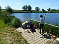
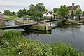
English: Deeping St James lies east of Market Deeping in Lincolnshire, England, on the River Welland, in the middle of rich sedimentary agricultural land on the B1166 and B1162. With a population of 6,923 in 2837 households, it is the largest of The Deepings parishes.
village and civil parish in Lincolnshire, England, UK  | |||||
| Carica un file multimediale | |||||
| Istanza di | |||||
|---|---|---|---|---|---|
| Luogo | South Kesteven, Lincolnshire, Midlands Orientali, Inghilterra | ||||
| Consiste di | |||||
 | |||||
Sottocategorie
Questa categoria contiene le 10 sottocategorie indicate di seguito, su un totale di 10.
2
- 2007 in Deeping St James (12 F)
D
- Deeping St James village lock-up (10 F)
F
- Fields in Deeping St James (12 F)
- Frognall (9 F)
R
- Roads in Deeping St James (10 F)
S
- Stowgate level crossing (6 F)
- Streets in Deeping St James (8 F)
File nella categoria "Deeping St James"
Questa categoria contiene 200 file, indicati di seguito, su un totale di 241.
(pagina precedente) (pagina successiva)-
 2016, a year on Geograph (Day 177) - geograph.org.uk - 5012188.jpg 640 × 480; 75 KB
-
 All Change - geograph.org.uk - 4615447.jpg 2 736 × 1 824; 2,54 MB
-
 Along the River Welland - geograph.org.uk - 5023171.jpg 640 × 480; 65 KB
-
 Along the River Welland - geograph.org.uk - 5023173.jpg 640 × 480; 98 KB
-
 Ancient and Modern, Deeping St James - geograph.org.uk - 641056.jpg 640 × 480; 120 KB
-
 Another notice - geograph.org.uk - 4615456.jpg 2 736 × 1 824; 1,69 MB
-
 Anti-Trespass - geograph.org.uk - 4615454.jpg 2 736 × 1 824; 2,42 MB
-
-
 B1166 towards Market Deeping - geograph.org.uk - 3118481.jpg 640 × 480; 63 KB
-
 B1166 towards Market Deeping - geograph.org.uk - 3118493.jpg 640 × 480; 69 KB
-
 B1166 towards Market Deeping - geograph.org.uk - 3118505.jpg 640 × 480; 62 KB
-
 Between the graveyards - geograph.org.uk - 5023201.jpg 640 × 480; 90 KB
-
 Bloodcurdling warnings - geograph.org.uk - 4615452.jpg 2 736 × 1 824; 2,2 MB
-
 Bridge Street (B1166) - geograph.org.uk - 3118824.jpg 640 × 480; 61 KB
-
 Bridge Street, Deeping St James - geograph.org.uk - 3102166.jpg 640 × 426; 71 KB
-
 Bridge Street, Deeping St James - geograph.org.uk - 3109219.jpg 640 × 426; 80 KB
-
 Bridge Street, Deeping St James - geograph.org.uk - 3109368.jpg 640 × 426; 70 KB
-
 Bridge Street, Deeping St James - geograph.org.uk - 3109413.jpg 640 × 426; 56 KB
-
 Bridge Street, Deeping St James - geograph.org.uk - 3109422.jpg 640 × 426; 59 KB
-
 Bridge Street, Deeping St James - geograph.org.uk - 4664472.jpg 1 280 × 844; 246 KB
-
 Bridge Street, Deeping St James - geograph.org.uk - 5128567.jpg 640 × 481; 51 KB
-
 Bridge Street, Market Deeping - geograph.org.uk - 5072105.jpg 640 × 480; 53 KB
-
 Bus shelter - geograph.org.uk - 6362459.jpg 6 240 × 4 160; 5,98 MB
-
 Canoeists on the Welland - geograph.org.uk - 4514891.jpg 4 320 × 3 240; 5,73 MB
-
 Carrying Straw - geograph.org.uk - 4615562.jpg 2 736 × 1 824; 2,76 MB
-
 Church Gate, Deeping St James - geograph.org.uk - 3101746.jpg 640 × 480; 63 KB
-
 Church Hall, Deeping St James - geograph.org.uk - 5023199.jpg 640 × 480; 70 KB
-
 Church Street, Deeping St James - geograph.org.uk - 3118806.jpg 640 × 480; 64 KB
-
 Class 153 approaching Stowgate crossing - geograph.org.uk - 6248800.jpg 1 024 × 683; 184 KB
-
 Convolvulus arvensis - geograph.org.uk - 5856317.jpg 6 032 × 4 014; 3,47 MB
-
 Cottage with former phone box - geograph.org.uk - 6359640.jpg 6 240 × 4 160; 3,51 MB
-
 Cranmoor Barn Farm - geograph.org.uk - 3793861.jpg 4 320 × 3 240; 5,29 MB
-
 Cross drain and track on Deeping Fen - geograph.org.uk - 3794388.jpg 4 320 × 3 240; 5,44 MB
-

-
 Cygnus olor - geograph.org.uk - 4514882.jpg 4 320 × 3 240; 5,78 MB
-
 Dactylorhiza fuchsii - geograph.org.uk - 4517208.jpg 4 320 × 3 240; 5,62 MB
-
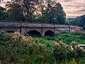
 Deeping Gate bridge - geograph.org.uk - 4664451.jpg 1 280 × 960; 380 KB
-
 Deeping Lakes - geograph.org.uk - 852876.jpg 640 × 480; 66 KB
-
 Deeping Lakes from the carpark - geograph.org.uk - 4513751.jpg 4 320 × 3 240; 5,82 MB
-
 Deeping Lakes nature reserve - geograph.org.uk - 4517200.jpg 4 320 × 3 240; 5,46 MB
-
 Deeping Lakes nature reserve - geograph.org.uk - 4615606.jpg 4 320 × 3 240; 5,33 MB
-
 Deeping Lakes nature reserve - geograph.org.uk - 4615612.jpg 4 320 × 3 240; 5,63 MB
-
 Deeping Lakes nature reserve open day - geograph.org.uk - 4513811.jpg 4 320 × 3 240; 6,05 MB
-

-
 Deeping lakes, from the public path - geograph.org.uk - 4635101.jpg 4 320 × 3 240; 5,99 MB
-
 Deeping Lakes, lake with marginal woodland - geograph.org.uk - 4635097.jpg 4 320 × 3 240; 5,46 MB
-
 Deeping Lakes, public path - geograph.org.uk - 4635105.jpg 4 320 × 3 240; 5,81 MB
-
 Deeping Lakes, small lake - geograph.org.uk - 4635094.jpg 4 320 × 3 240; 5,71 MB
-
 Deeping Lakes, succession growth - geograph.org.uk - 4635103.jpg 4 320 × 3 240; 5,56 MB
-
 Deeping Lakes, swans on the water - geograph.org.uk - 4635096.jpg 4 320 × 3 240; 5,49 MB
-
 Deeping Lakes, the large lake - geograph.org.uk - 4635089.jpg 4 320 × 3 240; 5,69 MB
-
 Deeping St James level crossing - geograph.org.uk - 3794465.jpg 4 320 × 3 240; 5,43 MB
-
 Deeping St James Low Locks - geograph.org.uk - 1559410.jpg 640 × 480; 104 KB
-
 Deeping St James village - geograph.org.uk - 326197.jpg 640 × 429; 42 KB
-
 Deeping St. James Allotments - geograph.org.uk - 15624.jpg 640 × 480; 51 KB
-
 Defibrillator dedication plaque - geograph.org.uk - 6359654.jpg 6 240 × 4 160; 2,26 MB
-
 Defibrillator in former phone box - geograph.org.uk - 6359646.jpg 4 160 × 6 240; 1,62 MB
-
 Drain beside the B1166 - geograph.org.uk - 3118483.jpg 640 × 480; 124 KB
-
 Drain beside the B1166 - geograph.org.uk - 3118484.jpg 640 × 480; 98 KB
-
 Drain beside the B1166 - geograph.org.uk - 3118492.jpg 640 × 480; 125 KB
-
 Drain off the B1166 - geograph.org.uk - 3118500.jpg 640 × 480; 99 KB
-
 Dry dike and unnamed lane - geograph.org.uk - 3794216.jpg 4 320 × 3 240; 5,96 MB
-

-
 Duck^ - geograph.org.uk - 4514898.jpg 4 320 × 3 240; 5,66 MB
-
 East Midlands railcar near Stowgate - geograph.org.uk - 3793960.jpg 4 320 × 3 240; 5,68 MB
-
 East window and Sanctuary, Deeping St James Priory church - geograph.org.uk - 6026096.jpg 4 000 × 3 000; 4,08 MB
-
 Eastgate, Deeping St James - geograph.org.uk - 3101055.jpg 640 × 480; 103 KB
-
 Eastgate, Deeping St James - geograph.org.uk - 3101711.jpg 640 × 480; 61 KB
-
 Eastgate, Deeping St James - geograph.org.uk - 3118512.jpg 640 × 480; 76 KB
-
 Eastgate, Deeping St James - geograph.org.uk - 3118518.jpg 640 × 480; 61 KB
-

-
 Extended Victorian House - geograph.org.uk - 6360596.jpg 6 240 × 4 160; 3,47 MB
-
 Faded safety - geograph.org.uk - 4615477.jpg 1 824 × 2 736; 1,62 MB
-
 Farm track off Crowland Road - geograph.org.uk - 3118486.jpg 640 × 480; 79 KB
-
 Farmland east of Deeping St James - geograph.org.uk - 3119821.jpg 640 × 480; 44 KB
-
 Farmland near Stowgate Farm - geograph.org.uk - 3794172.jpg 4 320 × 3 240; 5,72 MB
-
 Farmland off Crowland Road - geograph.org.uk - 3118489.jpg 640 × 480; 79 KB
-
 Farmland off Station Road - geograph.org.uk - 3118506.jpg 640 × 480; 108 KB
-
 Farmland off the B1166 - geograph.org.uk - 3118480.jpg 640 × 480; 76 KB
-
 Farmland off the B1166 - geograph.org.uk - 3118504.jpg 640 × 480; 76 KB
-
 Farmland, Deeping Common - geograph.org.uk - 3118495.jpg 640 × 480; 100 KB
-
 Fenland dike crossing Hall Meadow - geograph.org.uk - 3794231.jpg 4 320 × 3 240; 5,53 MB
-
 Field boundary near Deeping St James Level Crossing - geograph.org.uk - 3793841.jpg 4 320 × 3 240; 5,47 MB
-
 Fingerpost at Deeping Gate Bridge - geograph.org.uk - 4664460.jpg 960 × 1 280; 431 KB
-
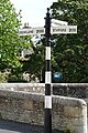
 Fingerpost, Deeping St James - geograph.org.uk - 4664469.jpg 960 × 1 280; 329 KB
-
 Fire Hydrant and kerb marker - geograph.org.uk - 6362467.jpg 6 240 × 4 160; 4,92 MB
-
 Flooded playing field, Litchfield Road, Market Deeping - geograph.org.uk - 3827569.jpg 4 320 × 3 240; 5,4 MB
-
 Floor of former telephone box - geograph.org.uk - 6362463.jpg 4 160 × 6 240; 3,45 MB
-
 Former goods yard - geograph.org.uk - 4615570.jpg 2 736 × 1 824; 1,96 MB
-
 Former goods yard gateway - geograph.org.uk - 4615567.jpg 2 736 × 1 824; 2,45 MB
-
 Former lock on The River Welland, Deeping Gate - geograph.org.uk - 3827646.jpg 4 320 × 3 240; 5,75 MB
-
 Former settling pond - geograph.org.uk - 4639034.jpg 4 320 × 3 240; 5,89 MB
-
 Former Station Hotel - geograph.org.uk - 4615432.jpg 2 736 × 1 824; 1,77 MB
-
 Geese on the river - geograph.org.uk - 4514885.jpg 4 320 × 3 240; 5,46 MB
-
 Graveyard view - geograph.org.uk - 5023204.jpg 640 × 480; 82 KB
-
 Grazing by the River Welland - geograph.org.uk - 3118490.jpg 640 × 480; 90 KB
-

-
 Guided walk - geograph.org.uk - 4516153.jpg 4 320 × 3 240; 6,03 MB
-
 Guided walk - geograph.org.uk - 4615686.jpg 4 320 × 3 240; 5,6 MB
-
 Hide at Deeping Lakes - geograph.org.uk - 4514595.jpg 4 320 × 3 240; 5,98 MB
-
 High locks Deeping St James - geograph.org.uk - 2362161.jpg 2 592 × 1 944; 1,27 MB
-
 High Locks Deeping St James geograph 705171.jpg 640 × 427; 67 KB
-
 High Locks on River Welland, Deeping Gate - geograph.org.uk - 640980.jpg 634 × 467; 133 KB
-
 House by the River Welland - geograph.org.uk - 3118828.jpg 640 × 480; 98 KB
-
 House with Sundial (geograph 7212673).jpg 6 252 × 4 164; 7,34 MB
-
 Houses alongside the River Welland, Deeping Gate - geograph.org.uk - 3971399.jpg 4 000 × 3 000; 2,64 MB
-
 Impromptu kerb - geograph.org.uk - 4524216.jpg 4 320 × 3 240; 5,56 MB
-
 Interpretation board 1 - geograph.org.uk - 4524221.jpg 4 320 × 3 240; 5,49 MB
-
 Interpretation board 2 - geograph.org.uk - 4524222.jpg 4 320 × 3 240; 5,62 MB
-
 Interpretation board 3 - geograph.org.uk - 4524224.jpg 4 320 × 3 240; 5,57 MB
-
 Interpretation boards - geograph.org.uk - 4524218.jpg 4 320 × 3 240; 5,94 MB
-
 Lake's Edge - geograph.org.uk - 4517197.jpg 4 320 × 3 240; 5,64 MB
-
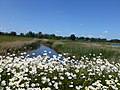 Leucanthemum vulgare - geograph.org.uk - 4514591.jpg 4 320 × 3 240; 5,95 MB
-
 Level crossing and signal box - geograph.org.uk - 3118496.jpg 640 × 480; 62 KB
-
 Level crossing at Stowgate - geograph.org.uk - 3793910.jpg 4 320 × 3 240; 5,53 MB
-
 Level crossing on Cranmore Drove - geograph.org.uk - 443095.jpg 640 × 427; 91 KB
-
 Lifting mechanism - geograph.org.uk - 4615443.jpg 1 824 × 2 736; 1,76 MB
-
 Local product - geograph.org.uk - 4524214.jpg 4 320 × 3 240; 5,78 MB
-
 Low Locks Deeping St James geograph 1824623.jpg 2 560 × 1 920; 1,38 MB
-
 Low Locks on the River Welland, Deeping St. James - geograph.org.uk - 3971198.jpg 4 000 × 3 000; 2,65 MB
-
 Manor Roofing - geograph.org.uk - 4615424.jpg 2 736 × 1 824; 2,14 MB
-
 Market Deeping.jpg 4 237 × 3 177; 7,99 MB
-
 Meadow - geograph.org.uk - 4615573.jpg 2 736 × 1 824; 2,37 MB
-
 Milepost London 91 Miles - geograph.org.uk - 15638.jpg 480 × 640; 84 KB
-
 Notice board on public shelter - geograph.org.uk - 4516156.jpg 4 320 × 3 240; 5,76 MB
-
 Notice board on public shelter - geograph.org.uk - 4516157.jpg 4 320 × 3 240; 5,6 MB
-
-

-
 Old Milepost - geograph.org.uk - 2868491.jpg 768 × 1 024; 198 KB
-
 Old Milepost - geograph.org.uk - 2868495.jpg 1 024 × 768; 225 KB
-
 Open day crowds - geograph.org.uk - 4615617.jpg 4 320 × 3 240; 5,94 MB
-
 Orchids in situ - geograph.org.uk - 4639024.jpg 4 320 × 3 240; 5,81 MB
-
 Osier Farm - geograph.org.uk - 3118513.jpg 640 × 480; 70 KB
-
 Osier Farm, Eastgate, Deeping St James - geograph.org.uk - 3793820.jpg 4 320 × 3 240; 5,52 MB
-
 Paddock on Back Lane, Deeping St James - geograph.org.uk - 3793805.jpg 4 320 × 3 240; 5,73 MB
-
 Panorama from banks of River Welland - geograph.org.uk - 4834122.jpg 14 840 × 1 560; 7,81 MB
-
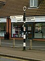
 Pet food suppliers - geograph.org.uk - 3118501.jpg 640 × 480; 105 KB
-
 Phase One Lake - geograph.org.uk - 1140835.jpg 3 072 × 2 304; 1,46 MB
-
 Plaque - geograph.org.uk - 6360580.jpg 6 240 × 4 160; 5,74 MB
-
 Ploughed field near Barron's Farm - geograph.org.uk - 3794194.jpg 4 320 × 3 240; 5,48 MB
-
 Poles in the fenland of Lincolnshire - geograph.org.uk - 3794409.jpg 4 320 × 3 240; 5,46 MB
-
 Pond dipping - geograph.org.uk - 4514603.jpg 4 320 × 3 240; 5,77 MB
-
 Pools at the nature reserve - geograph.org.uk - 4768890.jpg 4 320 × 3 240; 5,7 MB
-
 Power Distribution - geograph.org.uk - 4615475.jpg 2 736 × 1 824; 2,59 MB
-
 Public route - geograph.org.uk - 4615685.jpg 4 320 × 3 240; 6,11 MB
-
 Public shelter, Deeping Lakes nature reserve - geograph.org.uk - 4527661.jpg 4 320 × 3 240; 5,58 MB
-
 Race at the High Locks - geograph.org.uk - 693504.jpg 427 × 640; 103 KB
-
 Railway towards Peterborough - geograph.org.uk - 3118497.jpg 640 × 480; 94 KB
-
 Relocated posting box - geograph.org.uk - 4615554.jpg 1 824 × 2 736; 1,75 MB
-
 Remote footpath sign on Stowgate, Deeping St James - geograph.org.uk - 4178685.jpg 4 320 × 3 240; 5,57 MB
-
 River Welland - geograph.org.uk - 442861.jpg 640 × 427; 106 KB
-
 River Welland - geograph.org.uk - 4615621.jpg 4 320 × 3 240; 5,71 MB
-
 River Welland - geograph.org.uk - 705177.jpg 640 × 427; 57 KB
-

-
 River Welland at Deeping Gate - geograph.org.uk - 4664463.jpg 1 280 × 960; 392 KB
-
 River Welland at Deeping St. James - geograph.org.uk - 5049326.jpg 4 608 × 3 456; 5,9 MB
-
 River Welland Deeping St James - geograph.org.uk - 1829663.jpg 2 560 × 1 920; 1,38 MB
-
 River Welland, Deeping Gate - geograph.org.uk - 640986.jpg 640 × 480; 113 KB
-
 River Welland, Deeping St James - geograph.org.uk - 3101951.jpg 640 × 426; 76 KB
-
 River Welland, Deeping St James - geograph.org.uk - 3101968.jpg 640 × 426; 77 KB
-
 River Welland, Deeping St James - geograph.org.uk - 3101981.jpg 426 × 640; 100 KB
-
 River Welland, Deeping St James - geograph.org.uk - 3101991.jpg 640 × 426; 92 KB
-
 River Welland, Deeping St James - geograph.org.uk - 3101997.jpg 640 × 426; 100 KB
-
 River Welland, Deeping St James - geograph.org.uk - 3102174.jpg 640 × 426; 86 KB
-
 River Welland, Deeping St James - geograph.org.uk - 3105880.jpg 640 × 426; 76 KB
-
 River Welland, Deeping St James - geograph.org.uk - 3108200.jpg 640 × 426; 88 KB
-
 River Welland, Deeping St James - geograph.org.uk - 3109171.jpg 640 × 426; 88 KB
-
 River Welland, Deeping St James - geograph.org.uk - 3109189.jpg 640 × 426; 90 KB
-
 River Welland, Deeping St James - geograph.org.uk - 3118812.jpg 640 × 480; 92 KB
-
 River Welland, junction with Folly River - geograph.org.uk - 5004928.jpg 1 600 × 998; 416 KB
-
 River Welland, the view downstream - geograph.org.uk - 4834129.jpg 5 600 × 3 733; 7,33 MB
-
 River welland.jpg 9 248 × 6 936; 14,19 MB
-
 Road junction - geograph.org.uk - 5072109.jpg 640 × 480; 57 KB
-
 Road junction - geograph.org.uk - 5072127.jpg 640 × 480; 80 KB
-
 Road junction - geograph.org.uk - 5367827.jpg 640 × 480; 72 KB
-
 Rosa canina - geograph.org.uk - 4752876.jpg 4 320 × 3 240; 5,08 MB
-
 Rosa canina - geograph.org.uk - 4752877.jpg 4 320 × 3 240; 5,47 MB
-
 Sand Martin nesting - geograph.org.uk - 4514605.jpg 4 320 × 3 240; 5,65 MB
-
 Sign by the river - geograph.org.uk - 4513797.jpg 4 320 × 3 240; 5,73 MB
-
 Signal box at Deeping St James - geograph.org.uk - 3795469.jpg 4 320 × 3 240; 5,48 MB
-

-
 Signs of business - geograph.org.uk - 4615578.jpg 1 824 × 2 736; 2,01 MB
-
 Signs on Lamppost - geograph.org.uk - 6362464.jpg 4 160 × 6 240; 3,35 MB
-
 Site of former signal box - geograph.org.uk - 4615437.jpg 2 736 × 1 824; 2,12 MB
-
 Small Lake - geograph.org.uk - 852868.jpg 640 × 480; 63 KB
-
 Spalding Road Frognall Deeping St James - geograph.org.uk - 1813676.jpg 2 560 × 1 920; 1,33 MB
-
 Speed limit on Linchfield Road - geograph.org.uk - 3837361.jpg 4 320 × 3 240; 5,27 MB
-
 St James Deeping - geograph.org.uk - 4615469.jpg 2 736 × 1 824; 2,45 MB
-
 St James Deeping Level Crossing - geograph.org.uk - 641072.jpg 632 × 455; 115 KB
-
 St James Deeping Station 2034089 1b7d47d8.jpg 640 × 376; 181 KB
-
 St James' Priory and churchyard, Deeping St. James - geograph.org.uk - 6026092.jpg 4 000 × 3 000; 4,14 MB
-
 Station Road (B1166) - geograph.org.uk - 3118503.jpg 640 × 480; 92 KB
-

-
 Stowgate Level Crossing - geograph.org.uk - 3793878.jpg 4 320 × 3 240; 5,43 MB
-
 Substantial warning lights - geograph.org.uk - 4615441.jpg 1 824 × 2 736; 2,41 MB
-
 Sundial on The Old Forge - geograph.org.uk - 4664457.jpg 1 280 × 1 280; 379 KB
-
 Sunset at Deeping Lakes - geograph.org.uk - 641117.jpg 640 × 480; 40 KB
-
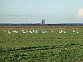
 Swans eating rape on Deeping Common - geograph.org.uk - 3794259.jpg 4 320 × 3 240; 5,59 MB
-
 Swans on Deeping Common - geograph.org.uk - 3794383.jpg 4 320 × 3 240; 5,54 MB
-
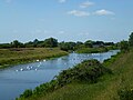 Swans on the Welland - geograph.org.uk - 4514880.jpg 4 320 × 3 240; 5,69 MB
_-_geograph.org.uk_-_5012188.jpg)


_-_geograph.org.uk_-_3118824.jpg)


_towards_Market_Deeping_-_geograph.org.uk_-_3118487.jpg)


.jpg)


_-_geograph.org.uk_-_3118503.jpg)


