Category:Denny Lodge
Aller à la navigation
Aller à la recherche
Paroisse civile anglaise  | |||||
| Téléverser des médias | |||||
| Nature de l’élément | |||||
|---|---|---|---|---|---|
| Lieu | New Forest, Hampshire, Angleterre du Sud-Est, Angleterre | ||||
| Population |
| ||||
 | |||||
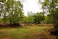
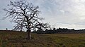
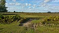
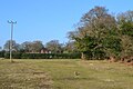
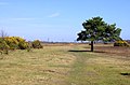
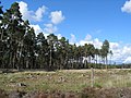
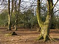
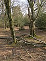
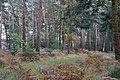
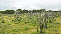
Denny Lodge is a civil parish in the New Forest, in Hampshire, England. The parish covers a large area of heathland and woodland.
Sous-catégories
Cette catégorie comprend 38 sous-catégories, dont les 38 ci-dessous.
A
- Ashurst Wood, Hampshire (8 F)
B
- Beaulieu Heath (East) (77 F)
- Black Down, New Forest (20 F)
- Busketts Lawn Inclosure (8 F)
C
- Churchplace Inclosure (17 F)
D
- Deerleap Inclosure (27 F)
- Denny Inclosure (22 F)
- Denny Lodge Inclosure (34 F)
- Dibden inclosure (9 F)
F
- Fawley Inclosure (9 F)
- Foxhunting Inclosure (2 F)
- Frame Heath Inclosure (27 F)
H
- Hawkhill Inclosure (40 F)
- Hollands Wood (26 F)
I
- Ipley Inclosure (35 F)
- Ironshill Inclosure (2 F)
K
- King's Copse Inclosure (15 F)
- King's Hat Inclosure (2 F)
L
- Lodgehill Inclosure (2 F)
- Longdown Inclosure (40 F)
- Longwater Lawn (22 F)
M
- Marchwood Inclosure (14 F)
- Matley Wood (11 F)
N
- New Copse Inclosure (18 F)
- New Forest Wildlife Park (26 F)
P
- Parkhill Inclosure (61 F)
- Perrywood Haseley Inclosure (12 F)
- Pignal Inclosure (13 F)
R
- Ramnor Inclosure (7 F)
S
- Stubby Copse Inclosure (18 F)
T
- Tantany Wood (16 F)
Y
- Yew Tree Heath (42 F)
Média dans la catégorie « Denny Lodge »
Cette catégorie comprend 1 531 fichiers, dont les 200 ci-dessous.
(page précédente) (page suivante)-
 A ballast train passes Perrywood Haseley Inclosure - geograph.org.uk - 6111133.jpg 1 024 × 654 ; 201 kio
-
 A Battered Looking Crab Apple Tree - geograph.org.uk - 5904386.jpg 5 184 × 3 456 ; 4,12 Mio
-
 A bit of fence, for some reason - geograph.org.uk - 5906561.jpg 4 856 × 3 278 ; 3,49 Mio
-
 A clearing at Culverley - geograph.org.uk - 1907751.jpg 1 500 × 1 000 ; 320 kio
-
 A dead pine tree on heath near Ferny Crofts, New Forest - geograph.org.uk - 6081411.jpg 1 600 × 900 ; 399 kio
-
 A Few Trees - geograph.org.uk - 5904728.jpg 4 814 × 3 156 ; 3,46 Mio
-
 A gap in Bishop's Dyke, New Forest - geograph.org.uk - 6082107.jpg 1 600 × 900 ; 387 kio
-
 A grass track in Foxhunting Inclosure - geograph.org.uk - 6642588.jpg 1 024 × 683 ; 662 kio
-
 A group of Fallow Bucks in the New forest heather - geograph.org.uk - 3698949.jpg 4 320 × 2 432 ; 2,82 Mio
-
 A happy afternoon at Longdown Activity Farm (a) - geograph.org.uk - 6834268.jpg 640 × 443 ; 105 kio
-
 A happy afternoon at Longdown Activity Farm (c) - geograph.org.uk - 6834275.jpg 497 × 640 ; 130 kio
-

-
 A happy afternoon at Longdown Activity Farm (f) - geograph.org.uk - 6834283.jpg 640 × 445 ; 105 kio
-
 A happy afternoon at Longdown Activity Farm (g) - geograph.org.uk - 6834284.jpg 492 × 640 ; 104 kio
-

-
 A hint of autumn colour in Foxhunting Inclosure - geograph.org.uk - 6642579.jpg 1 024 × 683 ; 711 kio
-
 A large area of fern near Denny Wood - geograph.org.uk - 6258779.jpg 1 024 × 768 ; 393 kio
-
 A minor road heading north from Beaulieu - geograph.org.uk - 6642543.jpg 1 024 × 683 ; 488 kio
-
 A northern corner of Blackwell Common - geograph.org.uk - 4861745.jpg 640 × 427 ; 79 kio
-
 A pine tree by the path - geograph.org.uk - 3460781.jpg 1 500 × 991 ; 191 kio
-
 A pony on Beaulieu Hilltop Heath - geograph.org.uk - 3460745.jpg 1 500 × 987 ; 230 kio
-
 A Sika hind - geograph.org.uk - 3692571.jpg 4 320 × 2 432 ; 3,58 Mio
-
 A small stand of pine trees - geograph.org.uk - 6258773.jpg 1 024 × 768 ; 755 kio
-
 A small stream crosses Rowbarrow Droke - geograph.org.uk - 6082090.jpg 1 600 × 900 ; 690 kio
-
 A Small Wood by the Beaulieu Road - geograph.org.uk - 2503718.jpg 3 968 × 2 232 ; 1,12 Mio
-
 A Spindly Holly Tree - geograph.org.uk - 2512705.jpg 3 592 × 2 232 ; 1,05 Mio
-
 A stand of pines, New Forest - geograph.org.uk - 3643472.jpg 640 × 480 ; 107 kio
-
 A stile at the New Forest pub - geograph.org.uk - 5749393.jpg 2 700 × 2 025 ; 501 kio
-
 A stream and a bridge - geograph.org.uk - 5906554.jpg 5 184 × 3 456 ; 3,78 Mio
-
 A train for Brockenhurst halts at Beaulieu Road station - geograph.org.uk - 6258259.jpg 1 024 × 768 ; 457 kio
-
 A train passing by - geograph.org.uk - 6625066.jpg 1 024 × 683 ; 371 kio
-
 A tree in blossom at Culverley - geograph.org.uk - 1907749.jpg 1 000 × 1 500 ; 455 kio
-
 A view across Shatterford Bottom - geograph.org.uk - 6258776.jpg 1 024 × 768 ; 567 kio
-
 A view across Woodley Passage - geograph.org.uk - 6258787.jpg 1 024 × 768 ; 332 kio
-
 A view over Yew Tree Heath from Beaulieu Road - geograph.org.uk - 3698473.jpg 640 × 480 ; 156 kio
-
 A view towards Dibden Bottom - geograph.org.uk - 6643420.jpg 1 024 × 683 ; 499 kio
-
 A3056 at Matley Ridge - geograph.org.uk - 3922247.jpg 640 × 372 ; 120 kio
-
 A35 at Wessex Institute turning - geograph.org.uk - 3921392.jpg 640 × 364 ; 91 kio
-
 A35 westbound - geograph.org.uk - 4417173.jpg 640 × 480 ; 127 kio
-
 Adder sunning itself at Woodfidley Passage - geograph.org.uk - 3979771.jpg 640 × 451 ; 234 kio
-
 An Adder Sunbathing between the two gate posts on the main track - geograph.org.uk - 2366175.jpg 2 592 × 1 944 ; 1,08 Mio
-
 An engineer's train passes Perrywood Haseley Inclosure - geograph.org.uk - 6111126.jpg 1 024 × 750 ; 206 kio
-
 An oak clump - geograph.org.uk - 6642531.jpg 1 024 × 683 ; 728 kio
-
 Ancient and modern from Yew Tree Heath - geograph.org.uk - 6642021.jpg 1 024 × 683 ; 311 kio
-
 Animal pen - geograph.org.uk - 5541054.jpg 640 × 480 ; 144 kio
-
 Animal pens at Beaulieu Road - geograph.org.uk - 1909114.jpg 1 500 × 1 000 ; 144 kio
-
 Animal pens at Beaulieu Road - geograph.org.uk - 1909115.jpg 1 500 × 1 000 ; 245 kio
-

-
 Applemore, byway - geograph.org.uk - 4549116.jpg 1 024 × 576 ; 224 kio
-
 Applemore, cattle grid - geograph.org.uk - 4578043.jpg 1 024 × 768 ; 180 kio
-
 Applemore, footbridge - geograph.org.uk - 4572030.jpg 1 024 × 768 ; 150 kio
-
 Applemore, Forest View - geograph.org.uk - 4549107.jpg 1 024 × 576 ; 154 kio
-
 Applemore, gate - geograph.org.uk - 4578070.jpg 1 024 × 768 ; 231 kio
-
 Applemore, power lines - geograph.org.uk - 4578059.jpg 1 024 × 768 ; 136 kio
-
 Applemore, track - geograph.org.uk - 4578230.jpg 1 024 × 768 ; 223 kio
-
 Applemore, track - geograph.org.uk - 4578235.jpg 1 024 × 768 ; 202 kio
-
 Applemore, tree clump - geograph.org.uk - 4578238.jpg 1 024 × 768 ; 185 kio
-
-
 Approaching Beaulieu Road Station - geograph.org.uk - 4978718.jpg 640 × 480 ; 522 kio
-
 Approaching bridge at Woodfidley Passage - geograph.org.uk - 3979764.jpg 640 × 427 ; 145 kio
-
 Approaching Denny Wood - geograph.org.uk - 6258777.jpg 1 024 × 768 ; 370 kio
-
 Arters Lawn - geograph.org.uk - 3089961.jpg 640 × 480 ; 102 kio
-
 Arters Lawn becomes Deerleap Lane - geograph.org.uk - 3138357.jpg 3 648 × 2 736 ; 1,87 Mio
-
 Arters Lawn south of Slowhays Copse - geograph.org.uk - 3137662.jpg 3 078 × 2 235 ; 999 kio
-
 Arters Lawn, Hampshire - geograph.org.uk - 4095376.jpg 4 000 × 2 666 ; 6,49 Mio
-
 Arters Lawn, Hampshire - geograph.org.uk - 4095383.jpg 4 000 × 2 666 ; 7,13 Mio
-
 Ashurst, bridge - geograph.org.uk - 4652397.jpg 1 024 × 768 ; 266 kio
-
 Ashurst, burnt gorse - geograph.org.uk - 4652350.jpg 1 024 × 768 ; 231 kio
-
 Ashurst, cattle grazing - geograph.org.uk - 4652299.jpg 1 024 × 768 ; 226 kio
-
 Ashurst, ditch - geograph.org.uk - 4652321.jpg 1 024 × 768 ; 177 kio
-
 Ashurst, drinking trough - geograph.org.uk - 4652313.jpg 1 024 × 768 ; 169 kio
-
 Ashurst, embankment ^ ditch - geograph.org.uk - 4393346.jpg 1 024 × 768 ; 325 kio
-
 Ashurst, farm road - geograph.org.uk - 4652307.jpg 1 024 × 768 ; 288 kio
-
 Ashurst, footbridge - geograph.org.uk - 4393183.jpg 1 024 × 768 ; 226 kio
-
 Ashurst, forestry crossroads - geograph.org.uk - 4652329.jpg 1 024 × 768 ; 188 kio
-
 Ashurst, forestry track - geograph.org.uk - 4652387.jpg 1 024 × 768 ; 162 kio
-
 Ashurst, gate - geograph.org.uk - 4393130.jpg 1 024 × 768 ; 329 kio
-
 Ashurst, heathland - geograph.org.uk - 4652325.jpg 1 024 × 768 ; 228 kio
-
 Ashurst, heathland - geograph.org.uk - 4652443.jpg 1 024 × 768 ; 220 kio
-
 Ashurst, pannage pigs - geograph.org.uk - 4665550.jpg 1 024 × 768 ; 243 kio
-
 Ashurst, pigs - geograph.org.uk - 4652438.jpg 1 024 × 1 024 ; 376 kio
-
 Ashurst, railway lines - geograph.org.uk - 4393211.jpg 1 024 × 768 ; 231 kio
-
 Ashurst, roadbridge - geograph.org.uk - 4393203.jpg 1 024 × 768 ; 301 kio
-
 Auction Ring at Denny Lodge - geograph.org.uk - 3979855.jpg 640 × 427 ; 149 kio
-
 Autumn morning, Hollands Wood - geograph.org.uk - 3128011.jpg 640 × 480 ; 155 kio
-
 B3055 crosses Worts Gutter - geograph.org.uk - 3643683.jpg 3 648 × 2 736 ; 2,55 Mio
-
 B3055 east of Stockley Cottage - geograph.org.uk - 3643689.jpg 3 481 × 2 597 ; 2,04 Mio
-
 B3055 north of Lodge Heath - geograph.org.uk - 3643663.jpg 3 182 × 2 338 ; 1,89 Mio
-
 B3055 south of New Copse Inclosure - geograph.org.uk - 3642989.jpg 3 648 × 2 736 ; 2,08 Mio
-
 B3056 (Beaulieu Road) - geograph.org.uk - 6191626.jpg 1 024 × 768 ; 238 kio
-
 B3056 - geograph.org.uk - 4494666.jpg 640 × 480 ; 54 kio
-
 B3056 approaches Beaulieu Road Station - geograph.org.uk - 3234702.jpg 3 648 × 2 432 ; 1,62 Mio
-
 B3056 approaches Pig Bush - geograph.org.uk - 3234716.jpg 3 648 × 2 432 ; 1,5 Mio
-

-
 B3056 at Beaulieu Hotel - geograph.org.uk - 4235542.jpg 640 × 480 ; 57 kio
-
 B3056 at Matley Passage - geograph.org.uk - 4235525.jpg 640 × 481 ; 71 kio
-
 B3056 at Shepton Bridge - geograph.org.uk - 3234724.jpg 3 648 × 2 432 ; 2,02 Mio
-
 B3056 at Shepton Bridge - geograph.org.uk - 5148301.jpg 640 × 427 ; 113 kio
-
 B3056 by Pig Bush car park - geograph.org.uk - 1123647.jpg 640 × 425 ; 42 kio
-
 B3056 climbs towards Matley Ridge - geograph.org.uk - 3234319.jpg 3 648 × 2 109 ; 1,5 Mio
-
 B3056 curves towards Matley Passage - geograph.org.uk - 3234326.jpg 3 370 × 2 432 ; 1,46 Mio
-
 B3056 east of Church Place - geograph.org.uk - 3234699.jpg 3 538 × 2 358 ; 1,03 Mio
-
 B3056 from Shatterford - geograph.org.uk - 3922799.jpg 640 × 427 ; 58 kio
-
 B3056 heading over Shepton Bridge - geograph.org.uk - 1123619.jpg 640 × 425 ; 69 kio
-
 B3056 intersection with unnamed road to Marchwood - geograph.org.uk - 3234704.jpg 3 648 × 2 432 ; 1,38 Mio
-
 B3056 is Hatchet Lane - geograph.org.uk - 3234731.jpg 3 212 × 2 281 ; 1,67 Mio
-
 B3056 near Beaulieu Road Station - geograph.org.uk - 4978780.jpg 640 × 480 ; 418 kio
-
 B3056 nearing Beaulieu Road Station - geograph.org.uk - 4235535.jpg 640 × 481 ; 52 kio
-
 B3056 north of Stephill Bottom - geograph.org.uk - 3234708.jpg 3 648 × 2 432 ; 1,45 Mio
-
 B3056 passing Stephill Bottom - geograph.org.uk - 1123669.jpg 640 × 425 ; 47 kio
-
 B3956 Beaulieu Road, towards Lyndhurst - geograph.org.uk - 4978781.jpg 640 × 480 ; 290 kio
-
 Balmer Lawn, cycle route - geograph.org.uk - 4352570.jpg 1 024 × 768 ; 173 kio
-
 Balmer Lawn, ditch - geograph.org.uk - 4352498.jpg 1 024 × 767 ; 212 kio
-
 Balmer Lawn, ditch - geograph.org.uk - 4371945.jpg 1 024 × 768 ; 252 kio
-
 Balmer Lawn, oak woodland - geograph.org.uk - 4352561.jpg 1 024 × 768 ; 357 kio
-
 Balmer Lawn, ponies - geograph.org.uk - 4371953.jpg 1 024 × 768 ; 181 kio
-
 Bartley Road south of Red House Farm - geograph.org.uk - 3366115.jpg 3 525 × 2 609 ; 1,7 Mio
-

-
 Beaulieu Heath - geograph.org.uk - 3643454.jpg 640 × 480 ; 98 kio
-
 Beaulieu Heath - geograph.org.uk - 4094726.jpg 4 000 × 2 666 ; 7,29 Mio
-
 Beaulieu Heath - geograph.org.uk - 4126258.jpg 2 592 × 1 944 ; 1,58 Mio
-
 Beaulieu Heath by Hawkhill Inclosure - geograph.org.uk - 4655007.jpg 640 × 480 ; 68 kio
-
 Beaulieu Heath, Beaulieu Road - geograph.org.uk - 4580066.jpg 1 024 × 768 ; 175 kio
-
 Beaulieu Heath, cattle - geograph.org.uk - 4580068.jpg 1 024 × 768 ; 173 kio
-
 Beaulieu Heath, dry pond - geograph.org.uk - 4580053.jpg 1 024 × 768 ; 215 kio
-
 Beaulieu Heath, embankment ^ ditch - geograph.org.uk - 4580077.jpg 1 024 × 768 ; 215 kio
-
 Beaulieu Heath, forestry crossroads - geograph.org.uk - 4580091.jpg 1 024 × 768 ; 193 kio
-
 Beaulieu Heath, forestry road - geograph.org.uk - 4554449.jpg 1 024 × 576 ; 125 kio
-
 Beaulieu Heath, forestry track - geograph.org.uk - 4580017.jpg 1 024 × 768 ; 176 kio
-
 Beaulieu Heath, forestry track - geograph.org.uk - 4580100.jpg 1 024 × 768 ; 183 kio
-
 Beaulieu Heath, forestry track junction - geograph.org.uk - 4580003.jpg 1 024 × 768 ; 160 kio
-
 Beaulieu Heath, gorse - geograph.org.uk - 4580046.jpg 1 024 × 768 ; 198 kio
-
 Beaulieu Heath, heathland - geograph.org.uk - 4554457.jpg 1 024 × 576 ; 139 kio
-
 Beaulieu Heath, heathland - geograph.org.uk - 4580061.jpg 1 024 × 768 ; 262 kio
-
 Beaulieu Heath, trigpoint - geograph.org.uk - 4580086.jpg 1 024 × 768 ; 223 kio
-
 Beaulieu Heath, tumuli - geograph.org.uk - 4579979.jpg 1 024 × 768 ; 174 kio
-
 Beaulieu Heath, tumulus - geograph.org.uk - 4554486.jpg 1 024 × 576 ; 145 kio
-
 Beaulieu Hilltop Heath - geograph.org.uk - 3460756.jpg 1 500 × 1 000 ; 204 kio
-
 Beaulieu Inn, Beaulieu Road, New Forest - geograph.org.uk - 1968445.jpg 640 × 480 ; 107 kio
-
 Beaulieu River - geograph.org.uk - 1304798.jpg 640 × 480 ; 330 kio
-
-
 Beaulieu River at dusk, Pottern Ford, New Forest - geograph.org.uk - 182795.jpg 640 × 480 ; 152 kio
-
 Beaulieu River at Fulliford Bog - geograph.org.uk - 1183283.jpg 640 × 482 ; 87 kio
-
 Beaulieu River at Longwater Lawn, New Forest - geograph.org.uk - 2772794.jpg 1 600 × 1 200 ; 841 kio
-
 Beaulieu River at Longwater Lawn, New Forest - geograph.org.uk - 2777050.jpg 1 600 × 1 200 ; 901 kio
-

-
 Beaulieu River south of Longdown Inclosure - geograph.org.uk - 2024635.jpg 427 × 640 ; 172 kio
-
 Beaulieu River, east of Pottern Ford, New Forest - geograph.org.uk - 398133.jpg 640 × 480 ; 119 kio
-
 Beaulieu River, King's Hat - geograph.org.uk - 4761541.jpg 640 × 480 ; 147 kio
-
 Beaulieu Road - geograph.org.uk - 1123710.jpg 640 × 425 ; 83 kio
-
 Beaulieu Road at Matley Ridge - geograph.org.uk - 4235520.jpg 640 × 480 ; 56 kio
-
 Beaulieu Road car park - geograph.org.uk - 335109.jpg 640 × 480 ; 114 kio
-
 Beaulieu Road Car Park - geograph.org.uk - 4314809.jpg 1 024 × 762 ; 280 kio
-
 Beaulieu Road Hotel - geograph.org.uk - 6258794.jpg 1 024 × 768 ; 354 kio
-
 Beaulieu Road near Matley Passage - geograph.org.uk - 5886049.jpg 1 600 × 1 200 ; 379 kio
-
 Beaulieu Road near Matley Passage, New Forest - geograph.org.uk - 6084611.jpg 1 600 × 900 ; 216 kio
-
 Beaulieu Road near Matley Wood - geograph.org.uk - 4978786.jpg 640 × 427 ; 363 kio
-
 Beaulieu Road passes The Bold Forester - geograph.org.uk - 3137629.jpg 3 498 × 2 499 ; 1,41 Mio
-
 Beaulieu Road past Matley Wood - geograph.org.uk - 5886039.jpg 1 600 × 1 200 ; 404 kio
-
 Beaulieu Road south of Rush Bush - geograph.org.uk - 1951510.jpg 640 × 480 ; 41 kio
-
 Beaulieu Road station - geograph.org.uk - 6258770.jpg 1 024 × 768 ; 544 kio
-
 Beaulieu Road Station at Dusk - geograph.org.uk - 6258795.jpg 1 024 × 768 ; 410 kio
-
 Beaulieu Road station information sign - geograph.org.uk - 6258793.jpg 1 024 × 768 ; 533 kio
-
 Beaulieu Road, bridge - geograph.org.uk - 4314596.jpg 1 024 × 768 ; 216 kio
-
 Beaulieu Road, Hampshire - geograph.org.uk - 4085413.jpg 4 000 × 2 250 ; 7,05 Mio
-
 Beaulieu Road, Hampshire - geograph.org.uk - 4095349.jpg 4 000 × 2 666 ; 7,53 Mio
-
 Beaulieu Road, near Marchwood Inclosure - geograph.org.uk - 1951498.jpg 640 × 480 ; 91 kio
-
 Beaulieu Road, railway cutting - geograph.org.uk - 4314586.jpg 1 024 × 768 ; 136 kio
-
 Beaulieu, bullock - geograph.org.uk - 4554244.jpg 1 024 × 576 ; 218 kio
-
 Beaulieu, footbridge - geograph.org.uk - 4554165.jpg 1 024 × 576 ; 241 kio
-
 Beaulieu, ford - geograph.org.uk - 4554168.jpg 1 024 × 576 ; 237 kio
-
 Beaulieu, forestry track - geograph.org.uk - 4554212.jpg 1 024 × 576 ; 224 kio
-
 Beaulieu, North Gate - geograph.org.uk - 4554156.jpg 1 024 × 576 ; 207 kio
-
 Beaulieu, postbox № SO42 40, Hill Top - geograph.org.uk - 3173060.jpg 480 × 640 ; 102 kio
-
 Beaulieu, River Beaulieu - geograph.org.uk - 4554173.jpg 1 024 × 576 ; 241 kio
-
 Beaulieu, Royal Oak - geograph.org.uk - 4310717.jpg 1 024 × 768 ; 172 kio
-
 Beaulieu, the Royal Oak, Hill Top - geograph.org.uk - 3173054.jpg 640 × 480 ; 87 kio
-
 Beech in Marchwood Inclosure - geograph.org.uk - 6644515.jpg 1 024 × 683 ; 679 kio
-
 Beech trees in Mallard Wood, New Forest - geograph.org.uk - 779513.jpg 640 × 427 ; 169 kio
-
 Beech woodland east of Ferny Crofts, New Forest - geograph.org.uk - 389787.jpg 640 × 480 ; 137 kio
-
 Beech woodland south of Ferny Crofts, New Forest - geograph.org.uk - 390912.jpg 480 × 640 ; 131 kio
-

-
 Belt of woodland around Decoy Pond Farm - geograph.org.uk - 4803518.jpg 640 × 427 ; 106 kio
-
 Bench - log near Frame Heath Inclosure - geograph.org.uk - 6082118.jpg 1 600 × 900 ; 691 kio
-
 Beneath the branches of a scots pine at Pig Bush - geograph.org.uk - 6641976.jpg 1 024 × 683 ; 593 kio
-
 Beside a forest path in Parkhill Inclosure - geograph.org.uk - 4722529.jpg 640 × 427 ; 113 kio
-
 Birch trees on heath at Halfpenny Green, New Forest - geograph.org.uk - 6082078.jpg 1 600 × 900 ; 331 kio
-

-
 Bishop's Dyke south of Beaulieu Road Station - geograph.org.uk - 3979790.jpg 427 × 640 ; 126 kio
-
 Bishop's Dyke west of Pig Bush - geograph.org.uk - 3979654.jpg 640 × 427 ; 161 kio
-
 Bishop's Dyke, New Forest - geograph.org.uk - 6082103.jpg 1 600 × 900 ; 322 kio
-
 Bishop's Dyke, New Forest - geograph.org.uk - 6082109.jpg 1 600 × 900 ; 453 kio
-
 Black Down - geograph.org.uk - 6625061.jpg 1 024 × 683 ; 406 kio
-
 Blackdown bridge sign - geograph.org.uk - 6625063.jpg 1 024 × 683 ; 422 kio
-
 Blackwell Common - geograph.org.uk - 4560598.jpg 1 024 × 576 ; 156 kio
-
 Blackwell Common Car Park - geograph.org.uk - 2621517.jpg 1 024 × 768 ; 247 kio
-
 Blackwell Common, bog - geograph.org.uk - 4560613.jpg 1 024 × 576 ; 175 kio
-
 Blackwell Common, bottom - geograph.org.uk - 4560854.jpg 1 024 × 576 ; 131 kio
-
 Blackwell Common, burnt gorse - geograph.org.uk - 4560879.jpg 1 024 × 576 ; 174 kio
-
 Blackwell Common, cattle - geograph.org.uk - 4560862.jpg 1 024 × 576 ; 120 kio


_-_geograph.org.uk_-_6834268.jpg)
_-_geograph.org.uk_-_6834275.jpg)
_-_geograph.org.uk_-_6834279.jpg)
_-_geograph.org.uk_-_6834283.jpg)
_-_geograph.org.uk_-_6834284.jpg)
_-_geograph.org.uk_-_6834289.jpg)


_-_geograph.org.uk_-_6191626.jpg)


_on_dry_heath,_New_Forest_-_geograph.org.uk_-_468937.jpg)


